
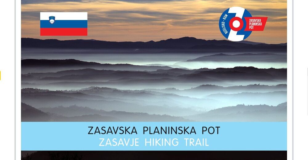


- Brief description
-
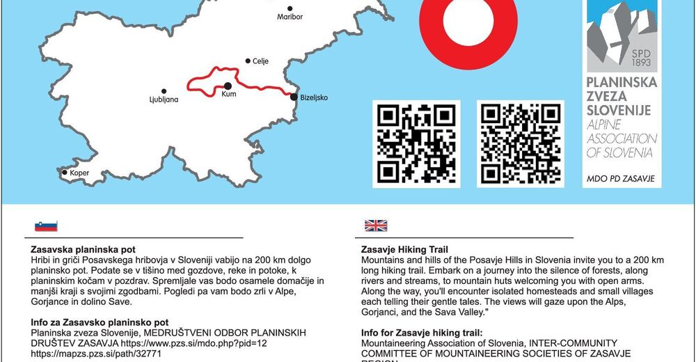
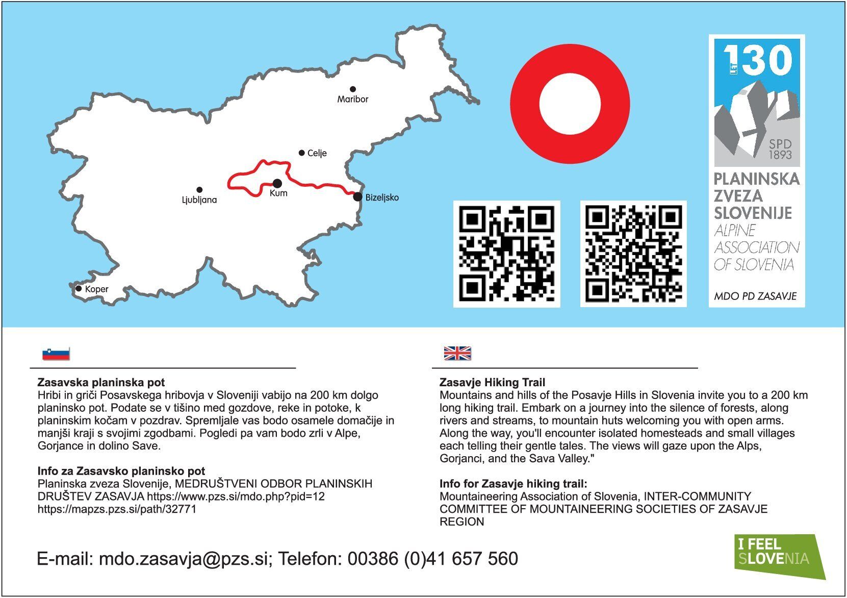
The many rolling, wine-producing hills of Bizeljsko form the starting point of a 160km hiking trail, that leads through Zasavje and finshes in Litija.
- Difficulty
-
medium
- Rating
-
- Starting point
-
Bizeljsko
- Route
-
BizeljskoGostilna ŠekoranjaSveti Vid2.3 kmOsredek pri Podsredi9.4 kmŽelezno16.3 kmTičnik (690 m)19.4 kmVetrnik23.9 kmZajčja gorca (676 m)24.9 kmVrh (782 m)26.4 kmBrest (808 m)27.8 kmŠkofov travnik30.2 kmKoča na Bohorju30.5 kmVeliki Javornik (1,023 m)33.0 kmZaloška gora (930 m)35.1 kmMrzla Planina36.9 kmPokojnik38.2 kmŽupnijska cerkev sv. Lenarta39.4 kmZabukovje nad Sevnico39.5 kmPodgorje ob Sevnični43.5 kmJešivec (934 m)47.0 kmMala Lisca (934 m)48.6 kmLisca (948 m)49.2 kmTončkov dom na Lisci49.3 kmJurkova koča na Lisci49.3 kmSveti Jošt50.1 kmZlaški hrib (771 m)50.2 kmRebeze (695 m)53.6 kmSveti Lovrenc53.9 kmLovrenc (722 m)53.9 kmKozlov hrib (752 m)54.9 kmVeliko Kozje (986 m)56.6 kmVeliko Kozje (žig)56.9 kmObrežje pri Zidanem Mostu60.1 kmBriše60.1 kmSteinbrück (204 m)62.2 kmDoljne Brezno64.4 kmŠirje (461 m)66.2 kmGore69.1 kmCerkev Svetega Štefana72.2 kmTurje72.5 kmMarno74.3 kmBrdce74.9 kmBelovo75.6 kmBrezno75.7 kmZavrate (552 m)77.7 kmCerkev blaženega Antona Martina Slomška79.5 kmZgornja Rečica79.7 kmPlaninski dom na Šmohorju83.7 kmŠmohor84.3 kmCerkev Svetega Mohorja84.4 kmPreval (735 m)86.1 kmKal92.6 kmPlaninski rudarski dom na Kalu92.9 kmKalski hrib (985 m)93.2 kmPlaninski dom na Mrzlici95.0 kmMrzlica (1,122 m)95.1 kmHomič (1,082 m)96.0 kmZa vrhom (1,034 m)96.4 kmPodmejski vrh (758 m)99.6 kmMali vrh (775 m)100.1 kmKnezdol102.1 kmRudarski dom na Partizanskem vrhu104.2 kmPartizanski vrh (1,011 m)104.3 kmCerkev sv. Lenarta106.6 kmVrhe106.6 kmHrib (950 m)107.7 kmGunet108.3 kmGunetova glava (926 m)108.4 kmPlaninski dom dr. Franca Goloba110.7 kmKoča na Čemšeniški planini110.8 kmRazgledna klop110.9 kmRazbor pri Čemšeniku111.9 kmCerkev Marije Vnebovzete113.2 kmČemšenik113.2 kmIzlake117.1 kmPizzeria Čebelica118.1 kmSmučidol118.9 kmRavne pri Mlinšah121.3 kmPlaninski dom na Zasavski Sveti gori122.5 kmŽupnijska cerkev Marijnega rojstva122.7 kmZasavska Sveta gora (852 m)122.8 kmVovški hrib (778 m)123.4 kmVovše124.0 kmCvetež125.5 kmKlenik127.7 kmVače128.4 kmGostilna Vrabec130.9 kmSpodnja Slivna130.9 kmDom na Zgornji Slivni132.4 kmZgornja Slivna132.4 kmCerkev sv. Neže132.5 kmDešen135.6 kmZgornji Prekar136.9 kmGrmače138.1 kmKatarija139.4 kmVelika vas140.7 kmČelo (402 m)141.8 kmSenožeti (278 m)142.6 kmJevnica (272 m)143.6 kmJevnica143.8 kmMala Noga145.0 kmZgornja Jevnica145.2 kmMežnar146.6 kmJanška voda148.4 kmJanče148.4 kmTuji Grm149.0 kmKoške Poljane149.8 kmMancin vrh (747 m)149.8 kmZavrh (669 m)150.5 kmJanezov vrh (656 m)151.3 kmOhanov Gobnek (626 m)153.2 kmRogačev grič (550 m)154.9 kmArhov hrib (506 m)155.8 kmLittai159.5 kmBistro Valvasor159.5 km
- Best season
-
JanFebMarAprMayJunJulAugSepOctNovDec
- Description
-
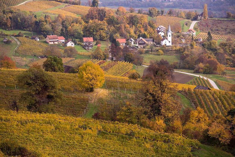
After the initial checkpoints, such as Podsreda Castle and Tonček Mountain Hut on Mt. Lisca, the trail takes hikers north-west: the rolling hills of the Posavje Region turn into the varied landscape of interchanging hills and valleys of the Zasavje Region.
In addition to an excellent meal, Mt. Kopitnik, the Gore Plateau, Mt. Šmohor, Mt. Kal, Mt. Mrzlica, Mt. Sveta Planina, and Mt. Čemšeniška Planina will also impress you with a wonderful view of the towns and villages in the valley below. From there, the trail takes you closer to the River Sava and the elevated landscape alongside the river, where hikers pass through the renowned Zasavska Sveta Gora pilgrimage site and the geometrical centre of Slovenia near Vače, climb the nearby Slivna Hill, pass through Janče to Ostrež Hill and finally walk up Mt. Kum, the highest mountain in the Posavje Hills. This trail is endowed with many natural wonders. It is also a trail where people still have a respectful attitude to these natural wonders.
- Directions
-
From Bizeljsko (177m) you first rise to Bohor (915m). Than goes to Lisca above Sevnica (984m). From Tončkov hut on Lisca to Wliko Kozje (993m). From there it descends to Zidani Most (railway station, 204m). It climbs to Kopitnik and Gora (813m), back down to Turje (441m), and than to Šmohor (204m). From Šmohor it heads to Kal (945m) and Mrzlica (1122m), before heading to Čemšenik plain (1120m). From there to Izlake and Sveta Gora (852m), Geos, Slivno, Zgornjo Slivno (852m) and Miklavž (741m). The last part is to Jevnica and from there on Janče (792m). From there the trail goes to Litija (238m, railway station) where you can end the trail or continue to Kum (1220m).
- Highest point
- 1,116 m
- Endpoint
-
Litija
- Height profile
-
 © outdooractive.com
 - Equipment
-
Classical hiking equipment. Enough supplies, gps and a sleeping bag.
- Safety instructions
-
Be carefull with the wine. Some trails can be poorly marked. Mountain huts can be closed, so make sure to check when they are opend when planning your trip.
- Tips
-
Don't forget to enjoy the local cousine along the way. Also take with you a gps, since some trails might be poorly marked.
- Additional information
-
The trail descends to railway stations many times, so you can shorten the tripl if you wish or have to.
- Directions
-
By car, from Ljubljana on highway towards Novo Mesto, through Novo Mesto to Brežice and Bizeljsko.
- Public transportation
-
From Ljubljana with train to Sevnica or Brežice, from there with bus to Bizeljsko.
- Parking
-
Parking avaliable in Litija (supermarket parking) or in Sevnica or Brežice.


- Author
-
The tour Zasavje long distance trail is used by outdooractive.com provided.


General info
-
Zasavsko Posavska
17
-
Laško
8