Tour data
27.48km
657
- 864m
255hm
02:00h
- Brief description
-
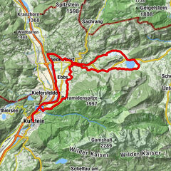
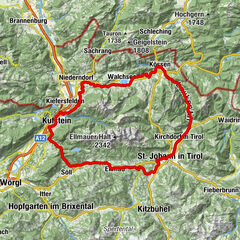
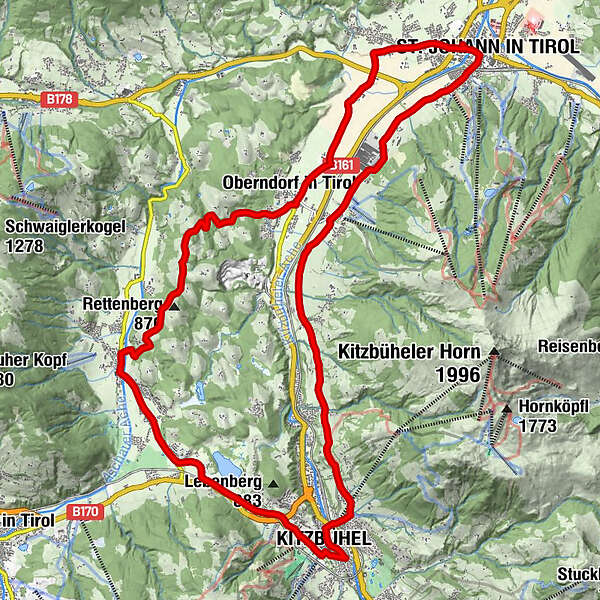
St. Johann in Tirol - Oberndorf - Römerweg - Kitzbühel - Reith - Oberndorf - St. Johann in Tirol
(*) = Anschluss: Brixental-Route oder über Jochberg/Pass Thurn zum Tauern-Radweg
- Rating
-
- Starting point
-
St. Johann in Tirol Parkplatz Dampflfeld
- Route
-
St. Johann in Tirol0.4 kmParzach0.7 kmApfeldorf1.5 kmFixlweber1.9 kmFoidler2.0 kmWeiberndorf2.3 kmBlumberg3.7 kmKitzbühel10.8 kmFranziskanerkirche11.6 kmFotomotiv Schwarzsee13.7 kmPipino's13.8 kmMünichau15.7 kmSchloss Münichau15.7 kmMünichau15.9 kmReith bei Kitzbühel17.0 kmOberndorf in Tirol22.6 kmDorfwirt22.7 kmPizzeria Marco22.7 kmPfarrkirche Oberndorf22.8 kmEberhartling23.8 kmSperten25.0 kmWeitau26.3 kmSt. Johann in Tirol27.4 km
- Highest point
- 864 m
- Rest/Retreat
-
diverse Cafés und Gasthäuser in St. Johann, Oberndorf oder Kitzbühel
- Ticket material
-
In allen Infobüros: St. Johann in Tirol - Oberndorf - Kirchdorf - Erpfendorf
- Info phone
-
0043 5352 63335 0
- Link
- www.kitzbueheler-alpen.com/de/st-johann
GPS Downloads


Surfaces
Asphalt
Gravel
Forest
Mountain paths
Single trails
Trial
Traffic
Other tours in the regions
-
Kitzbühel
168
-
Oberndorf in Tirol
39