- Brief description
-
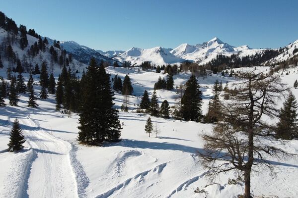
Beautiful winter hike in Hüttschlag, where you can stop at the Aschaustüberl.
- Difficulty
-
medium
- Rating
-
- Starting point
-
Hüttschlag - Aschaustüberl
- Route
-
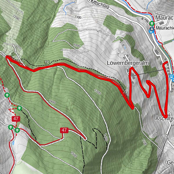
Aschlreit0.4 kmAschlreit4.7 km
- Best season
-
AugSepOctNovDecJanFebMarAprMayJunJul
- Description
-
From the Aschaustüberl, the Güterweg Oberneureit leads past several farms upwards until the Oberneureit farm.
You can sled downwards, then it is much faster and much more fun. But ATTENTION: The Güterweg Oberneureit is a public road, so all cars have priority. There is no liability for any accidents.
At the start or end point of this winter hike, there is the Aschaustüberl, where you can take a rest.
- Directions
-
From the Aschaustüberl, you cross the street and walk up the Güterweg Oberneureit, about 3 km in one direction - back on the same way.
OPTION: A bit after the barrier you continue to the intersection and then go straight ahead (right) into the Hubalmtal. Follow the way just before the Hubalm Chapel and go down the valley to the village center in Hüttschlag.
- Highest point
- 1,336 m
- Endpoint
-
Oberneureit farm
- Height profile
-

- Equipment
-
winter boots with grip sole
- Safety instructions
-
The Güterweg Hinterfeld is a public road, the cars have priority. There is no liability for any accidents.
- Tips
-
Take your sled with you, then this winter hike is fun for the whole familly.
- Additional information
- Directions
-
You go by car or public bus no. 540 to Hüttschlag and further in direction to the valley end to the Aschaustüberl (approx. 4 km).
- Public transportation
- Parking
-
parking possibility at the Aschaustüberl

- Author
-
The tour Hüttschlag: Güterweg Oberneureit is used by outdooractive.com provided.