


- Brief description
-
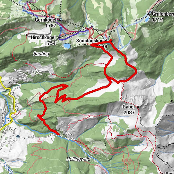
Great mountain tour to the Maurachalm and to the Sonntagskogel.
- Difficulty
-
medium
- Rating
-
- Starting point
-
Grossarl - Sonneggbrücke
- Route
-
Muggenfeldalm (Rothofalm)4.8 kmMaurachalm5.7 kmSonntagskogel (1,849 m)7.7 kmMaurachalm10.2 kmMuggenfeldalm (Rothofalm)11.2 km
- Best season
-
JanFebMarAprMayJunJulAugSepOctNovDec
- Description
-
You hike from the Sonneggbrücke along the forestry road or on shortcuts through the forest to the Muggenfeldalm (closed) and further to the Maurachalm.
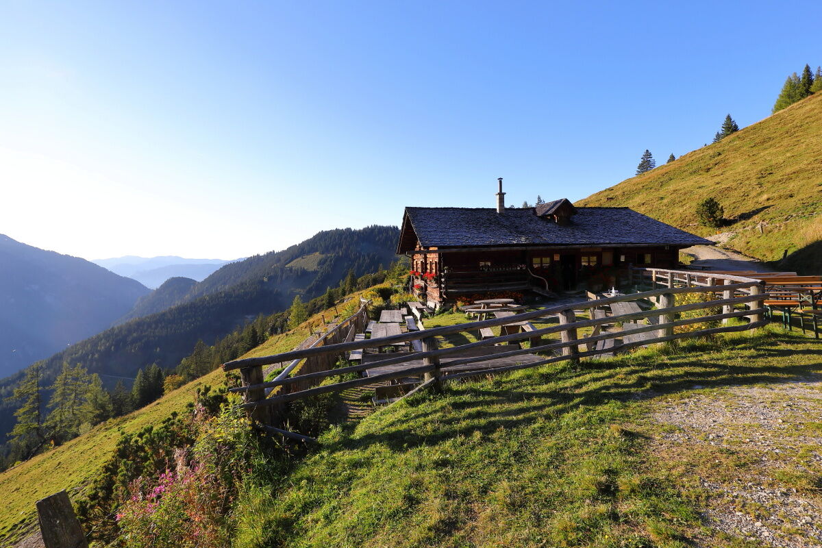
At the Maurachalm you are pampered with delicacies from their own production. The Maurachalm is the most northern mountain hut in Grossarltal and is particularly well-known for the exquisite schnapps. The people on the Maurachalm oft sing and play music.
You ascend via the Wagrainer Höhenweg to the Sonntagskogel, where you have a wonderful view to the Salzachtal as well as to the Hohe Tauern.
You descend via the Auhofalm (closed) around the Grindkogel back to the Maurachalm.
- Directions
-
You go by car or hiking taxi via the Sonneggweg in the district of Au to the Sonneggbrücke - parking possibility. You hike upwards on the forestry road (no. 71, there are some shortcuts) to the Muggenfeldalm, 1,545 m (approx. 1 3/4 h, closed) and to the Maurachalm, 1,620 m (approx. 1/4 h). You hike on the "Wagrainer Höhenweg" to the Sonntagskogel, 1,849 m. Then you hike to the Auhofalm, 1,680 m (closed) and around the Grindkogel, 1,823 m back to the Maurachalm (approx. 1 h). Descent on the same way.
- Highest point
- 1,812 m
- Endpoint
-
Sonntagskogel
- Height profile
-

- Equipment
-
hiking boots with grip sole, hiking map
- Tips
-
You could go up by the Alpendorf cable cars.
- Additional information
- Directions
-
You go by car or hiking taxi via the Sonneggweg in the district Au to the Sonneggbrücke.
- Public transportation
- Parking
-
parking at the Sonneggbrücke


- Author
-
The tour Grossarl: Sonntagskogel is used by outdooractive.com provided.


General info
-
Katschberg Lieser-Maltatal
2574
-
Großarltal
2171
-
St. Johann in Salzburg
808


