- Brief description
-
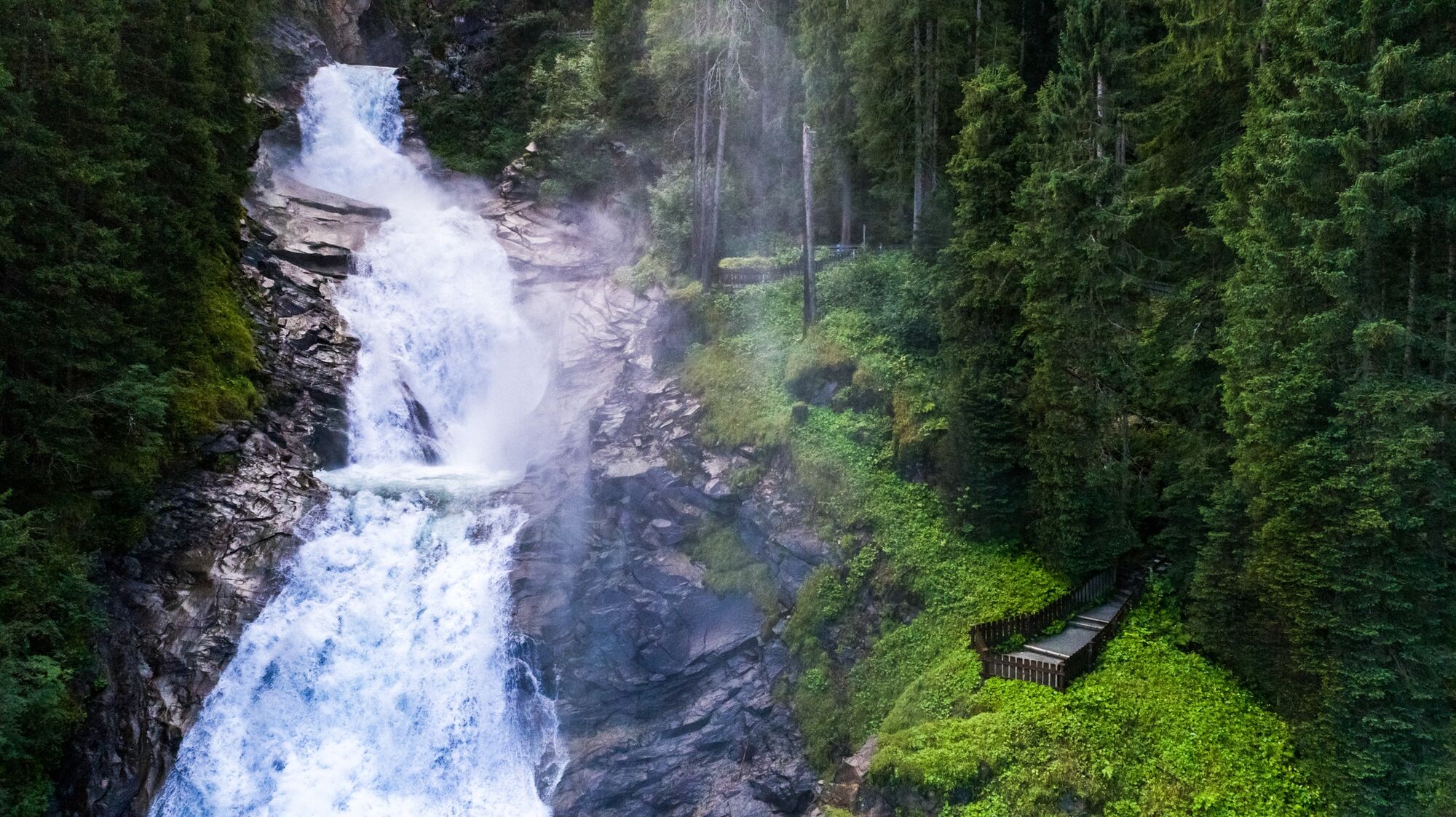
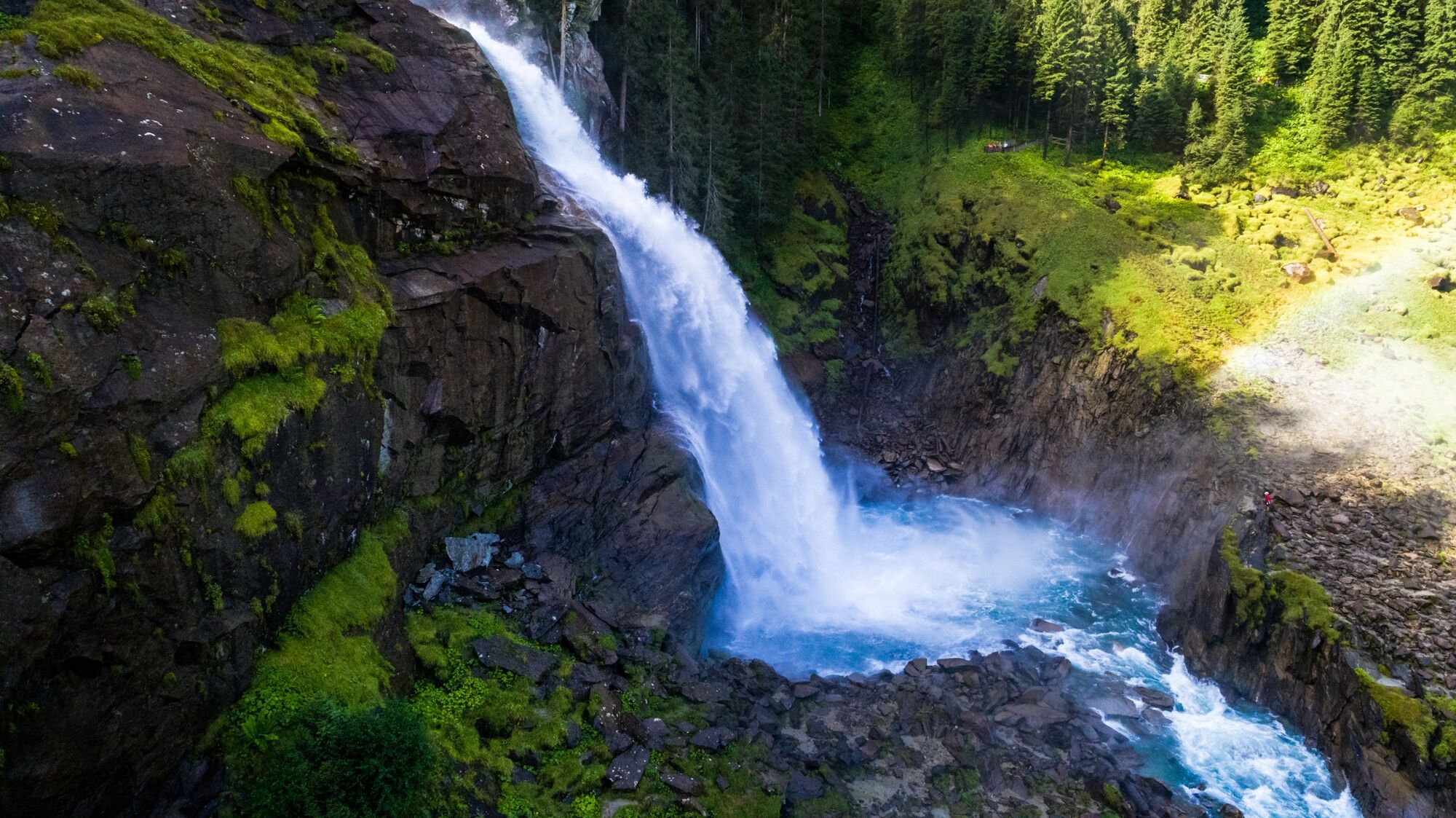
A path parallel to Europe’s biggest waterfalls and an astonishing form of natural therapy.
- Difficulty
-
medium
- Rating
-
- Route
-
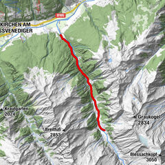
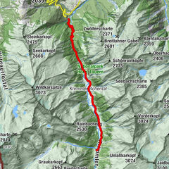
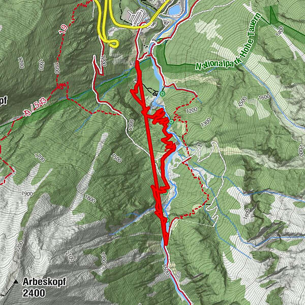
Rupertiwinkel0.0 kmHanke's Cafe- Restaurant Souvenir0.1 kmRieman Kanzel (1,110 m)0.5 kmUnterer Krimmler Wasserfall0.8 kmRegen Kanzel (1,150 m)0.8 kmSendtner Kanzel (1,170 m)1.0 kmJung Kanzel (1,215 m)1.2 kmJagasprung (1,220 m)1.2 kmBergersteig (1,245 m)1.5 kmGasthof Schönangerl1.8 kmStaubige Reib (1,330 m)2.3 kmBerger Blick2.6 kmOberer Krimmler Wasserfall2.8 kmOberhafen2.9 kmKürsingerplatz (1,070 m)4.4 kmHanke's Cafe- Restaurant Souvenir4.5 kmRupertiwinkel4.7 km
- Best season
-
JanFebMarAprMayJunJulAugSepOctNovDec
- Description
-
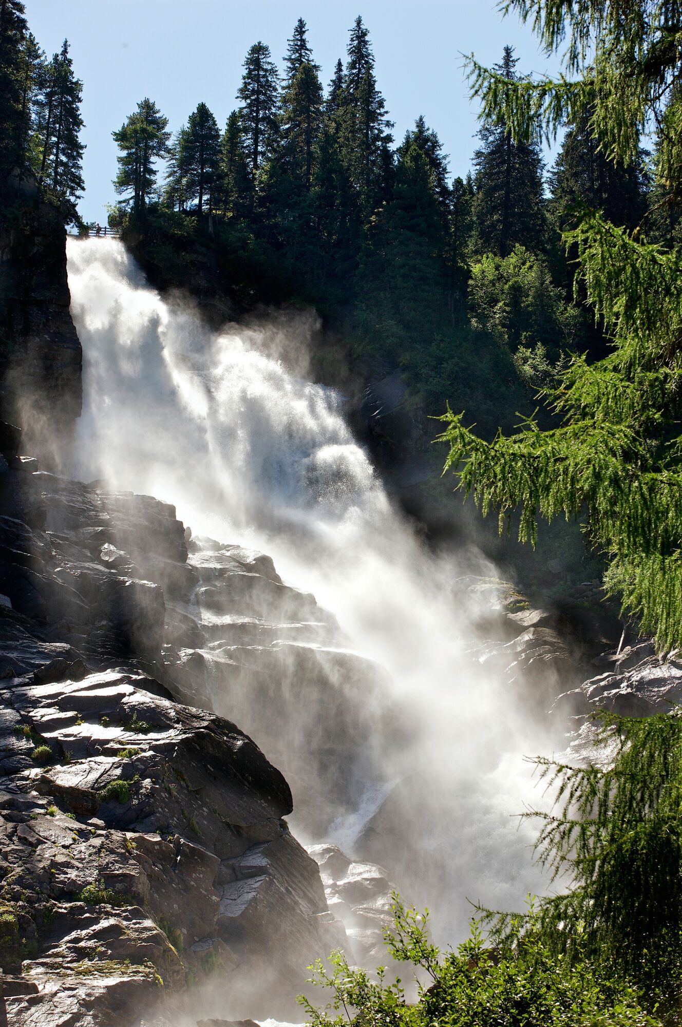
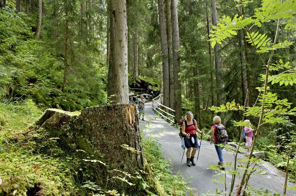
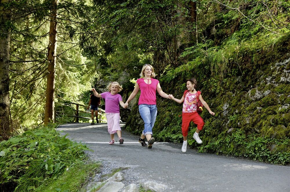
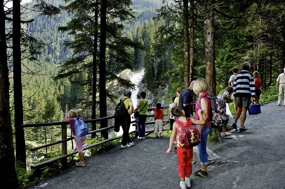
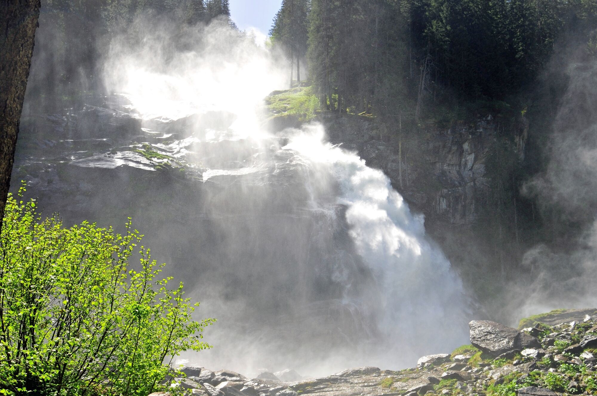
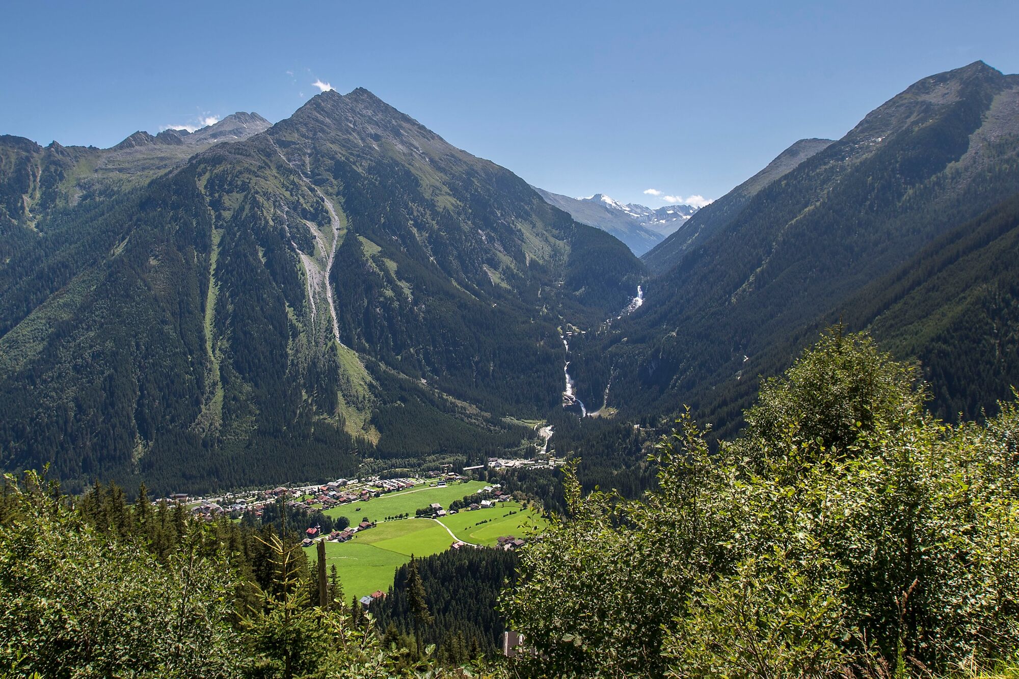
The Krimml waterfalls are a very special kind of natural spectacle that you really don`t want to miss on your hiking holiday in Pinzgau! With a drop height of 380 metres, they are the biggest waterfalls in Europe and the fifth biggest in the world. Hiking trail no. 40 leads you to the winding roads right next to the powerful bodies of water and creates an indescribable impression that you certainly won`t quickly forget! Souvenir photos can be taken from the numerous viewing turrets. Immerse yourself in the enormous power of the water amidst the fantastic scenery in the Hohe Tauern National Park!
- Highest point
- 1,483 m
- Endpoint
-
Eintritt Krimmler Wasserfälle
- Height profile
-

- Equipment
-
Sturdy shoes, weatherproof clothing, potentially hiking poles recommended
- Safety instructions
-
Sturdy shoes, hiking poles recommended.
Dogs should be kept on a leash.
- Tips
-
At the foot of Krimml Waterfalls, the fine spray kicked up by the water provides refreshment along with great photographs as souvenirs of this beautiful excursion.
From the entrance gate to the foot of the waterfalls, the pathway is handicapped-accessible.
You do have the option of taking the National Park Taxi to the top falls.
- Directions
-
If you are coming from Tyrol, use the Gerlos Alpenstrasse. Coming from the east, travel in on the B165 via Mittersill.
- Public transportation
-
By bus to the stops “Krimml Ort” or “Krimmler Wasserfälle”.
- Parking
-
Clearly signposted car parks are located right next to the road. Parking fees are charged.
- Author
-
The tour Krimml Waterfall Path (full tour) is used by outdooractive.com provided.


General info
-
Zillertal Arena
1310
-
Krimml - Hochkrimml
321