


Tour data
4.5km
1,271
- 1,509m
235hm
02:00h
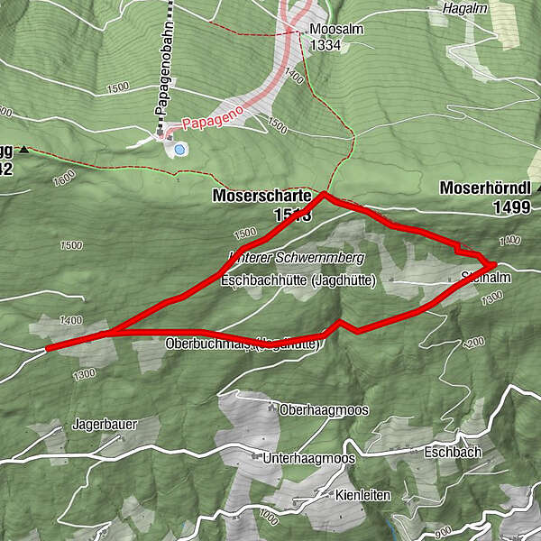
- Rating
-
- Starting point
-
Kurve - Resialm
- Route
-
Moserscharte (1,513 m)1.4 kmSteinalm2.6 km
- Highest point
- 1,509 m
- Rest/Retreat
-
Steinalm
GPS Downloads


Trail conditions
Asphalt
Gravel
Meadow
Forest
Rock
Exposed
Other tours in the regions
-
Schladming - Dachstein
3001
-
Ramsau am Dachstein
1689
-
Filzmoos
628


