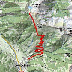
Tagkopf (Dorfer Himmel)

Logo Tagkopf (Dorfer Himmel)
Tour data
9.25km
846 - 2,031m
Distance
1,210hm
1,210hm
Ascent
07:30h
 
Duration
Brief description

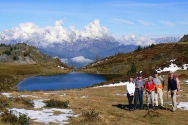
Wanderung mit Gipfelsieg

Difficulty
medium
Rating
Technique
Fitness
Landscape
Experience
Starting point

Dorfgastein, Ortsteil Unterberg

Route
Dorfgastein
Sebastian Ruh
0.4 km
Dorfberg
2.0 km
Gmündseiten
5.8 km
Präaualm
8.0 km


Best season
Jan
Feb
Mar
Apr
May
Jun
Jul
Aug
Sep
Oct
Nov
Dec
Highest point
2,031 m

Rest/Retreat

Strohlehenalm, Präau-Hochalm, Heinreichalm

Ticket material

TVB Dorfgastein, info@dorfgastein.com


Info phone

+43 6432 3393 0

Link
www.dorfgastein.com

Overall rating

5

0

%

4

0

%

3

0

%

2

0

%

1

0

%

Error
An error has occurred. Please try again.
Thank you for your review

Rating has been deleted

GPS Downloads
  • GPX GPS Exchange Format (XML)
  • KML Google Earth, Google Maps
QR Download Codes for Mobile Phones

Trail conditions

Asphalt
Gravel
Meadow
Forest
Rock
Exposed

Popular tours in the area

Höhenweg nach Bad Hofgastein - 2,5 Stunden

Hiking
8.08km | 208hm | 02:30h

Wanderung zum Naturjuwel Reedsee

medium Hiking
10.76km | 756hm | 04:30h

Heinrich Kiener Haus/Hochgründeck 1827m (453)

medium Hiking
12.62km | 628hm | 06:00h

Paarseen

medium Hiking
8.52km | 1188hm | 08:00h