


- Brief description
-
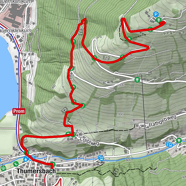
Via meadows and forest paths to Berggasthof Mitterberg with a unique view of the Zell am See-Kaprun region
- Difficulty
-
medium
- Rating
-
- Starting point
-
Thumersbach
- Route
-
Thumersbach0.1 kmMitterberghof3.0 kmHerz-Jesu-Kapelle3.1 km
- Best season
-
JanFebMarAprMayJunJulAugSepOctNovDec
- Directions
-
Opposite the lido Thumersbach on meadow paths and forest walks to Berggasthof Mitterberg. Optional on the asphalt road.
(Mitterbergweg 155, 5700 Zell am See)
- Highest point
- 1,200 m
- Endpoint
-
Mountain inn Mitterberg
- Height profile
-

- Tips
-
In addition to the magnificent panorama, there is also a beautiful house chapel to see
- Additional information
- Directions
-
lido Thumersbach: Pocherweg 28, 5700 Zell am See
- Public transportation
-
bus service from Zell am See

-

-
AuthorThe tour Schwalbenwandweg zum Berggasthof Mitterberg is used by outdooractive.com provided.
GPS Downloads


General info
Refreshment stop
A lot of view
Other tours in the regions
-
Zell am See - Kaprun
1503
-
Maishofen
517


