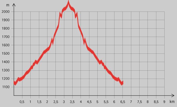
Maria Alm - Riemannhaus

Logo Maria Alm - Riemannhaus
Tour data
3.99km
1,143 - 2,180m
Distance
1,073hm
1,073hm
Ascent
05:00h
 
Duration
Brief description

Schöne Tour mit Hütte als Ziel

Rating
Technique
Fitness
Landscape
Experience
Starting point

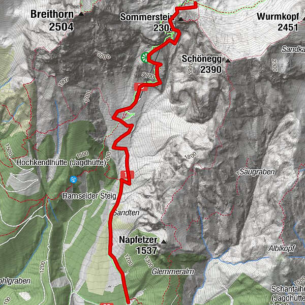
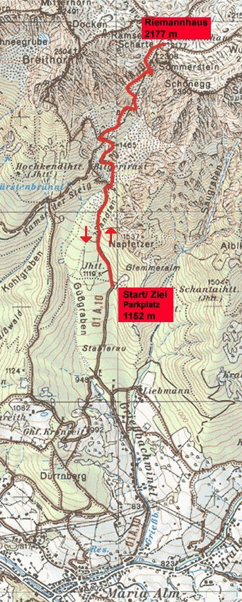
Parkplatz (1152 m) oberhalb der Stablerau nördlich von Maria Alm.


Highest point
2,180 m

Rest/Retreat

Riemannhaus

Ticket material

Info phone

+43 6584 7816

Link

3,9
Overall rating

5

38

%

4

31

%

3

23

%

2

0

%

1

8

%

GPS Downloads
  • GPX GPS Exchange Format (XML)
  • KML Google Earth, Google Maps
QR Download Codes for Mobile Phones

Trail conditions

Asphalt
Gravel
Meadow
Forest
Rock
Exposed
Other tours in the regions

Popular tours in the area

Pfarrachhöhe ab Gries

medium Hiking
11.14km | 1196hm | 05:24h

Golling: Carl von Stahl Haus - Hoher Göll

Hiking
8.5km | 889hm | 06:00h

Hoher Göll über Mannlsteig

medium Hiking
16km | 1464hm | 07:00h

Summit tour Taghaube

difficult Hiking
6.25km | 768hm | 03:00h