- Brief description
-
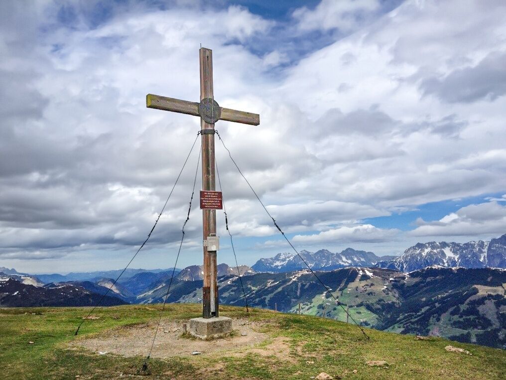
The grass-covered summit of the Maurerkogel at 2,074 m above sea level in the Kitzbühel Alps/Pinzgauer Grasberge makes the hearts beat of mountain hikers faster.
- Difficulty
-
medium
- Rating
-
- Starting point
-
Hochsonnbergalm Piesendorf
- Route
-
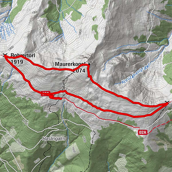
Hochsonnbergalm0.0 kmKesselscharte (1,847 m)2.3 kmMaurerkogel (2,074 m)3.9 kmRohrertörl (1,919 m)5.2 kmHochsonnbergalm6.4 km
- Best season
-
JanFebMarAprMayJunJulAugSepOctNovDec
- Description
-
Especially worth mentioning is the magnificent panorama view that the Maurerkogel offers from the Hohe Tauern over Steineres Meer, Hochkönig to the Hundsteingruppe, to name the most important massifs.
- Directions
-
From the Hochsonnbergalm follow the Pinzgauer Spaziergang, path no. 19 in the direction of Schmittenhöhe to the Kesselscharte. Turn left here and hike along the ridge to the summit. Now continue in a westerly direction until you reach the Rohrertörl. From there the Pinzgauer Spaziergang, path no. 719 leads back to the starting point.
The ascent to the Hochsonnbergalm takes approx. 3 to 4 hours.
Hiking taxi Hochsonnbergalm: Oberkofler Touristik tel. +43 6549 20421
- Highest point
- 2,055 m
- Endpoint
-
Hochsonnbergalm Piesendorf
- Height profile
-

- Equipment
-
Ankle-high hiking boost, drinks & snacks, backpack, rain protection & mobile phone
- Safety instructions
-
Dear nature lovers!
We hope that the snacks and drinks you take with you on your hike will give you the strength to carry back the packaging material and empty cans and bottles.We kindly ask you to observe the Fair Play & Rules of Conduct!
Fairness and mutual consideration form the basis for a common together and the protection of the various interests in the natural region!
- Additional information
- Public transportation
- Parking
-
Parking available at the parking lot in Schiliftstraße. By hiking taxi or via the hiking trail 18/18A to the Hochsonnbergalm.
- Author
-
The tour Maurerkogel is used by outdooractive.com provided.