


- Brief description
-
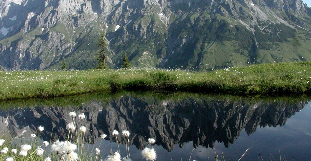
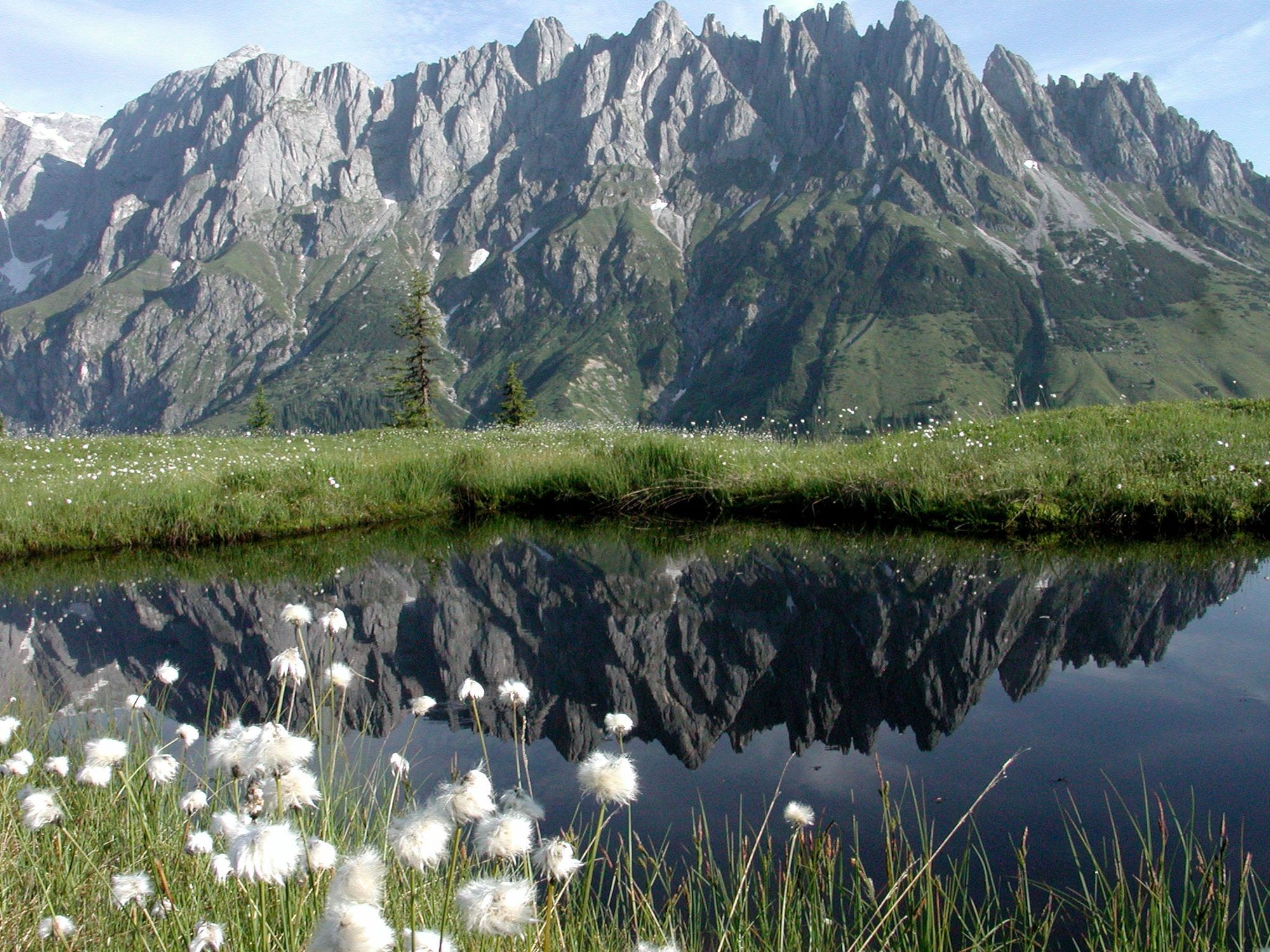
A moderate hike to one of the most beautiful places in Mühlbach am Hochkönig. Everyone will be enchanted by the panorama at the Hochkeil.
- Difficulty
-
medium
- Rating
-
- Starting point
-
Mühlbach Center
- Route
-
Mühlbach am Hochkönig0.2 kmMitterbergsattel (1,515 m)12.6 kmSennerei Schweizerhütte13.1 kmArthurhaus13.1 km
- Best season
-
JanFebMarAprMayJunJulAugSepOctNovDec
- Description
-
You can also climb the Hochkeil if you start directly in Mühlbach. To do this, take the Erzweg (nos. 84a, 88, 85) until you reach the Sonneck Inn. Here you first follow the goods path No. 18a, which leads around the Hochkeil. However, if you have the summit as your destination, follow the turnoff to path no. 84, which leads directly to the Hochkeil. In good visibility, you can even make out the summit of the Großglockner from here. For the way back you can take the path towards Arthurhaus. (see Panorama hike to the Hochkeil) From there the hiking bus will take you to Mühlbach.
- Directions
-
forest, gravel, forest path, ascending
- Highest point
- 1,519 m
- Endpoint
-
Hochkeil Summit
- Height profile
-

- Equipment
-
ankle-high
hiking boots
Hikingpoles
long and short sleeve breathable clothing
Sun protection
Wind and rain protection
Sunglasses
Sun cream
Beverages
Hiking map
Binoculars - Safety instructions
-
Safe hiking requires advance information and preparation. Please observe the rules for correct behavior in the mountains. Because your safety is very important to us. And don't forget to drink plenty of fluids during the tour! Take litter down into the valley. Conserve the flora and fauna. Behavior with animals on the mountain pastures: Do not stroke or irritate cows, calves, sheep, horses etc., but behave "quite normally" and do not show any fear. Do not leave paths on alpine pastures and avoid animals at great distances. Dogs must be kept on a leash. Dogs must never chase the grazing animals, especially mother cows fear for their calves. However, if a grazing animal attacks the dog, simply let it run for its own protection.
Emergency numbers: Alpine emergency call: 140International emergency call: 112
- Tips
-
The 10 rules of conduct for handling grazing livestock must be observed
- Additional information
- Directions
-
Arrival from Bischofshofen:
Take the A10 motorway to the Bischofshofen exit, then follow the Hochkönig federal road/B164 to Mühlbach.
Coming from Saalfelden:
On the Loferer Straße/B178 towards St. Johann i.T., then on the Hochkönig Bundesstraße/B164 via Saalfelden to Mühlbach.
- Public transportation
- Parking
-
Car park fire brigade


- Author
-
The tour Via the Erzweg to the Hochkeil is used by outdooractive.com provided.


