- Brief description
-
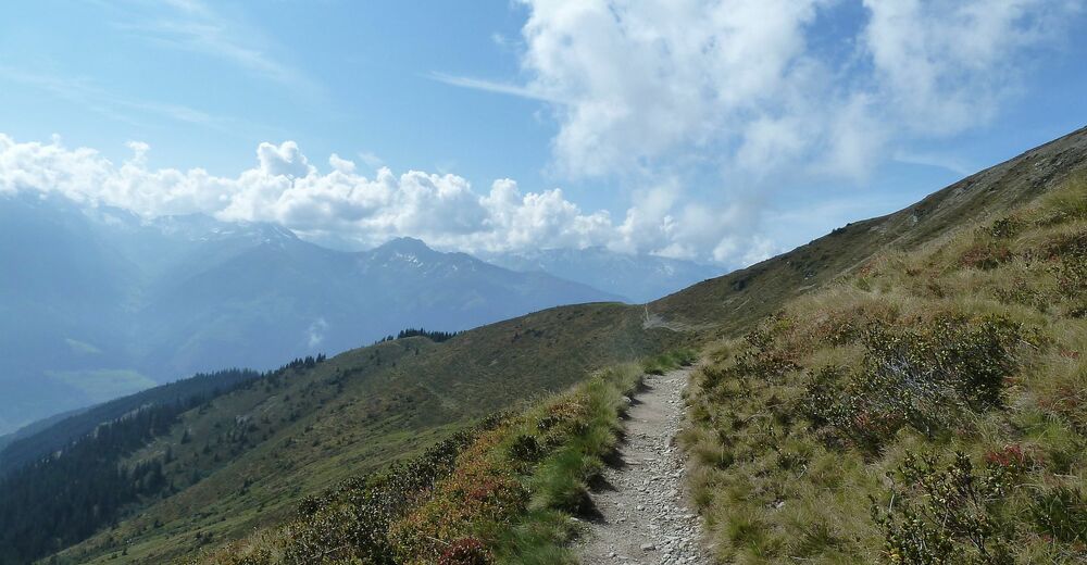
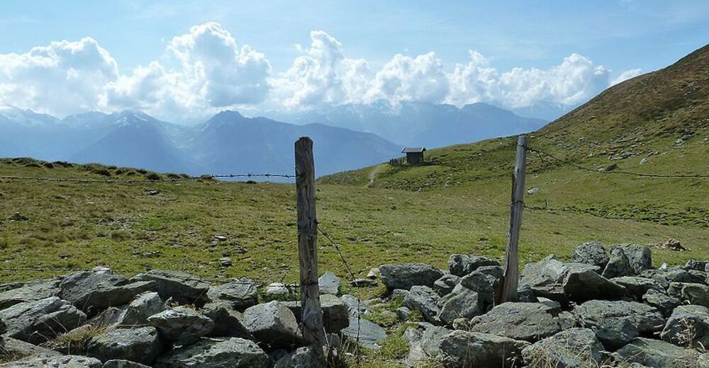
The Pinzgauer Spaziergang is one of the most beautiful high-altitude paths in the Eastern Alps with breathtaking views of the Hohe Tauern peaks.
- Difficulty
-
medium
- Rating
-
- Starting point
-
Schmittenhöhe
- Route
-
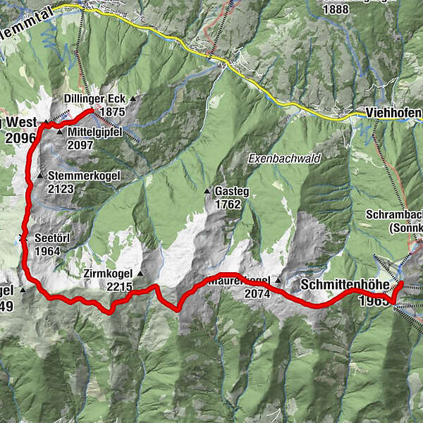
Schmittenhöhe (1,965 m)0.0 kmBerghotel Schmittenhöhe0.1 kmElisabeth-Kapelle0.2 kmEderhütte1.0 kmKettingtörl (1,780 m)1.1 kmKettingkopf (1,865 m)1.7 kmKesselscharte (1,847 m)2.3 kmRohrertörl (1,919 m)5.0 kmKlammscharte (1,993 m)7.5 kmKlinglertörl (2,059 m)11.1 kmSeetörl (1,964 m)12.5 kmSchattberg West (2,096 m)15.5 kmWestgipfelhütte15.6 kmSkyRest16.8 kmSchattberg-Ost (2,018 m)16.9 km
- Best season
-
JanFebMarAprMayJunJulAugSepOctNovDec
- Description
-
During the whole tour, the Salzach Valley, which lies approx. 1,000 m lower, lies at your feet. Above it, well-known peaks such as the Großglockner, Kitzsteinhorn, Granatspitze, Sonnblick and Großvenediger rise up. Please note that the tour is very long and requires good physical condition.
Altogether an extremely rewarding tour in the Kitzbühel Alps/Pinzgauer Grasberge from the Schmittenhöhe to the Bürglhütte in Stuhlfelden or to the Schattberg in Saalbach Hinterglemm.
- Directions
-
After a comfortably ascent with the cable car, the Pinzgauer Spaziergang trail (path nos. 19 & 719) begins southwest below the mountain station at Kettingtörl and leads over Kettingkopf and Kesselscharte to Rohrertörl. Now follow the hiking trail further to the Klammscharte and then to the Klingler Törl in Niedernsill. The hike on hiking trail no. 764 continues past the Hacklberger Seen lakes to the mountain station of the Schattberg X-Press in Saalbach.
NOTICE! Hikers with good physical condition can take the one or other summit experience with them - the summits are not included in the hiking time! Descent options to Piesendorf, Walchen and Niedernsill are possible - hiking time approx. 3 hours.
INFO: At the Klingler Törl you are spoilt for choice - hike to the Schattberg or further towards the Bürglhütte in Stuhlfelden. ;-)
- Highest point
- 2,075 m
- Endpoint
-
Schattberg (Saalbach)
- Height profile
-

- Equipment
-
Ankle-high mountain boot, drinks & snacks, backpack, rain protection, mobile phone
- Safety instructions
- Additional information
- Public transportation
- Parking
-
Sufficient parking available at the valley station of the Schmittenhöhe cable car.


-

-
AuthorThe tour Pinzgauer Spaziergang nach Saalbach is used by outdooractive.com provided.