
- Brief description
-
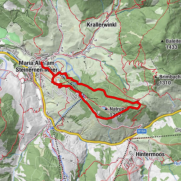
Beautiful hike on the local mountain of Maria Alm, the Natrun.
- Difficulty
-
medium
- Rating
-
- Starting point
-
Tourist office Maria Alm
- Route
-
Wallfahrtskirche Maria Alm0.0 kmMaria Alm am Steinernen Meer0.1 kmSchlosspielplatz5.0 kmGrammlergut5.0 kmMaria Alm am Steinernen Meer7.9 kmWallfahrtskirche Maria Alm8.0 km
- Best season
-
JanFebMarAprMayJunJulAugSepOctNovDec
- Description
-
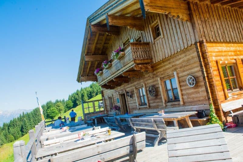
Ascend via meadow and forest paths with a view of Maria Alm to Gasthof Jufen, then continue along the ridge with a view of the Hundstein area to the Natrun cable car. Descent to Maria Alm.
- Directions
-
Behind the pilgrimage church in Maria Alm, trail no. 401A leads uphill towards Natrun. Later, turn left and continue hiking along trail no. 26 to the Postalm and then to Gasthof Jufen. The way back is nice and easy via trail no. 401A, no. 26a and no. 26b to the Grammleralm. From there you can either hike back to Maria Alm via the steep trail no. 401A or flatter via trail no. 26a.
- Highest point
- 1,177 m
- Endpoint
-
Tourist office Maria Alm
- Height profile
-

- Equipment
-
Sturdy, ankle-high footwear
Walking sticks
Headgear
Sun protection
Sunglasses
Rain protection
Drinks and a snack
Necessary medication
First aid kit
Hiking map - Safety instructions
-
Self-assessment Check your physical fitness before every mountain tour and correctly assess your strength as well as that of your companions - especially those of your children! Surefootedness and a head for heights are often very important!
Planning and preparation Plan each intended mountain tour in detail beforehand. Hiking maps and guides as well as information from alpine associations and local experts such as mountain guides and mountain hut keepers can be helpful.
Equipment On the mountain, you will need appropriate equipment and clothing, especially sturdy, high shoes with good grip soles. Weather and cold protection are essential, as the weather can often change unexpectedly.
Weather forecasts Take note of the current weather conditions at: www.zamg.at
Together Follow the 10 rules for the correct handling of grazing animals and do not leave any waste in nature!
Do not kick stones Do not kick stones as this can seriously endanger other hikers. Marked places with a danger of falling rocks should be crossed as quickly as possible and with attention and caution.
Turn back in good time This is not a disgrace, but a sign of common sense. It becomes necessary when the weather changes, fog rolls in, and also when the path is too difficult or not in good condition.Emergency numbers: Alpine emergency call: 140
International emergency call: 122 - Tips
-
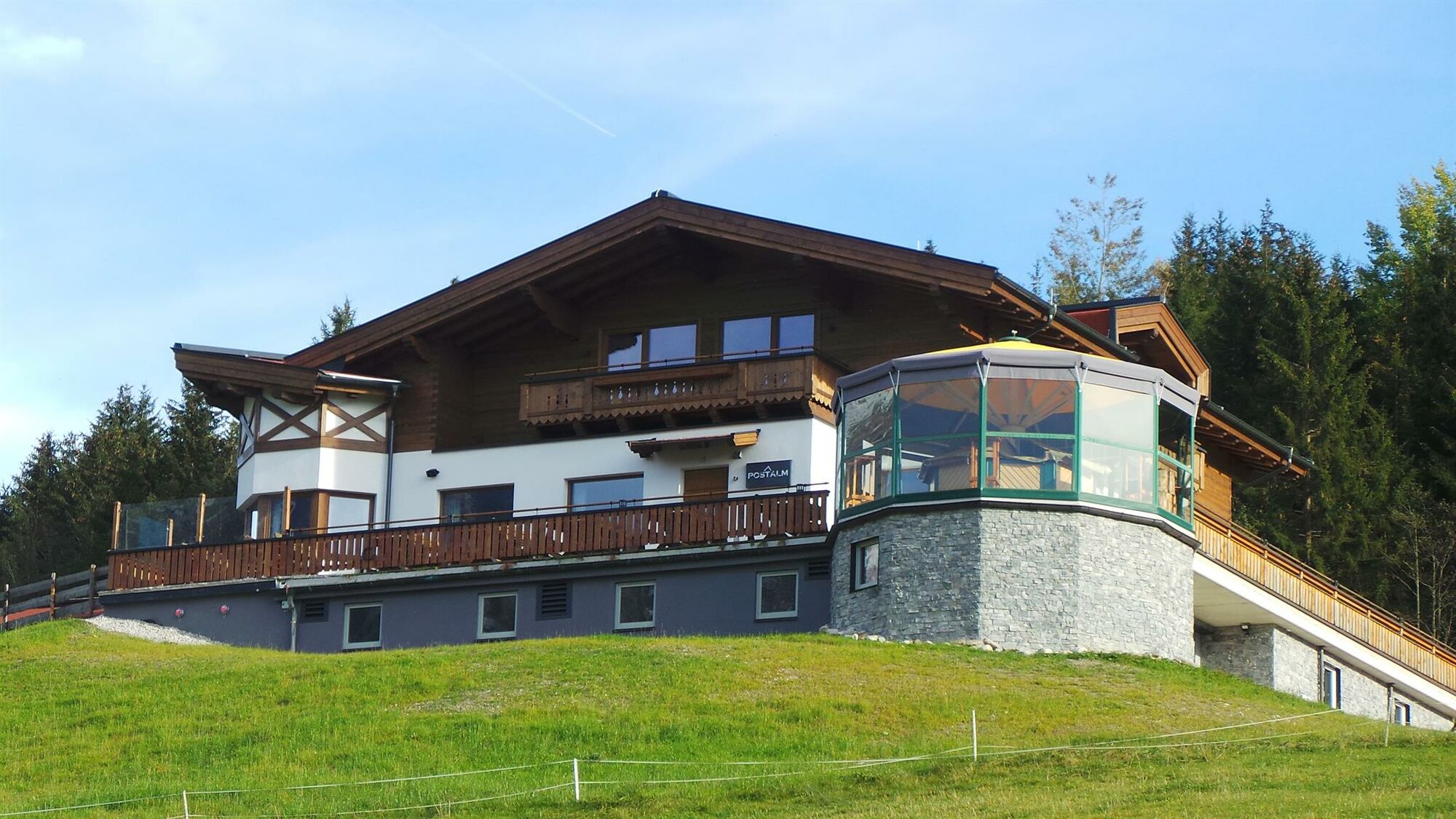
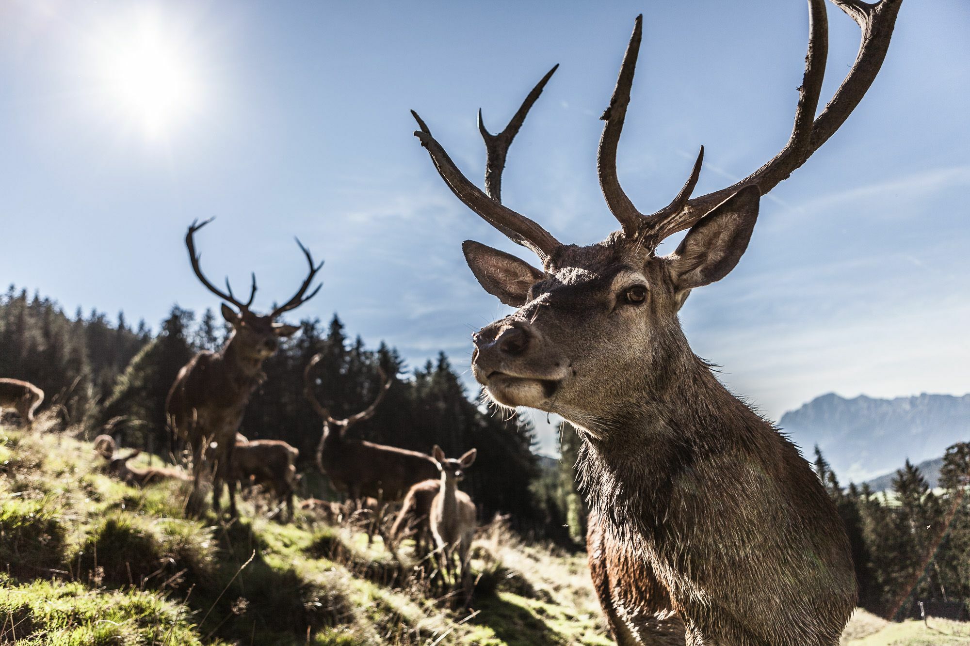
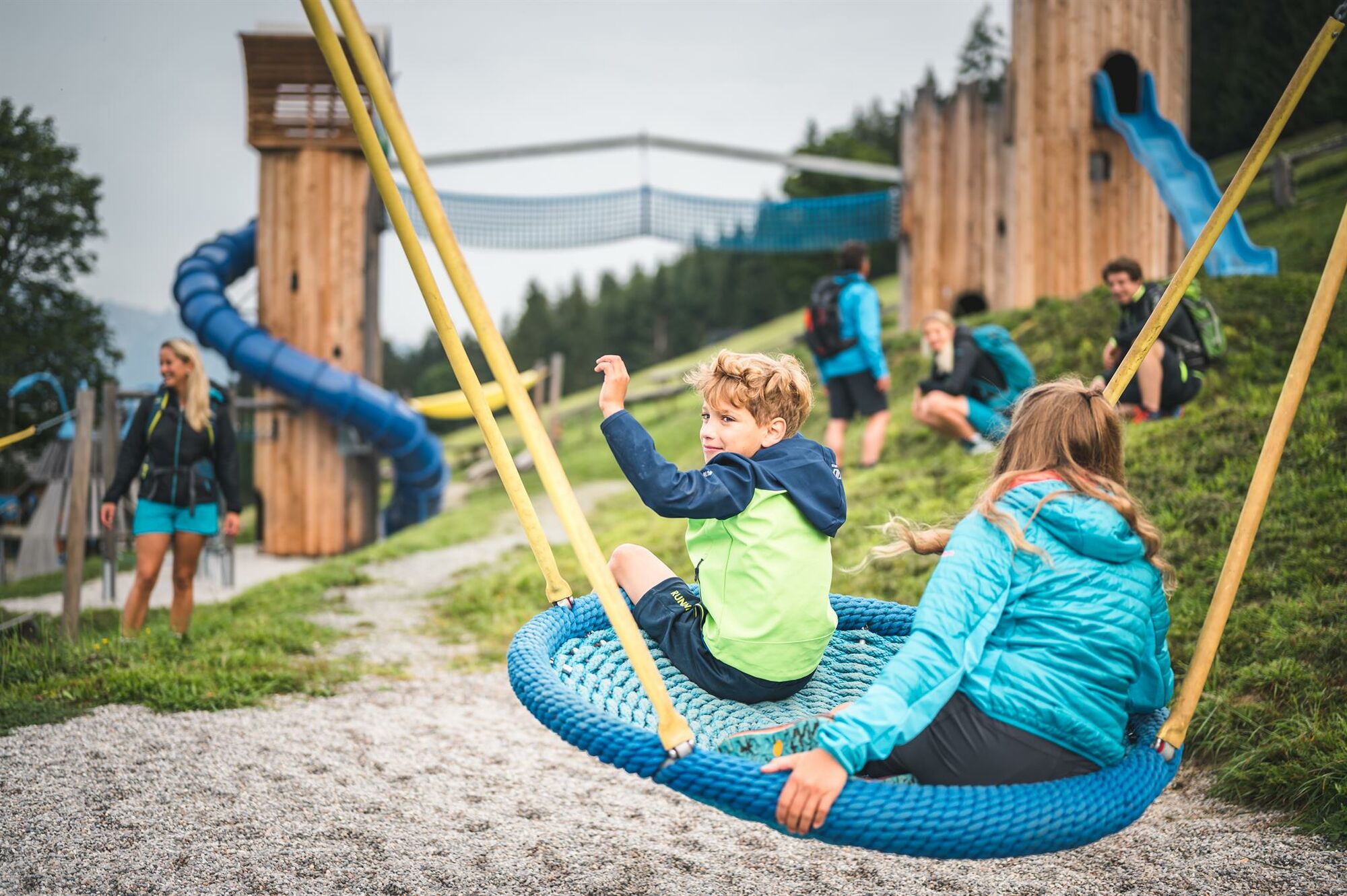
Visit the game reserve at Gasthof Jufen. Big playground for children! During opening hours you can take the Natrunbahn (gondola) down into the valley.
- Additional information
- Directions
-
Coming from Salzburg: Take the A10 motorway to the Bischofshofen exit, then take the B311 towards Bischofshofen. Follow the Hochkönig Bundesstraße/B164 to Maria Alm.
Coming from Innsbruck/ Kufstein: Take the Loferer Straße/B178 in the direction of St. Johann i.T., then follow the Hochkönig Bundesstraße/B164 via Saalfelden to Maria Alm.
A valid vignette is required to use the Austrian motorway and motorway network. It is also compulsory to carry a first-aid kit, warning triangle and high-visibility waistcoat. Further information can be found under Asfinag. - Public transportation
- Parking
-
Free parking at the entrance to the village and in the center of Maria Alm
- Author
-
The tour Mountain pasture and hut hike "Circular route Natrun - Jufen" is used by outdooractive.com provided.