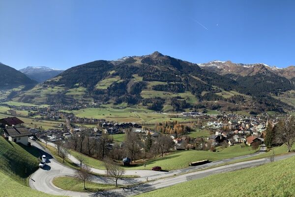

- Brief description
-
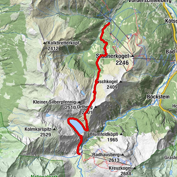
Wald- und Almweg, Alpenvereinsweg
- Route
-
NaßfeldBockhartseehütte1.4 kmSchattbachalm9.0 km
- Highest point
- 2,229 m
- Height profile
-

-
-
AuthorThe tour Angertal Bockhartsee Sportgastein (Nassfeld) is used by outdooractive.com provided.
GPS Downloads


Other tours in the regions