- Brief description
-
Beautiful round trip in Grossarl, where you hike up the Penkkopf.
- Difficulty
-
medium
- Rating
-
- Starting point
-
Parking lot Breiteneben barrier
- Route
-
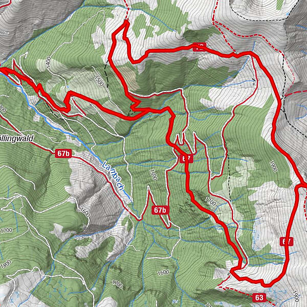
Breitenebenalm1.1 kmGroßwildalm3.8 kmPenkkopf (2,011 m)5.2 kmKarsegg-Heimalm8.2 kmBreitenebenalm10.0 km
- Best season
-
JanFebMarAprMayJunJulAugSepOctNovDec
- Description
-
The ascent takes place from the Sonneggbrücke bridge via the forest road or via the shortcuts through the forest past the Breitenebenalm. Ascent on a hiking trail to the Grosswildalm, where hikers are greeted with a tasty snack of home-made delicacies.
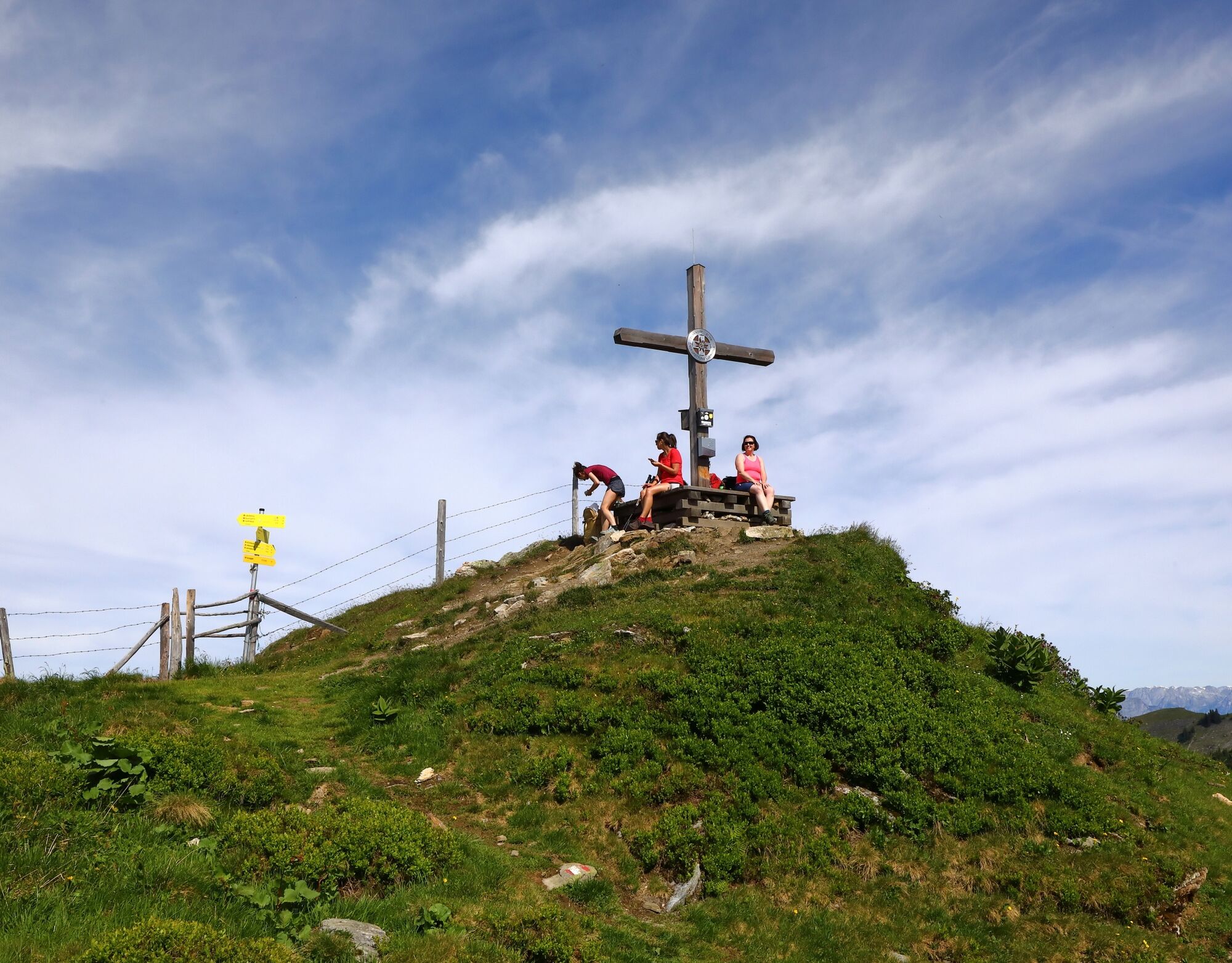
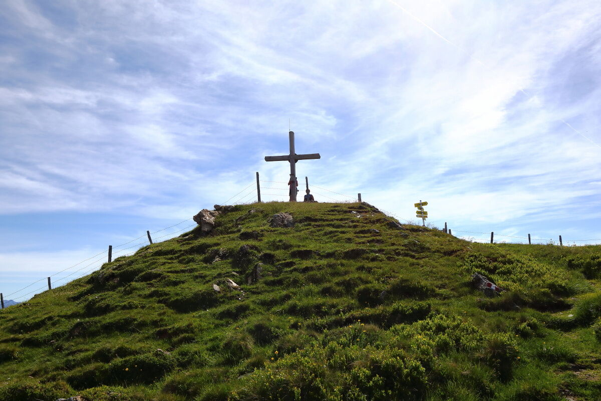
The route then continues up to the Penkkopf. From here you have a wonderful panoramic view of the Hochkönig, over the Tennengebirge and Hagengebirge mountains to the Hohe Tauern with the first three thousand metre peaks. Descent via the Promaualm and Oberwandalm (both unserviced) to the Karseggalm.
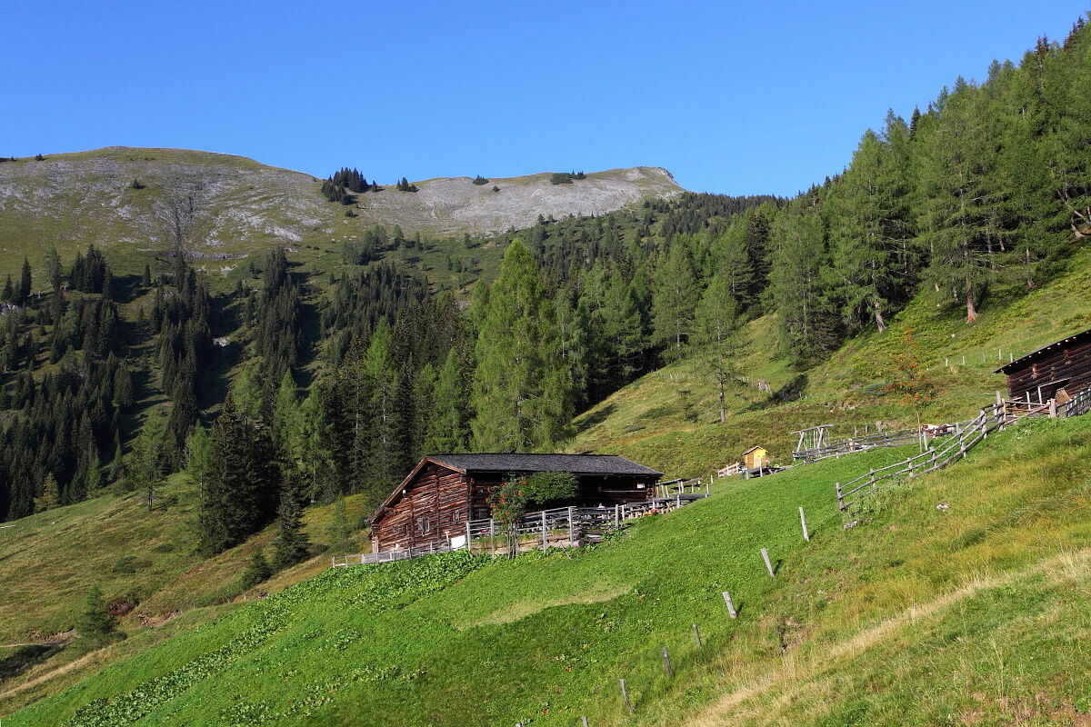
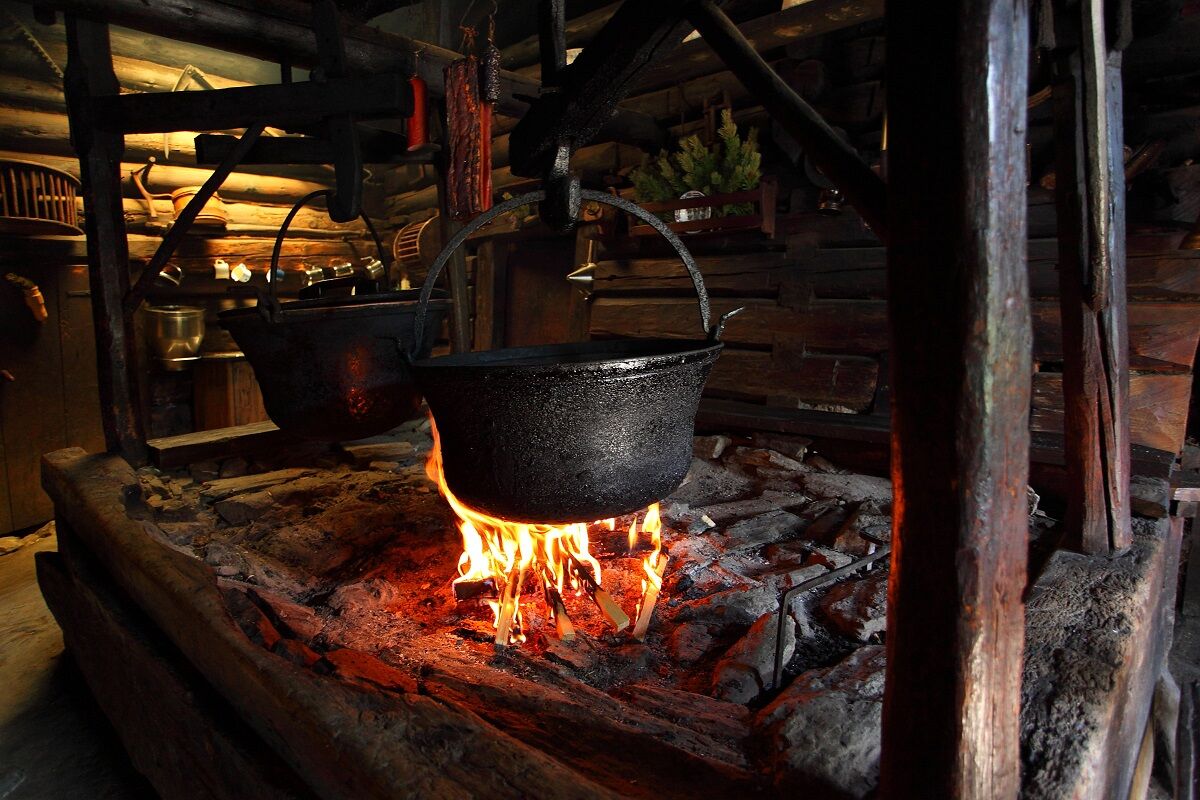
The Karseggalm is probably one of the most rustic huts in the entire Alpine region and, at around 400 years old, it is also one of the oldest. When you enter the hut, you are immediately surprised. The floor inside the hut is covered with clay and tree bark. It is quite possible that the "Wehstatt", as the "kitchen" in an old hut is called, is full of smoke. There is an open fireplace here. This is where a speciality from Grossarltal is made: kneaded cheese. Once a week, you can watch the dairymaid or dairyman making the sour cheese that is so typical of Grossarltal.
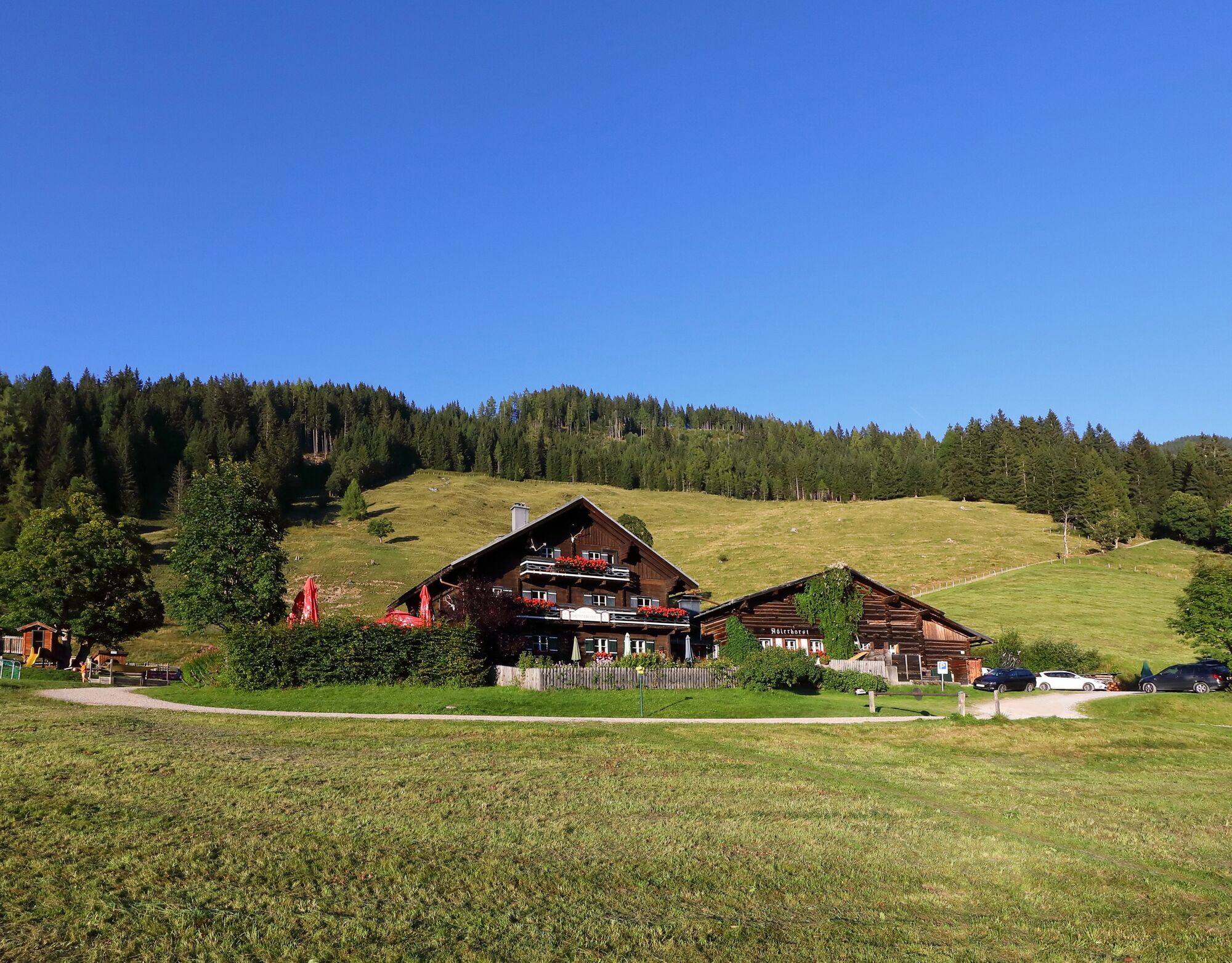
Then descend via a beautiful alpine path to the Breitenebenalm. It is particularly famous for its desserts such as apple strudel or freshly baked cakes. These taste particularly good on the large sun terrace. Finally, you return to the car park, the starting point of the tour.
- Directions
-
Go by car or hiking taxi via the Sonneggweg in the Au district to the Sonneggbrücke bridge and continue to the "parking lot Breitenebenalm" - parking available.
Hike along trail no. 67 or via the shortcuts through the forest (no. 70B) to the Breitenebenalm, 1,420 m (approx. 3/4 h). Ascent on trail no. 67 to the Grosswildalm, 1,778 m (approx. 1 1/2 h). Ascent to the Penkkopf, 2,011 m (approx. 1 h). Descent via the Promaualm and the Oberwandalm (both not farmed) to the Karseggalm, 1,603 m (trail no. 72, approx. 1 h). Descent first via the forest path, then via Almsteig trail no. 70 to the Breitenebenalm (approx. 3/4 h). Descent via the forest path or the shortcuts through the forest to the starting point of the tour (approx. 1/2 h).
- Highest point
- 1,998 m
- Endpoint
-
Parking lot Breiteneben barrier
- Height profile
-

- Equipment
-
Hiking boots with treaded soles, hiking map, rucksack with provisions, water bottle and first aid pack
- Tips
-
You will be spoilt with homemade delicacies at the Grosswildalm, the Karseggalm and the Breitenebenalm.
- Additional information
- Directions
-
You go by car or hiking taxi via the Sonneggweg in the district Au to the Sonneggbrücke and further to the parking lot Breiteneben barrier.
- Public transportation
- Parking
-
Parking lot Breiteneben barrier


- Author
-
The tour Grossarl: Grosswildalm - Penkkopf - Karseggalm - Breitenebenalm is used by outdooractive.com provided.