- Brief description
-
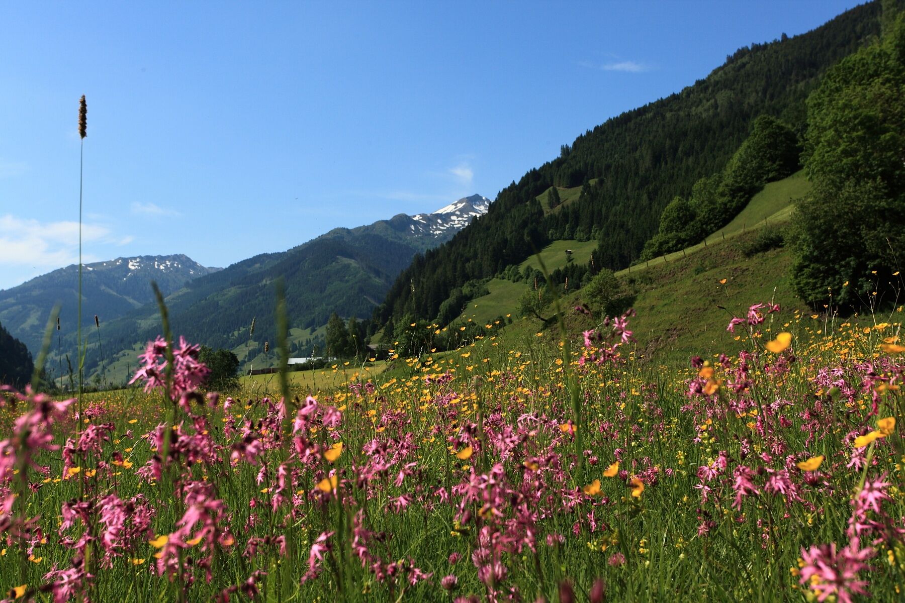
You hike through meadows and forests from Grossarl to Hüttschlag.
- Difficulty
-
easy
- Rating
-
- Starting point
-
Grossarl - village center
- Route
-
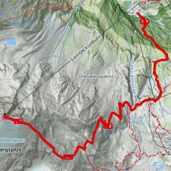
Großarl0.0 kmHubdörfl1.4 kmNiederaigen2.8 kmHörmannlehen2.8 kmEiblbauer3.6 kmGriesbichlkapelle6.6 kmKaminstadl9.8 kmHotel Almrösl10.0 kmHüttschlag10.0 kmSchappachkapelle10.1 kmGriesbichlkapelle13.5 kmEiblbauer16.4 kmHörmannlehen17.2 kmNiederaigen17.2 kmHubdörfl18.6 kmGroßarl20.1 km
- Best season
-
JanFebMarAprMayJunJulAugSepOctNovDec
- Description
-
The Panoramawanderweg connects Grossarl and Hüttschlag and runs on the western side of the Grossarltal.
From the village center of Grossarl, you walk quite comfortably upstream along the river. Just after you have crossed the footbridge, you will see an old mill. You continue along the river and pass several houses and the Gruber carpentry as well as the building of the Kaiserbau. Afterwards, the path leads again along the river until the Gasthof Neumayr (closed).
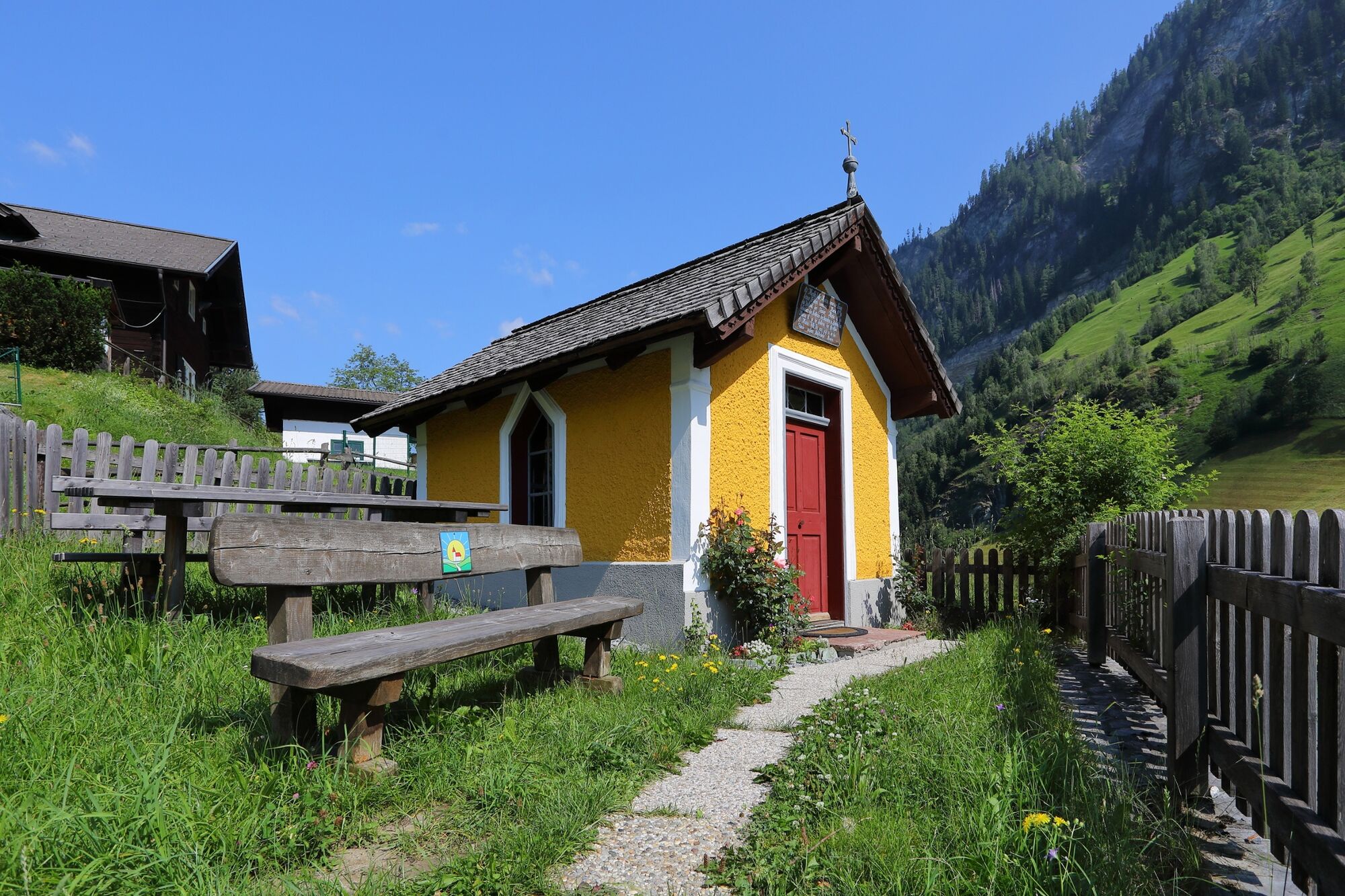
Then, you hike along a hiking path towards Mandldorf. You reach the Ebengasse through meadows. Here you can make a short detour to the Figler Chapel.
Then you coninue through meadows and the forest. After approx. 2 hours you reach the village center of Hüttschlag. Here you can have a break at the Hotel Almrösl or the Hotel Hüttenwirt. If you can prefer, you can go back by public bus.
- Directions
-
From the village center of Grossarl, you walk to the roundabout, then upstream (left). After approx. 50 you take the bridge over the river. Then you follow the Achenpromenade to the Gruber carpentry. Here you cross the Bergstrasse and you turn left. After the building of the Kaiserbau you turn right and follow the Achenpromenade until the Gasthof Neumayr (closed). From here approx. 50 m along the Grossarler Landesstrasse in the direction to Hüttschlag, then you turn right, take the Güterweg to Paulbauer (Niederaigen). Here, you turn left and take the hiking path to the Mandl Farm ("Mandlgasse"). After that, you turn left and after approx. 100 m you turn right and follow the path to the Hotel Moargut. You continue on the same path to the Schmiedhof Farm and to the Untereben Farm. Here, you follow the Ebengasse upwards for about 1/2 km. You go straight (= left) at the crossing.
After about 1/2 km at the turn you go again straigh. You follow the street, then the hiking path to the Griesbichl Farm. You pass some houses and farms, the path finally leads through meadows to the Tofern Farm. From here you follow a somehow steeper path through meadows and through a small forest upwards, before you finally reach the Güterweg Hinterfeld. You hike down to the Grossarler Landesstrasse. Here are two options: Either the way through the tunnel to Hüttschlag (not recommended) or about 150 m along the Grossarler Landesstrasse back towards Grossarl. You cross this and take the first exit on the right where you walk around the tunnel to the village center of Hüttschlag. You can go back by public bus.
- Highest point
- 1,008 m
- Endpoint
-
Hüttschlag - village center
- Height profile
-

- Equipment
-
hiking boots with grip sole, hiking map, beverages
- Safety instructions
-
There are no restaurants etc. along the route. Therefore, take enough beverages with you.
- Additional information
- Directions
-
You go by car or public bus no. 540 to the village center of Grossarl.
- Public transportation
- Parking
-
parking in the south of Grossarl or at the gas station


- Author
-
The tour Grossarltal: Panoramawanderweg is used by outdooractive.com provided.