
- Brief description
-
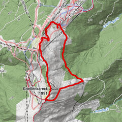
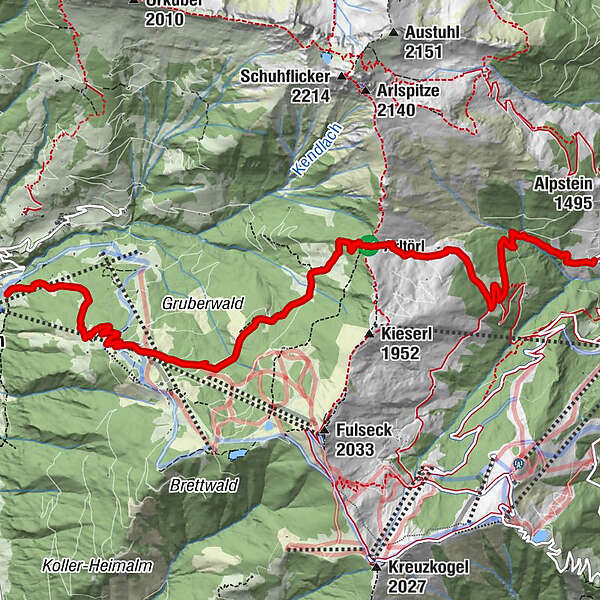
Hiking tour from Grossarltal to the Gasteinertal.
- Difficulty
-
medium
- Rating
-
- Starting point
-
Grossarl - Lainholz farm
- Route
-
Arltörl-Kapelle3.5 kmHeumoosalm4.5 kmReiterhütte6.4 km
- Best season
-
JanFebMarAprMayJunJulAugSepOctNovDec
- Description
-
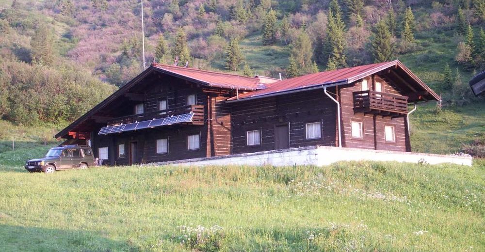
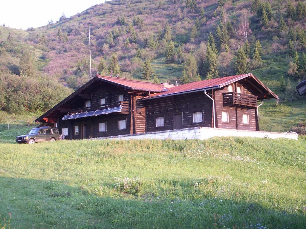
This hike leads past the Berglandhaus, which used to be the earlier ski center in Grossarltal. As early as 1932, the Berglandhaus was one of the first houses in the province of Salzburg, which was open to the public.
In the middle of the fifties in the last century (1955-1958), the Berglandhaus experienced a real boom: the then owner was Sepp Forcher. According to Hedi and Sepp Forcher, the time they spent in the mountain hut was the most beautiful in their lives.
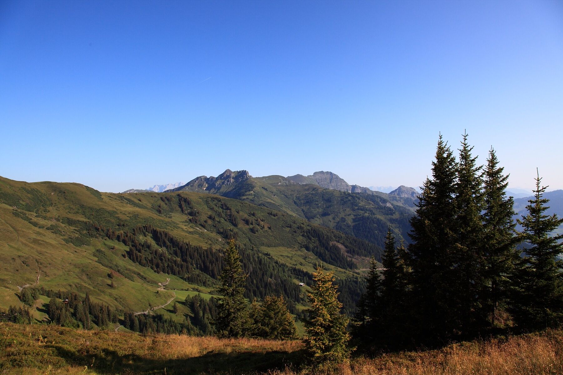
The route continues to the Arltörl, which is the deepest incline between Grossarl and Dorfgastein. Directly at the Arltörl is a small chapel.
You desend to the Heumoosalm, where you can taste local delicacies. Then you hike to the middle station of the Fulseckbahn (cable cars), from where you can go very comfortable into the valley.
Back to Grossarl, you go by train to St. Johann im Pongau and further by public bus into the Grossarltal.
- Directions
-
You hike on the route Rattersberg in the district of Unterberg to the Lainholz farm (until here, going by car is possibe). You hike on the path no. 35 to the Roslehen-Heimalm and further to the Berglandhaus, 1,613 m (both closed) - continue on the path (path no. 35) to the Arltörl, 1,797 m (about 1 ½ h from the Lainholz farm). Then you descend to the Heumoosalm, 1,618 m (approx. 1/4 h). Here, either you hike to the Alpengasthof Hauserbauer and further to Dorfgastein (approx. 2 h) OR you hike along the path no. 515 to the Brandlalm, 1, 458 m (= middle station of the cable cars) and further into the valley (or you go by cable cars to Dorfgastein).
Back to Grossarltal by public transport.
- Highest point
- 1,796 m
- Endpoint
-
Dorfgastein
- Height profile
-

- Equipment
-
hiking boots with grip sole, hiking map
- Safety instructions
-
This hiking tour ends in Dorfgastein. You go back to Grossarltal by public transport.
- Tips
-
There is a swimming pool near the valley station of the cable cars.
- Additional information
- Directions
-
You go by car or hiking taxi on the road Rattersberg in the district Unterberg to the Lainholz farm.
- Public transportation
- Parking
-
cable car car park

- Author
-
The tour Grossarl - Arltörl - Dorfgastein is used by outdooractive.com provided.