
- Brief description
-
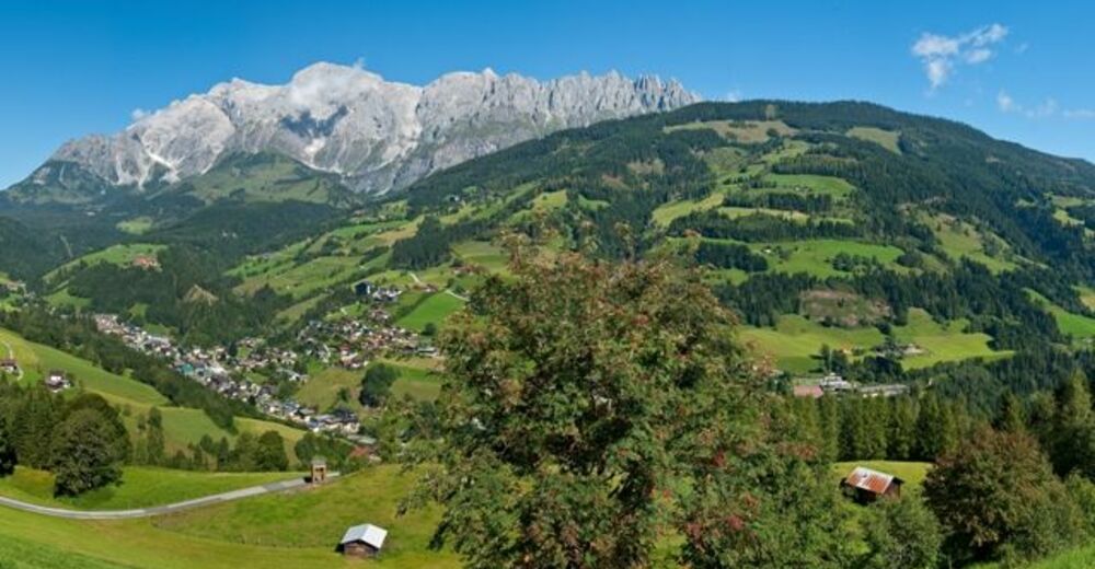
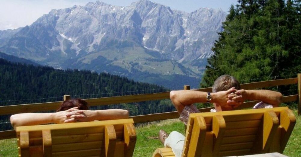
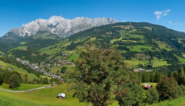
The view of the impressive Hochkönig and the Mandlwände is your constant companion on the hike. Fresh mountain air, towering rocks, idyllic hill farms, lush meadows, and legendary views of the alpine world – this is a balm for the soul. The network of hiking paths is well signposted and designated with the Austrian Hiking Seal of Quality.
- Difficulty
-
medium
- Rating
-
- Starting point
-
Tourist Office Mühlbach
- Route
-
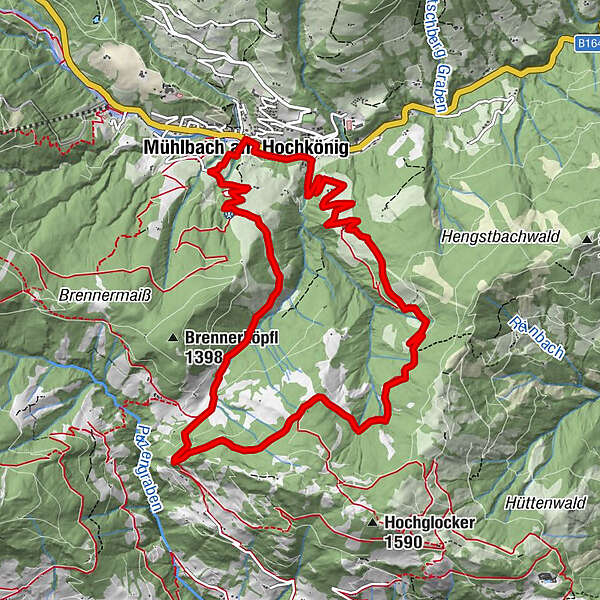
Mühlbach am Hochkönig0.1 kmPaussbauer2.8 kmPronebenalm4.1 kmHubertuskapelle7.6 kmKreisten7.6 kmNasen8.5 kmKapelle10.1 kmMühlbach am Hochkönig11.8 kmPfarrkirche zum hl. Sebastian12.0 kmHöring12.0 kmAnderlwirt12.0 kmMesnerhaus, Café, Bar & Restaurant12.0 km
- Best season
-
JanFebMarAprMayJunJulAugSepOctNovDec
- Description
-
The starting point is the village center of Mühlbach. Turn right after the bakery Bauer and cross the bridge, turn left, past the asphalt path through the district from the Neubau. Below the Gasthof Scherer is a narrow path across a bridge to a road, follow it steadily uphill along the Paussenberggallerie to Gasthof Paussbauer. From there take path no. 79 leads through forests and wetlands to the Pronebenalm. About a forest road of the route no. 79 goes on to the Hubertuskapelle or to Althaus saddle. The trail no. 17 takes you over the Brenner Bauer dirt trail along always downhill back to Mühlbach.
- Directions
-
The starting point is the village center of Mühlbach. Turn right after the bakery Bauer and cross the bridge, turn left, past the asphalt path through the district from the Neubau. Below the Gasthof Scherer is a narrow path across a bridge to a road, follow it steadily uphill along the Paussenberggallerie to Gasthof Paussbauer. From there take path no. 79 leads through forests and wetlands to the Pronebenalm. About a forest road of the route no. 79 goes on to the Hubertuskapelle or to Althaus saddle. The trail no. 17 takes you over the Brenner Bauer dirt trail along always downhill back to Mühlbach.
- Highest point
- 1,406 m
- Endpoint
-
Tourist Office Mühlbach
- Height profile
-

- Equipment
-
Good walking shoes , possibly rain gear, something to drink.
- Safety instructions
-
Safe hiking requires advance information and preparation. Please observe the rules for correct behavior in the mountains. Because your safety is very important to us. And don't forget to drink plenty of fluids during the tour! Take litter down into the valley. Conserve the flora and fauna. Behavior with animals on the mountain pastures: Do not stroke or irritate cows, calves, sheep, horses etc., but behave "quite normally" and do not show any fear. Do not leave paths on alpine pastures and avoid animals at great distances. Dogs must be kept on a leash. Dogs must never chase the grazing animals, especially mother cows fear for their calves. However, if a grazing animal attacks the dog, simply let it run for its own protection.
Emergency numbers: Alpine emergency call: 140
International emergency call: 112
- Tips
-
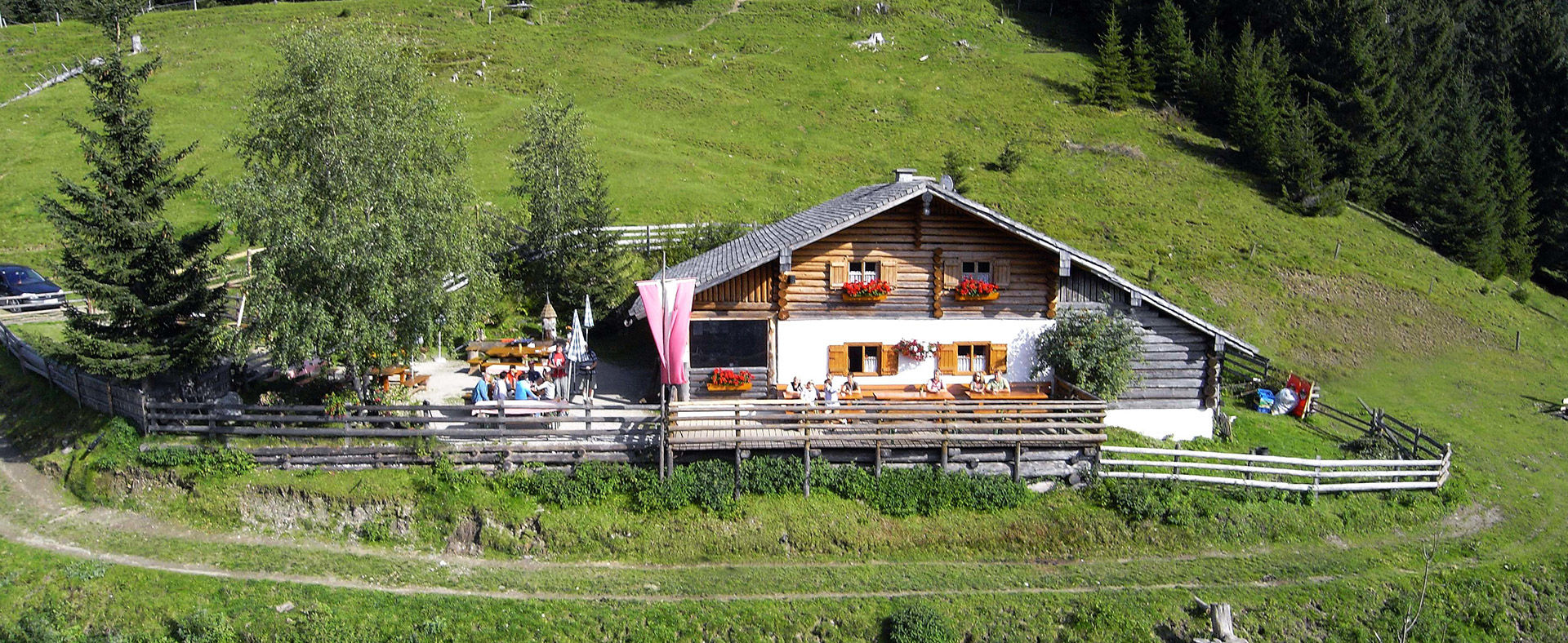
Experience points: In the village baker mill, magnificent view of the Hochkönig from the trail or from the Pronebenalm, Brettljausn on the Alm, herbs hill alm of the Hochkönig region and small animals.
- Additional information
- Directions
-
Hochkönigbundesstrasse B164
- Public transportation
- Parking
-
Parking opposite the fire department.

- Author
-
The tour Idyllic hike from Mühlbach to the Pronebenalm is used by outdooractive.com provided.