- Brief description
-
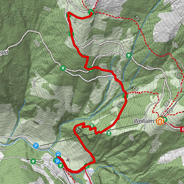
Comfortable hiking tour to the Ellmaualm in Grossarl.
- Difficulty
-
medium
- Rating
-
- Starting point
-
Parking lot Grundlehen
- Route
-
Ellmaualm2.3 km
- Best season
-
JanFebMarAprMayJunJulAugSepOctNovDec
- Description
-
This hiking tour starts at the end of the Ellmautal in Grossarltal at the parking space Grundlehen. You reach the Ellmaualm on a rustic alpine path, which leads through the forest, then over wide alpine meadows. You pass the Grossellmau-Heimalm, which is closed.
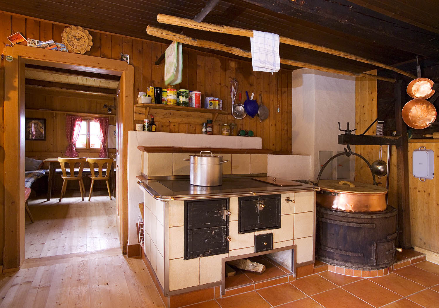
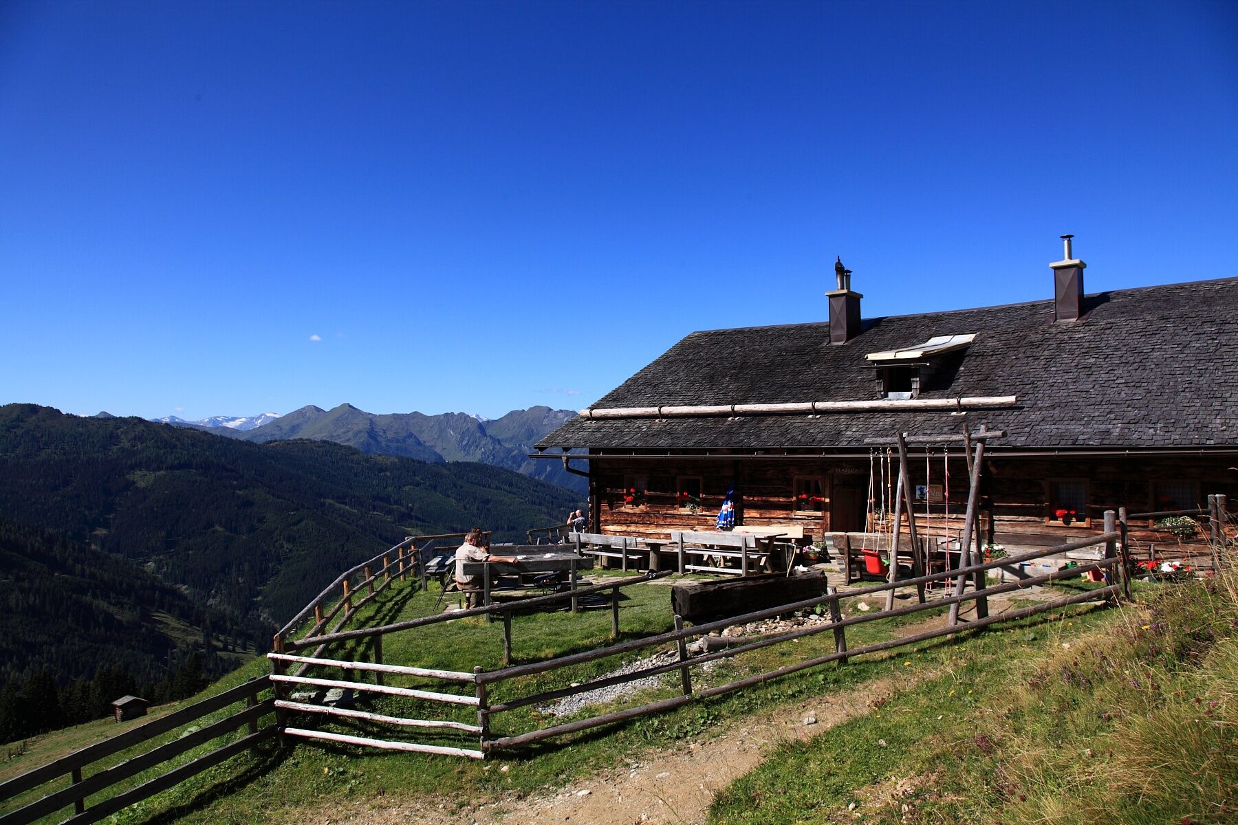
At the Ellmaualm you have a picturesque view and you can enjoy self-made delicacies such as bread, butter, cheese, sausage or bacon. For the children there is a small but nice playground.
- Directions
-
You go by car or public bus into the Ellmautal to Grundlehen - here is a possibility for parking. You hike up on the path no. 62 to the Grossellmau-Heimalm (closed) and further to the Ellmaualm, 1,794 m (approx. 1 1/2 h).
Back on the same route or you hike to the path no. 63 to the neighboring mountain huts (Weissalm, 1,723 m - approx. 1/2 h; Loosbühelalm, 1,769 m - approx. 1 h; Filzmoosalm, 1,710 m - approx. 2 h). Then you hike to Grundlehen.
- Highest point
- 1,790 m
- Endpoint
-
Ellmaualm
- Height profile
-

- Equipment
-
hiking boots with grip sole, hiking map
- Tips
-
There is a cross just some minutes above the Ellmaualm.
- Additional information
- Directions
-
You go by car or public bus (no. 540) to Grossarl. Then you go to Ellmautal between the Spar-market and the Hotel Alte Post. After approx. 6 km you reach the parking space Grundlehen.
- Public transportation
- Parking
-
parking space Grundlehen
- Author
-
The tour Grossarl: Ellmaualm is used by outdooractive.com provided.