
- Brief description
-
Famous surprise tour with beautiful flowers und naturjuwel saw in the Salzburger grasmontain Nationalpark Hohe Tauern
- Starting point
-
EU Wanderhotel Zum Stern
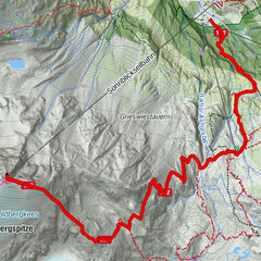
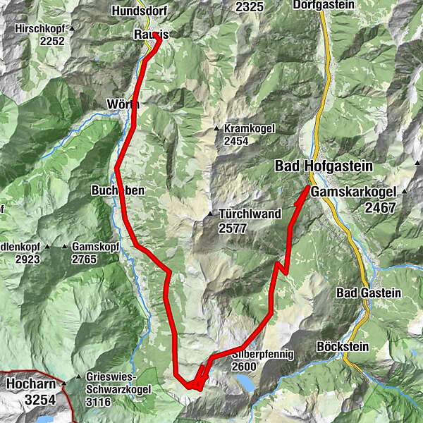
- Route
-
Bad Hofgastein1.0 kmLechner Kapelle3.3 kmSchattbachalm7.1 kmSilberpfennig (2,600 m)10.6 kmBockhart (2,260 m)19.2 kmBucheben30.1 kmJausenstation Kohlhub37.0 kmRauris39.4 km
- Description
-
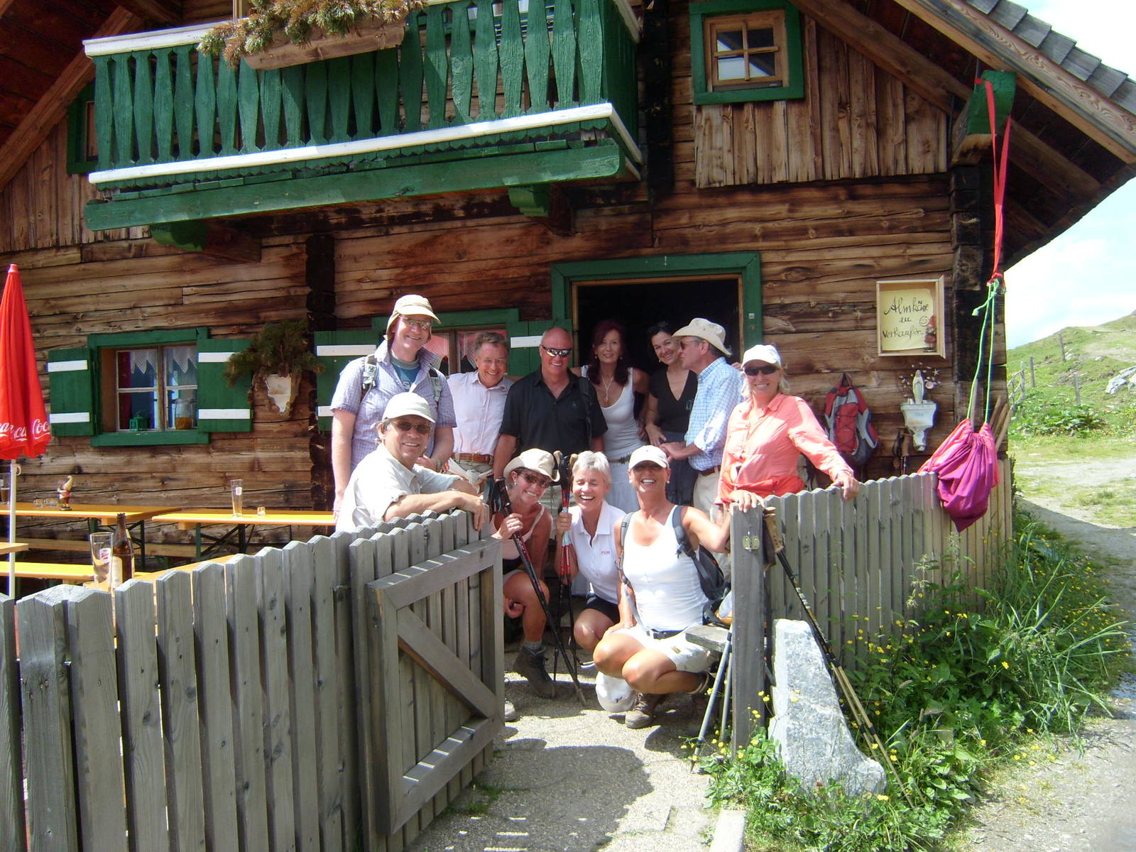
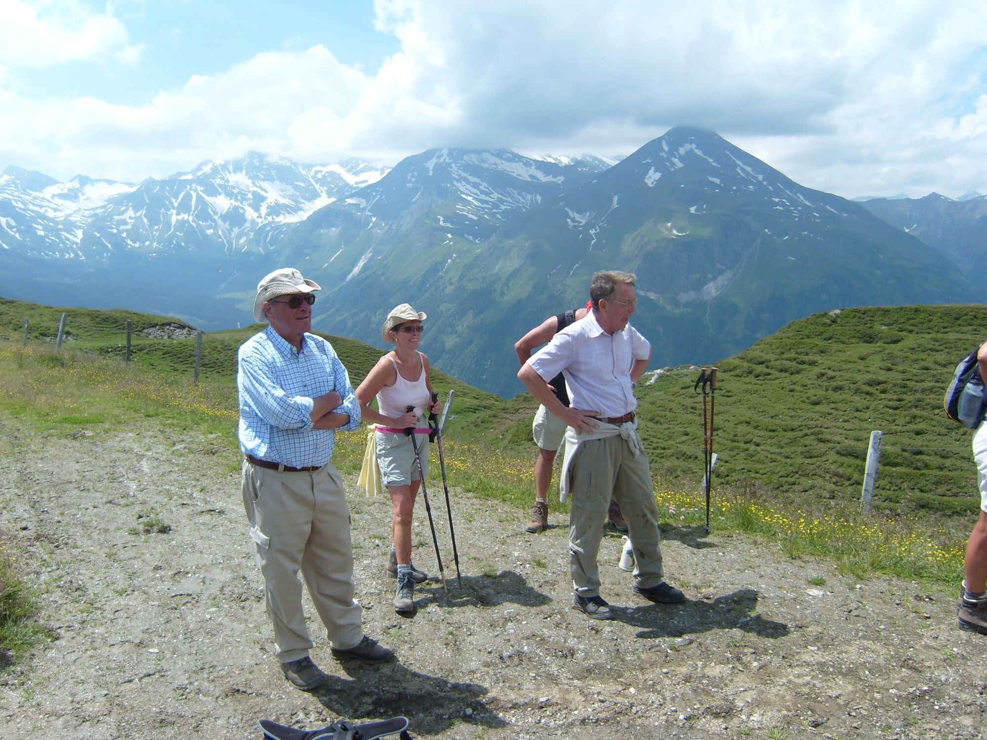
We start from the hotel Zum Stern 875 m with the Shuttlebus (stop direkt by the hotel) to Anger valley 1198 m over the Angerriver pass the Wolfsstall. There the steepliest path (ca. 80 m.) of our hiking tour starts, through the high forest to Gadaunerer Almen 1830m We enjoy a drink in the Feldinghütte. From here the path leads you on westward the Kalkbretterkopf gently up to the the Stanz Scharte 2102m wich offers a marvellous view over the Sonnblick Hoharn Grossglokner Wiesbachhorn Kitzsteinhorn and the montains of the Rauris Valley.
We follow the path down to the Stanz Alm there we take a Jause (Lunch) and go further to Bucheben 1070m.
We take the Shuttlebus to the Hotel Rauriser
- Highest point
- 2,403 m
- Height profile
-

- Directions
-
by foot: start by the Wanderhotel um Stern past th Mittereggbauer througt the wood to the Angertal
by car: start by Wanderhotel Zum Stern by car to the Angertal
- Public transportation
-
Post Bus 551 Hotel Stern
- Author
-
The tour Cross the montain Gadauner Hochalm Stanzscharte Bucheben Rauris is used by outdooractive.com provided.