- Brief description
-
Hiking tour to the Bichlalm, which is one of the most impressive view points in Grossarltal.
- Difficulty
-
medium
- Rating
-
- Starting point
-
Parking lot Finsterwald
- Route
-
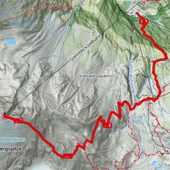
Bichlalm2.7 km
- Best season
-
JanFebMarAprMayJunJulAugSepOctNovDec
- Description
-
Go by car or hiking taxi to the parking lot Finsterwald (above the farm Finsterwald). From there, ascend via the Himmelsleiter to the Bichlalm. The name "Himmelsleiter" (ladder to heaven) already indicates the nature of the path. How else could you get to heaven faster? The hiking trail continues steeply through the forest until you reach the forest road again. Once you reach the top of the forest road, it is worth taking a deep breath and enjoying the wonderful panorama, which is like something out of a picture book. Continue along the forest track without any further ascent to the Bichlalm.
Once you arrive at the mountain hut, you will be spoilt with delicacies such as bread, butter, bacon, cheese or a glass of schnapps from our own production. There is a playground for the children. Above the Bichlalm is a cross with a carved Lord God. As so often on our mountain pastures or mountains, you can see the (former) deep connection to religion in our valley. However, a cross, a chapel or Materl is still a place to keep still and say thank you.
Other variants:
The easiest option starts in Ellmautal at the parking lot above the Hotel Lammwirt. It is a leisurely walk along the forest path through the forest to the Bichlalm. Directly from the centre of Grossarl via the Europatisch in the direction of the farm Finsterwald and from here via the Himmelsleiter. - Directions
-
Drive along Ellmaustraße until the first junction on the right onto the Thalgau goods road. Continue to the parking lot Finsterwald. Ascent initially on a tractor track, then steep ascent via the "Himmelsleiter" (path no. 56) to the forest road (path no. 56A). Continue along the forest road without any incline to the Bichlalm, 1,731 m (approx. 1 3/4 h).
Alternative parking above the Hotel Lammwirt:
Go by car to Ellmautal, past the Hotel Lammwirt on the Jaitlehen goods road and continue along the forest road to the parking lot at the barrier. From there, walk along the slightly ascending forest road (trail no. 56A) through the forest to the Bichlalm, 1,731 m (approx. 2 h).
Variant Grossarl village centre and Europatisch:
Start directly from the village centre of Grossarl. Ascent via the Kirchasse, past the church and on to the Europatisch and on towards the farm Finsterwald (approx. 1 1/2 hours). From there, continue as described above via the Himmelsleiter to the Bichlalm, 1,731 m (approx. 1 3/4 h).
- Highest point
- 1,729 m
- Endpoint
-
Bichlalm
- Height profile
-

- Equipment
-
hiking boots with grip sole, hiking map
- Tips
-
The benches at the Bichlalm invite you to relax.
- Additional information
- Directions
-
Take the car or the hiking taxi to Ellmautal, via the first Thalgau goods road to the Finsterwald farm (parking possibility). Alternatively, take the car to the hotel Lammwirt and continue to the parking lot Bichlalm above the Jaitlehen farm.
- Public transportation
- Parking
-
Parking at the farm Finsterwald or parking lot Bichlalm


- Author
-
The tour Grossarl: Bichlalm is used by outdooractive.com provided.