


- Brief description
- Difficulty
-
medium
- Rating
-
- Starting point
-
Mühlbach tourist office
- Route
-
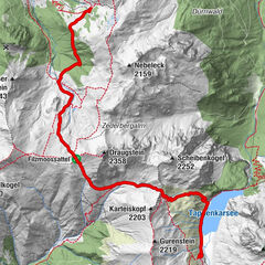
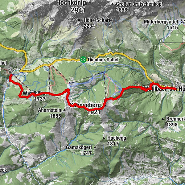
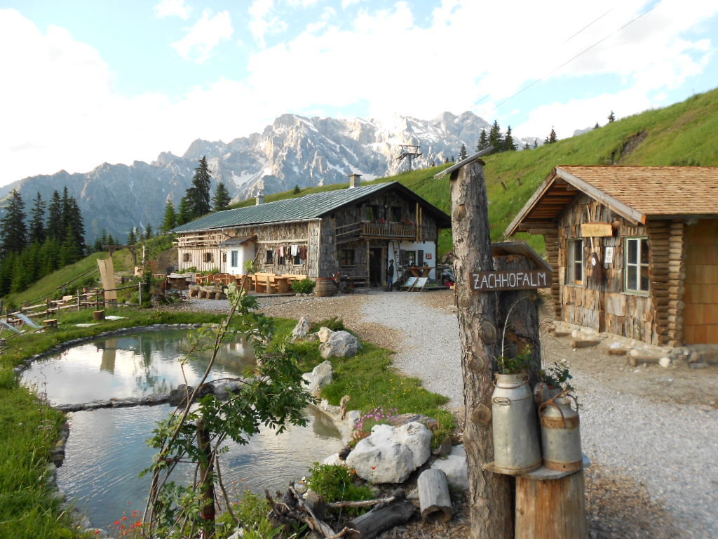
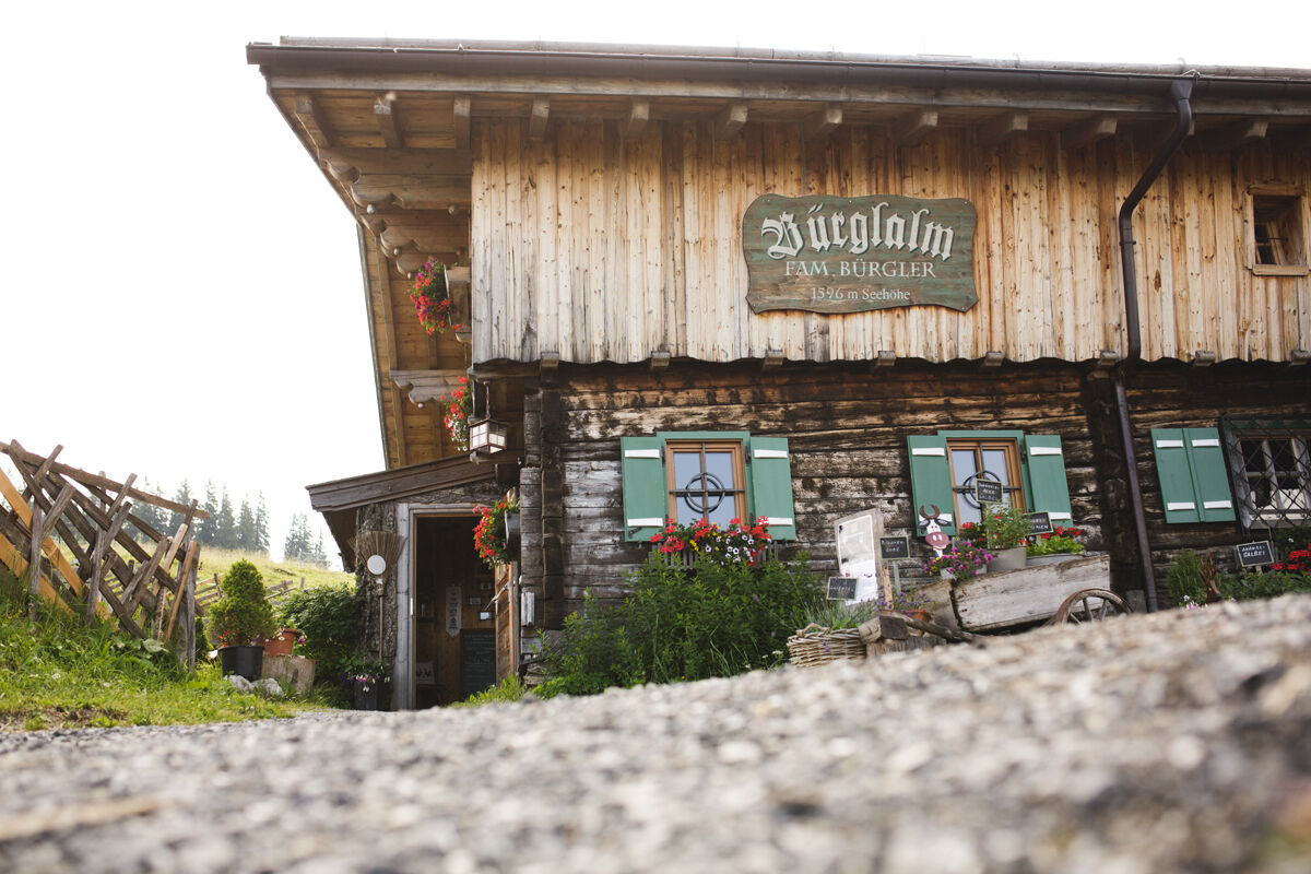
Pfarrkirche zum hl. Sebastian0.0 kmMesnerhaus, Café, Bar & Restaurant0.1 kmAnderlwirt0.1 kmHöring0.1 kmMühlbach am Hochkönig0.1 kmKarbachalm1.3 kmKarbachalm4.1 kmFellersbach5.4 kmSchneeberg (1,921 m)5.9 kmWastlhöhe (1,737 m)10.6 kmWastlhöhelift10.8 kmBürglalm12.1 kmDienten am Hochkönig14.3 km
- Best season
-
JanFebMarAprMayJunJulAugSepOctNovDec
- Description
-
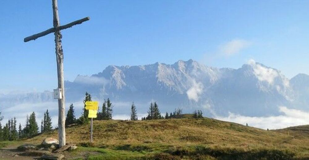
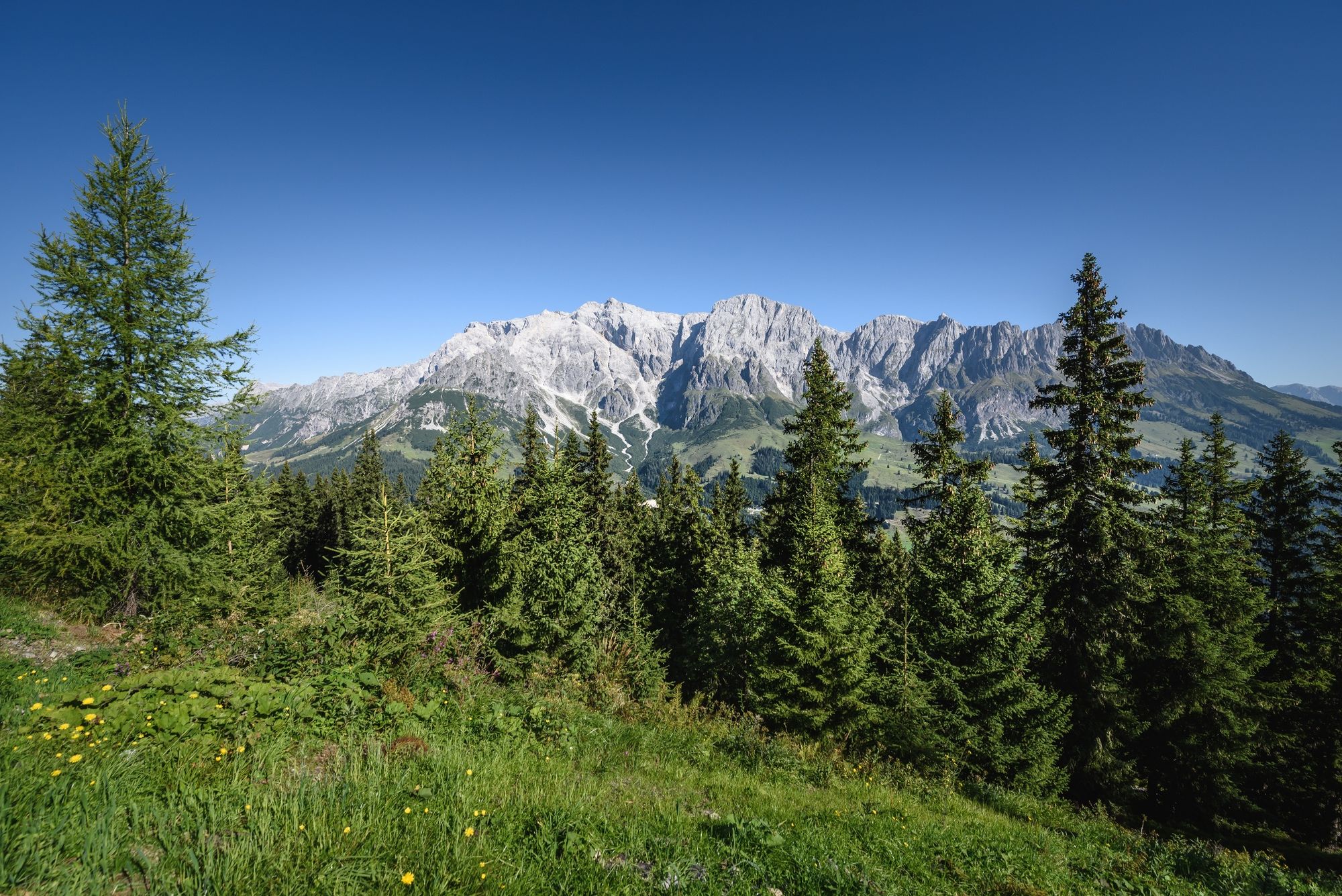
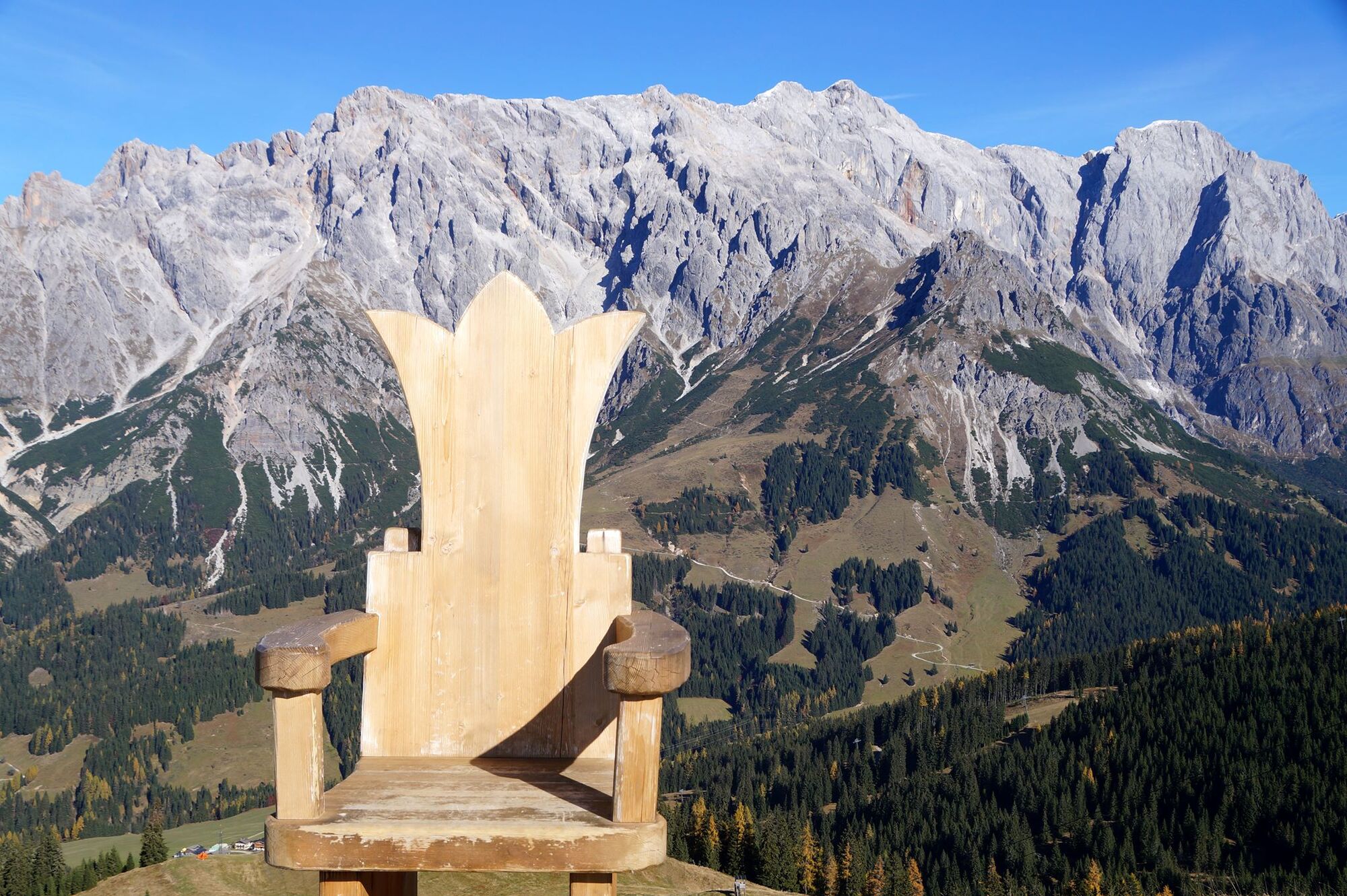
The paths along the fourth stage through the grassy mountains of the Hochkönig region are characterised by their idyllic character. They blend gently into the landscape and offer impressive views of the striking cliffs of the Hochkönig and the highest mountains in Austria. During this stage, nature spoils you with a breathtaking panorama and fascinating views of the surrounding mountains.
- Directions
-
STAGE 4 FROM MÜHLBACH TO DIENTEN
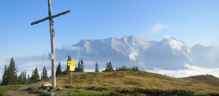
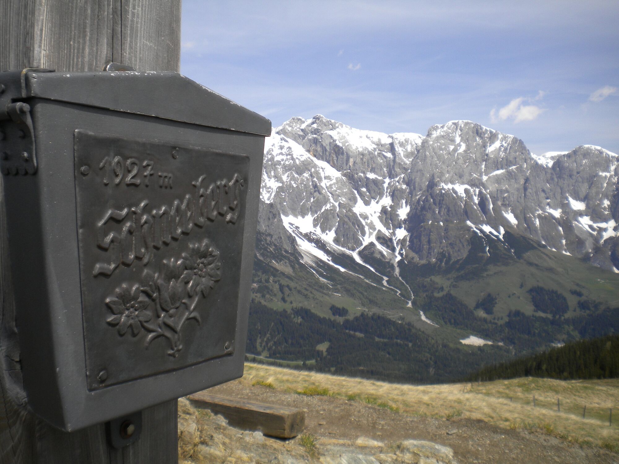
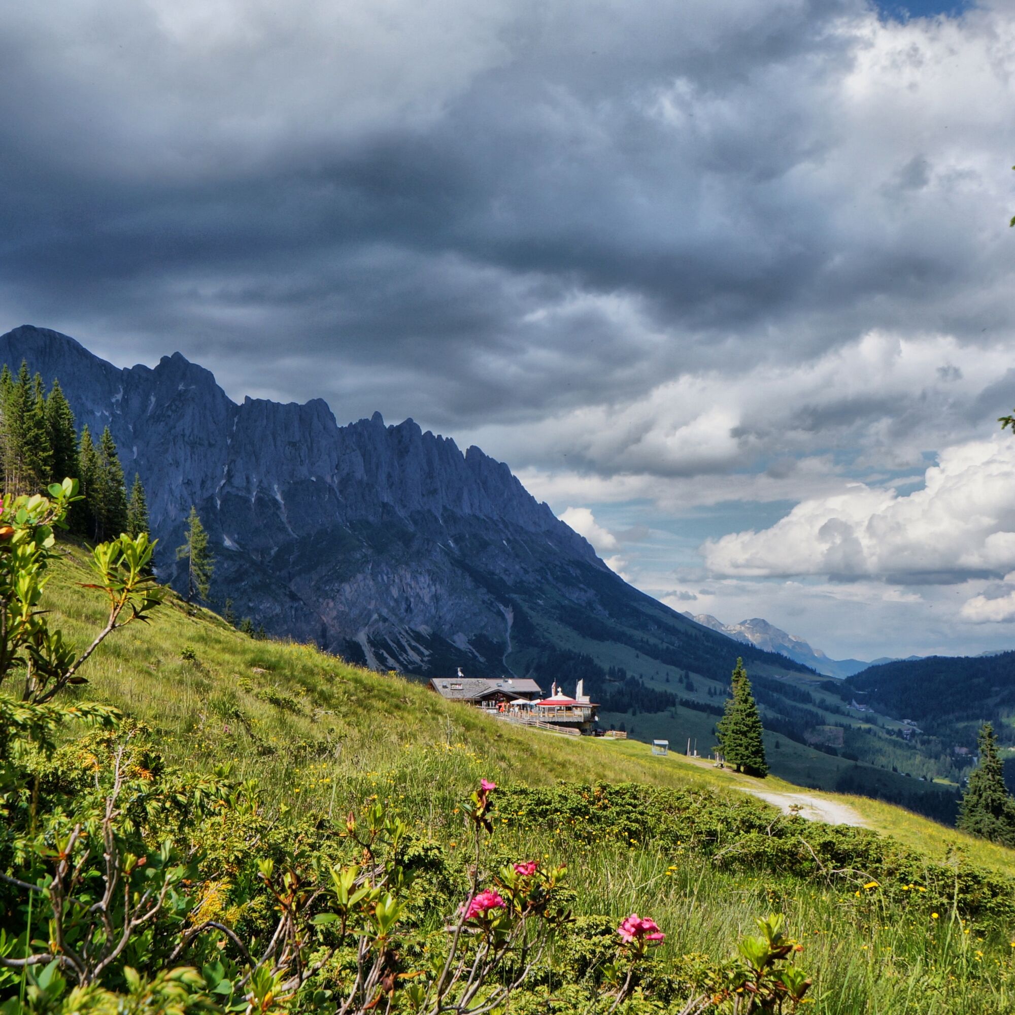
The starting point is the Mühlbach tourist office. Cross the Spar supermarket car park and the bridge. Then turn right onto the village promenade, path no. 15. Following this path, past the mill with the Kneipp facility, you will reach the valley station of the Karbachalmbahn cable car after about 1.5 km. The Karbachalmbahn cable car takes you quickly and comfortably up 670 metres in altitude. After a brief panoramic view of the surrounding mountains, the actual tour begins. Take trail no. 15 uphill, past the Karbachalm mountain station on the left, along a meadow and forest path to the Mühlbacher ski hut. Continue across gentle alpine pastures and finally a short, steep section through rocky terrain before reaching the highest point of this tour, the Schneeberg with summit cross (1,921m). Here you can take a short break to enjoy the unique mountain panorama, and from here the trail leads gently downhill through blueberry bushes and heather, past tousled wind trees. Trail no. 15 leads to the saddle and on to the Klausalm cross. Before heading uphill again, keep right and follow trail no. 57a to the Sunnhüttl. On the flat, forest-free path no. 63, accompanied by the majestic mountain backdrop of the Hochkönig, you continue the hike towards Dienten. Before the Zachhofalmbahn mountain station, this trail rejoins trail no. 15, leading past the mountain station and the summit cross of the Wastlhöhe (1,737m). Continue across alpine pastures and meadows to the Bürglalm, which invites you to take a final rest with a wonderful view of the surrounding mountains (alternatively, take the wide gravel path no. 63). The route then descends somewhat more steeply on trail no. 15, past the Plaudereggalm. After passing a forest path, you can already see the picturesque mountain village of Dienten. A short distance downhill on the forest road, hiking trail no. 5 branches off to the left. The last section of this day tour leads steeply downhill again, through a section of forest and then across meadows into the centre of the village of Dienten. The total walking time is around 5 hours.
The leisurely variant (with use of the summer cable cars): On some days, the Karbachalmbahn cable car in Mühlbach and the Bürglalmbahn cable car in Dienten are in operation at the same time. These summer lifts are suitable for the ascent to the Karbachalm and the descent to Dienten from the Bürglalm. The total walking time is around 3.5 hours.
- Highest point
- 1,904 m
- Endpoint
-
Dienten
- Height profile
-

- Equipment
-
Sturdy, ankle-high footwear
Walking sticks
Headgear
Sun protection
Sunglasses
Rain protection
Drinks and a snack
Necessary medication
First aid kit
Hiking map - Safety instructions
-
Self-assessment Check your physical fitness before every mountain tour and correctly assess your strength as well as that of your companions - especially those of your children! Surefootedness and a head for heights are often very important!
Planning and preparation Plan each intended mountain tour in detail beforehand. Hiking maps and guides as well as information from alpine associations and local experts such as mountain guides and mountain hut keepers can be helpful.
Equipment On the mountain, you will need appropriate equipment and clothing, especially sturdy, high shoes with good grip soles. Weather and cold protection are essential, as the weather can often change unexpectedly.
Weather forecasts Take note of the current weather conditions at: www.zamg.at
Together Follow the 10 rules for the correct handling of grazing animals and do not leave any waste in nature!
Do not kick stones Do not kick stones as this can seriously endanger other hikers. Marked places with a danger of falling rocks should be crossed as quickly as possible and with attention and caution.
Turn back in good time This is not a disgrace, but a sign of common sense. It becomes necessary when the weather changes, fog rolls in, and also when the path is too difficult or not in good condition.Emergency numbers: Alpine emergency call: 140
International emergency call: 122 - Tips
-
award-winning Kaiserschmarren at the Bürglalm
Summer cable cars or hiking bus shorten the route - Additional information
- Directions
-
Coming from Salzburg: Take the A10 freeway to the Bischofshofen exit, then take the B311 in the direction of Bischofshofen. Follow the Hochkönig Bundesstraße/B164 to Mühlbach and further to Dienten.
Coming from Innsbruck/ Kufstein: On the Loferer Straße/B178 in the direction of St. Johann i.T., then on the Hochkönig Bundesstraße/B164 via Saalfelden and Maria Alm to Dienten or to the Filzensattel.
A valid vignette is required to use the Austrian motorway and motorway network. It is also compulsory to carry a first-aid kit, warning triangle and high-visibility waistcoat. Further information can be found under Asfinag.
- Public transportation
- Parking
-
Public parking in the center of Mühlbach or at the valley station Karbachalmbahn

- Author
-
The tour The Königsweg stage 4 (Mühlbach - Dienten) is used by outdooractive.com provided.


General info
-
Hochkönig
2042
-
Goldegg am See
799