Grossarl: Unterwandalm - Karseggalm - Kitzstein (Gabel) - Maurachalm


- Brief description
-
Wonderful circular hike with summit experience on the Kitzstein (Gabel) and 3 mountain huts to stop off at.
- Difficulty
-
medium
- Rating
-
- Starting point
-
Parking lot Sonneggbrücke
- Route
-
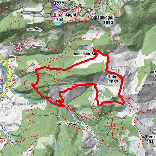
Unterwandalm2.7 kmKarsegg-Heimalm3.6 kmGabel (2,037 m)6.1 kmMaurachalm7.9 kmMuggenfeldalm (Rothofalm)8.8 km
- Best season
-
JanFebMarAprMayJunJulAugSepOctNovDec
- Description
-
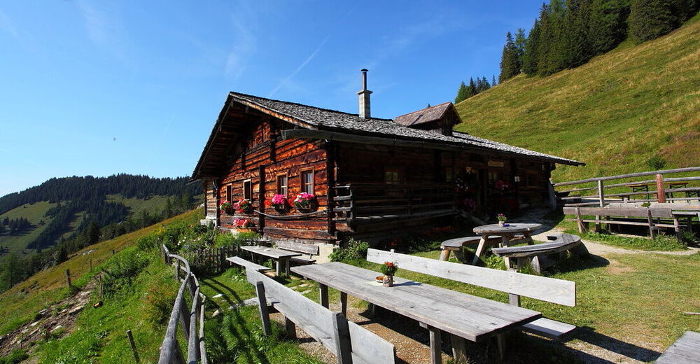
From the parking lot at the Sonneggbrücke, take the hiking trail to the Unterwandalm. This is your first stop on your circular hike. There is often music and singing at the Unterwandalm. Continue at the same altitude to the Karseggalm. The Karseggalm is probably one of the most rustic mountain huts in the entire Alpine region and, at around 400 years old, it is also the oldest mountain hut in Grossarltal.
From there, ascend via the Oberwandalm (not serviced) to the Kitzstein (Gabel). From here you have a wonderful view of the Salzach valley as well as the Hochkönig, the Tennen and Hagen mountains on one side and the Hohe Tauern on the other. After your summit victory, you continue via the Auhhoalm (not managed) to the Maurachalm, your last destination on this wonderful hike. Here, too, you will be spoilt with delicacies from our own production. The Maurachalm is the northernmost alpine pasture in Grossarltal and is particularly famous for its exquisite schnapps (rowanberry or elderberry). The dairymen often sing and play music here.
Take the forest path downhill to the Muggenfeldalm (not managed) and continue via the shortcuts through the forest back to the starting point of the tour.
- Directions
-
Go by car or hiking taxi via the Sonneggweg in the Au district to the Sonneggbrücke - parking available. Head uphill first along the forest path and then along the somewhat steeper hiking trail (trail no. 70C) to the Unterwandalm, 1,600 m (approx. 1 1/2 h). Follow trail no. 70 to the Karseggalm, 1,603 m (approx. 1/2 h) and then ascend via the hiking trail (no. 72) towards the Promaualm and Oberwandalm, 1,858 m (not serviced) to the Kitzstein (Gabel), 2,037 m (approx. 1 1/4 h). Descent on trail no. 72 to the Auhofalm, 1,680 m (not managed) and on to the Maurachalm, 1,620 m (approx. 1 h). From there, descend via the forest path and the shortcuts through the forest to the parking lot Sonneggbrücke (approx. 1 1/2 h).
- Highest point
- 2,019 m
- Endpoint
-
Parking lot Sonneggbrücke
- Height profile
-

- Equipment
-
Hiking boots with treaded soles, hiking map, rucksack with provisions, water bottle and first aid pack
- Safety instructions
-
On the trail from the Kitzstein (Gabel) to the Maurachalm, surefootedness and a head for heights are required in some places.
- Tips
-
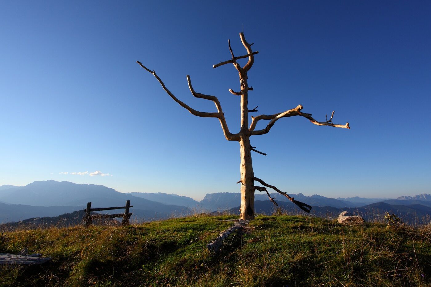
The Kitzstein (Gabel) is the northernmost peak on the east side of Grossarltal and a particularly beautiful vantage point in the valley.
- Additional information
- Directions
-
Go by car or by hiking taxi on the Sonneggweg in the district Au to the Sonneggbrücke
- Public transportation
- Parking
-
Parking possibility at the Sonneggbrücke


- Author
-
The tour Grossarl: Unterwandalm - Karseggalm - Kitzstein (Gabel) - Maurachalm is used by outdooractive.com provided.


General info
-
Katschberg Lieser-Maltatal
2572
-
Großarltal
2157
-
Großarl
968


