


- Brief description
-
Impressive hike to the unique hermitage Saalfelden with stunning view of the surrounding mountains. Especially suitable for families.
- Difficulty
-
easy
- Rating
-
- Starting point
-
Car park Bürgerau (Lichtenbergstraße, Saalfelden)
- Route
-
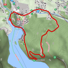
Palfenkapelle hl. Georg0.6 kmGeorgskapelle0.6 kmBachwinkl2.1 kmObsmarkt4.1 kmSaalfelden am Steinernen Meer (748 m)4.2 km
- Best season
-
JanFebMarAprMayJunJulAugSepOctNovDec
- Description
-
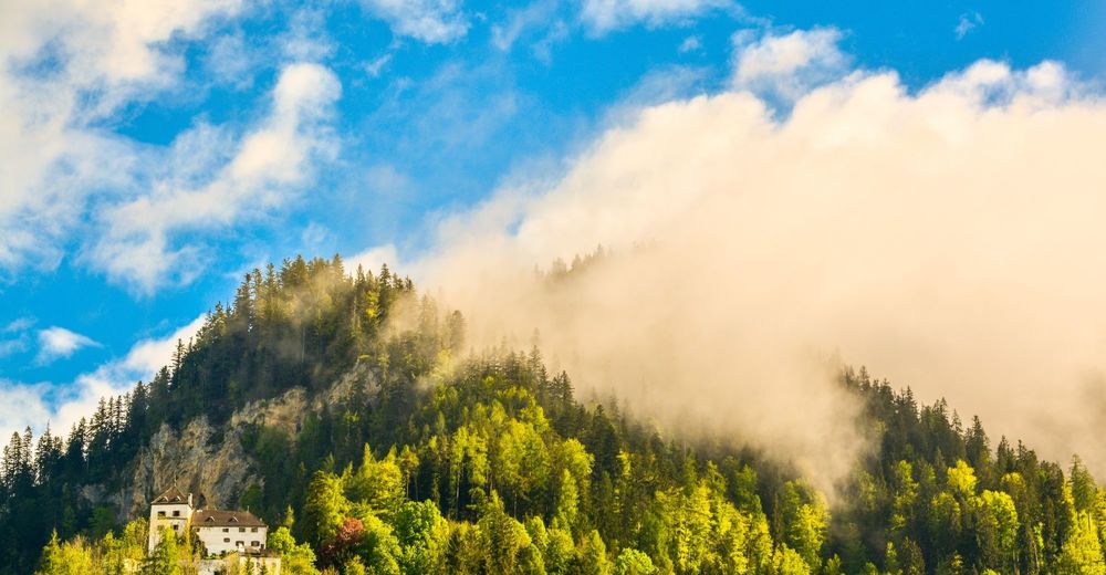
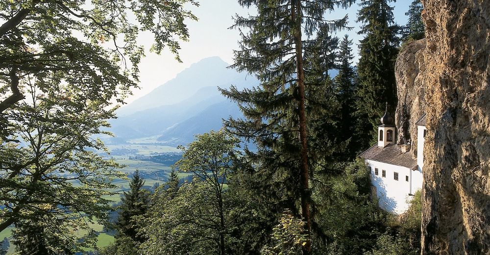
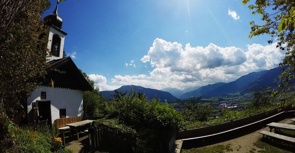
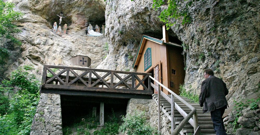
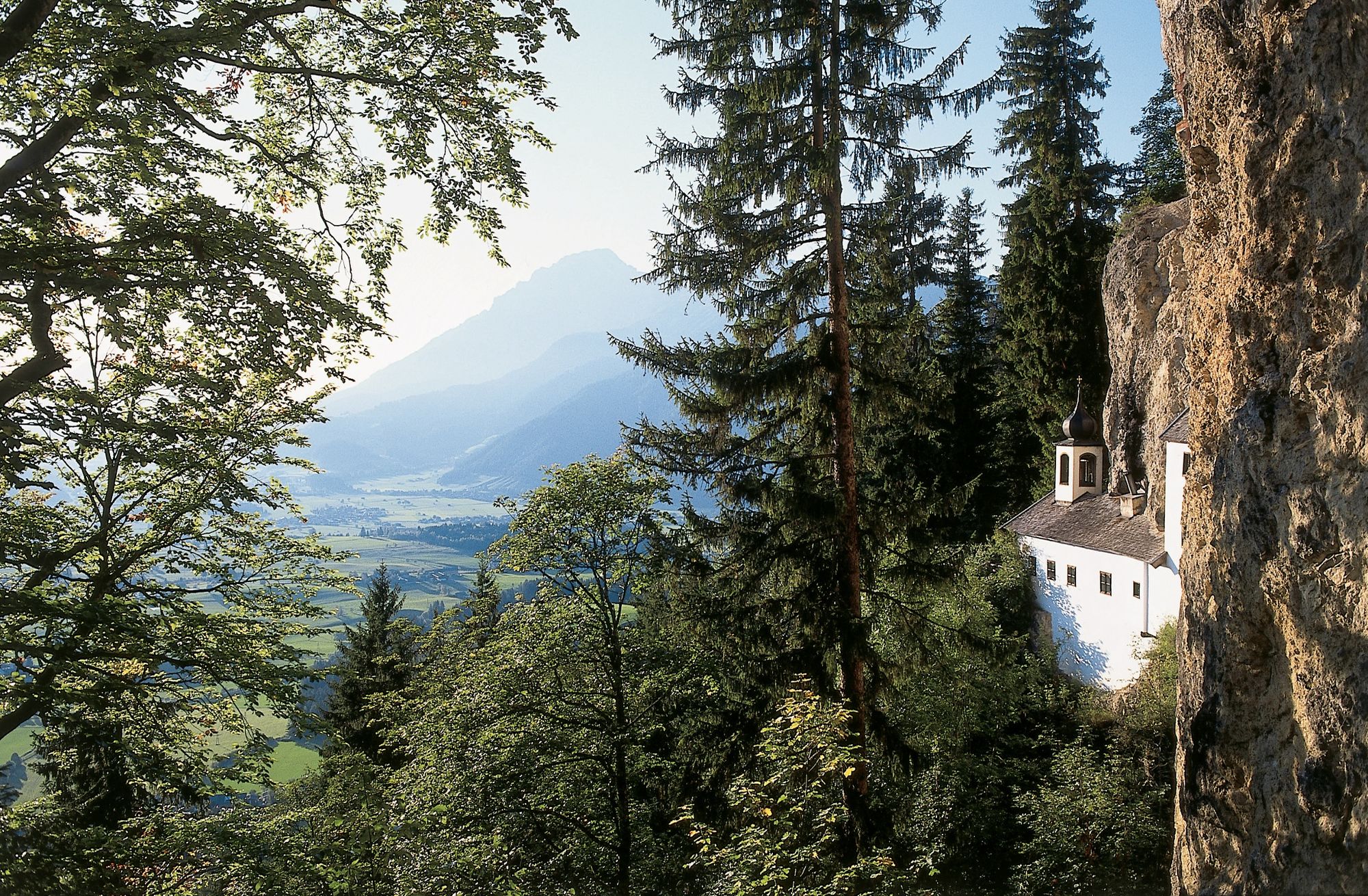
The hiking tour to the hermitage in Saalfelden is especially suitable for families and those seeking an easy hike. When choosing this route, we recommend you to take a pause at the hermitage for a little while – you might even meet the hermit, who lives up here in the summer. The hermitage Saalfelden on 1.006 m was built in the 17th century above the Lichtenberg castle. It is Europes‘ last inhabited hermitage and there is also a small chapel up there. Residents and visitors of Saalfelden Leogang and the Pinzgau region value the hermitage as a place of peace and a resting place for one’s soul. From here you can enjoy the stunning view of Saalfelden Leogang and the surrounding mountains.
- Directions
-
This circular trail starts at the car park "Bürgerau" in Saalfelden. From here you walk across a bridge and a short forest path up to the beautiful Lichtenberg castle. From there on it is a short hike to the Hermitage. After a short recommented pause at the hermitage, you continue to Bachwinkel from where you can return via a hiking path to your starting point.
Walking time circular trail: 1 h 30 min.
- Highest point
- 981 m
- Endpoint
-
Hermitage Saalfelden
- Height profile
-

- Equipment
-
alpine boots, backpack, hiking map, hiking poles
- Tips
-
From the hermitage you can expand your hike and take the "Fuchssteig" path to reach the Steinalm mountian hut. NOTE: This ascent is only recommened for proficient mountaineers and requires skillfulness and a head for heights.
- Additional information
-
Stop-off points: Hermitage Saalfelden
- Directions
-
BY CAR
Drive on the Pinzgauer federal highway B311 from Saalfelden in the direction of Lofer. About 500 m after the roundabout at the Interspar supermarket, take a turn right into 'Anton-Wallner-Straße'. Follow the road for 350 m, then take a turn left into the Lichtenbergstraße. Follow the road for about 1.5 km past the high school until you see the car park on the left.
- Public transportation
-
BY TRAIN
Take the train and start to enjoy your vacation as soon as you leave home. Relax and enjoy the view as you travel to Saalfelden Leogang with no traffic to slow you down. Visit the website of the Austrian railway (ÖBB) for schedules and tickets. www.oebb.at
BY BUS
The starting point at the car park Bürgerau can be reached by bus from the city center of Saalfelden. The bus stop "Saalfelden Höhere Internatsschule" is located in walking distance to the starting point.
- Parking
-
Free parking spaces are available at the starting point, the car park Bürgerau.


-

-
AuthorThe tour Hermitage Saalfelden is used by outdooractive.com provided.


General info
-
Saalfelden - Leogang
1816
-
Saalfelden
466