© Zell am See-Kaprun Tourismus GmbH - Zell am See-Kaprun Tourismus

- Difficulty
-
difficult
- Rating
-
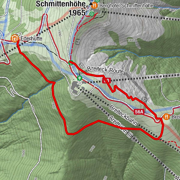
- Starting point
-
Near Kettingalm (1804)
- Route
-
Breiteckalm1.6 km
- Best season
-
JanFebMarAprMayJunJulAugSepOctNovDec
- Description
-
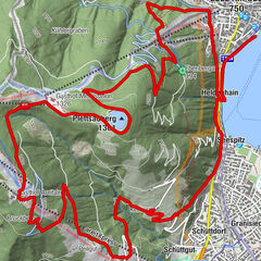
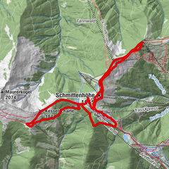
For the two high-altitude running routes Hochsonnbergalm-Trail and Panorama-Trail, we have prepared a fabulous alternative for all Trail-Running-Freaks going back to the starting point. Shortly after the Kettingalm, turn to the right across the ski slope and enter the pristine forests which spread out until just before the Breiteckalm Lodge. From there, take the new gravel path to get up to the Schmittenhöhe.
Surface: Forest floor and gravel
- Highest point
- 1,898 m
- Height profile
-

- Author
-
The tour Variant Breiteckalm is used by outdooractive.com provided.
GPS Downloads


General info
Refreshment stop
A lot of view
Other tours in the regions