
- Brief description
-
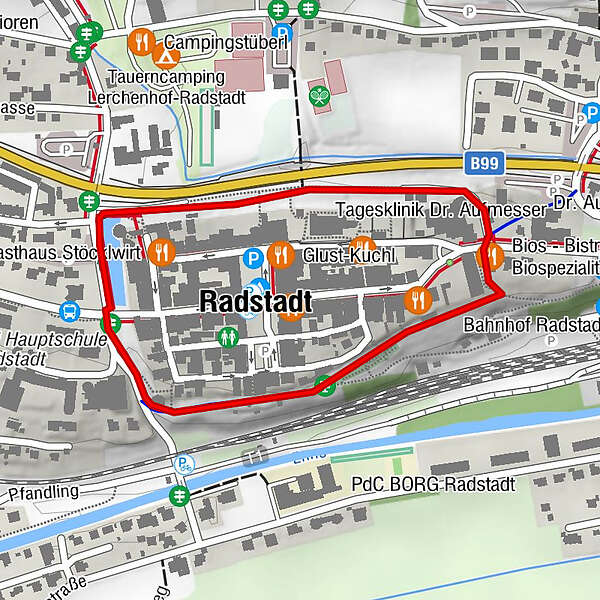
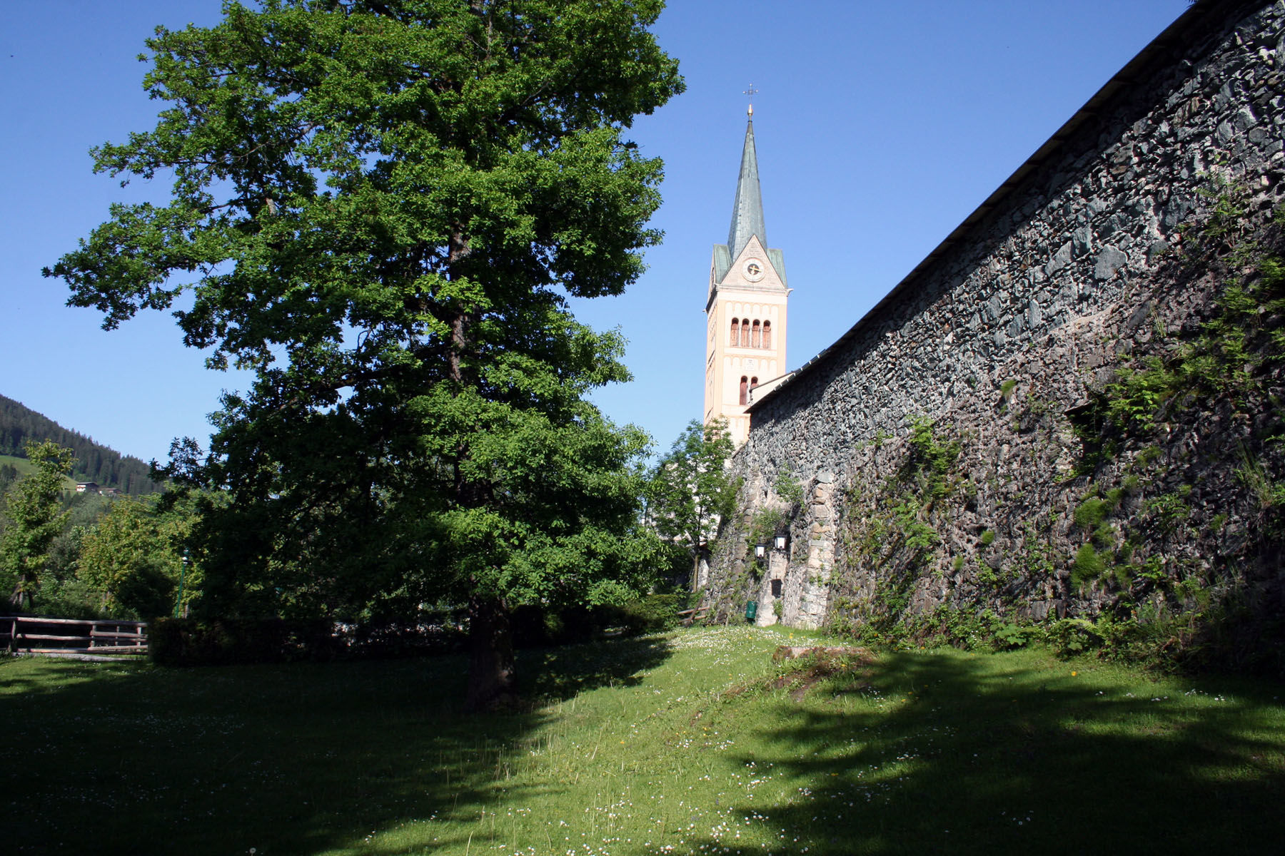
Promenade path around the historic city wall of Radstadt.
- Difficulty
-
easy
- Rating
-
- Starting point
-
Radstadt post office
- Route
-
Stadtpfarrkirche0.2 kmKapuzinerkirche0.4 kmRadstadt (858 m)0.9 km
- Best season
-
JanFebMarAprMayJunJulAugSepOctNovDec
- Description
-
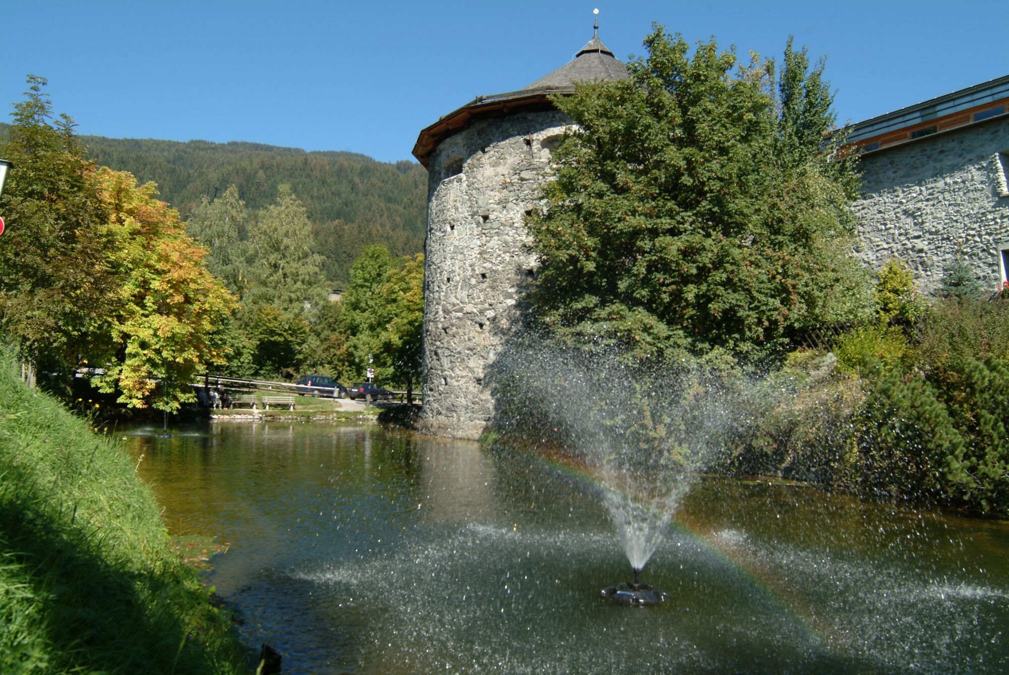
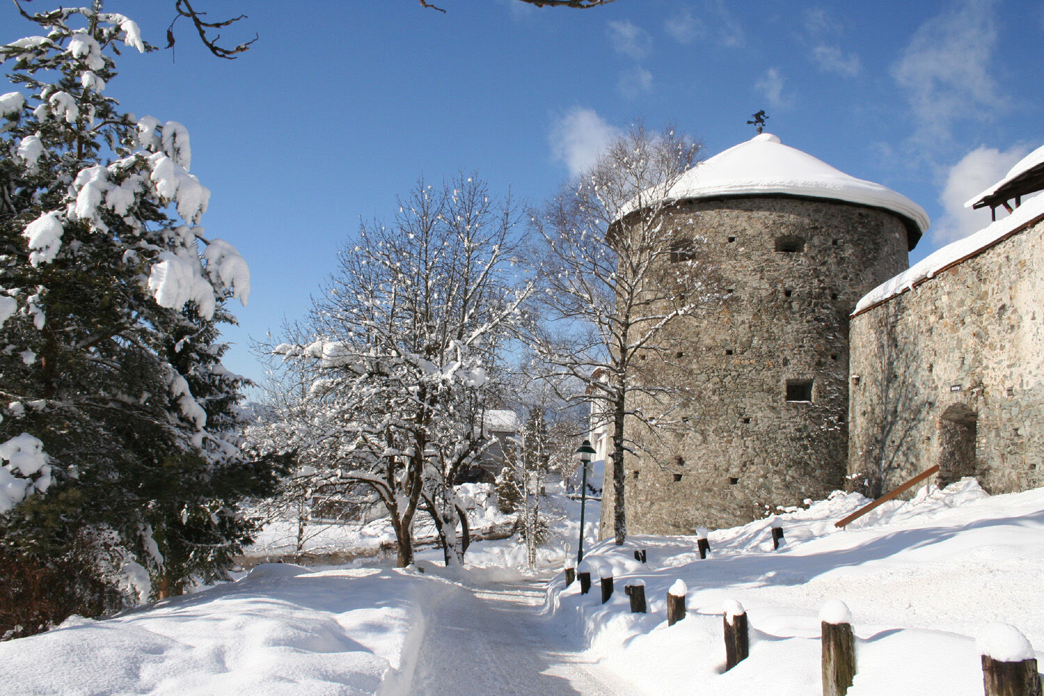
This tour leads along the city pond to the armory tower and further through the so-called shooting range. This is where the Millennium Trail begins, which gives you the most important data on the history of Radstadt in the past 1000 years on display boards. The number of steps corresponds to the respective annual intervals. At the corner house on the main street on the east side, parts of the old city gate (Steirertor) can be seen. South of the city wall you have a wonderful view of the Radstadt Tauern, the Lackenkogel and the Grießenkareck. There are plenty of benches in shady and sunny locations where you can take a break and enjoy the view.
- Directions
-
Starting from the Radstadt post office, you walk along the city pond to the armory tower. After the pond, go right along the city wall through the shooting range. Past the monastery, the oldest part of Radstadt and the Capuchin tower, the path takes you south again. After you have crossed the main street, the path leads along the "Hofkasten" and then further to the right westwards along the city wall. From the "witch tower" the path leads back up to the post office.
- Highest point
- 851 m
- Endpoint
-
Radstadt post office
- Height profile
-

- Tips
-
You can get a folder for this walk through "the old town in the mountains" with the most important information about Radstadt and the historical sites for free at the tourist office.
- Parking
-
It is best to park directly at the city pond or at the Gardeplatz.
-

-
AuthorThe tour Around the city wall is used by outdooractive.com provided.


General info
-
Schladming - Dachstein
2999
-
Salzburger Sportwelt
2192
-
Radstadt
596