
- Brief description
-
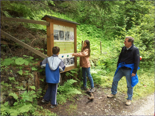
An interesting hiking trail for the whole family. Hiking and learning at the same time. - What could be better? Learn more about the historic copper mining in Mühlbach.
- Difficulty
-
easy
- Rating
-
- Starting point
-
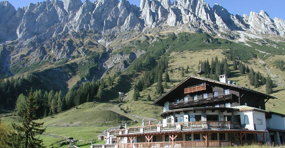
Arthurhaus
- Route
-
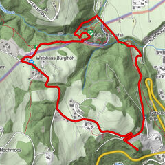
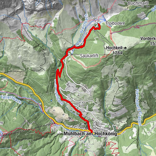
ArthurhausKnie4.5 kmAnderlwirt5.7 kmPfarrkirche zum hl. Sebastian5.7 kmMesnerhaus, Café, Bar & Restaurant5.8 kmMühlbach am Hochkönig5.8 km
- Best season
-
JanFebMarAprMayJunJulAugSepOctNovDec
- Description
-
From the Arthurhaus, follow trail 85 a little way up to the Hochkeilweg, then downhill past the valley station of the "Rosswieslieft" to the Keltenloch. Pass behind the Hochkeilhaus to Mandelwandstraße. At the Mandlwandhaus you reach the entrance to the Barbara Gorge. The secured path, once built by miners, leads through the gorge. The path leads below the Ruperti tunnel into the old Mitterbergstraße (Hochkönig sports hall), follow this downhill and turn left over a brick arched bridge, continue through the Hochwald forest and turn right to Viererwasch. Cross the route of the old light railway or the old Mitterbergstraße, the path continues to the Kniegut. From there across the meadow to Bernhardgut. Immediately after, turn right across the meadow, continue down to Schrammbach and follow the path to Mühlbach.
- Directions
-
From the "Arthurhaus" starting point, follow path no. 85 past the prehistoric copper mining sites, downhill to the galleries of the modern copper mining industry and former processing plants. Afterwards, a path leads through the romantic Barbara Gorge, which flows into the old Mitterbergstraße below the Ruperti Gallery. Follow this downhill and turn left over a brick arched bridge and continue through the Hochwald forest to Viererwasch. Cross the route of the old light railway and continue to Kniegut and Mühlbach.
- Highest point
- 1,520 m
- Endpoint
-
Village center of Mühlbach
- Height profile
-

- Equipment
-
No special equipment necessary.
- Safety instructions
-
Partly damp substrate.
Varied terrain.
- Tips
-
If they take the time to read the information boards, they will learn as much as possible about copper mining in Mühlbach.
- Additional information
- Directions
-
Arriving from Salzburg: Take the A10 motorway to the Bischofshofen exit, then take the B311 in the direction of Bischofshofen. Follow the Hochkönig federal road/B164 to Mühlbach.
Coming from Innsbruck/ Kufstein: On the Loferer Straße/B178 towards St. Johann i.T., then on the Hochkönig Bundesstraße/B164 via Saalfelden to Mühlbach.
A valid vignette is required to use the Austrian motorway and motorway network. It is also compulsory to carry bandages, warning triangle and high-visibility waistcoat. For further information see Asfinag.
- Public transportation
- Parking
-
Car park Arthurhaus

- Author
-
The tour Mitterberger Erzweg is used by outdooractive.com provided.