


- Brief description
-
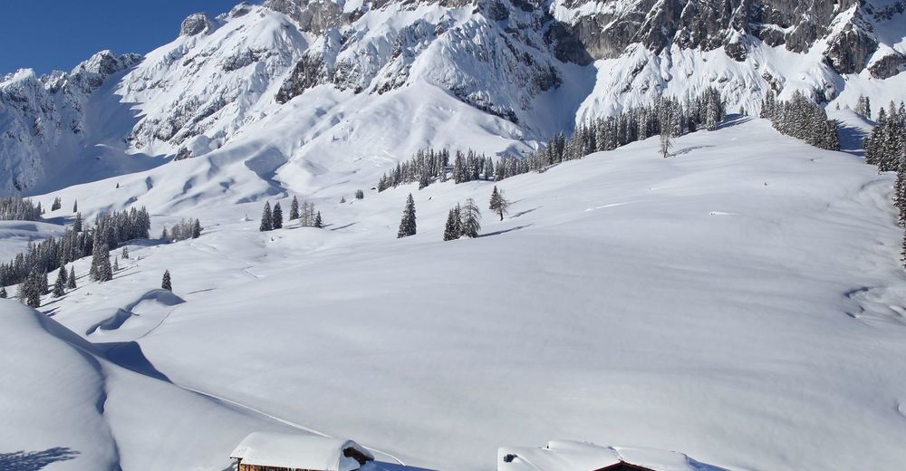
Short, easy and not too steep ski tour beneath the Großer Bratschenkopf.
- Difficulty
-
medium
- Rating
-
- Starting point
-
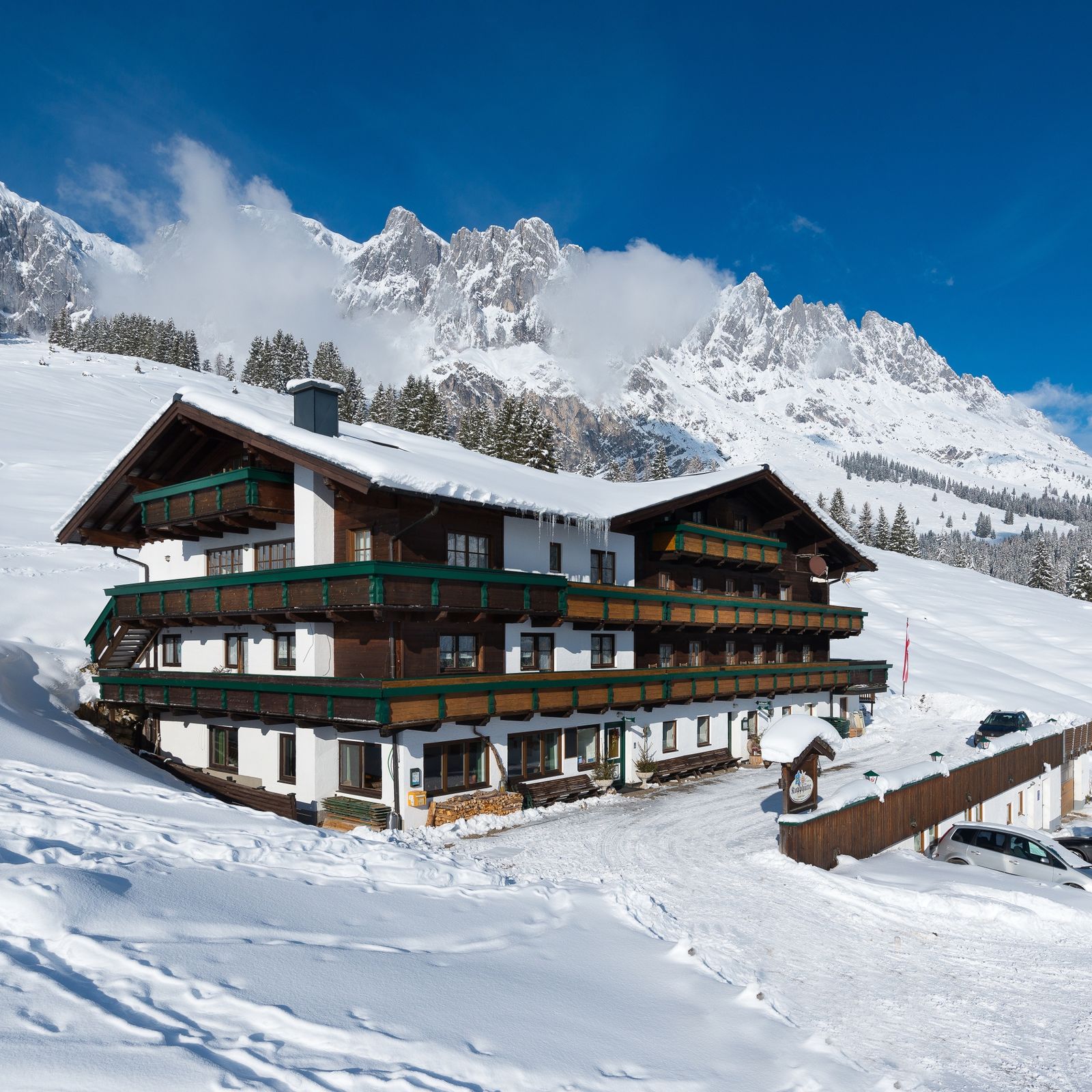
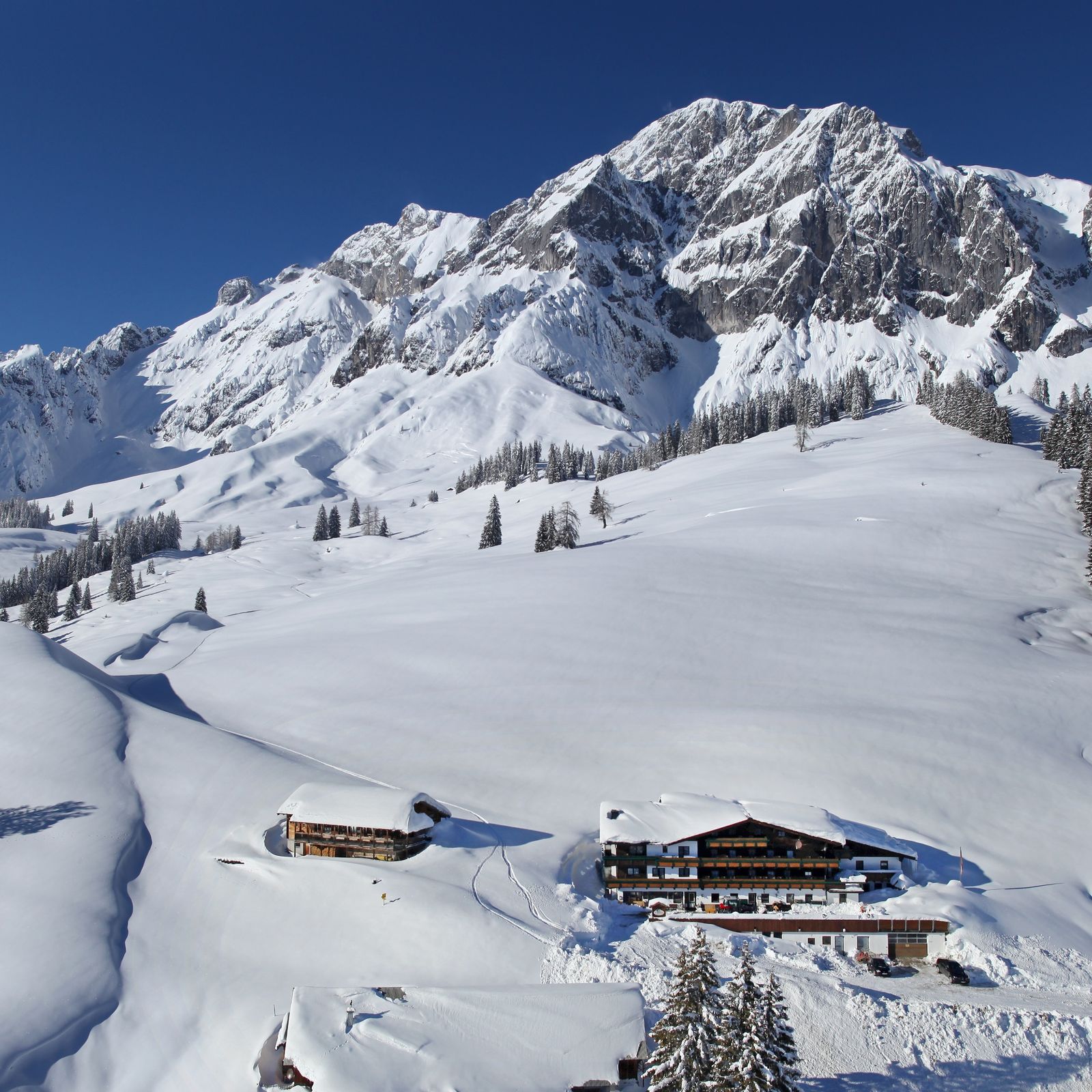
Kopphütte
- Route
-
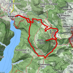
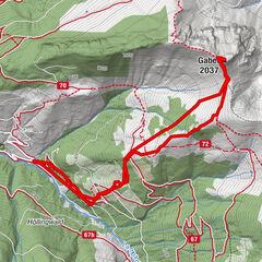
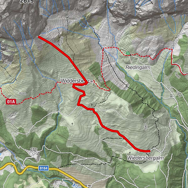
Koppalm0.1 kmBerghüttn1.0 kmBrandstatthütte1.6 kmWiddersberg1.7 kmWiddersbergalmen1.8 kmMolteraualm1.8 kmFirst2.5 km
- Best season
-
AugSepOctNovDecJanFebMarAprMayJunJul
- Description
-
The starting point for this ski tour is the Kopphütte. The wonderful, gentle slopes around the Widdersbergalmen are perfect areas for beginners in ski touring. The terrain is upward ever steeper, depending on the skill and stamina is always an abort of the tour easily. The maximum slope is about 35 °, the slopes are south - oriented East side.
- Directions
-
Start at Gasthof Kopphütte. Follow the unprepared forest road no. 87 always uphill. Towards the Berghütte and vier Hütten behind the vier Hütten, you reach over the Widdersberg along the ridge to a maximum of 1900m .
If you prefer a path away from the forest road, we recommend the path behind the Kopphütte. The path leads you along the snow-covered landscape uphill to the Widdersberg Aries ( vier Hütten ). - Highest point
- 1,892 m
- Endpoint
-
First
- Exposition
- Height profile
-

- Equipment
-
Ski touring equipment required.
- Safety instructions
-
Behavioral and safety instructions for ski tourers
Plan your trip and find out about the expected requirements :
Length of the tour, altitude, difficulty and slope gradients, conditional
Requirements, snow conditions, avalanche situation, weather. Calculate a breaks and reserve time. Select your fitness level matched tempo and stay together in the group. Look for matching clothes and properly functioning Schitour equipment .
Emergency equipment is duty (bivouac sack , avalanche shovel , avalanche probe , avalanche transceiver , possibly airbag)! Wear the avalanche transceiver directly on the body and test it before the tour starts. Remember the potential risks and your responsibility in alpine terrain Be attentive and pay special attention to signs of avalanche danger. Decide in doubt for the safe option or the reverse. Take into account the nature, avoid noise and take your rubbish back home with you. Avoid planting areas and young forest and observe the rules of conduct to protect the wild animals (dogs on a leash , feeding evade , areas of retreat of wildlife protect). Avoid at low snow conditions on tours . The vegetation responds to damage very sensitive. Help other touring who are getting into trouble or could come . Give first aid , help in avalanche accidents and do not hesitate to organize a salvage ( emergency the Mountain Rescue Service : 140 ). European emergency number 112, if not a normal reception possible. Switch off the device, turn it on again and choose instead of PIN codes 112. The mobile phone will automatically search the mobile phone network with the best reception and establishes the connection to the nearest security center. If you still do not have a receipt, you change the location and select periodically 112th - Tips
-
Rental equipment is available at the Berghotel Arthurhaus or at Sport Klaus at the Karbachalm valley station.
- Additional information
- Directions
-
Arriving from Salzburg: Take the A10 motorway to the Bischofshofen exit, then take the B311 in the direction of Bischofshofen. Follow the Hochkönig federal road/B164 to Mühlbach.
Coming from Innsbruck/ Kufstein: On the Loferer Straße/B178 towards St. Johann i.T., then on the Hochkönig Bundesstraße/B164 via Saalfelden and Maria Alm to Mühlbach.
Continue along Mandlwandstraße in the direction of Arthurhaus.
- Public transportation
- Parking
-
Parking at the bus stop Kopphütte.


- Author
-
The tour Skitouring Kopphütte - First is used by outdooractive.com provided.


General info
-
Hochkönig
140
-
Mühlbach am Hochkönig
42