- Brief description
-
Ski touring in the Hochkönig region is a dreamlike experience! Numerous twilight tours, where selected pistes and huts are specially exempted from the piste closure for ski tours! And all of this in the midst of an unparalleled mountain panorama.
- Difficulty
-
medium
- Rating
-
- Starting point
-
Car park Hochmaisbahn
- Route
-
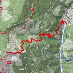
Gabühelhutte2.4 km
- Best season
-
AugSepOctNovDecJanFebMarAprMayJunJul
- Description
-
When the slopes slowly empty and the sun sets behind the Kalkriese, the ski region is bathed in a sea of different hues - a natural spectacle perfect for chilling out with a cool cocktail and cool music on the mountain.
Every Thursday, piste no. 29 from the valley station of the Hochmaisbahn (on the left side of the Hochmaisbahn) to the Hochmaisalm, from here
on the right side of the Hochmaisbahn, to the mountain station of the Hochmaisbahn as well as the Steinbockalm or Gabühelhütte, is exempt from the piste closure for ski tourers from 17.00 - 22.00 hrs. - Directions
-
The tour starts at the car park of the Hochmais 6-seater chairlift in Hinterthal. Along piste no. 29 you go up on the left side. Continue through a short section of woodland along the piste until you reach the Hochmaisalm and now head uphill on the right-hand side of the Hochmais cable car. Shortly before the mountain station, change to the left side again. If you stay on the left, you will reach the Gabühelhüte, if you stay on the right, you will soon stop at the Steinbbockalm.
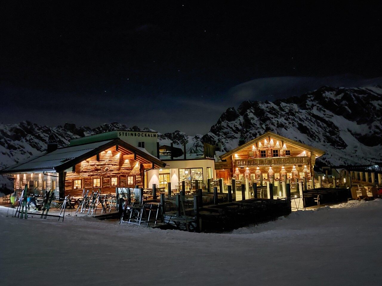
The Steinbockalm and Gabühelhütte are open.
Descent as for the ascent. - Highest point
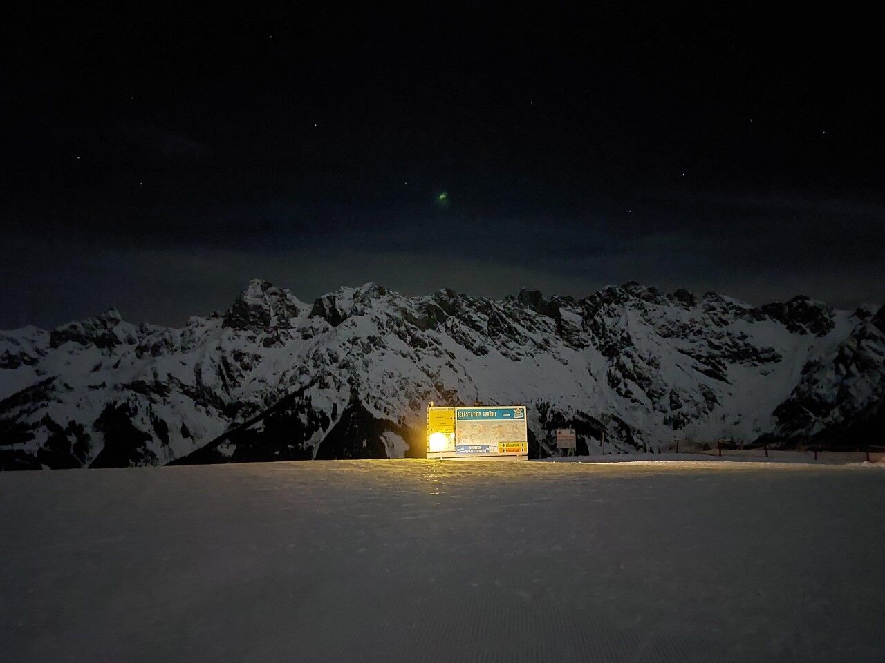
- 1,620 m
- Endpoint
-
Steinbockalm
- Height profile
-

- Equipment
-
Ski touring equipment
Crampons
Backpack with hot drink and light snack
Necessary medication
First aid kit - Safety instructions
-
Healthy in the mountains Ski and snowshoe tours are endurance sports. The valuable stress stimuli for heart and circulation require health and good self-assessment. Avoid time pressure and choose the pace so that no one in your group gets out of breath. Make sure you have energy reserves for the descent.
Careful planning Maps, guide books, internet and experts provide information on length, altitude difference, difficulty and current conditions. Pay particular attention to the weather forecast, as strong winds and poor visibility greatly increase the risk of accidents.
Study the avalanche situation report Before setting out on the tour, inform yourself in detail about the current danger level (European danger scale for avalanches in 5 levels). Pay particular attention to the information on danger points (Where is it dangerous today?) and sources of danger (What is the main danger today?).
Complete equipment Adapt your equipment to the winter conditions and make sure your backpack is light. For avalanche emergencies, an avalanche transceiver, shovel and probe are standard, as are a first aid kit, bivouac sack and mobile phone. An airbag system increases the chances of survival.
Regular hydration breaks Fluids, energy and breaks are necessary to maintain performance and concentration. Hot, isotonic drinks are ideal thirst quenchers and warmers. Easy-to-digest foods such as muesli bars, dried fruit and biscuits satisfy small hunger pangs on the way.
Weigh up the avalanche risk When it comes to recognising the avalanche danger, humans have narrow limits. Therefore, base your decisions on strategic methods of risk assessment (reduction methods) and learn to recognise danger signs in the terrain.
Maintain distances Relief distances of 10 m when ascending steep slopes (≥ 30°) reduce the load on the snowpack and increase comfort when making hairpin turns. Always keep distances of at least 30 m when skiing downhill and ski very steep slopes (≥ 35 °) individually.
Avoid falls Falls on the descent are the most frequent cause of accidents on ski tours. They also place a great deal of additional stress on the snowpack. Good skiing technique and a speed adapted to your ability reduce the risk. A ski helmet can protect against head injuries.
Small groups Small groups enable mutual help and reduce the risk of triggering an avalanche. Stay together in the group. Attention lone skiers: Even small incidents can lead to serious emergencies. Therefore always inform familiar people about destination, route and return.
Respect for nature To protect nature: Do not leave waste behind, avoid noise, do not enter reforested areas, respect protected and restricted areas. Show special consideration for wild animals in winter! To get there, carpool or use public transport.Emergency numbers: Alpine emergency call: 140
International emergency call: 122 - Tips
-
In the Hochkönig region there are also weekly organised or individually guided ski tours with state-certified mountain and ski guides.
Registration at the tourist offices in Maria Alm, Dienten or Mühlbach - Additional information
- Directions
-
Coming from Salzburg: Take the A10 motorway to the Bischofshofen exit, then take the B311 towards Bischofshofen. Follow the Hochkönig Bundesstraße/B164 to Maria Alm.
Coming from Innsbruck/ Kufstein: Take the Loferer Straße/B178 in the direction of St. Johann i.T., then follow the Hochkönig Bundesstraße/B164 via Saalfelden to Maria Alm.
A valid vignette is required to use the Austrian motorway and motorway network. It is also compulsory to carry a first-aid kit, warning triangle and high-visibility waistcoat. Further information can be found under Asfinag. - Public transportation
- Parking
-
Free parking at the ski centre Hintermoos/Schwarzeckalmbahn


- Author
-
The tour Twiglight tour Hochmais is used by outdooractive.com provided.


General info
-
Hochkönig
140
-
Dienten am Hochkönig
37