

- Brief description
-
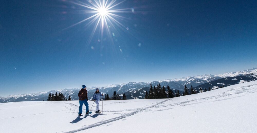
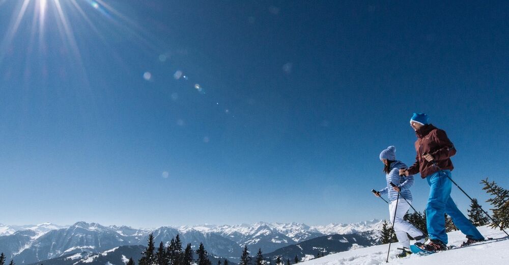
Admire nature, breathe clear winter air and enjoy the silence - our snowshoe trails in the Hochkönig region take you into a magical world of snow and ice!
- Difficulty
-
medium
- Rating
-
- Starting point
-
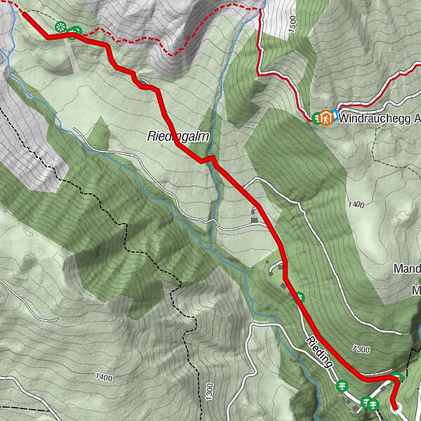
Car park bus stop Kopphütte
- Route
-
Riedingalm1.4 km
- Best season
-
AugSepOctNovDecJanFebMarAprMayJunJul
- Description
-
An idyllic snowshoe trail with views of the imposing Hochkönig. Follow the snow-covered winter landscape along the cleared hiking trail towards Riedingtal and enjoy the view of the icy Riedinger waterfalls.
- Directions
-
Start the hike at the Kopphütte car park and follow the cleared path no. 86 towards Riedingtal.
- Highest point
- 1,386 m
- Endpoint
-
Riedingtal
- Height profile
-

- Equipment
-
Snowshoe rental:
Berghotel Arthurhaus Sport Klaus - Safety instructions
-
Ski, snowboard and snowshoe tours offer great opportunities for fitness, community and nature experience. The following recommendations serve to effectively counteract the risks in the winter mountains. Their practical implementation is taught in ski touring and avalanche courses: Let yourself be trained!
1. healthy in the mountains
Ski and snowshoe tours are endurance sports. The valuable stress stimuli for heart and circulation require health and a good self-assessment. Avoid time pressure and choose your pace so that nobody in your group gets out of breath. Make sure you have reserves of strength for the descent.
2. careful planning
Maps, guide literature, internet and experts provide information about length, altitude difference, difficulty and current conditions. The weather report deserves special attention, as strong winds and poor visibility greatly increase the risk of accidents.
3. study the avalanche situation report
Before starting the tour, inform yourself in detail about the current danger level (European danger scale for avalanches in 5 levels). Pay particular attention to the information on the danger zones (Where is it dangerous today?) and the sources of danger (What is the main danger today?).
4. complete equipment
Adapt your equipment to the winter conditions and make sure your rucksack is light. For avalanche emergencies, avalanche transceiver, shovel and probe are standard, as well as first aid kit, bivouac bag and mobile phone. An airbag system increases the chances of survival.
5. regular drinking breaks
Fluid, energy and breaks are necessary to maintain performance and concentration. Hot, isotonic drinks are ideal thirst quenchers and warmers. Easily digestible foods such as muesli bars, dried fruit and biscuits satisfy the small hunger on the go.
6. weigh up the avalanche risk
When it comes to recognising the danger of avalanches, there are narrow limits to what people can do. Therefore, base your decisions on strategic methods of risk assessment (reduction methods) and learn to recognise danger signs in the terrain.
7. keep distances
Relief distances of 10 m when ascending steep slopes (≥ 30°) reduce the load on the snowpack and increase the comfort during hairpin turns. Always maintain distances of at least 30 m when descending and ski on very steep slopes (≥ 35°) individually.
8. avoid falls
Falls on the slopes are the most common cause of accidents on ski tours. For the snow cover, they also mean a great deal of additional stress. Good skiing technique and a speed adapted to your ability reduce the risk. A ski helmet can protect against head injuries.
9. small groups
Small groups enable mutual assistance and reduce the risk of triggering an avalanche. Stay together in the group. Attention single persons: Even small incidents can lead to serious emergencies. Therefore always inform familiar people about the destination, route and return.
10. respect for nature
To protect nature: Do not leave any waste behind, avoid noise, do not enter afforested areas, respect protected and restricted areas. Special consideration for wild animals in winter! Carpool or use public transport to get to the site.
- Tips
-
A camera is a must on this tour!
- Additional information
- Directions
-
Arriving from Salzburg: Take the A10 motorway to the Bischofshofen exit, then take the B311 in the direction of Bischofshofen. Follow the Hochkönig federal road/B164 to Mühlbach.
Coming from Innsbruck/ Kufstein: On the Loferer Straße/B178 towards St. Johann i.T., then on the Hochkönig Bundesstraße/B164 via Saalfelden and Maria Alm to Mühlbach.
Afterwards, continue along Mandlwandstraße in the direction of Arthurhaus.
- Public transportation
- Parking
-
Parking at the bus stop Kopphütte.


- Author
-
The tour Snowshoe walking Rieding is used by outdooractive.com provided.