
- Brief description
-
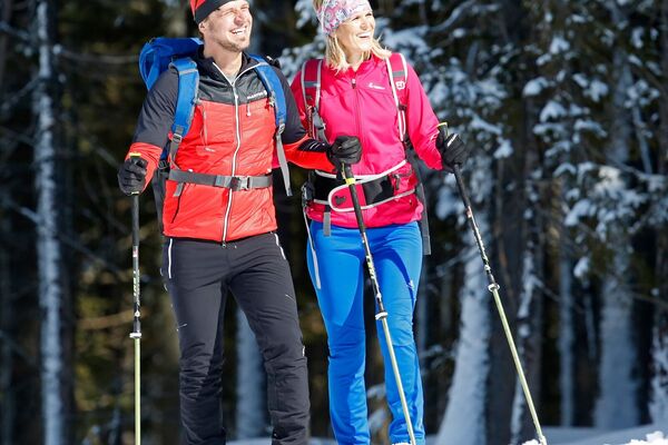
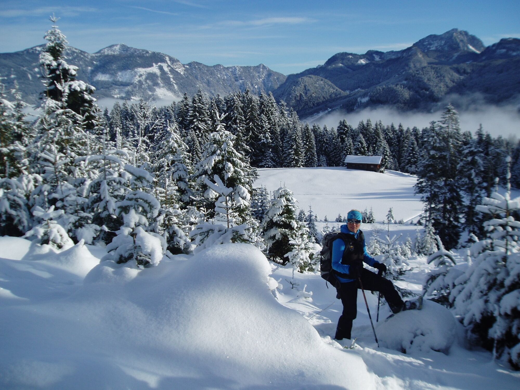
The snowshoe trail leads through alpine terrain and should only be used by experienced hikers with appropriate equipment in good and safe snow conditions.
- Difficulty
-
medium
- Rating
-
- Best season
-
AugSepOctNovDecJanFebMarAprMayJunJul
- Description
-
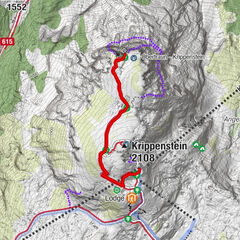
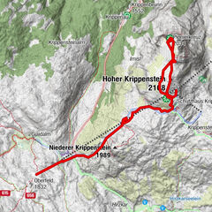
TRAIL 1: "Dachsteinblick" (CIRCULAR TRAIL)
The trail is marked with red and yellow signs, distance between poles about 30-40m. Please be careful when crossing the trail - walking the trails at your own risk! The last descent with the 8er-Panorama Jet Zwieselalm at 04:00 p.m.
Starting point: Top station 8er-Panorama Jet Zwieselalm (1580m)
Difficulty: Easy to medium
Path length: 2.2 km
vertical meters: 240 m
walking time: 1 - 1.5 hours
From the top station, the trail leads downhill past the eastern edge of the Sonnenalm, to the old lift track and the valley station of the 4-seater chairlift Törleck. From there it continues to the top station of the Gosaukammbahn (summer operation only), where you can enjoy a fascinating view of the rugged and deeply snow-covered rocks of the Gosaukamm. The trail now heads west past the Gablonzerhütte and Breininghütte, along the ski trail towards the 8-person Panorama Jet. Shortly before crossing the slopes, you reach a small hill where you can enjoy a fantastic view of the impressive Dachstein Glacier with the highest mountain in Upper Austria, the high Dachstein (2996 m). Continue past the Sonnenalm and the view to the starting point, the 8-person Panorama Jet.
Prices:
Adults: € 23.90
child: € 17.20
Included: ascent and descent with the 8-seater Panorama Jet to the Zwieselalm and snowshoes (Snowshoes available after ticket purchase at Gosau ski rental (valley station Hornspitzbahn) and Sport Jirka (valley station 8-er Panorama-Jet Zwieselalm)
GUIDED SNOWSHOE HIKE
Go on a guided hike with Betty and her team. In addition to trial tours and day tours, individual tours are also possible - just contact Betty. Tours for clubs, schools, families and groups are also possible!
Bookings and information:
Betty Jehle
+43 650 63 66 177
betty@betty-jehle.at
www.betty-jehle.at
Experience a 360° Panorama Tour through the Dachstein Salzkammergut region - Highest point
- 1,575 m
- Height profile
-

- Additional information
- Directions
-
by car
from Salzburg:
Motorway exit Golling via B162 Abtenau and B166 to Gosau
from Linz:
Motorway exit Regau on Salzkammergut street B145 towards Gmunden and Bad Ischl to Bad Goisern, in Bad Goisern turn right onto B166, at the Gosaumühle junction turn right towards Gosau
from Vienna/Graz:
Motorway exit Liezen on the B320, in Trautenfels turn on Salzkammergut street B145 to Bad Aussee, turn on Koppen street through Obertraun and Hallstatt, at the Gosaumühle junction turn left towards Gosau
from Villach:
Tauern motorway to exit “Eben im Pongau”, via the B166 Pass Gschütt federal road to Gosau
by train
Attnang-Puchheim - Stainach-Irdning lines
Arrival by train in "Steeg / Gosau" then continue with bus 542 in the direction Gosausee
By bus
Bus 470 (Abtenau - Gosau) direction Gosau, stop Gosau Abzw. Pass Gschütt
Bus 542 (Bad Ischl - Gosausee) direction Gosausee, stops Haltestelle: Gosau Klaushof, Gosau Bärnausiedlung, Gosau Ressenbachweg, Gosau Vordertal B166, Gosau Ramsau B166, Gosau, Gemeindeamt, Abzw. Pass Gschütt, Gosau Wirtsweg, Gosau Leitenweg, Gosau Schüttmannweg, Mittertal b. Gosau Ort, Mittertal, Hornspitzlift, Hintertal b. Gosau Falmbach, Hintertal b. Gosau Mühlradl, Hintertal b. Gosau Ort, Hintertal b. Gosau Madlgasse, Hintertal b. Gosau Schmiedweg, Hintertal b. Gosau Freilichtmuseum,Hintertal b. Gosau Zwieselalmbahn (Panoramajet)
Detailed information on the respective train and bus times can be found at https://www.oebb.at/en/ (train) and https://www.postbus.at/en(bus).

- Author
-
The tour Snow shoe trail "Dachsteinblick" is used by outdooractive.com provided.