
- Brief description
-
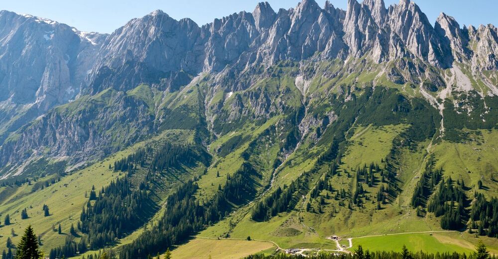
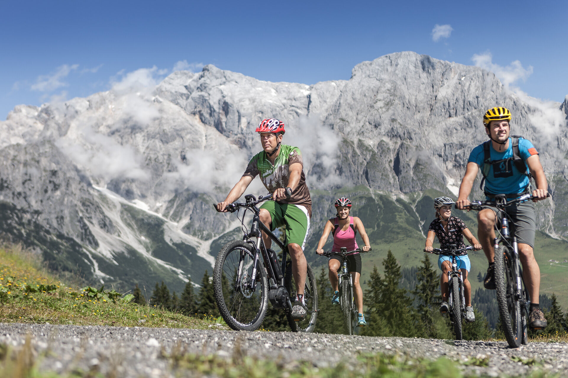
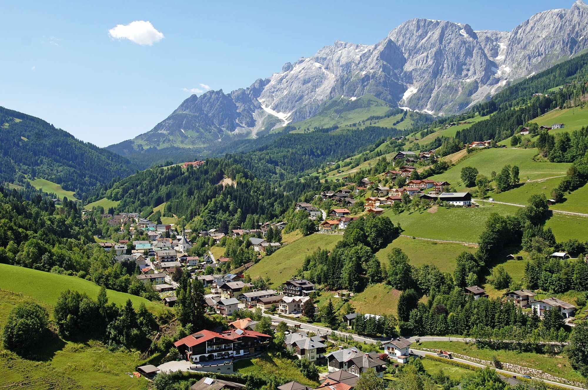
The Hochkönig Panorama Tour takes you through the entire region with unique views of the Hochkönig.
- Difficulty
-
difficult
- Rating
-
- Starting point
-
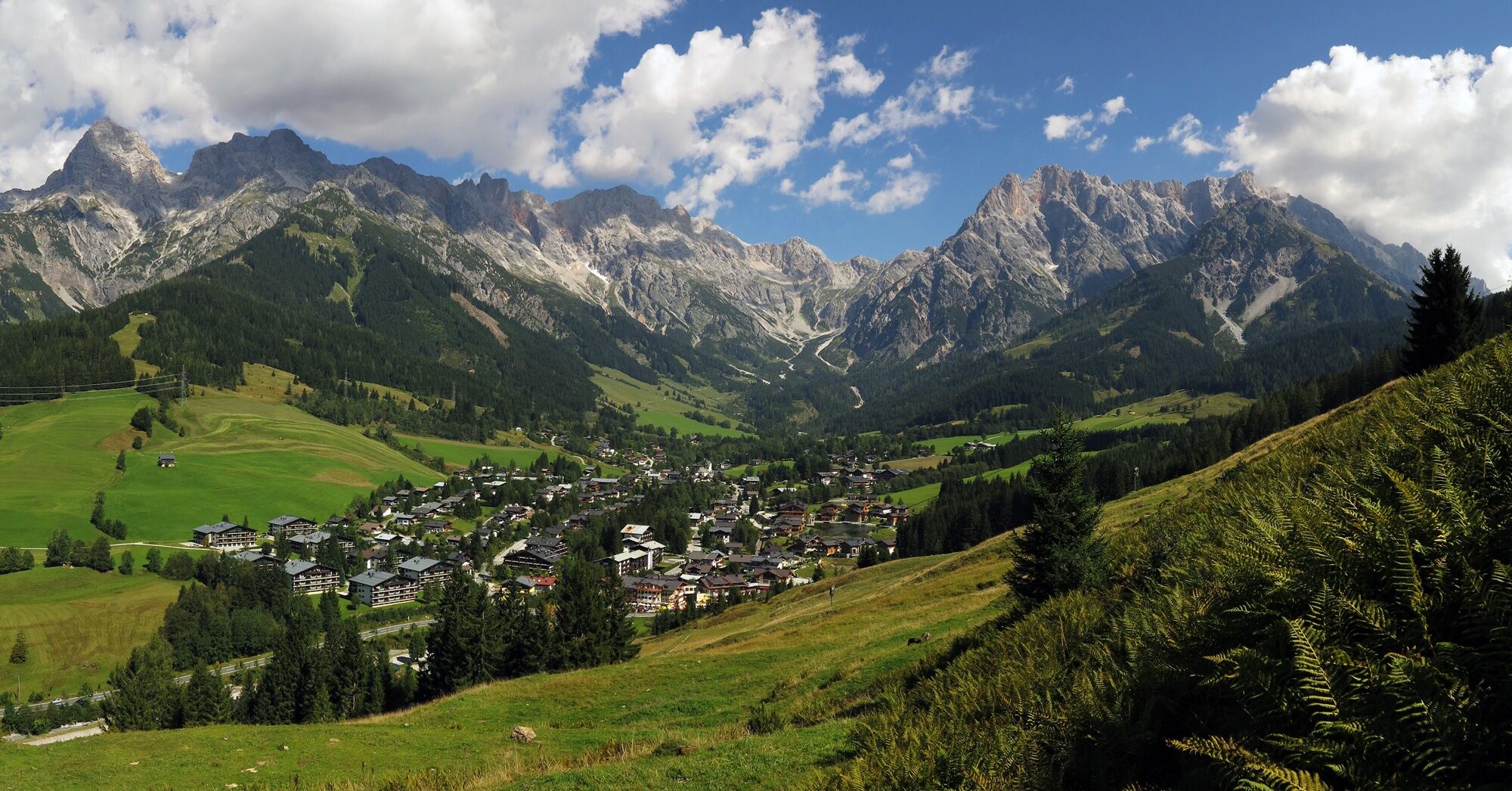
Maria Alm
- Route
-
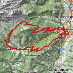
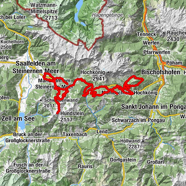
Maria Alm am Steinernen Meer0.2 kmKapelle0.8 kmSchinking1.4 kmTheurerhof2.7 kmRain3.5 kmAlmdorf4.4 kmSchloßberg7.9 kmMaria Alm am Steinernen Meer8.3 kmAberg11.6 kmChristernreith13.5 kmSchönanger14.3 kmAbergalm15.3 kmHundstein (2,117 m)22.5 kmStatzerhaus22.5 kmAbergalm29.5 kmBachwinkl33.7 kmHandlerkapelle33.8 kmHintermoos34.5 kmBirnbach38.4 kmGrünegg Alm47.2 kmDienten am Hochkönig49.3 kmBürglalm49.6 kmHöfl-Zachhof50.2 kmBürglalm54.7 kmBürglalm55.4 kmWastlhöhe (1,737 m)56.1 kmZachhofalm56.3 kmTiergartenalm59.0 kmFellersbachalm61.4 kmKarbachalm62.7 kmFellersbachalm63.8 kmFellersbach64.9 kmZapferlalm65.0 kmSchepperlalm67.9 kmHöring70.1 kmAnderlwirt70.1 kmMesnerhaus, Café, Bar & Restaurant70.1 kmMühlbach am Hochkönig70.1 kmPfarrkirche zum hl. Sebastian70.1 kmKnie73.2 kmMitterbergsattel (1,515 m)84.5 kmArthurhaus85.0 kmMitterbergalm85.6 kmZapferlalm92.8 kmFellersbach93.0 kmDientalm95.9 kmKönig & Kuh97.8 kmHöfl-Zachhof99.6 kmBirnbach105.9 kmRaum der Stille113.4 kmMaria Alm am Steinernen Meer113.5 kmWallfahrtskirche Maria Alm113.6 kmGasthaus Waldhaus114.8 kmGasthaus Waldhaus117.2 kmEnterwinkl117.3 kmJufenalm119.7 kmEnterwinkl121.9 kmGasthaus Waldhaus122.0 kmMaria Alm am Steinernen Meer123.1 km
- Best season
-
JanFebMarAprMayJunJulAugSepOctNovDec
- Description
-
The following tour description assumes a tour start in Maria Alm. However, the panoramic tour can of course be started in any of the three villages.
- Directions
-
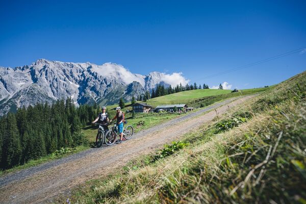
The ii tour takes you through the entire region with unique views of the Hochkönig. The following tour description assumes a tour start in Maria Alm (eBike filling station Hotel Niederreiter). The ii-Tour can of course be started in any of the three towns. The first loop of the ii-Tour leads via Oedt, Almdorf and Hinterreit (eBike filling station) back to Maria Alm. Continue along the Urslau (stream) to Maria Alm, Unterberg district.
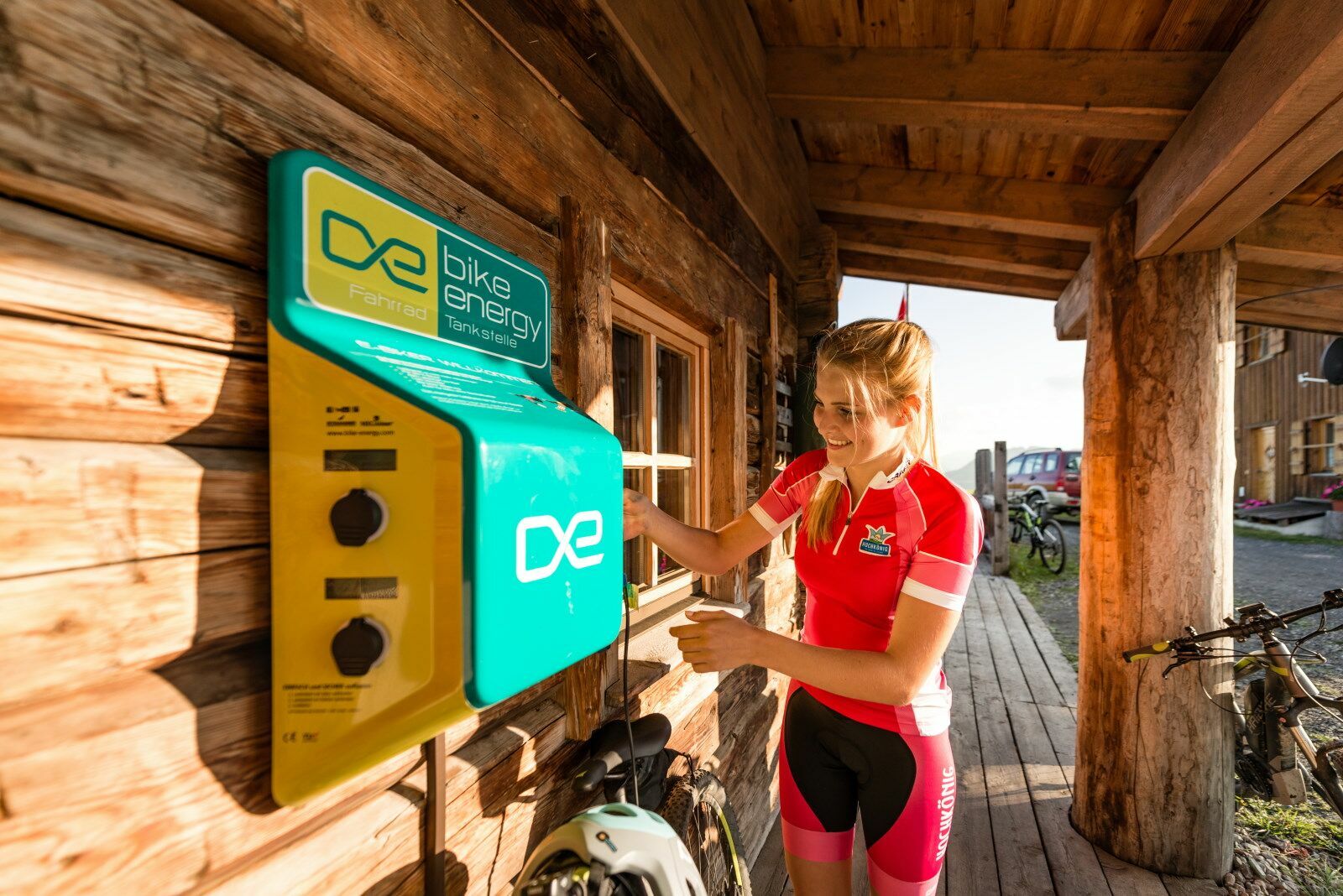
Here is the first ascent up to the mountain station of the Schwarzeckalm cable car. As a variant, very motivated bikers can cycle up to the Hundstein. The ii tour leads to Hintermoos and on to Hinterthal (eBike filling station at the Landhotel Schafhuber and at the Aueralm). Continue through the town centre to the church and over the Aueralm (eBike filling station). After an ascent you reach the Filzensattel. From here up the forest road via the Gabühelhütte, the Steinbockalm (eBike filling station) and down to the Grüneggalm (eBike filling station) to Dienten.
From Dienten to the ski centre (cross the parking deck), continue to Forststaße to Bürglalm (eBike filling station), continue via Wastlhöhe to Tiergartenalm. Continue past the Tiergartenalm to the Zapferlalm, where summit strikers can cycle up to the Karbachalm (eBike filling station) or choose the downhill run to the valley station of the Karbachalm cable car.
We follow the trail to the centre of Mühlbach (eBike filling station Bäckerei & Konditorei Bauer). We head up the mountain again, around the Hochkeil until we arrive at the Arthurhaus, from there we follow the road back downhill over the Viererwasch onto the Hochkönigbundesstraße where we rejoin the trail towards the Zapferlalm.
From the Zapferlalm, we continue to the Dientner Sattel and follow the federal road to the Filzensattel.
Now it's downhill to Maria Alm and if you still feel like climbing a few metres, you can cycle into Enterwinkl and to Jufenalm. The same route is taken back to Maria Alm.
- Highest point
- 2,110 m
- Endpoint
-
Maria Alm
- Height profile
-

- Equipment
-
Controlled bike equipment with helmet
Sunglasses
Sun protection
Rain protection
Drinks and a snack
Necessary medication
First aid kit
Bike map - Safety instructions
-
Fair play!
Drive only on marked paths! Close all gates, barriers and pasture gates! Observe the road traffic regulations! Overtake only at walking pace! Behave respectfully towards other nature users! and the forestry and hunting staff! Be considerate of animals! Do not leave waste in nature! Act responsibly! Check the weather forecast. Fog and bad weather can come surprisingly quickly.Emergency numbers: Alpine emergency call: 140
International emergency call: 122 - Tips
-
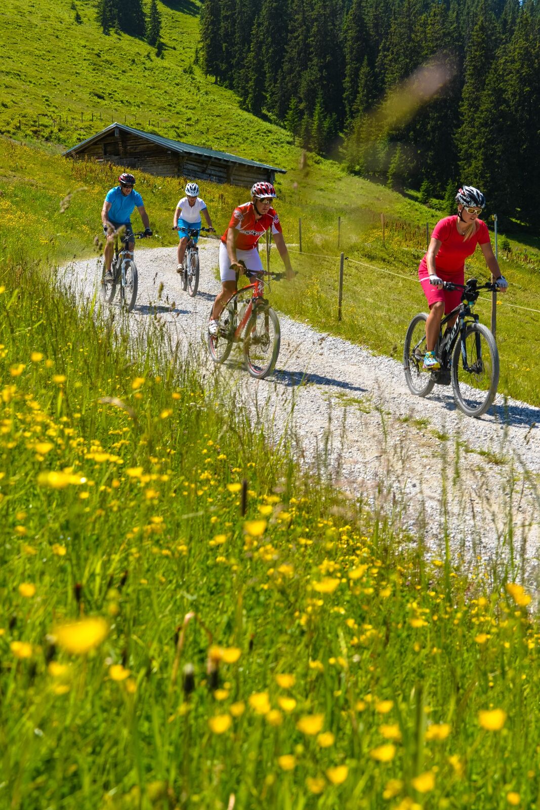
The many alpine pastures and huts along the route not only invite the biker to take a rest, the eBike can also charge its battery thanks to the many charging stations on the mountain.
- Additional information
- Directions
-
Coming from Salzburg: Take the A10 motorway to the Bischofshofen exit, then take the B311 towards Bischofshofen. Follow the Hochkönig Bundesstraße/B164 to Maria Alm.
Coming from Innsbruck/ Kufstein: Take the Loferer Straße/B178 in the direction of St. Johann i.T., then follow the Hochkönig Bundesstraße/B164 via Saalfelden to Maria Alm.
A valid vignette is required to use the Austrian motorway and motorway network. It is also compulsory to carry a first-aid kit, warning triangle and high-visibility waistcoat. Further information can be found under Asfinag. - Public transportation
- Parking
-
Free parking at the beginning of the village and in the centre of Maria Alm


- Author
-
The tour ii-Tour is used by outdooractive.com provided.


General info
-
Hochkönig
168
-
Dienten am Hochkönig
50