
- Brief description
-
A challenging mountain bike tour on the Grießenkar in Flachau. Where skiers wedeln down in winter - bikers go uphill in summer!
- Difficulty
-
difficult
- Rating
-
- Starting point
-
Flachau Tourism
- Route
-
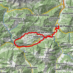
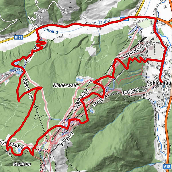
FlachauFranzl Alm14.5 kmMoadörfl17.6 kmScharfettkapelle20.5 kmFeuersang21.0 kmFlachau23.3 km
- Best season
-
JanFebMarAprMayJunJulAugSepOctNovDec
- Description
-
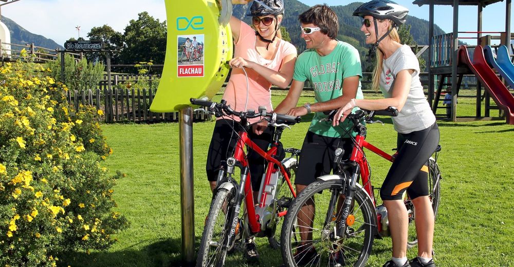
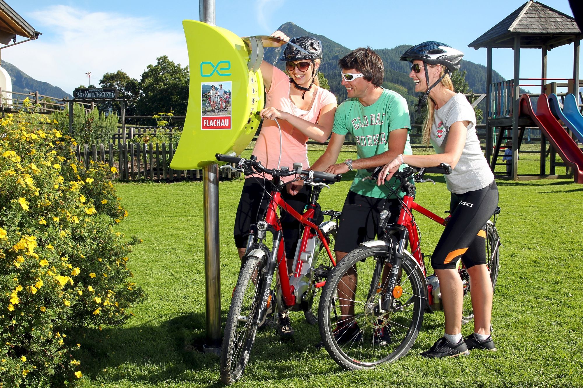
Only for E-Mountainbike suitable!
Possibility for lunch are directly on the way. A short trip by foot to the summit of Grießenkar is very recommendable, there you have a fantastic view. Highlight is the downhill of about 100 difference in altitude from the Grießenkar into the Moadörfl.
e-bike loading station directly at the tourist office Flachau, Waldgasthof, Jandlalm and Restaurant Paularei.
- Directions
-
Only for E-Mountainbike suitable!
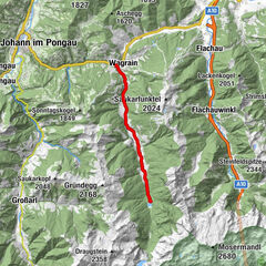
Flachau tourist office - follow the Flachauerstraße in direction to the roundabout – after 500 meters turn left into the Grießenkarweg (after the Hotel Pongauerhof - connection MTB-Route 15) - long ascent on a gravel road to the Grießenkar (gastronomical stops & e-bike loading stations: Waldgasthof, Jandlalm, Hofalm, Latschenhof) - pass the Jandlalm and go on righthandside in direction to the Almstadl and Rupertisee (connection to MTB-Route 14 and MTB-Route 17) - at km 8,7 turn in direction to Wagrain – long descent till the Mayrdörfl (parking place „Rote-8er) – turn right and follow the bicycle track back to Flachau
- Highest point
- 1,747 m
- Endpoint
-
Flachau Tourism
- Height profile
-

- Equipment
-
For your own safety, wearing a helmet is recommended.
- Tips
-
At the tourist info Flachau you get a bike map with information to this tour.
- Directions
-
to Flachau Center / Flachau Tourist Office
- Parking
-
Parking space near the starting point
-

-
AuthorThe tour Grießenkar Tour - E-MTB is used by outdooractive.com provided.


General info
-
Katschberg Lieser-Maltatal
150
-
Salzburger Sportwelt
228
-
Flachau
144