
- Brief description
-
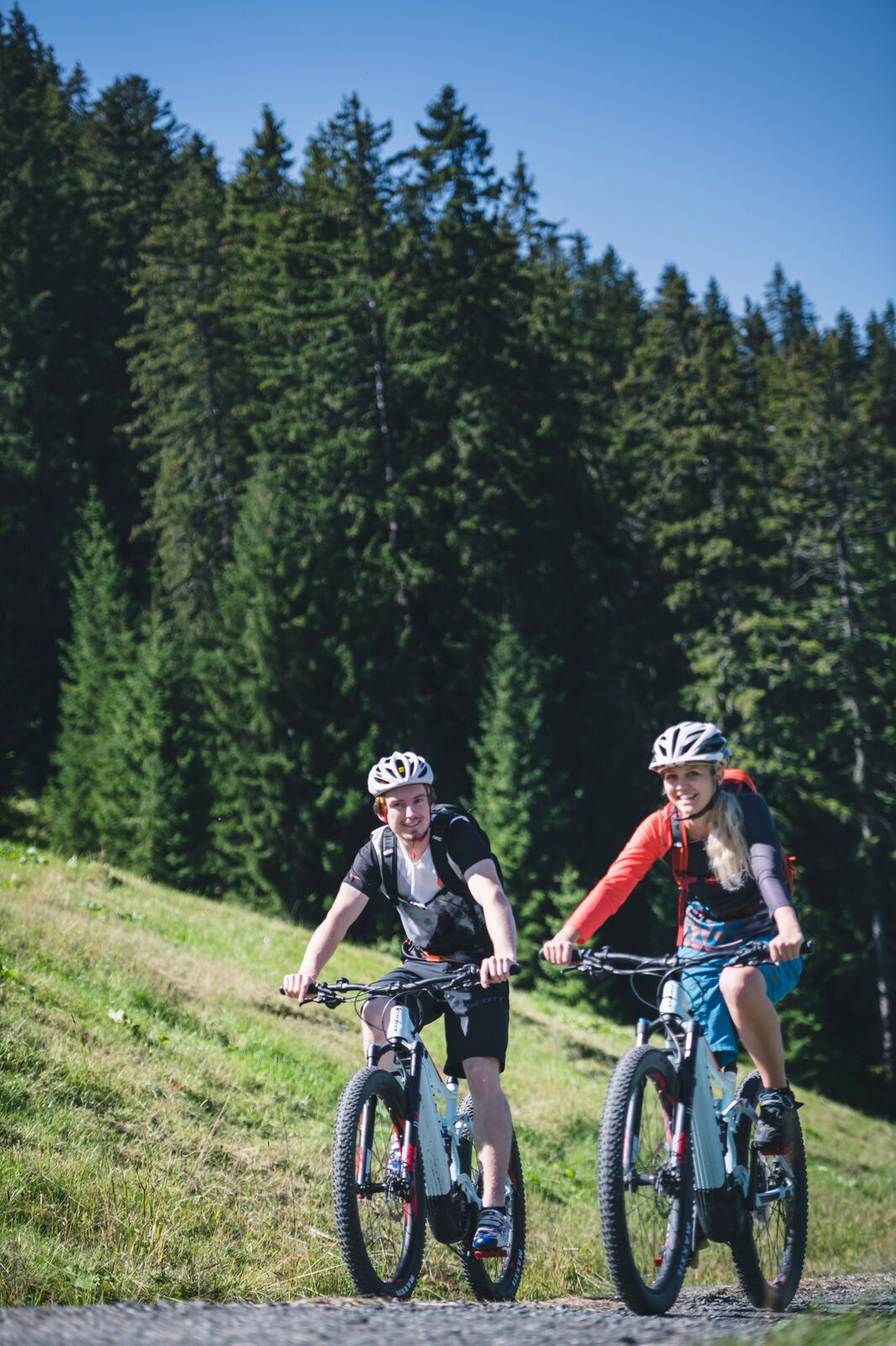
A leisurely MTB tour for beginners.
- Difficulty
-
easy
- Rating
-
- Starting point
-
Tourist information Maria Alm
- Route
-
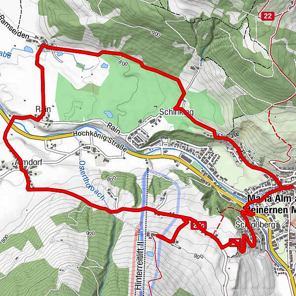
Maria Alm am Steinernen Meer0.1 kmKapelle0.7 kmSchinking1.3 kmTheurerhof2.6 kmRain3.5 kmAlmdorf4.3 kmSchloßberg7.9 kmMaria Alm am Steinernen Meer8.6 km
- Best season
-
JanFebMarAprMayJunJulAugSepOctNovDec
- Description
-
The Hinterreit-Runde is a perfect tour for the start of the biking summer. This loop leads comfortably uphill and downhill from Maria Alm in the direction of Saalfelden. A stop at the Gasthof Hinterreit should not be missed.
- Directions
-
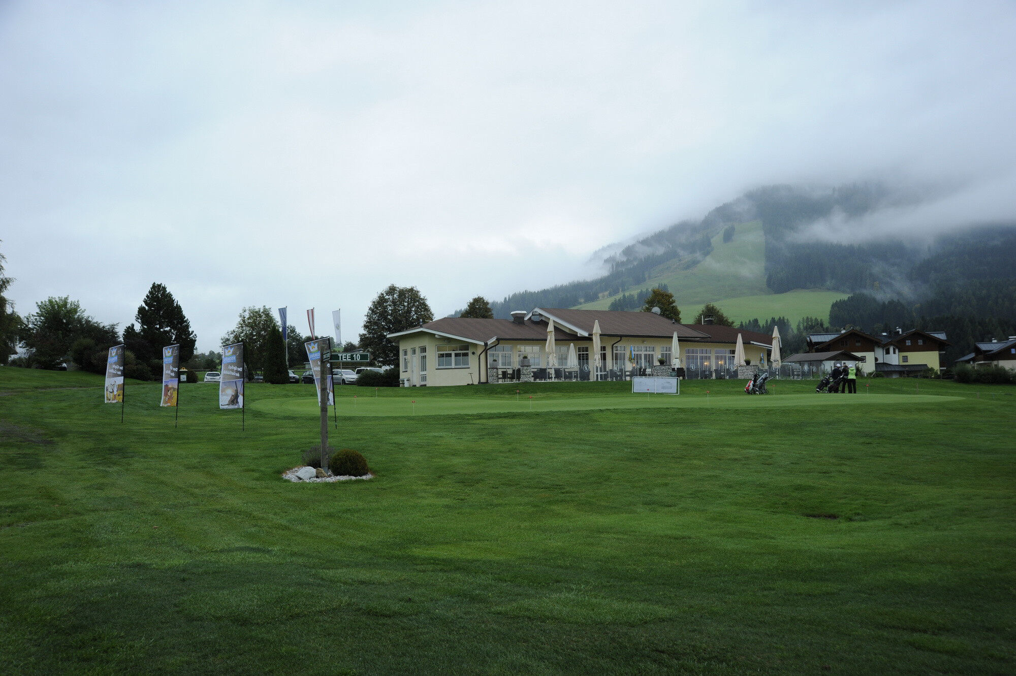
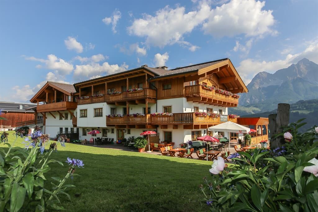
Start is at the tourist office Maria Alm. After approx. 100m (direction of travel at the entrance to the village) turn right - immediately after the Hotel Moserwirt - over a bridge onto trail no. 12 and follow this in the direction of Schinking. Along the golf course Urslautal it leads to the district Oedt. There you turn sharply left and follow trail no. 20 to the federal highway (B164). You cross the federal road and follow a small side road via Almdorf to Berggasthof Hinterreit(e-bike filling station). From there, you return to the center of Maria Alm via the Schlossberg (short pushing stretch, approx. 70m).
- Highest point
- 901 m
- Endpoint
-
Tourist information Maria Alm
- Height profile
-

- Equipment
-
Controlled bike equipment with helmet
Sunglasses
Sun protection
Rain protection
Drinks and a snack
Necessary medication
First aid kit
Bike map - Safety instructions
-
Fair play!
Drive only on marked paths! Close all gates, barriers and pasture gates! Observe the road traffic regulations! Overtake only at walking pace! Behave respectfully towards other nature users! and the forestry and hunting staff! Be considerate of animals! Do not leave waste in nature! Act responsibly! Check the weather forecast. Fog and bad weather can come surprisingly quickly.Emergency numbers: Alpine emergency call: 140
International emergency call: 122 - Tips
-
Listen to the anecdotes Peter Hörl tells about famous ski stars who prepare for their World Cup skiing at Hinterreitlift.
- Additional information
- Arrival
-
Coming from Salzburg: Take the A10 motorway to the Bischofshofen exit, then take the B311 towards Bischofshofen. Follow the Hochkönig Bundesstraße/B164 to Maria Alm.
Coming from Innsbruck/ Kufstein: Take the Loferer Straße/B178 in the direction of St. Johann i.T., then follow the Hochkönig Bundesstraße/B164 via Saalfelden to Maria Alm.
A valid vignette is required to use the Austrian motorway and motorway network. It is also compulsory to carry a first-aid kit, warning triangle and high-visibility waistcoat. Further information can be found under Asfinag. - Public transportation
- Parking
-
Free parking at the beginning of the village and in the centre of Maria Alm

- Author
-
The tour MTB Tour - Hinterreit Round (Tour 5 ) is used by outdooractive.com provided.


General info
-
Saalfelden - Leogang
386
-
Maria Alm
93