- Brief description
-
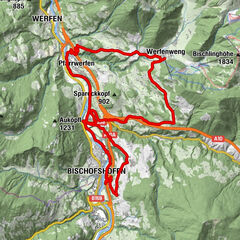
Mountain bike tour in Grossarl, where you reach 3 mountain huts - Mooslehenalm, Viehhausalm and Igltalalm.
- Difficulty
-
medium
- Rating
-
- Starting point
-
cycle path Grossarl - Schiedweg
- Route
-
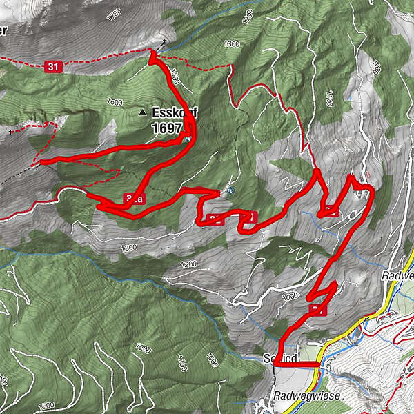
Schied0.2 kmMooslehenalm5.2 kmViehhausalm7.6 kmIgltalalm (Niggeltalalm)9.3 kmSchied15.7 km
- Best season
-
JanFebMarAprMayJunJulAugSepOctNovDec
- Description
-
You start in the village center of Grossarl and go along the cycling path towards St. Johann and you turn after the Hotel Schiederhof towards Himmelsknoten.
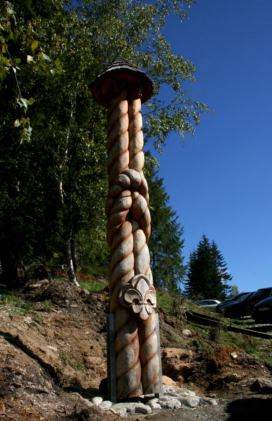
The "Himmelsknoten" is located at the transmitter. This is a monument of the Scouts. The forestry road leads to the Mooslehenalm. There is the scent of delicious Schwarzbeernocken.
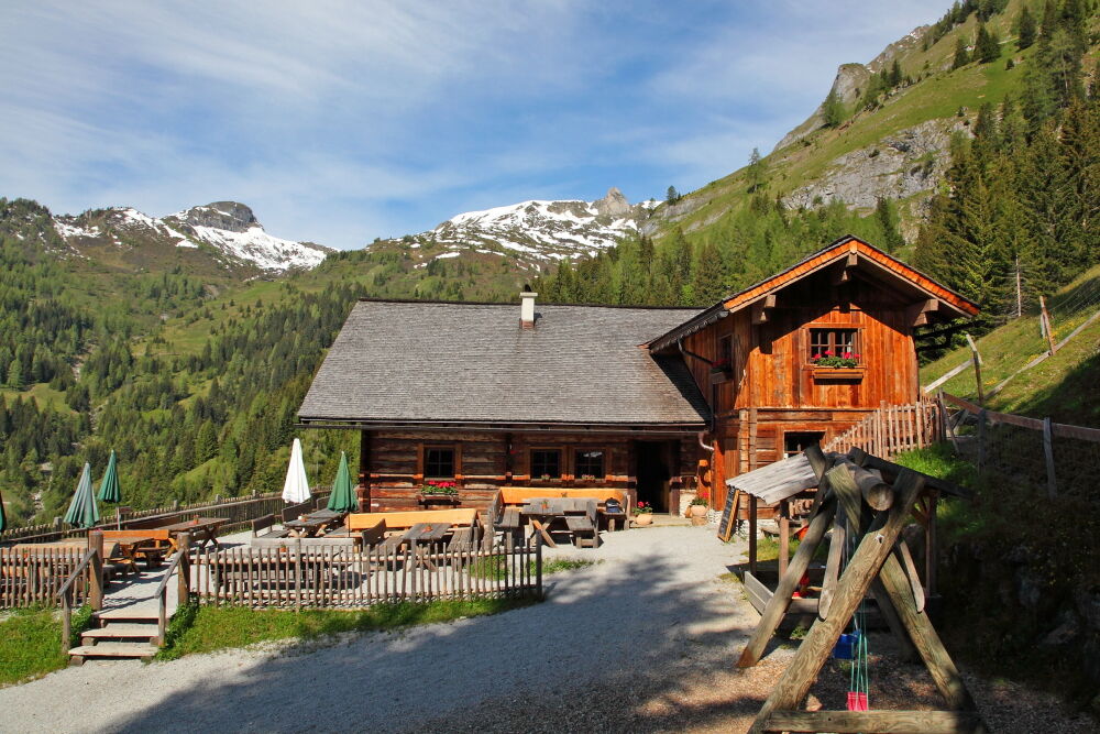
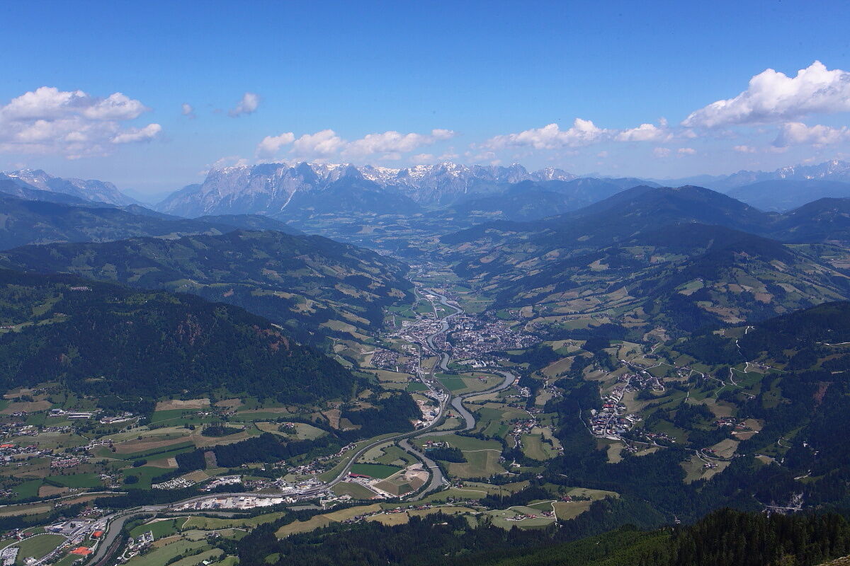
After a refreshment, the path leads to the Viehhausalm, where you have a wonderful view to Grossarltal. The people on the Viehhausalm pamper all hungry hikers with homemade delicacies. Here the children have a lot of fun.
You continue to the Igltalalm (Niggeltalalm). A beautiful waterwheel, which was used for making butter is in front of the hut. This mountain hut is a paradise for children - a little stream and a small pond, a large playground as well as cats, dogs, ducks ...
You cycle back to the Mooslehenalm and further into the valley - there is some traffic.
- Directions
-
You start in the village center of Grossarl and cycle to Unterberg. You cycle via the large parking lot from the mountain railways and take the cycling path towards St. Johann. Cross the street and the river and you follow the cycle path to Gasthof Schiederhof. After the Schiederhof, you turn left and take the Schiedweg and follow this until the transmitter Holzlehen, to the "Himmelsknoten". You continue along the forestry road no. 31 to Mooslehenalm, 1,449 m. You cylce along the same way to the intersection, take the path no. 32A to the Viehhausalm, 1,640 m. Cycle back to the intersection and follow the path no. 31 to the Igltalalm / Niggeltalalm, 1,507 m.
Back on the same route.
- Highest point
- 1,632 m
- Endpoint
-
Igltalalm/Niggeltalalm
- Height profile
-

- Equipment
-
mountain bike, helmet, beverages
- Safety instructions
-
There is some traffic on the route to mountain huts.
- Tips
-
You can hike up from the Viehhausalm to the Wetterkreuzsattel, 1,840 m (approx. 1/2 - 3/4 h). Back on the same way.
- Additional information
- Directions
-
You can reach the starting point of this tour by mountain bike via the valley cycle path from the centre of Grossarl in approx. 3.7 km.

- Author
-
The tour Grossarl: Mooslehenalm - Viehhausalm - Igltalalm is used by outdooractive.com provided.


General info
-
Katschberg Lieser-Maltatal
240
-
Großarltal
306
-
Großarl
116