- Brief description
-
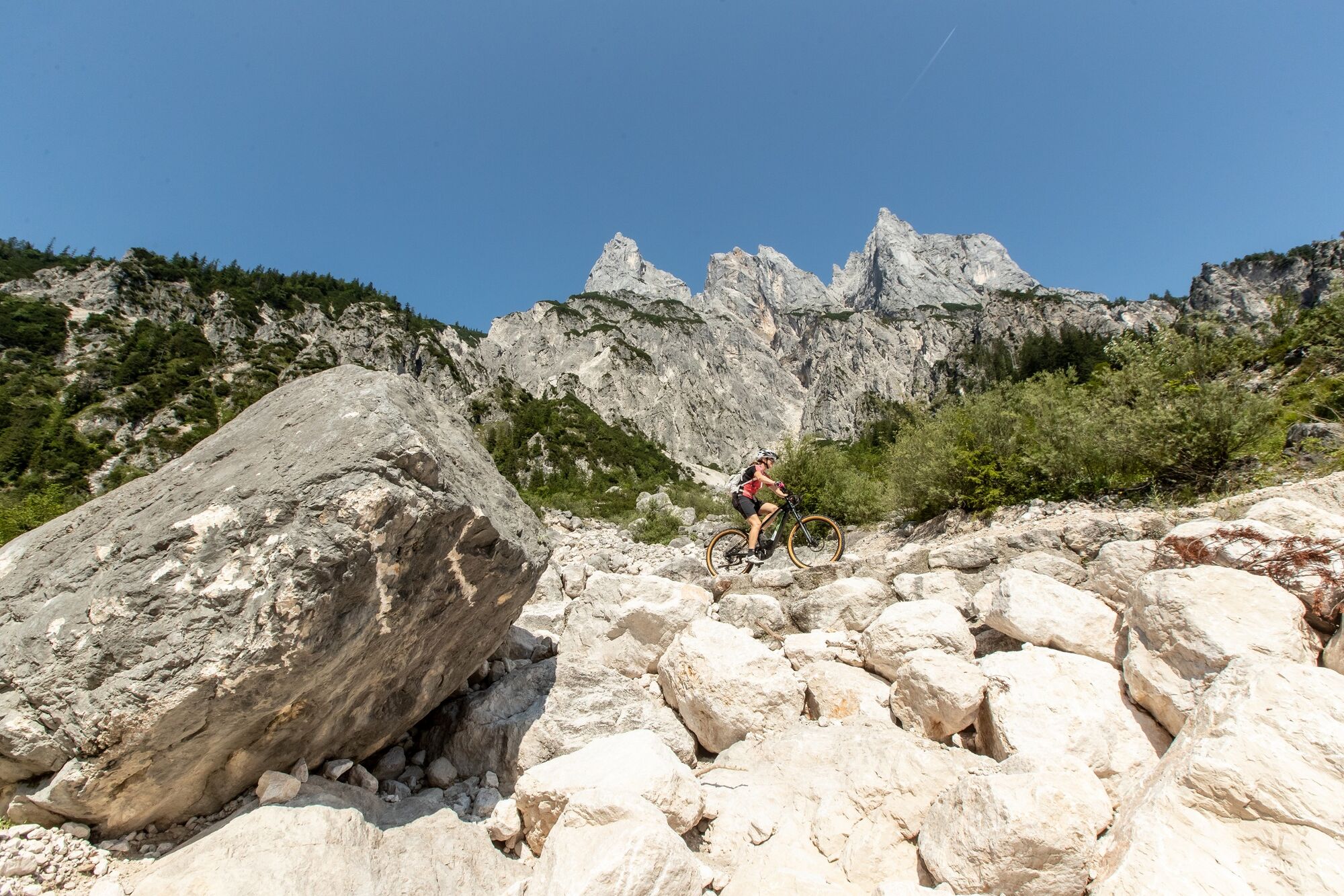
Beautiful mountain bike tour with approx. 1350 vertical metres
- Difficulty
-
difficult
- Rating
-
- Starting point
-
Reith
- Route
-
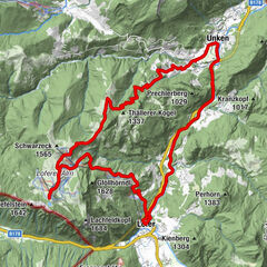
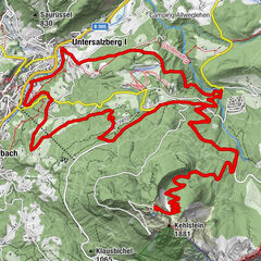
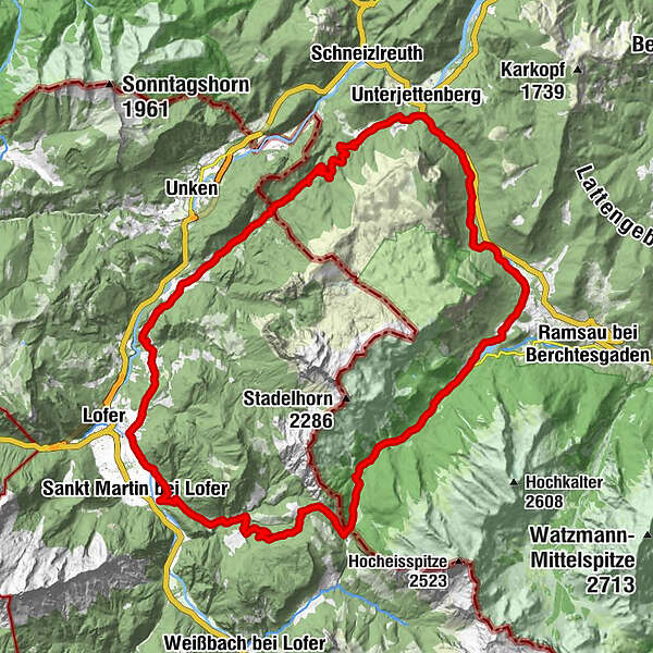
Reith0.0 kmAntoniuskapelle3.0 kmAu3.4 kmScheffsnoth5.6 kmStrohwolln8.2 kmEiblkreuzung16.3 kmHufnagei (1,267 m)17.0 kmMooswachtkapelle18.3 kmAlpengasthof Hirschbichl18.4 kmHirschbichl18.5 kmBergheim Hirschbichl18.5 kmBindalm18.9 kmHirschbichlstraße20.8 kmHängebrücken21.9 kmAuzinger25.4 kmSeeklause26.4 kmAschauer Klamm-Blick43.5 kmAschau-Blick45.3 kmAschau45.5 kmMitterhorn-Blick46.1 kmHochreith47.6 kmReith48.7 km
- Best season
-
JanFebMarAprMayJunJulAugSepOctNovDec
- Description
-
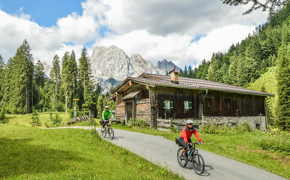
The tour leads over almost 50 kilometres and 1350 metres around the Reither Steinberge (Reither Alpe). There are several places to stop for refreshments and great panoramic spots on the tour.Tour SASA 26 in the bike map Salzburger Saalachtal
- Directions
-
We start our e-mountainbike tour in Reith and ride via Lenzen and Au upstream of the Saalach to St. Martin. Here we take the steep ascent into the Wildental valley and along the Möserwald forest road to Hirschbichl. From here, the route continues through the Berchtesgaden National Park, on the Bavarian side, past the Hintersee lake to the Taubensee lake and the Schwarzbachalm hut. We now follow the stream to Unterjettenberg and over the Aschauersattel back to the starting point of the tour in Reith.
- Highest point
- 1,268 m
- Endpoint
-
Reith
- Height profile
-

- Equipment
-
E-mountain bike or mountain bike
- Directions
-
We reach Reith, the starting point of our tour, via the B178. The district of Reith lies between Unken and Lofer.
- Public transportation
- Parking
-
There are free parking facilities immediately after crossing the Saalach.

-

-
AuthorThe tour Around the Reiter Alpe is used by outdooractive.com provided.