- Brief description
-
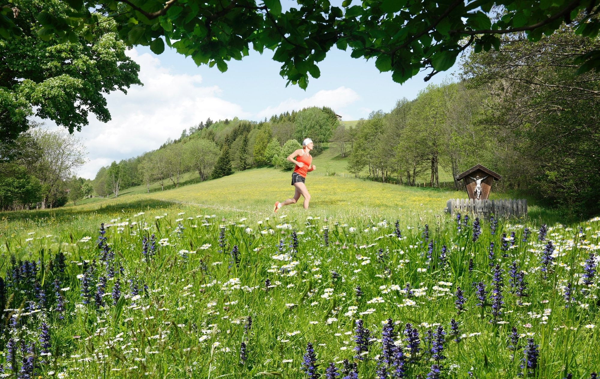
A wonderful introductory route for trail runners from the valley floor via the Naglköpflweg and the Kulturlandschaftsweg trail.
- Difficulty
-
medium
- Rating
-
- Starting point
-
Car park Steindorf
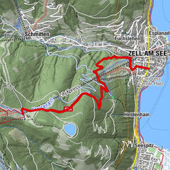
- Route
-
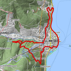
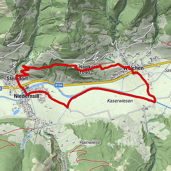
SteindorfEmaten0.7 kmNaglköpfl (1,090 m)2.8 kmWalchen4.9 kmJesdorf9.9 kmNiedernsill10.7 kmSteindorf11.3 km
- Best season
-
JanFebMarAprMayJunJulAugSepOctNovDec
- Description
-
The route is about 11 km long and has a 332 meters difference in altitude and passes through Niedernsill and Walchen.
- Directions
-
From the car park in Steindorf run uphill towards Ematberg until you reacht the junction with the Naglköpflweg. Follow the path to Naglköpfl and continue downhill along the Kulturlandschaftsweg to Walchen. From Kehlbachgasse turn right into Bachweg, pass the underpass and follow the road to the bridge in Hummersdorf. Turn right onto the field path and run along the Salzach river to the dog training area in Niedernsill. At the fork, turn right over the bridge and continue along the Tauern Cycle Path to the tourist office. Cross the bridge over the Salzach and continue along the Niedernsiller Straße and underpass back to the starting point.
- Highest point
- 1,078 m
- Endpoint
-
Car park Steindorf
- Height profile
-

- Equipment
-
Trail running shoes, light & breathable clothing, wind/rain jacket, backpack or running waistcoat, poles, drink (water, energy drink), food (energy bars, fruits, gels), headlamp (recommended), sun protection, first aid kit (emergency blanket, blister plaster, …), mobile phone, map
- Safety instructions
-
Dear trail runners!
We hope that the snacks and drinks you take with you on your route will give you the strength to carry back the packaging material and empty cans and bottles.The running, walking, ... off the marked routes/paths is strictly forbidden.
We kindly ask you to observe the Fair Play & Rules of Conduct!
Fairness and respect for each other are the basis for a common togetherness and the protection of the different interests in the nature area!
- Tips
-
Start slowly and warm up to prepare your body for uneven terrain. Run at your own pace and don't overdo it.
- Additional information
- Public transportation
- Parking
-
Sufficient parking available.

-

-
AuthorThe tour Trail running: NAGLKÖPFLRUNDE Niedernsill is used by outdooractive.com provided.