© Tourismusverband St. Johann in Salzburg - Tourismusverband St. Johann

- Brief description
-
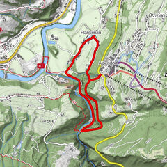
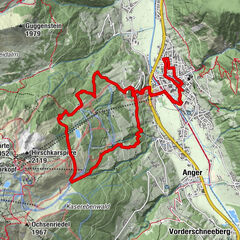
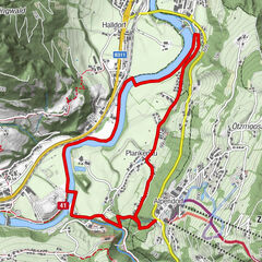
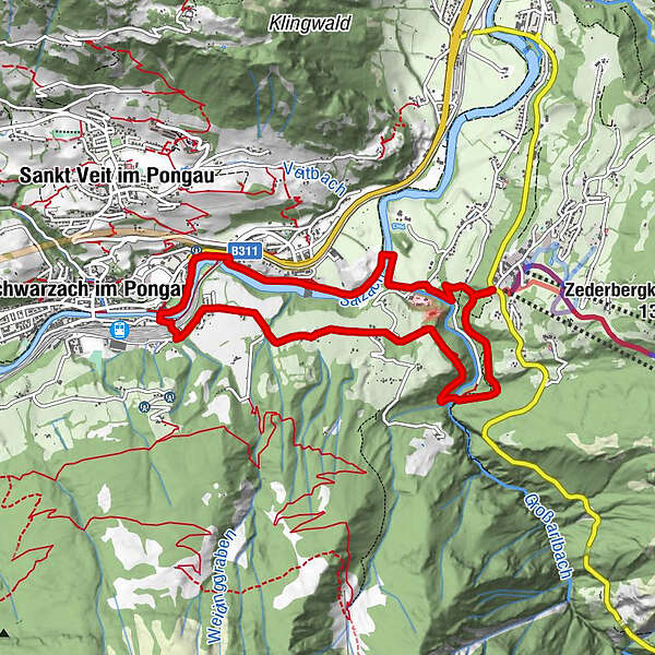
Large loop (green signposting): Alpendorf - Liechtensteinklamm - Schwarzach
- Difficulty
-
difficult
- Rating
-
- Starting point
-
Alpendorf
- Route
-
AlpendorfKlammfürst1.3 kmNiederuntersberg2.9 kmHub4.1 kmGasthof Huab4.3 kmOka-Bichl7.6 kmAlpendorf8.6 km
- Best season
-
JanFebMarAprMayJunJulAugSepOctNovDec
- Description
-
From the car park of the Alpendorf cable car, follow the hiking trail downhill in the direction of the Liechtensteinklamm until you reach the entrance to the gorge. Here you cross the stream and follow the path uphill towards Niederuntersberg. After the path, change to the road until it goes downhill again towards Schwarzach. From Schwarzach, take the Treppelweg in the direction of St. Johann until you reach the bridge in the direction of Liechtensteinklamm. Here you take the Thomassteig uphill back to the Alpendorf.
- Highest point
- 712 m
- Endpoint
-
Alpendorf
- Height profile
-

- Tips
-
Large loop (green signposting): Alpendorf - Liechtensteinklamm - Schwarzach

- Author
-
The tour Trailrunning Alpendorf - Large Loop is used by outdooractive.com provided.
GPS Downloads


Other tours in the regions