Ennsradweg - Through the world of mountains and water


- Brief description
-
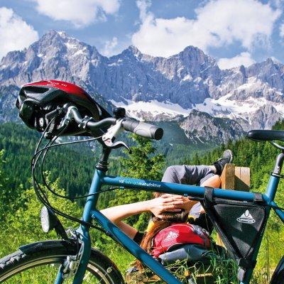
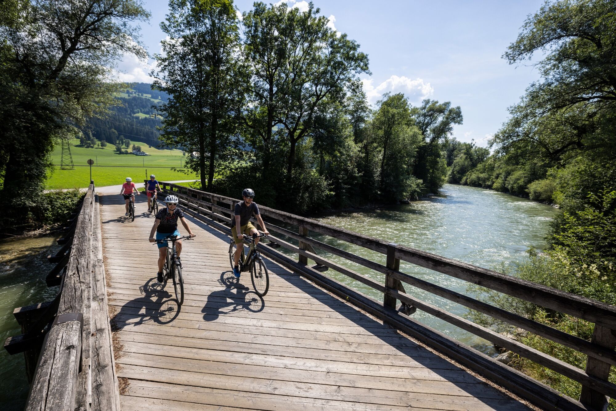
The Enns, and above all the landscape through which it accompanies us on our tour, has numerous faces. Impressive mountains as companions on the Enns bike path, romantic valleys, rushing streams, dreamy villages and historic small towns with beautiful centres and eventful history. This is what accompanies us on our way along the Enns to the Danube. An adventure between Dachstein and Niederen Tauern, a journey through the two national parks Gesäuse and Kalkalpen up to the Reichraminger Hintergebirge and into the cities Steyr and Enns, the oldest city of Austria.
- Difficulty
-
difficult
- Rating
-
- Starting point
-
Flachauwinkel
- Route
-
Ofentürl0.0 kmFlachauwinkl0.9 kmPfarrkirche Flachau5.7 kmFlachau5.8 kmSinnhub13.4 kmAltenmarkt im Pongau14.7 kmKrallinger15.3 kmRadstadt (858 m)18.1 kmDas Geringer28.1 kmMandling28.3 kmGleiming30.4 kmPichl bei Schladming31.9 kmPichl31.9 kmFreizeitstüberl32.1 kmMaistatt37.2 kmSchladming (745 m)38.1 kmSeebacher-Siedlung38.8 kmMauterndorf40.4 kmLehen42.0 kmOberhaus43.0 kmKulmiNarium43.3 kmHaus im Ennstal45.0 kmWeißenbach47.6 kmBärenwirt51.5 kmAich51.6 kmPruggern56.3 kmLandgasthof Bierfriedl56.5 kmGröbming (676 m)58.9 kmMoosheim59.5 kmSt. Michael59.5 kmBach65.1 kmEdling66.7 kmPfarrkirche Öblarn67.8 kmÖblarn68.0 kmGasthaus Stralz'n68.2 kmEvang. Heilandskirche68.6 kmNiederöblarn70.8 kmTrummer-Kapelle71.0 kmZum Grimmingtor71.0 kmFalkenburg78.7 kmIrdning78.8 kmMaitschern85.7 kmPoschenhof86.5 kmWörschach86.6 kmPfarrkirche hl. Anna86.6 kmAu-Kapelle87.9 kmLiezen97.1 kmLiezen (642 m)97.3 kmPürgschachen106.5 kmDorfwirt109.1 kmArdning109.3 kmAdmont118.4 kmGasthaus Gesäuseblick123.2 kmGasthaus Wengerwirt123.9 kmWeng im Gesäuse124.1 kmGesäuseeingang128.9 kmGstatterboden136.1 kmHieflau144.8 kmHieflau145.3 kmWegkapelle146.2 kmWandau146.7 kmHarmonika Waldi147.0 kmGasthof Brückenwirt151.1 kmHoamat154.2 kmGroßreifling154.8 kmGasthof Schnabl157.2 kmHocherb159.8 kmBuchsteinstüberl161.4 kmReiflingviertel162.4 kmAuf der Au164.7 kmMarkt165.6 kmSankt Gallen165.7 kmUnterer Markt165.9 kmAm Spitzenberg166.5 kmRestaurant Caffe Lounge Ivo167.1 kmWeißenbach an der Enns167.3 kmFlößerkapelle168.3 kmAltenmarkt bei Sankt Gallen170.0 kmGasthaus Post170.0 kmPfarrkirche hl. Nikolaus170.2 kmGasthof G. Jax170.2 kmNach der Enns180.8 kmPfarrkirche Kleinreifling183.4 kmKleinreifling183.4 kmAnger187.5 kmKüpfern189.5 kmFlößerstube195.8 kmRialto196.7 kmGroßraming196.8 kmHeinzl201.5 kmPfarrkirche Reichraming206.6 kmReichraming206.7 kmGasthaus Aglas206.7 kmLosenstein212.3 kmTrattenbach218.6 kmTernberg221.0 kmFaller Wasserfall223.9 kmWirtshaus zur Gerti224.6 kmLahrndorf227.8 kmSand229.5 kmGarstnerfeld231.7 kmGarsten232.3 kmKraxental233.4 kmPyrach233.6 kmNeuschönau234.0 kmNeutor234.8 kmMarienkirche235.0 kmSteyr (310 m)235.0 kmInnere Stadt235.0 kmZwischenbrücken235.3 kmEnnsdorf235.7 kmOrt236.9 kmResthof238.5 kmSchindlalm238.9 kmStadtgut Steyr239.7 kmStaning244.2 kmWinkling246.6 kmPlaik249.2 kmKronstorf251.3 kmAutodiele Pizza & Grillhaus251.5 kmUnterhaus253.8 kmSchieferegg253.9 kmThaling255.0 kmThalinger Hof255.1 kmHiesendorf256.5 kmKönigreichssaal der Zeugen Jehovas258.6 kmNeugablonz259.0 kmEnnsdorf259.9 kmEnns260.0 kmLorch261.8 kmGasthaus Walter Wurdinger262.3 km
- Best season
-
JanFebMarAprMayJunJulAugSepOctNovDec
- Description
-
We will get to know impressive mountain personalities and landscapes. We will be impressed by how the cosy, quiet Enns in the Gesaeuse National Park builds up into a thundering, raging river. As if the Enns was angry that the valley is not wider. If in the first part of the route the high alpine mountain world is your companion, in the second part the main focus is on the increasingly calm Enns. Just like in a good literary work: after the raging climax comes the gentle finale - through a landscape that enchants us with romantic towns, orchards and meadows, until at our destination we can choose the connection to the Danube bike path, which also takes us to Linz. We are looking forward to unforgettable culinary and cultural impressions.
Some of the highlights of the Enns bike path, in brief: The start at almost 1,000 metres above sea level at the foot of the Niederen Tauern in Flachauwinkel. The impressive mountains and numerous bathing lakes. The historic towns of Radstadt and Schladming with their lively sporting attractions. The impressive Grimming, long considered the highest mountain in Styria, and at its feet Trautenfels Castle with its wonderful exhibitions on culture and nature. A few kilometres further on is the Admont Monastery at the entrance to the Gesäuse National Park with the largest Sifts library in the world. And of course the old trading town of Steyr and Austria's oldest town of Enns. Between the two stations, the Enns forms the natural border between Upper and Lower Austria.
Our following daily stages are suggestions. You will see, so much beauty cannot be meticulously planned, and we will give you one or the other tip, which may mean a detour, but will certainly be worth seeing and experiencing. By the way, the indicated altitude meters with ascent and descent really include every small ascent - even if it is only a few meters uphill on a length of several hundred meters, which one doesn't notice at all. One more comment: The variety of our trip requires the right "adjustment". Don't forget your swimsuit as well as sturdy shoes, for example during a stopover for a hike in the Schladminger Tauern or in one of the national parks.
And important: Here we give you a description of the Enns cycle path, which only partially replaces correct map material (e.g. "bikeline - Ennradweg" in the publishing house Esterbauer). There are also plenty of variants on your way. To describe them all here would go beyond the scope.
- Directions
-
There are many ways that lead to Rome, or in our case to Enns. We would like to give you an overview of your tour and recommend to take at least six days. The daily stages are also variable. Because some people have already "stuck" at one or the other inn in a particularly romantic place and have only continued their tour the next day. Because we are not on the "run", we choose one of the most beautiful ways to experience Austria. And that needs open eyes, a little stamina, but also time.
Important note: the individual stage kilometres add up to just under 3 km more than the total tour, as the outward and return journeys to town/city centres or to accommodation have been added to the stages.
1st stage of the day
2nd day stage
3rd day stage
4th day stage
5th day stage
6th day stage
- Highest point
- 1,014 m
- Endpoint
-
Enns
- Height profile
-

- Equipment
-
The right bike: touring bike or city bike, racing bikes are not recommended.
Breakdowns can happen - but seldom in front of the door of one of the numerous service points: basic equipment for tools and supplies therefore never does any harm! Replacement hose and/or repair kit, universal wrench, air pump, brake and shift cable and a screwdriver are of advantage.
- Tips
-
On the road with children: the trip is only recommended to a limited extent, as in the Gesäuse National Park and partly also in the Kalkalpen National Park the route leads partly on the road and some stages also have gradients. However, if you are travelling with children, you will notice the "piggyback transport" through the Gesäuse: Up to 5 bicycles can be transported on all ÖBB Postbus courses on lines 910 and 912 with the bicycle symbol or with the note "Bicycle transport limited possible". The tariff is independent of distance and amounts to € 3.10 per bike. Children's bicycles are free. For information and reservations please call +43 810 222 333 (daily from 6 a.m. to 10 p.m.). You can download the timetables here: Line 910 and line 912. Another possibility for the route St. Gallen - Mooshöhe is the bike transfer of the Gasthof Hensle, more information under Tel. +43 3632 7171.
Children should have completed the cycling licence or course in advance!
- Additional information
-
Steiermark Tourism
Phone +43 (0)316 / 4003
Fax: +43 (0)316 / 4003-30
www.ennsradweg.comYou can find the Enns bike trail with all facts and figures at www.ennsradweg.com
Return journey from Enns to Flachau:
Huber Taxi Reisen, Flachau, Tel. +43 (0)6457 / 2402, registration required in advance. Further information: Huber Tours www.huberreisen.at


-

-
AuthorThe tour Ennsradweg - Through the world of mountains and water is used by outdooractive.com provided.