- Brief description
-
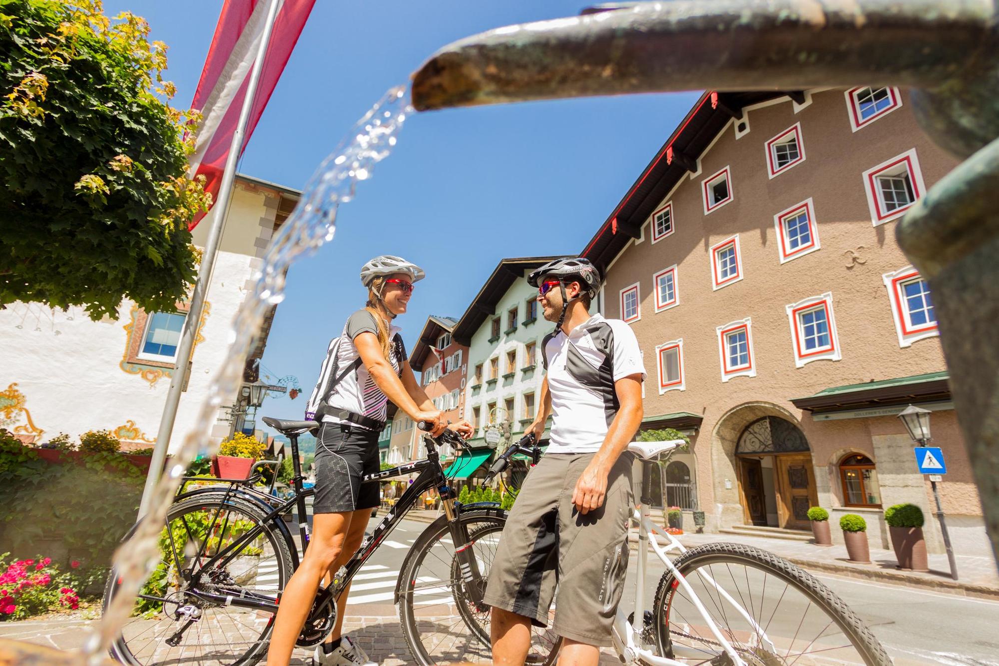
The Tauern Cycle Trail follows the rivers Salzach and Saalach, offering wonderful natural scenery, and a host of castles, palaces and little towns along the way.
- Difficulty
-
medium
- Rating
-
- Starting point
-
Krimml
- Route
-
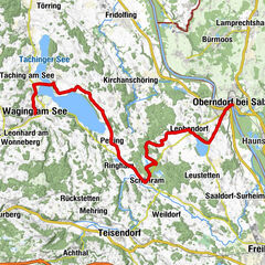
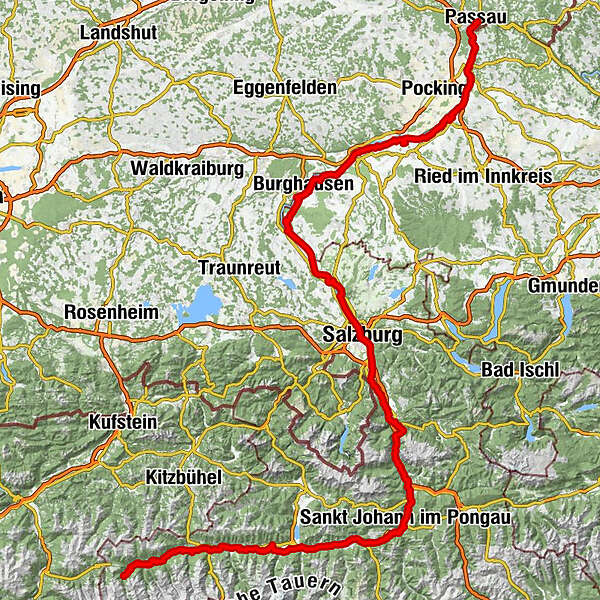
Krimml (1,067 m)0.8 kmKrimml (911 m)3.6 kmGasthaus Pension Marienhof3.6 kmVorderkrimml4.2 kmLahn4.4 kmFamiliengasthof Schranz4.4 kmRestaurant Kirchplatzl6.4 kmPfarrkirche St. Nikolaus6.6 kmLahn6.6 kmWald im Pinzgau (855 m)6.7 kmRestaurant Walderwirt6.7 kmTrattenbach7.6 kmRosental8.4 kmNeukirchen am Großvenediger11.4 kmBärngarten13.2 kmSchönbach14.9 kmWeyerhof16.1 kmWeyer16.6 kmWeichseldorf18.3 kmBramberg am Wildkogel18.9 kmBicheln21.0 kmMühlbach21.3 kmDorf22.2 kmDorf-Pass Thurn22.9 kmHollersbach im Pinzgau25.4 kmPfarrkirche St. Vitus25.6 kmReitlehen25.9 kmMittersill30.7 kmFelben32.0 kmFelberkirche32.1 kmWilhelmsdorf34.4 kmStuhlfelden35.4 kmPirtendorf36.8 kmUttendorf39.0 kmGasthof Tischlerwirt39.1 kmTobersbach40.0 kmUggl40.9 kmLengdorf43.9 kmNiedernsill45.8 kmPfarrkirche hl. Luzia46.0 kmJesdorf46.7 kmHummersdorf50.3 kmIl Capriccio52.4 kmGasthof Neuwirt52.5 kmPiesendorf52.7 kmEinödhof54.6 kmKaprun57.2 kmBruck an der Großglocknerstraße62.5 kmHl. Maria62.7 kmBruck-Fusch63.1 kmGries68.2 kmLacken68.8 kmThannberg70.0 kmHögmoos70.2 kmHasenbach72.0 kmTaxenbach-Rauris72.7 kmTaxberg74.2 kmGasthof zur Post74.7 kmTaxenbach74.7 kmTaxwirt Pizzeria74.7 kmPfarrkirche Taxenbach74.7 kmGschwandtnerberg74.9 kmLend81.6 kmBruderau81.7 kmLend81.7 kmKlamm84.5 kmRaststation Posauner Petrol84.6 kmGasthof Posaunerwirt84.8 kmPummhäusl85.5 kmOberuntersberg89.1 kmUrfahrgut91.4 kmSchwarzach im Pongau91.5 kmSankt Johann im Pongau98.5 kmSankt Johann im Pongau98.7 kmunder the bridge105.6 kmBischofshofen107.5 kmPfarrkirche St. Maximillian107.5 kmPfarrwerfen (545 m)112.9 kmReitsamerhof114.1 kmWerfen115.6 kmWispelhofsiedlung115.9 kmTenneck118.2 kmGasthof Hochkogel118.3 kmWimm119.4 kmAschauer121.0 kmSulzau121.4 kmStegenwald124.4 kmBrunnecker Höhle128.5 kmGolling an der Salzach133.0 kmTorren133.4 kmHallein144.9 kmAltstadt145.1 kmBürgerspitalskirche145.9 kmRehhof148.8 kmRifer Spitz150.6 kmRestaurant Waldbad Anif151.9 kmElsbethen152.2 kmHaslach153.3 kmAnlegestelle Hellbrunn154.9 kmSalzburg (424 m)159.3 kmChristuskirche160.5 kmElisabeth-Vorstadt162.1 kmHagenau163.9 kmBergheim164.3 kmBergheim164.6 kmPabing175.3 kmOberndorf bei Salzburg178.3 kmLaufen und die Salzach179.6 kmSchifferkapelle181.0 kmLaufen (Salzach)181.0 kmRiedersbach193.3 kmTittmoning200.2 kmSankt Radegund204.4 kmHolzgassen210.1 kmAch215.9 kmDuttendorf217.3 kmBurghausen (421 m)217.4 kmWeng219.0 kmAufhausen220.1 kmBerg221.4 kmPfarrkirche St. Peter222.8 kmÜberackern222.8 kmBraunau am Inn (352 m)238.4 kmSimbach am Inn (345 m)238.7 kmLaab240.4 kmHagenau244.5 kmMostschänke Hatheier-Bernroithner246.0 kmAham246.1 kmBurgschänke249.8 kmFrauenstein250.2 kmObersunzing251.1 kmUntersunzing252.2 kmUfer259.8 kmGasthaus Marienhof261.1 kmKirchdorf am Inn261.1 kmKatzenbergleithen262.1 kmGasthaus - Pension Salletmaier262.1 kmPfarrkirche266.5 kmObernberg am Inn266.6 kmReichersberg270.8 kmMinaberg271.4 kmBründlkapelle274.4 kmBründl Quelle Viehausen274.4 kmGasthaus zur 1000-jährigen Linde279.2 kmSuben281.6 kmGasthof Labmayr281.7 kmGasthof Schnelldorf282.6 kmSchnelldorf282.7 kmBadhöring284.1 kmPfarrkirche St. Florian am Inn285.2 kmSankt Florian am Inn285.5 kmLandhotel und Gasthof Sankt Florian285.6 kmVorstadt286.8 kmSchärding287.5 kmSchärding287.9 kmNeuburg am Inn293.2 kmWernstein293.3 kmSchifferkreuz295.1 kmHofötz295.9 kmIngling300.1 kmKapelle der Familie Meindl300.2 kmBergkeller301.2 kmSankt Severin302.3 kmPassau (312 m)302.8 kmAltstadt303.3 km
- Best season
-
JanFebMarAprMayJunJulAugSepOctNovDec
- Directions
-
There where the Kirmml waterfalls – the highest in Central Europe - roar into the depths below, is the starting point of one of the most beautiful cycling routes through Austria.
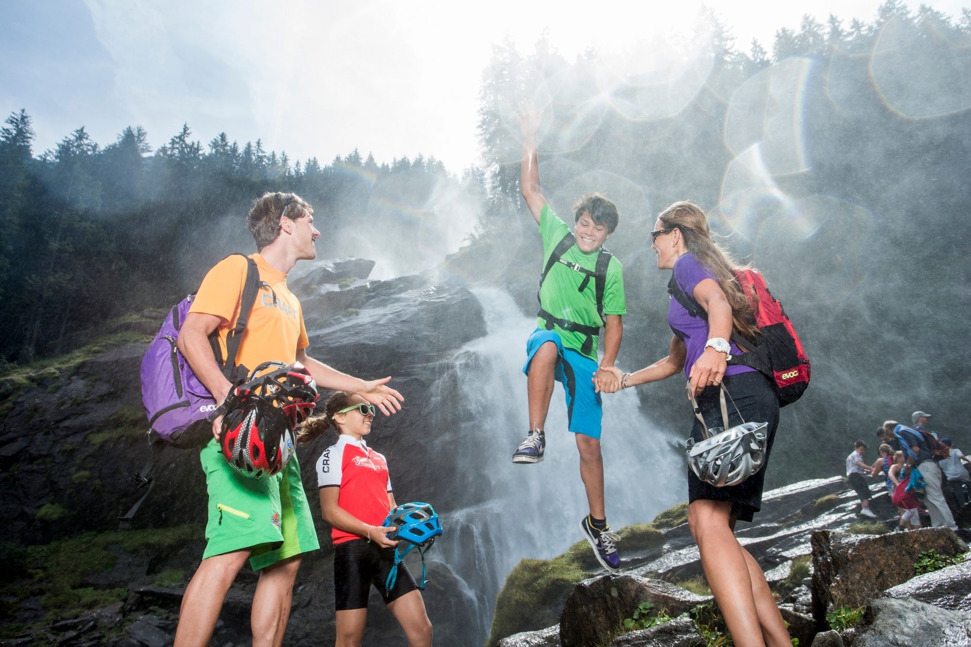
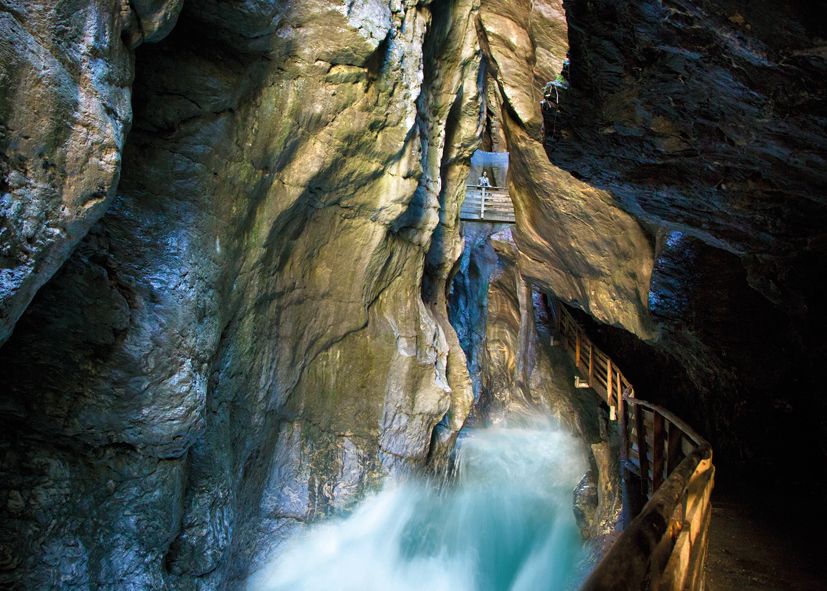
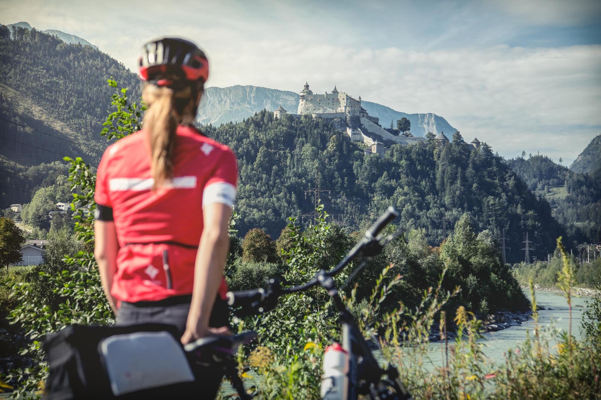
On the edge of the National Park Hohe Tauern, you cycle along the river Salzach; both the Glockner-Kaprun reservoirs and the Großglockner mountain offer for a wonderful excursions. More comfortable, we continue to the reservoirs of the Pongau Salzachkraftwerke, where in recent years beautiful cycling routes have ensued. The wild and romantic Liechtensteinklamm, the Eisriesenwelt the largest ice cave in the world and the castle Hohenwerfen are all sights one should miss under no circumstances! Past the romantic Gollinger waterfall the tour continues to Hallein, the ancient celtic and salt city. A visit to the salt mine is mandatory!
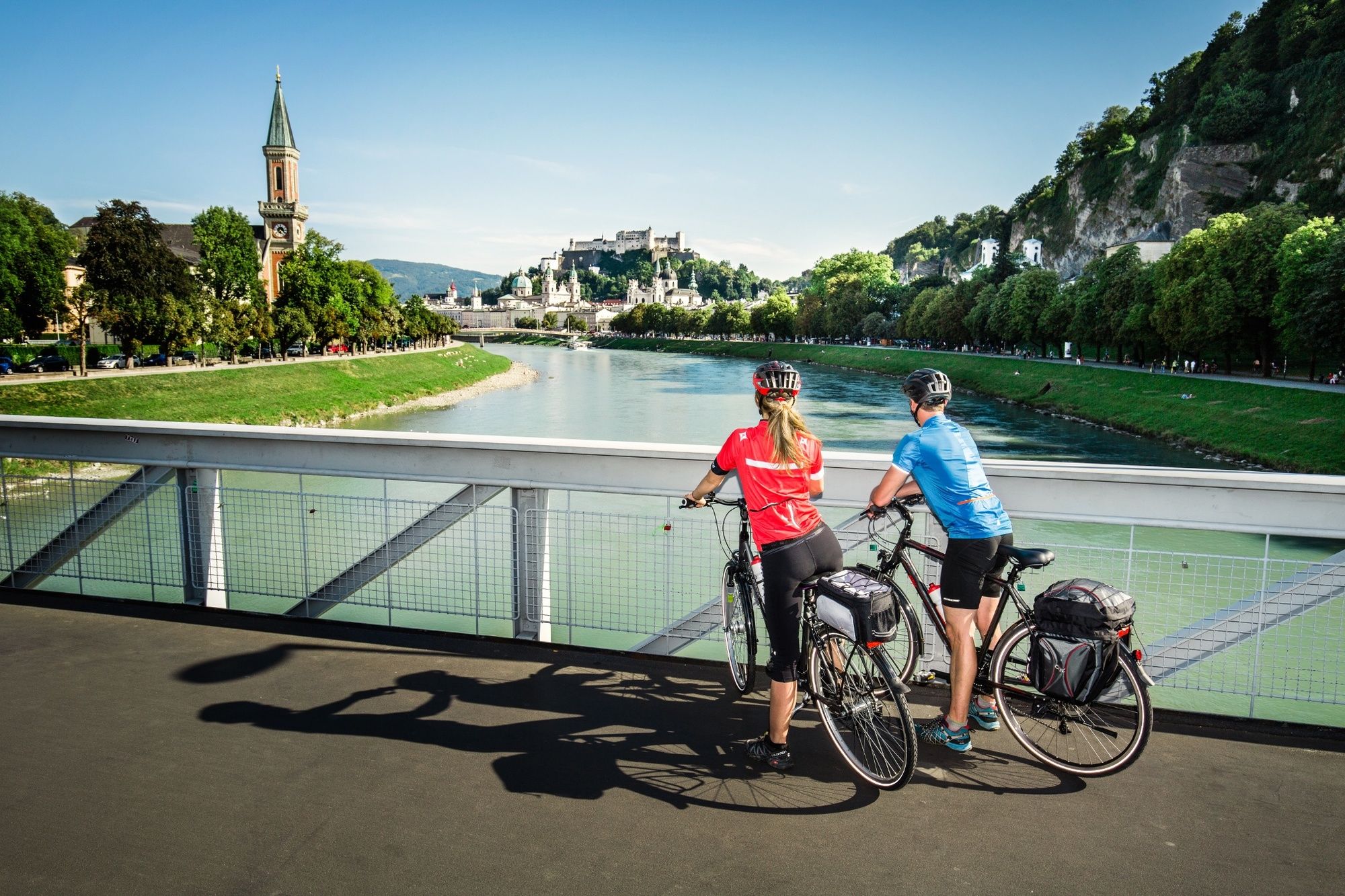
From afar you can see then the Fortress Hohensalzburg. Overlooking Salzburg's old town with its large squares and winding streets: the most beautiful view is directly from the bike path along the river Salzach.Those who chose the route via the Saalach Valley are also able to enjoy this sight. On the completely new cycle path between Saalfelden and Lofer, one reaches the city of Mozart at the Stiegl BB´s Brauwelt (interactive museum). This variant allows also for a magnificent tour.
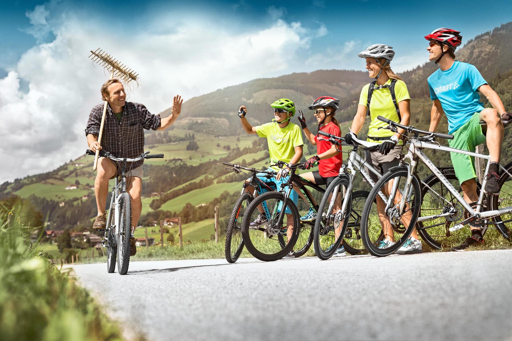
The Tauern Bike Tour through the quiet Salzach and Inn-Auen continues to the North. On its shores lie the old market town Oberndorf, the Gothic-like Braunau, the millenial Oberberg, the Augustinian monastery of Reichersberg, the baroque town of Schärding, the castle Wernstein and - at the end - the "three rivers"city of Passau.
- Highest point
- 1,066 m
- Endpoint
-
Passau
- Height profile
-

- Safety instructions
-
ROUTE: Due to the largely downhill gradient (only a few ascents), an anti-clockwise direction is recommended. Approx. 70 % of the cycle route is on tarmac surface. 90 % runs along cycle paths or quiet back roads. Suitable for touring bikes and trekking bikes, but only to a certain extent for racing bikes. Mountain bikes allow you to explore additional alpine detours.
- Additional information

- Author
-
TauernradwegThe tour B: Tauern Cycle Trail Krimml ‒ Passau Full Route is used by outdooractive.com provided.