- Brief description
-
The first part of the hike is on a pedestrian-friendly forest path and leads us to the lookout point Brandaussicht and afterwards over the Brandstufen ladders into the Polenztal valley. The trail in the silent valley Polenztal continues to the mill Waltersdorfer Mühle and over the gorge along the Neuweg trail back to the village Hohnstein.
- Difficulty
-
medium
- Rating
-
- Starting point
-
town Hohnstein
- Route
-
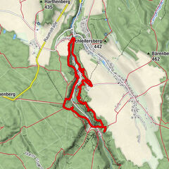
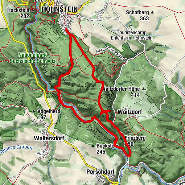
HohnsteinWaldborn0.8 kmBrandaussicht2.9 kmBrand-Baude2.9 kmThümmelgrotte2.9 kmZeigefinger3.1 kmKleine Barbarine3.1 kmAussicht Hafersäcke3.1 kmViermännerturm3.2 kmHexe3.5 kmArchipel9.1 kmKobold9.6 kmNeuwegwand9.9 kmHohnstein11.0 km
- Best season
-
JanFebMarAprMayJunJulAugSepOctNovDec
- Description
-
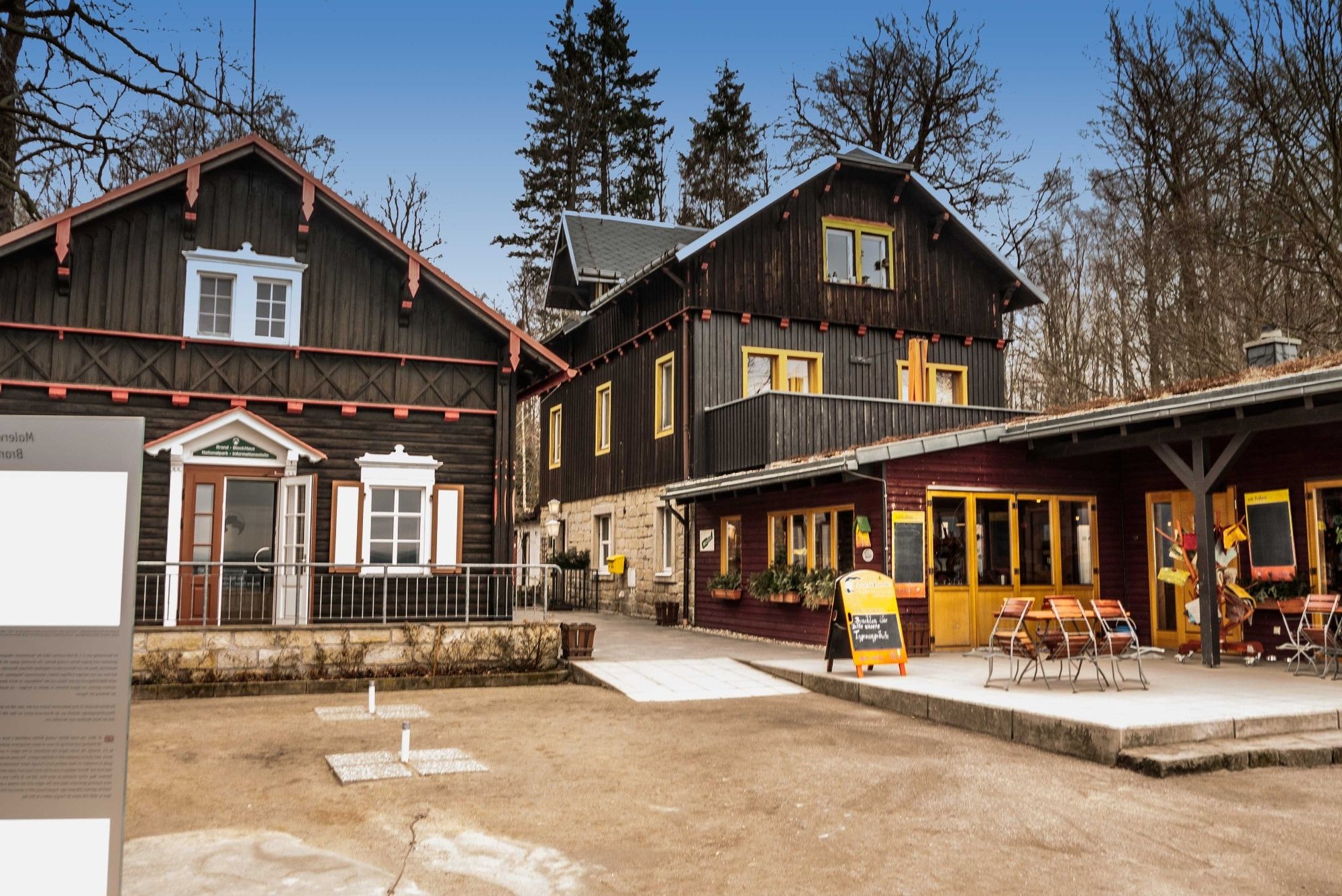
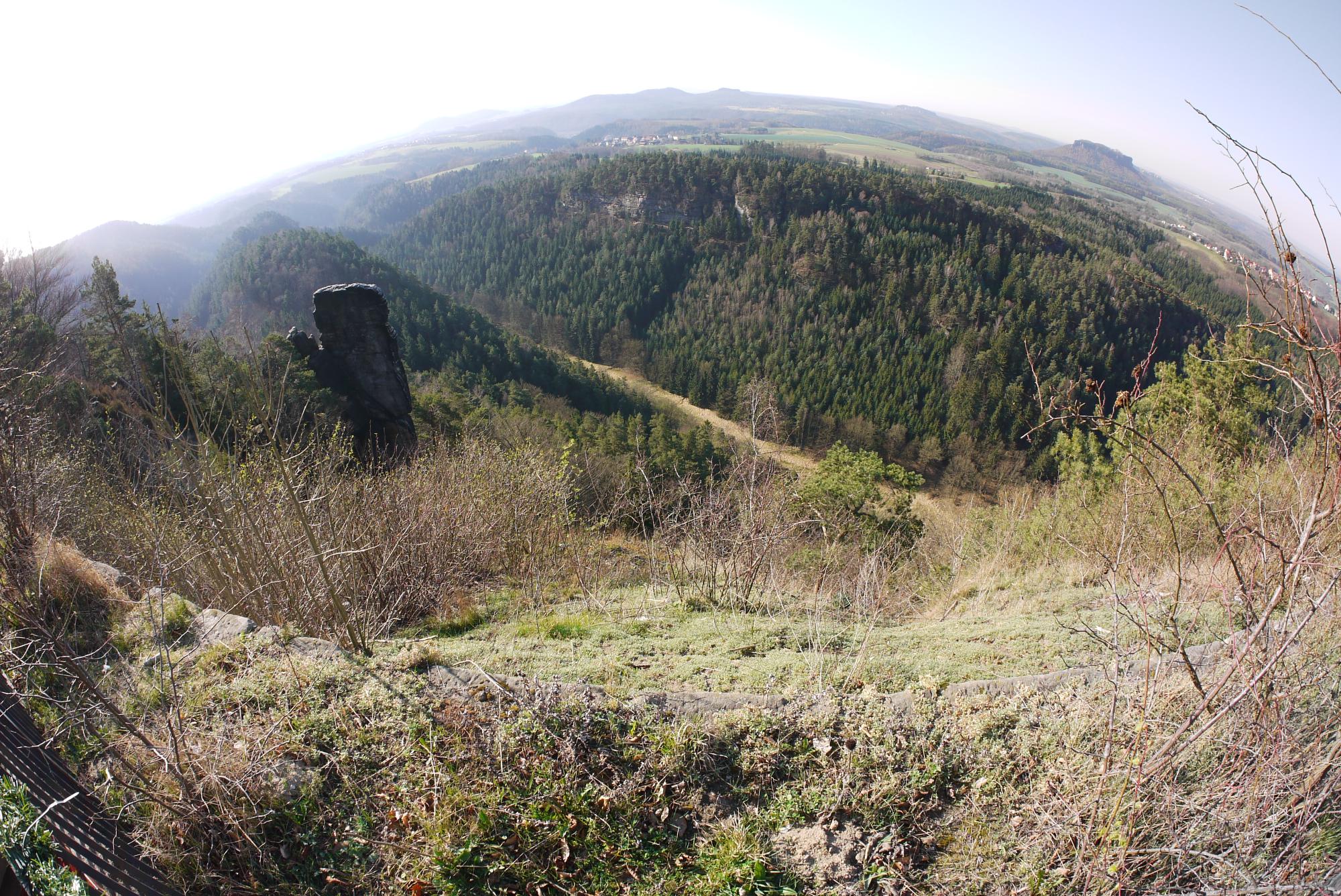
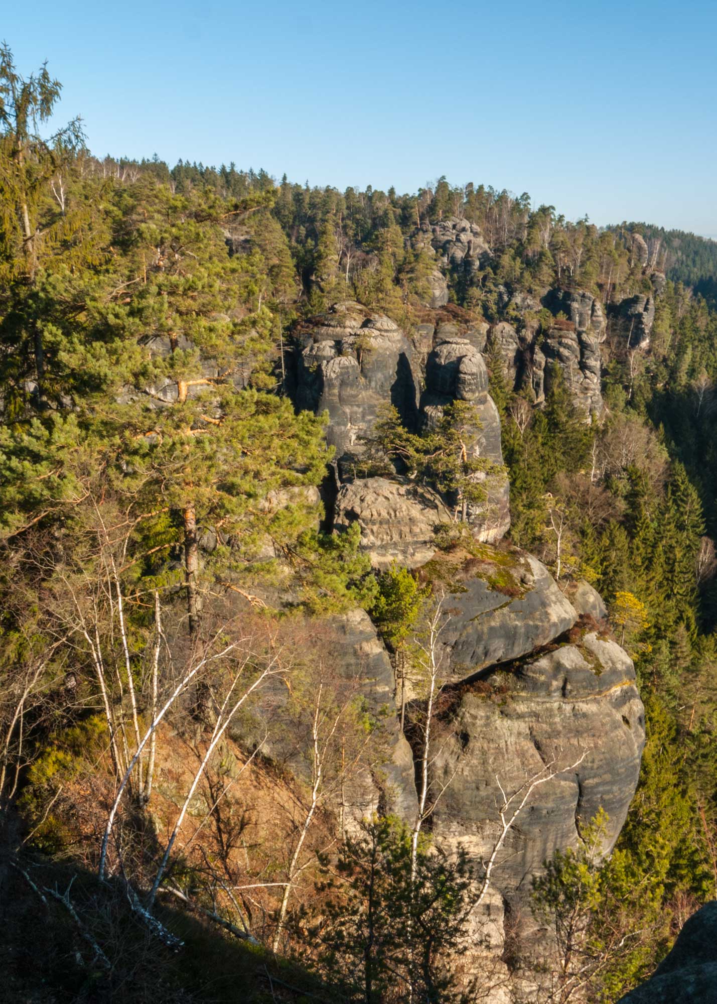
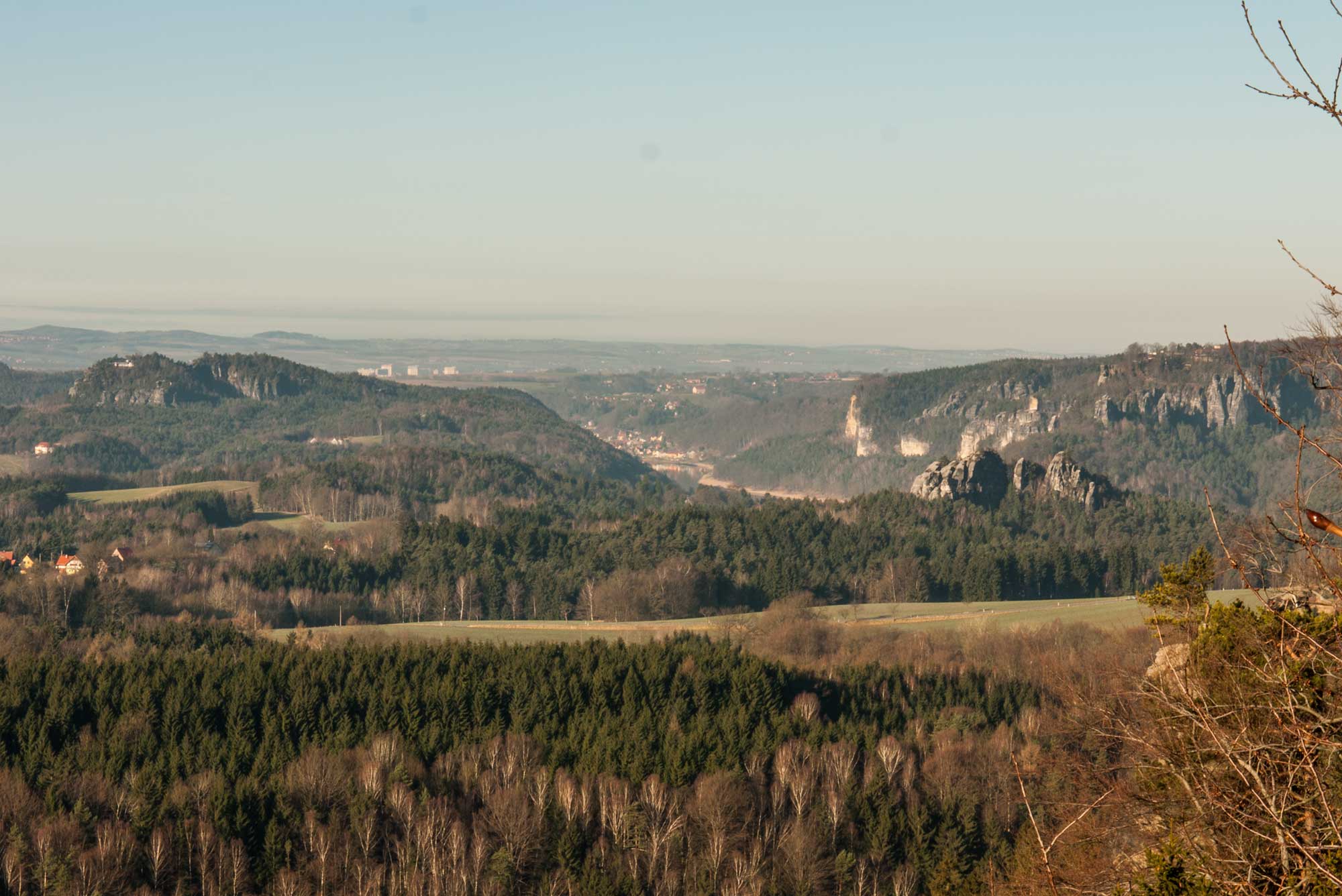
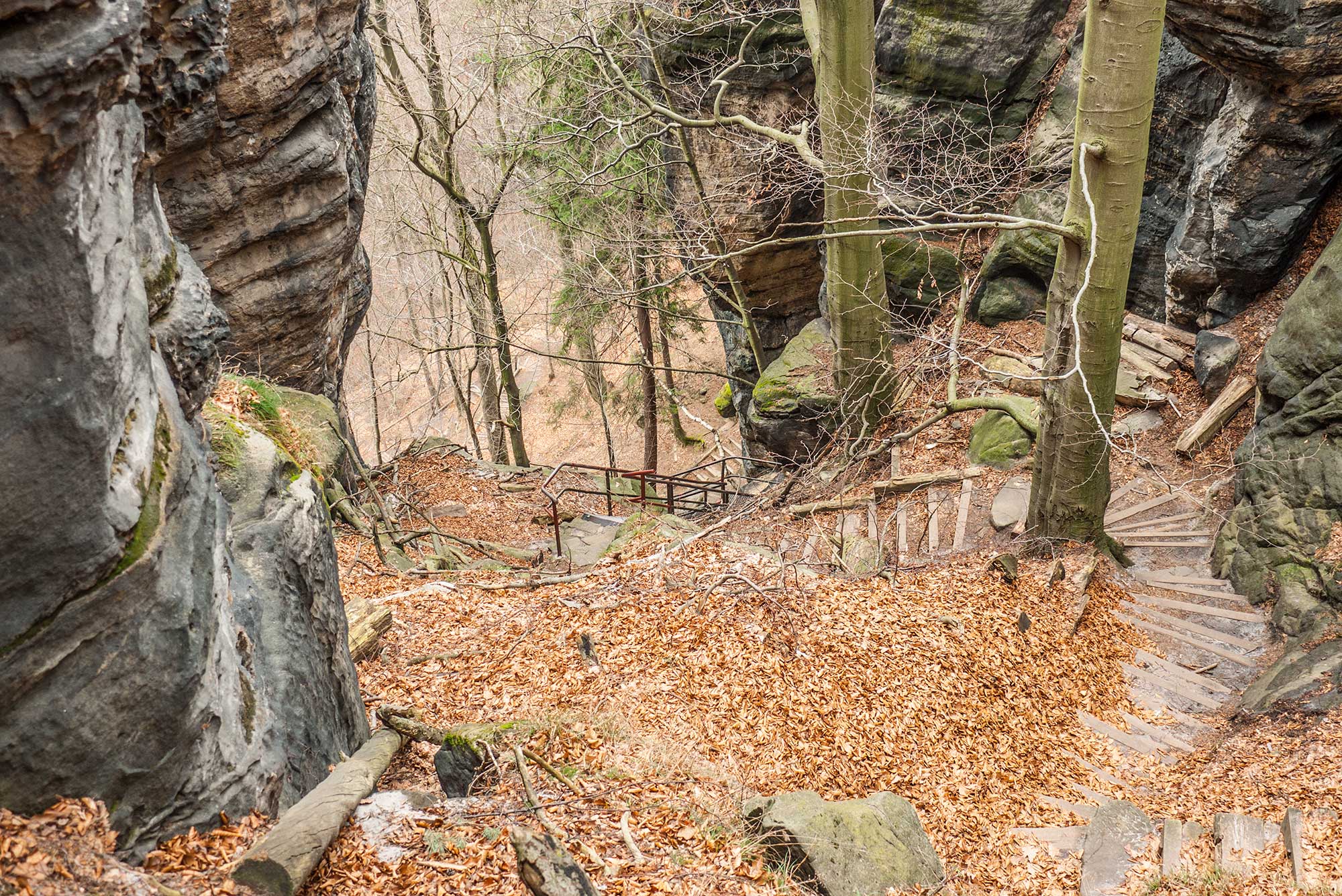
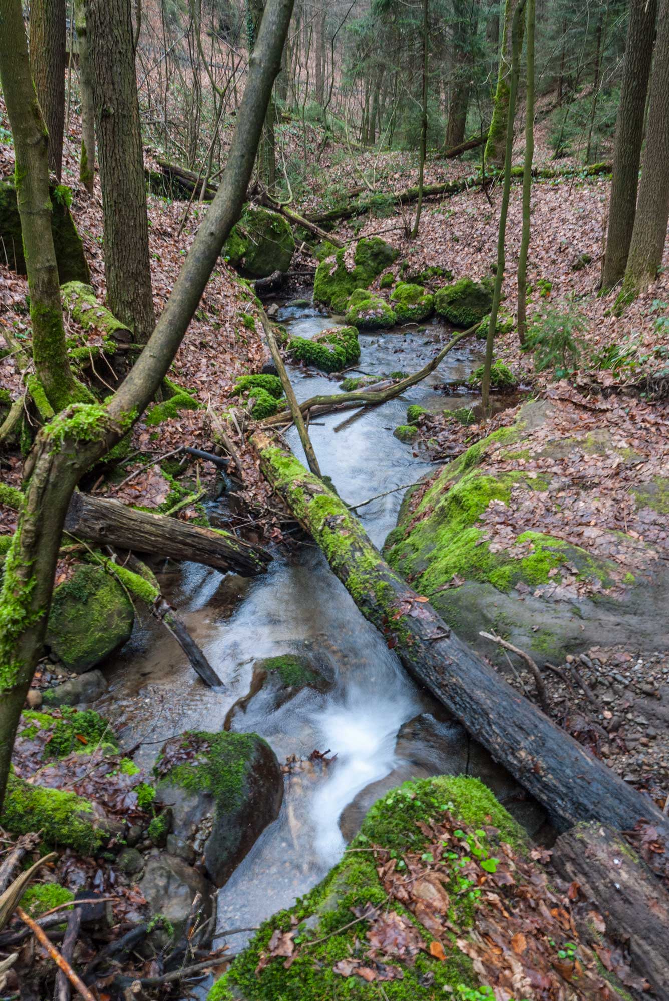
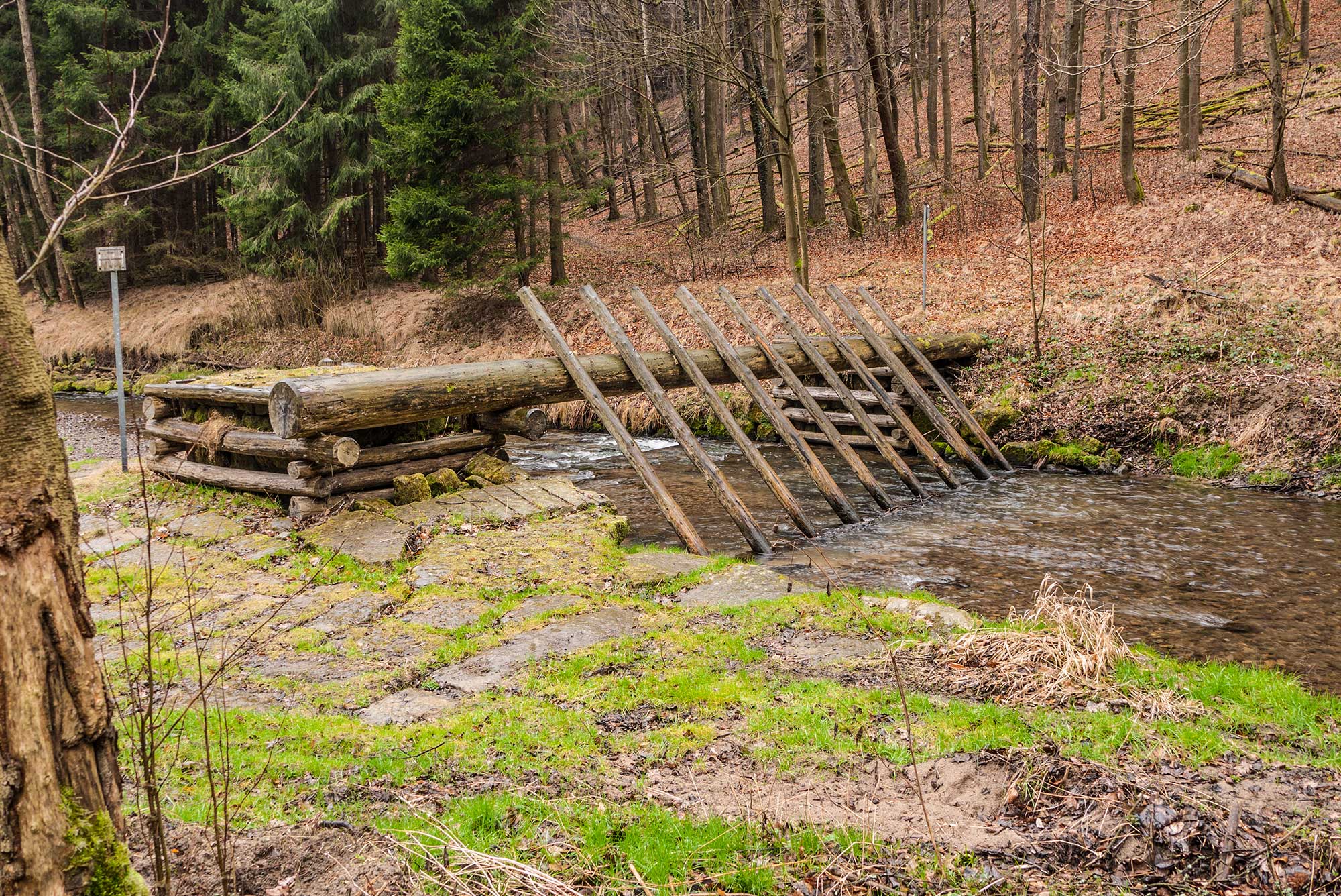
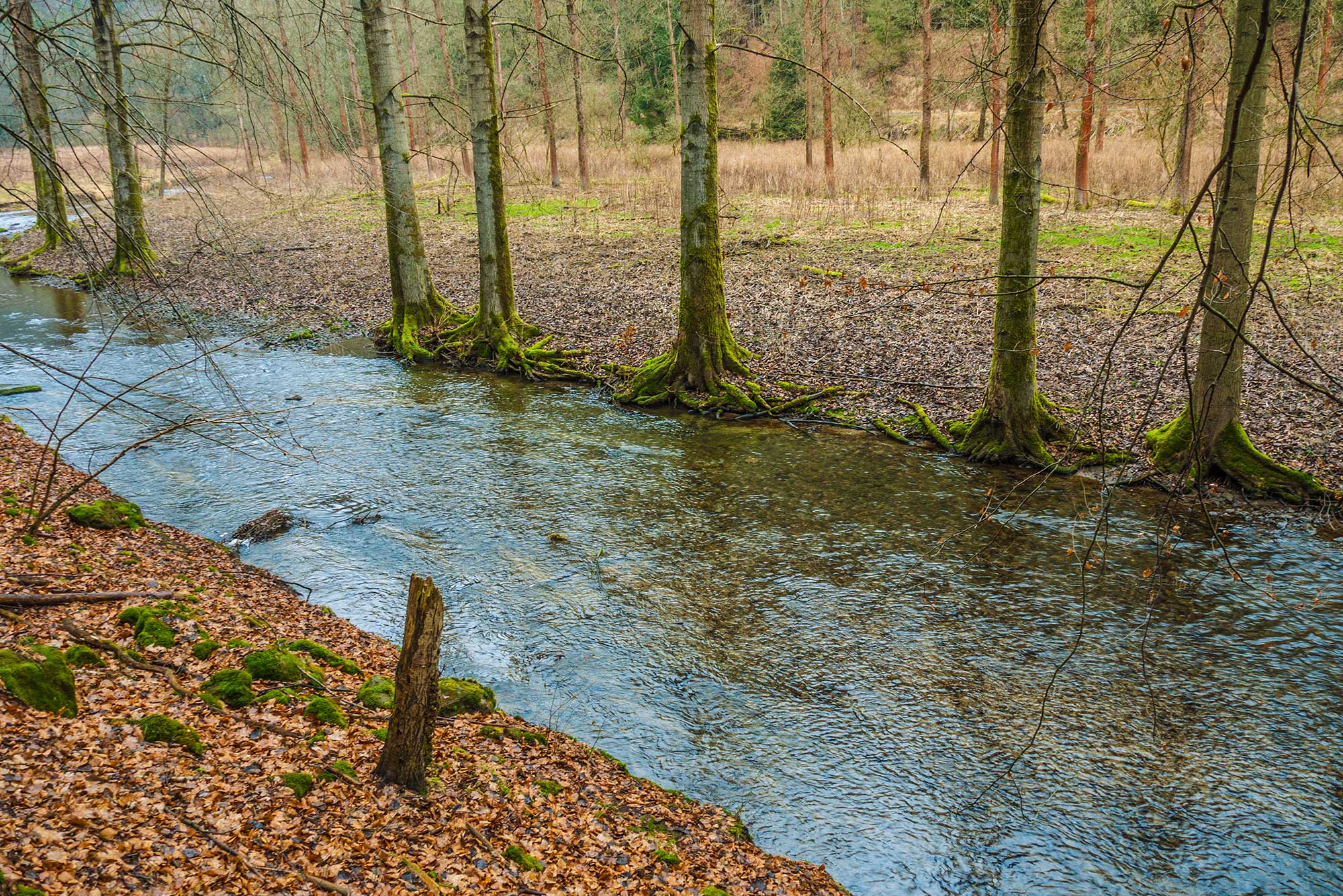
The starting point of the hike is located at the last public parking on the Brandstraße street, close to the old-age home in the forest. If this parking area is already full on the weekends, you can alternatively use the larger parking area by approaching via the street Obere Straße at the junction to the Teichstraße street. The hike starts at the edge of the forest towards the Brand rock (blue line waymark). After about 300 meters we see left from us at a slope-shaped clearing an official fire pit. Here hikers are allowed to make a campfire, except for forest fire warning levels. The fireplace is made of circular arranged sitting places and a fire bowl. The firewood must be organized individually and cannot be taken from the surrounding area. After about 300 meters a circular arrangement of trees at a street appears. On the wayside is located the "Waldborn", an old water pump which still gives spring water. This pump is named "Brandpumpe" because since 1855 it ensured the water supply for the buildings at the Brand rock for many years. Continuing the hike we see on the left wayside at the junction to the forest gorge a so-called „Forstbergsäule" (old signpost pillar, only a copy), standing in memory of the horrible death of a clergyman in the year 1795. It is said that this man probably had tasted too much of the altar wine before he went from Bad Schandau over the Brandwände rock walls to the town Hohnstein and then fatally crashed. Since we are still reminded of the accident, indicates that probably very few hikers in this mountain region suffered the same tragedy. The following parts of the trail confirm our thinking, because the path is well built and with almost no altitude differences. Here numerous very old beech trees define the wayside. The route to the Brand rock is nice for mothers with prams or nature loving but disabled people. After about 300 meters on the left wayside is again a possibility for a short detour to the lookout point from the forest gorge wall. Finally we arrive at the Brand rock with the restaurant and an excellent view from the visitor’s terrace. The panoramic 180-degree view includes from left (southeast) the Schrammsteine rock formation, followed by the table mountains left from river Elbe until the area of the Bastei rock formation near Rathen (northwest). Fortunately this lookout point, as also the one at the Bastei, can be accessed throughout the whole year. Next to the restaurant stands a log cabin where tourists can get information about the National Park. In close proximity in south direction is located a special climbing rock which attracts a lot of attention. It is called "Brandscheibe" and offers climbing routes up to the level of difficulty VIIIc. In dry weather spectators can watch very adventurous climbers on weekends. Especially the observation deck with installed binoculars is great for following the action. The tables in the restaurant at the Brand rock are placed directly on the railing and offer a great view. Thus it is a popular place to have a rest and enjoy this panorama. On a clear day you can stay here for hours. Therefore, the restaurateurs organize holidays and regular cultural events outdoors. Nearby the Brand rock lookout point is also located a lookout point with a view over the "Hafersäcke" (transl. "oat sacks") rock formation. The route is signposted and leads along a nearby goat stall, towards the opposite side of the ledge, facing northeast. The sandstone rock formations in the north actually looks like petrified and slumped bags. In front of us is the gorge Tiefer Grund, which separates us from the Waitzdorfer walls rock formation. The next section of the path leads us on the serpentine-like arranged Brandstufen (ladders and stairs) down to the street Schandauer Straße. The path (blue line waymark) turns to the right direction, downhill and along the "Tiefen Grund Bach" (creek). Although the street Schandauer Straße now runs parallel to the hiking trail, you can feel the potential power of this presently so peaceful brook. During downpours, which occurred more often in recent years, the tame brook grows to a raging torrent. Nevertheless the pavements in this valley are built solid enough, so that this brook can cause no serious damage to it. Soon thereafter the first buildings of the municipality Porschdorf are in sight. At this point the trail makes a sharp right turn and changes over to a forest road with the red dot waymark. This waymark accompanies us through the Polenztal valley until the Waltersdorfer Mühle (mill). For now, we leave Porschdorf and on our left side we can see the railing of the former mill Frinztalmühle. Today, a small commercial area is located in this place; until 100 years ago, this was one of the well-regarded restaurants in the Polenztal valley. About 100 meters upstream, we see a river rake. During floods this prevents that driftwood from the river Polenz can cause any damage in the nearby town. After another kilometer we are below the rock Brandscheibe and the trail leads over a bridge to the other side of the river. The trail runs now for a few meters elevated on a secured sandstone wall. Shortly before the mill Waltersdorfer Mühle is another official fire pit, just nearby the path (made by the National Park administration). This fireplace has the advantage of not being in close proximity to the village. Due to the good traffic-ability and the nearby water at this remote place, the administration realized that it was overdue to create a romantic fire place for the nature-loving people. At the mill Waltersdorfer Mühle we cross the river Polenz once again. For many years this mill accommodated gastronomy and also a FDGB (Trade Union Confederation) holiday home. In terms of building it is to say that due to the close proximity to the river Polenz and the narrow section in the valley pose an extreme challenge to the structure. Due to the floods and only moderate tourism in the high season, there is hardly any economically driven gastronomy left ... which is quite frankly a shame. At this point we can choose whether we want to walk back to the lookout point Brandaussicht through the Schulzengrund valley or to the town Hohnstein through a gorge along the "Neuweg" trail (both directions with red line waymark). At this point we do realize that the meters in altitude that we went down at the beginning on the Brandstufen must now be won back again in order to reach our starting point. Hiking in the Elbe Sandstone Mountains also includes the occasional sweating. At the end of the ascent we can see on the right side a grotto, which is decorated with icicles during freezing winters. Now we follow the red line waymark until the entrance of Hohnstein and finish our hike on the street Brandstraße.
- Highest point
- 357 m
- Endpoint
-
town Hohnstein
- Height profile
-
 © outdooractive.com
 - Additional information
- Public transportation
-
Bus line 264 from Bischofswerda and Neustadt
Bus line 237 from Pirna and Sebnitz
- Parking
-
Brandstraße street, Hohnstein railway station or Hohnstein Eiche.
-

-
AuthorThe tour Brand rock lookout-point and Polenztal valley is used by outdooractive.com provided.


General info
-
Sächsische Schweiz
1393
-
Westlausitz
451
-
Hohnstein
491