© Wandermagazin

- Brief description
-
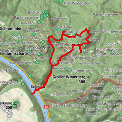
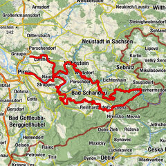
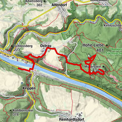
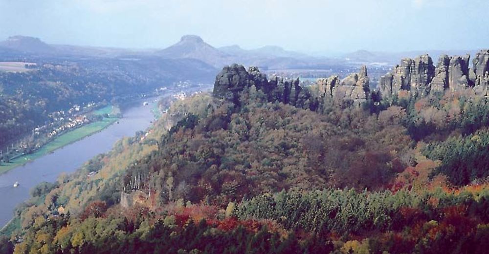
Unsere Wanderung führt uns durch die wildromatischen Täler und zu spektakulären Aussichtspunkten des Elbsandsteingebirges.
- Difficulty
-
difficult
- Rating
-
- Route
-
Kohlmühle0.0 kmAltendorf1.8 kmOstrauer Mühle3.4 kmGroßer Backofen4.8 kmHoher Torstein (424 m)6.0 kmBaustein6.8 kmMittelwinkel7.1 kmVagabund7.9 kmWandwächter8.7 kmRegenturm8.7 kmSchrammsteine9.1 kmGute-Ader-Wand12.2 kmVorderer Torstein12.2 kmMeurerturm12.2 kmKesselturm12.3 kmViererturm12.3 kmLanges Horn14.8 kmEmmabank14.9 kmOstrau16.2 kmBad Schandau (146 m)18.2 kmBad Schandau, Stadt18.3 kmBad Schandau, Bahnhof19.3 km
- Best season
-
JanFebMarAprMayJunJulAugSepOctNovDec
- Highest point
- 394 m
- Height profile
-
 © outdooractive.com

- Author
-
The tour In den Schrammsteinen is used by outdooractive.com provided.
GPS Downloads


General info
Refreshment stop
Cultural/Historical
A lot of view
Other tours in the regions
-
Sächsische Schweiz
1393
-
Böhmisches Schweiz
775
-
Reinhardtsdorf-Schöna
584