

- Brief description
-
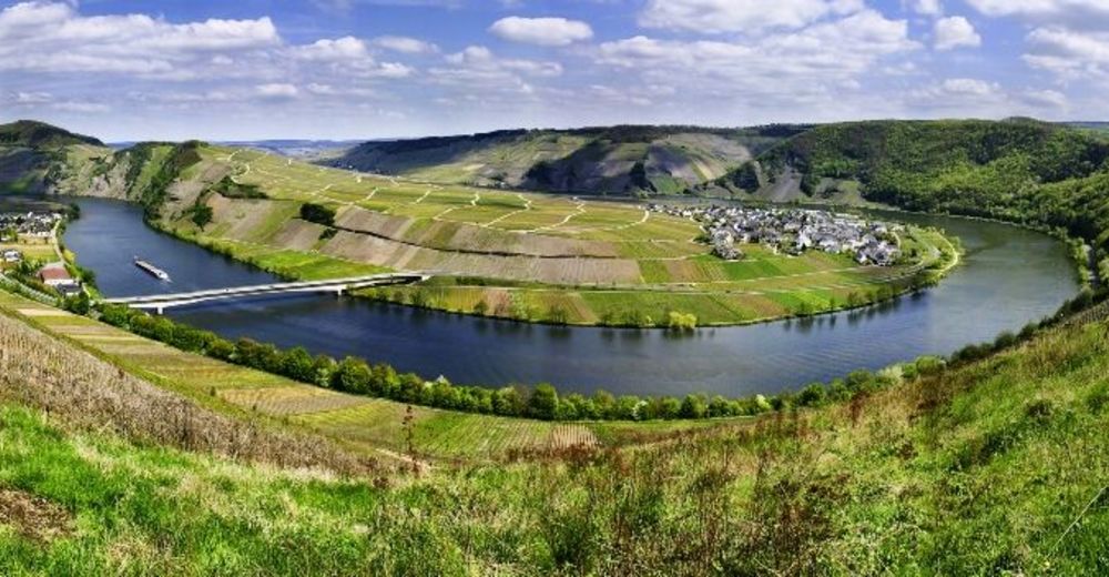
A panoramic tour on a high terrace of the Moselle. Hiking is mostly on vineyard paths - always accompanied by a wonderful view of the Moselle and the vineyards.
- Difficulty
-
medium
- Rating
-
- Starting point
-
Town center, Bahnhofstraße
- Route
-
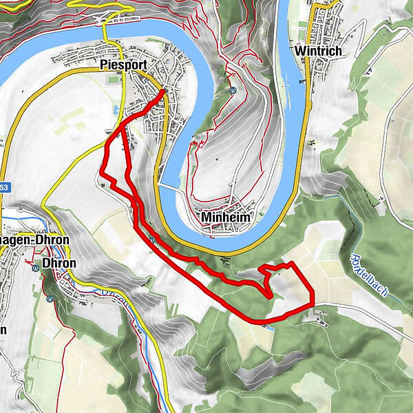
Pfarrkirche St. Martin0.1 kmNiederemmel0.1 kmZimmet1.8 kmZimmet8.0 kmNiederemmel10.1 kmPfarrkirche St. Martin10.2 km
- Best season
-
JanFebMarAprMayJunJulAugSepOctNovDec
- Description
-
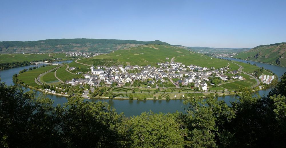
The settlement of Zimmet belongs to the Moselle community of Piesport and gives its name to this hike. Situated on top of the mountain, it offers a magnificent view of the Moselle valley.Insights into the hiking tour:On this circular hike the small settlement of Zimmet, high above the Minheim Moselle loop, is first of all circled. A small path below the settlement and forest and wingerts paths lead up to a plateau where many Moselle people used to cultivate their fields. Today there are extensive apple plantations and a large apple farm. Exactly on the route of today's country road, along which one walks a good distance parallel, a Roman road led from Hunsrück into the Moselle valley in ancient times. During the hike through the vineyards, one always has the Moselle in view. A particularly beautiful view of the Moselle valley awaits you at Zimmet.There are no rest stops along the circular hike, so it is recommended that you take backpack provisions with you and take a break along the way.
- Directions
-
From the centre of the village (Bahnhofstraße) walk in the direction of the Römerbrunnen and the industrial estate. On farm tracks you walk further through vineyards. Below the weekend houses of Zimmet - halfway up - you will reach a small path leading through the hillside forest. You come across a forest path on which there are hardly any gradients to overcome at first. Only after a sharp bend at a stream, the path then climbs steeply uphill again through vineyards. You reach the high terrace and walk across the meadow to the L157, the course of which corresponds for a few kilometres to the former Roman road, which led from Bingen over the Hunsrück to Neumagen and on to Trier. Walk along the road until you reach the Schäferhof, which is known in the region for fruit growing and markets its own products in a farm shop. Along the L157, the path continues to Zimmet. From this settlement with residential and weekend houses you can enjoy the view of the Moselle bend of Minheim. Downhill the path then leads through the vineyards back to Piesport.
- Highest point
- 325 m
- Endpoint
-
Town center, Bahnhofstraße
- Height profile
-
 © outdooractive.com
 - Equipment
-
hiking or trekking shoes, rucksack food if necessary
- Safety instructions
-
no special safety instructions
- Tips
-
In the farm shop of the Schäferhof in Piesport you have the opportunity to buy many fresh products such as apples, honey, schnapps and much more.
- Additional information
- Directions
-
From Bernkastel follow the B53 in the direction of Trier. Follow the road through Andel, Mülheim, Brauneberg and Wintrich to Piesport/Liederremmel.
- Public transportation
- Parking
-
There are parking facilities in the "Bahnhofsstraße".


-

-
AuthorThe tour Rund um Zimmet Moselwanderung at Piesport is used by outdooractive.com provided.


General info
-
Mosel-Saar
1078
-
Ferienland Bernkastel-Kues
570