Großer Rundweg Teufelsschlucht - Naturparkzentrum Teufelsschlucht


- Brief description
-
Der Große Rundweg Teufelsschlucht verlängert den Kleinen Rundweg um eine Schleife, die durch phantastische Felsformationen und vorbei an den historischen Mühlsteinbrüchen verläuft.
- Difficulty
-
medium
- Rating
-
- Route
-
Keltenhöhle2.8 km
- Best season
-
JanFebMarAprMayJunJulAugSepOctNovDec
- Description
-
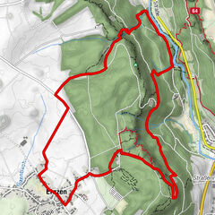
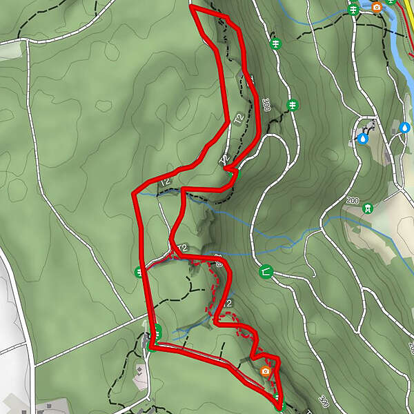
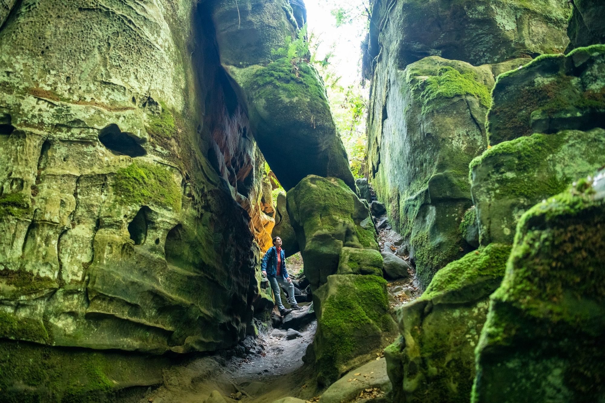
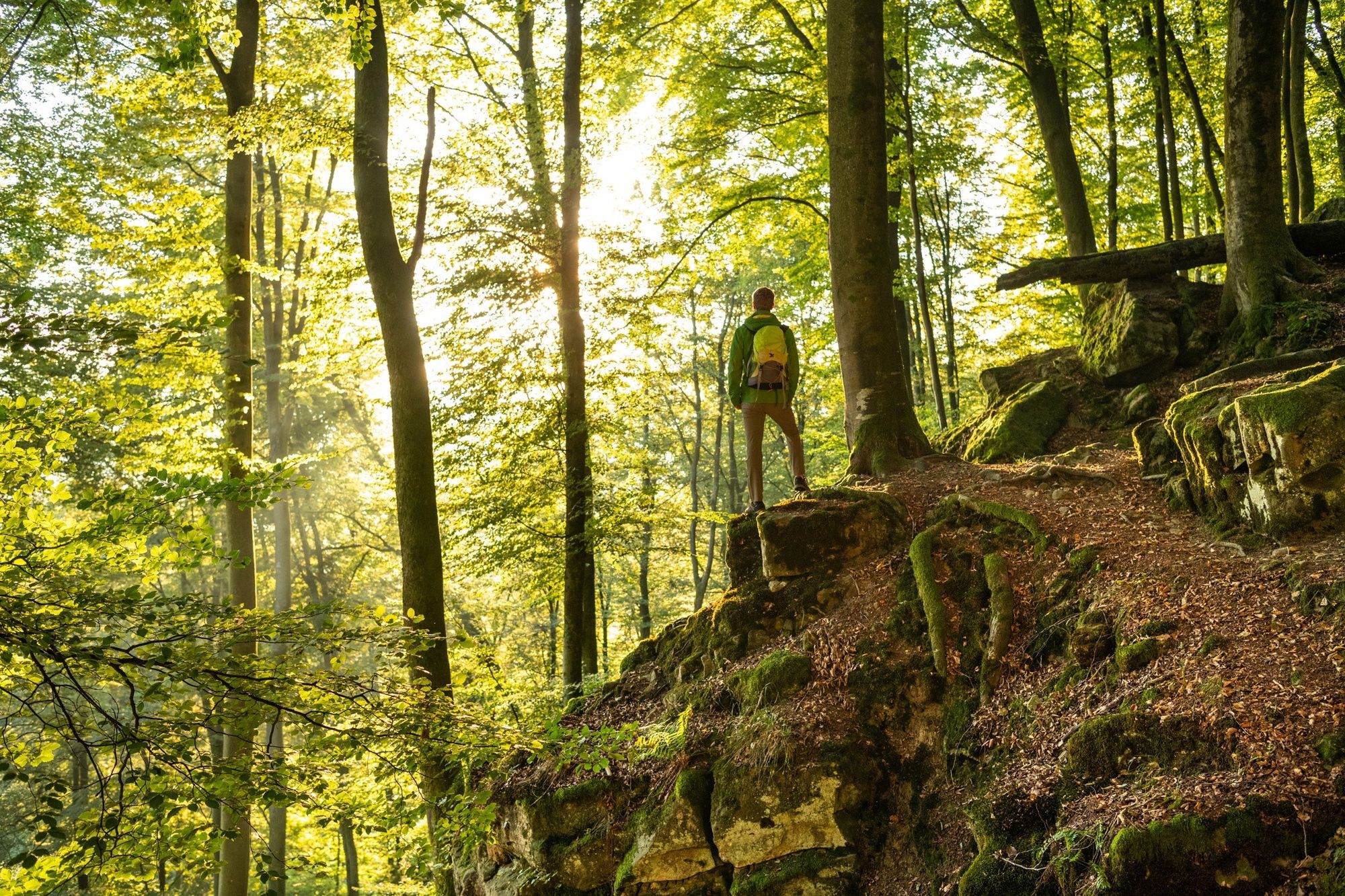
If you want to take a slightly longer, but not too strenuous rocky hike through the Teufelsschlucht (Devil's Gorge) and its surroundings, you should choose the Große Rundweg (Grand Circular Trail). It extends the Kleine Rundweg (Short Circular Trail) by a loop that runs through more fantastic rock formations, including the historic millstone quarries on the eastern edge of the Ferschweiler plateau. The route of just under 4 kilometres takes you up and down narrow paths through the rocks. A hike with a nature experience guarantee. The tour starts and finishes at the Naturparkzentrum Teufelsschlucht.
The highlights:
Teufelsschlucht (Devil's Gorge) Historic millstone quarries - Directions
-
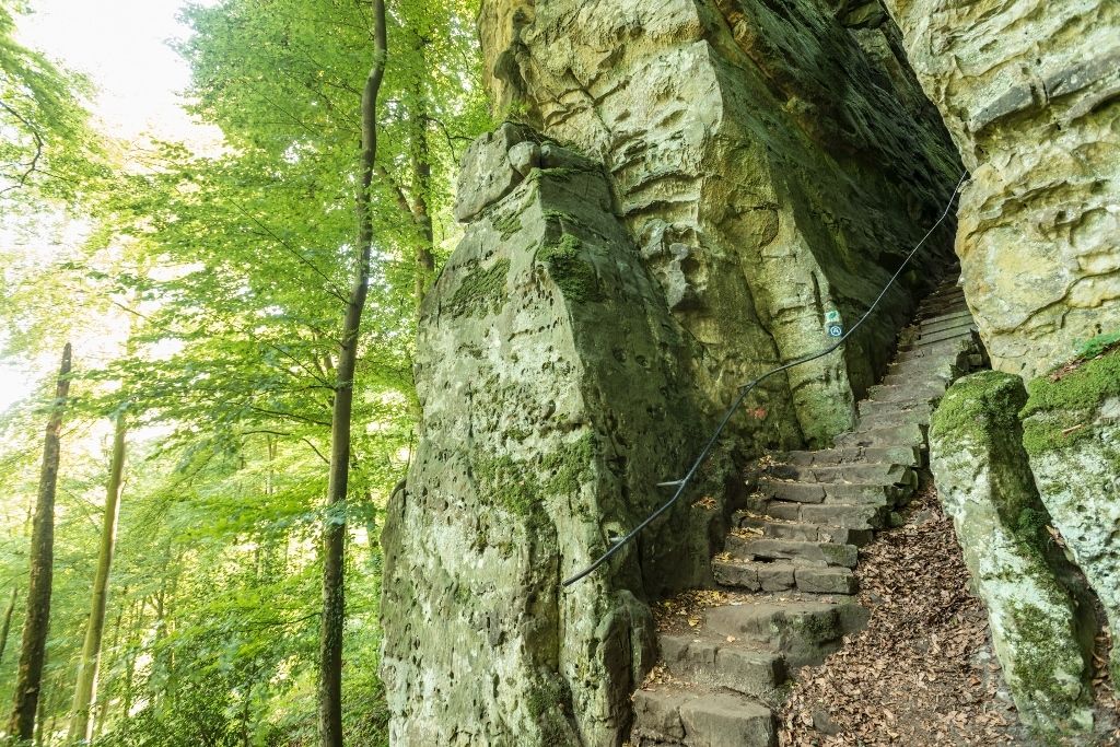
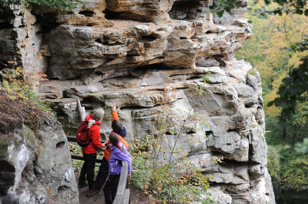
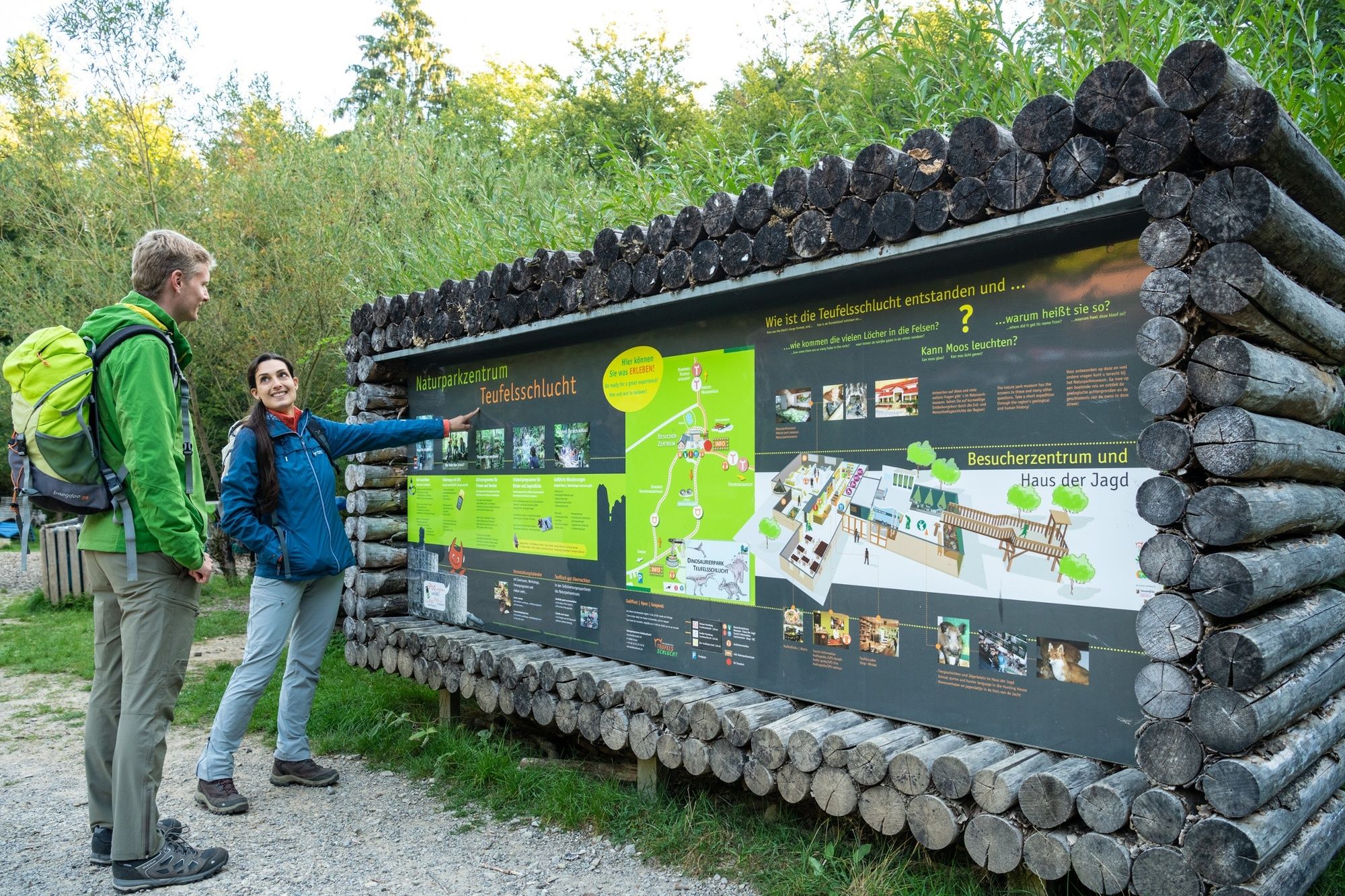
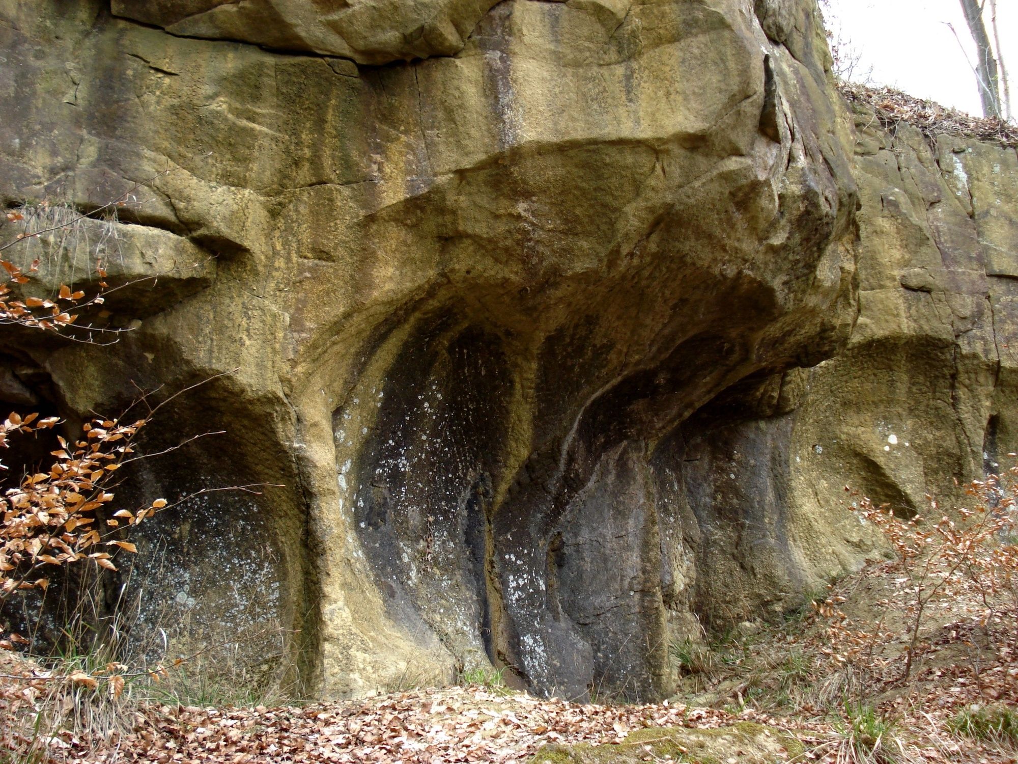
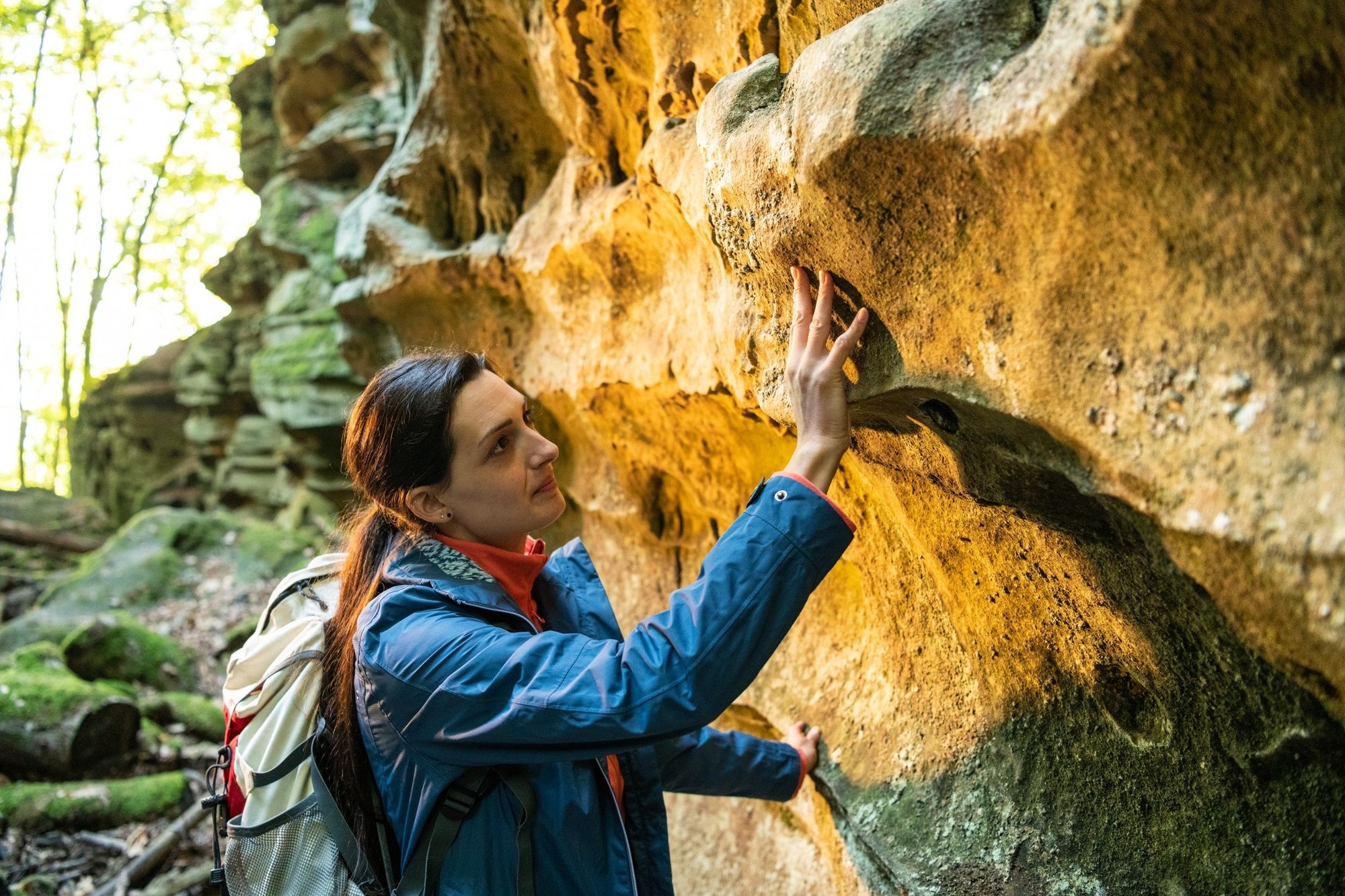
Starting point of the hike is the Naturparkzentrum Teufelsschlucht. Follow the red Devil's T on a white background first down into the Teufelsschlucht (Devil's Gorge) and from there along the rocky edge of the Ferschweiler plateau high above the Prüm valley. The path takes you past bizarre rock formations and offers magnificent views of the neighbouring mountain ranges. Via the so-called "VIA point" (can you find the Latin word VIA carved into the rock?), you reach the historic millstone quarries through a fantastically wild rocky world. Here you can clearly recognise the round caves where millstones were once quarried from the very hard and calcareous sandstone. Shortly after the so-called "Celtic cave", which has nothing to do with the Celts, the trail leads back up to the plateau and along a flat path back to the visitor centre.
- Highest point
- 330 m
- Endpoint
-
Naturparkzentrum Teufelsschlucht - Besucherzentrum, Ferschweilerstr. 50, 54668 Ernzen
- Height profile
-
 © outdooractive.com
 - Equipment
-
Hiking boots and clothing suitable for the weather are recommended, rucksack provisions - at least water - are also advisable.
- Safety instructions
-
The hike is not suitable for pushchairs or people with walking difficulties. It leads along narrow paths and over many steps through the rocky landscape. Experienced children can manage the route well and experience shows that they enjoy the adventurous rocky landscape.
In wet weather and in winter, the rocky paths can be slippery.
- Tips
-
Longer and more strenuous, but definitely worthwhile, is the alternative "Teuflische Acht" between the Teufelsschlucht and Irreler Wasserfälle (rapids).
- Additional information
-
Naturparkzentrum Teufelsschlucht, Ferschweiler Str. 50, 54668 Ernzen
The bistro with outdoor terrace is a great place to stop for a bite to eat.
Tourist Information Bollendorf, Neuerburger Str. 6, 54669 Bollendorf
Centrale phone no. 0049-6525-933930
- Author
-
The tour Großer Rundweg Teufelsschlucht - Naturparkzentrum Teufelsschlucht is used by outdooractive.com provided.


General info
-
Bitburger Land
474