
- Brief description
-
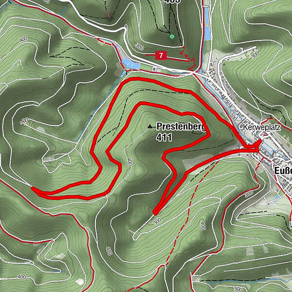
Well-surfaced circular trail around the Prestenberg and below the Sommerfelsen (summer rock)
- Difficulty
-
easy
- Rating
-
- Starting point
-
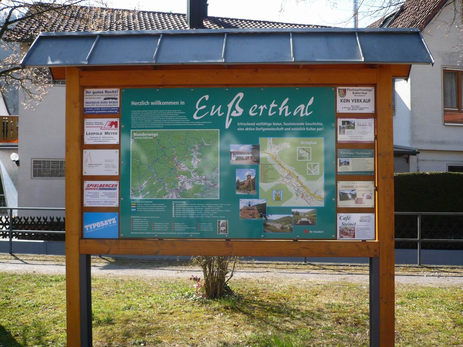
Car park at the village community centre, Hauptstraße 76857 Eußerthal
- Route
-
EußerthalEußerthal7.2 km
- Best season
-
JanFebMarAprMayJunJulAugSepOctNovDec
- Description
-
There is a car park and a bus stop at the starting point of the tour. You can easily take the bus from Albersweiler to Eußerthal (line 521) and then start the tour directly.
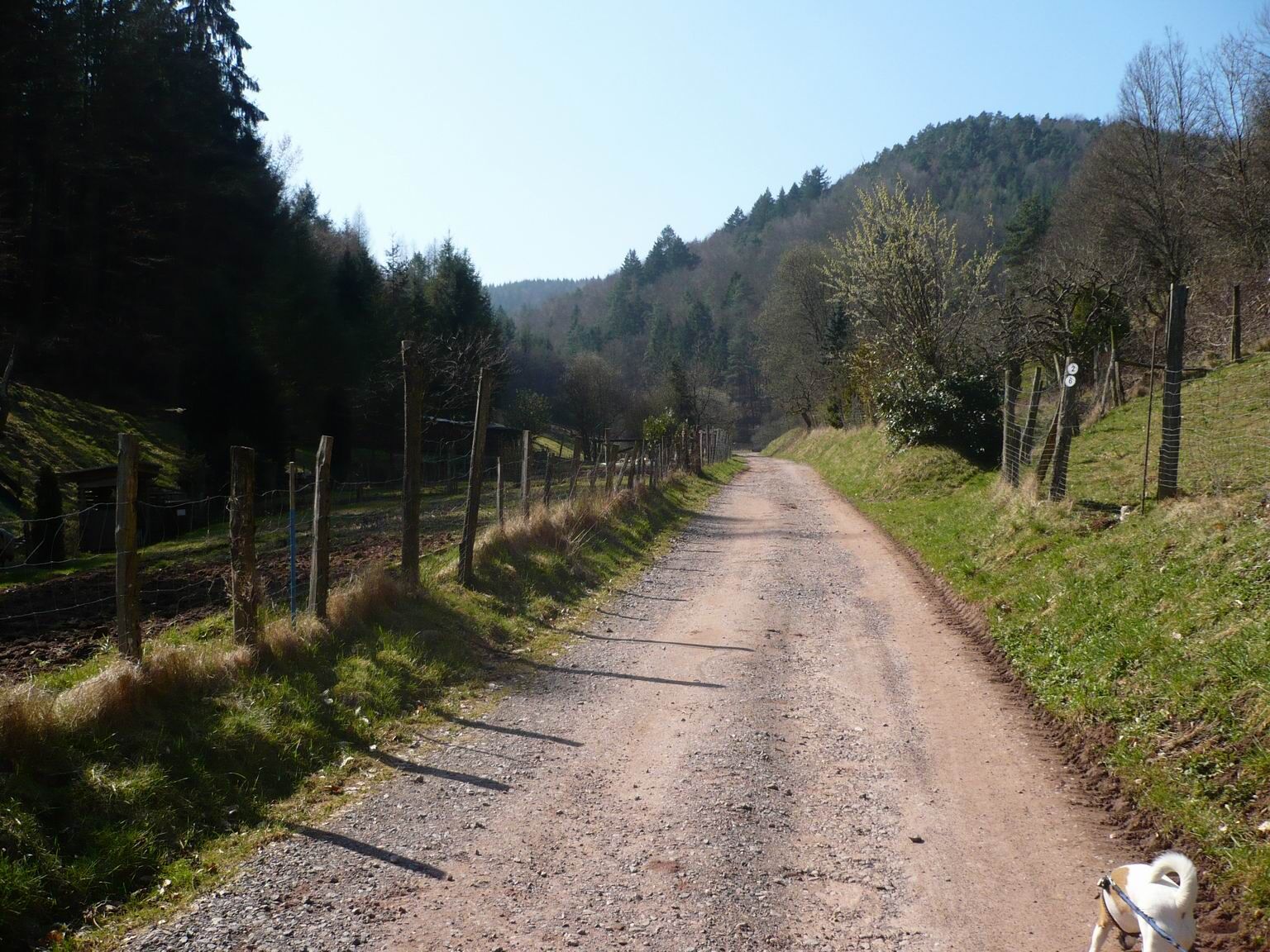
From the car park at the village community centre, turn right into the main road. At the next crossroads, turn right into Breitbachstraße and follow this to the right out of the village. After a few metres, keep left at the next fork in the road. The trail now runs above the Dörrental valley and the sports field until the marker with the number 2 turns left.Now the trail climbs before running parallel to the Prestenberg in a southerly direction. At rescue point 221, the circular trail leads us back towards Prestenberg, passing below Sommerfelsen, and then downhill to the fish ponds. Along the stream, the trail leads back to Eußerthal to our starting point.
UFFBASSE! - Campaign for considerate coexistence in nature
Always behave in a forward-looking, friendly and considerate manner towards everyone you meet along the way. Respect nature, do not destroy plants and always stay on the paths. Try to avoid excessive noise and leave the forest before dusk. Remember to bring a rubbish bag for the road and take rubbish home with you. Please keep your dog on a lead at all times. Other visitors and animals will thank you. For your own safety, observe all road closures, even at weekends. Park only in designated parking areas. Leave space for emergency vehicles and agricultural machinery. Please give priority to agricultural and forestry traffic.www.pfalz.de/uffbasse
- Directions
-
There is a car park and a bus stop at the starting point of the tour. You can easily take the bus from Albersweiler to Eußerthal (line 521) and then start the tour directly.
From the car park, we turn right into the main road. At the following intersection, we turn right into Breitbachstraße. We stay on this road and leave the village. After a few metres at the next fork in the road, we have to keep left. The path now runs above the Dörrental and the sports field until the mark with the number 2 turns left.
Now the path climbs before running parallel to the Prestenberg in a southerly direction. At rescue point 221, the circular trail leads us back towards Prestenberg, passing below the Sommerfelsen, and then downhill to the fish ponds. We walk along the stream back to Eußerthal to our starting point.
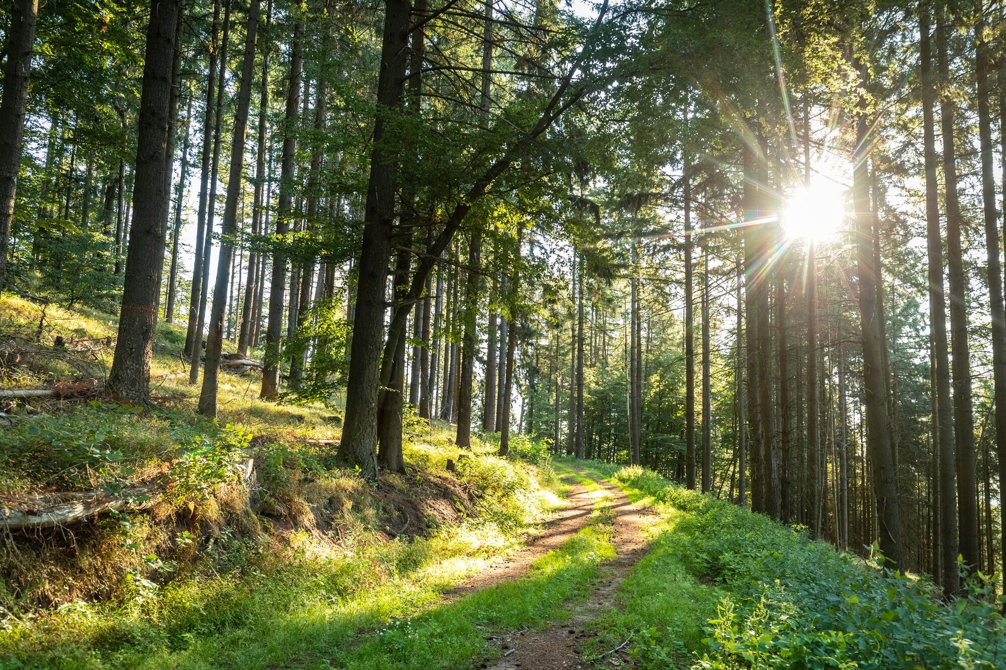
The trail runs mostly on wide forest paths and is therefore generally good to walk on all year round. It offers a beautiful, honest forest experience and does not require any lookout points.
- Highest point
- 388 m
- Endpoint
-
Car park at the village community centre, Hauptstraße 76857 Eußerthal
- Height profile
-
 © outdooractive.com
 - Equipment
-
For our hiking tours we recommend the following equipment as standard:
Sturdy shoes Clothing suitable for the weather Sun and rain protection Sufficient supplies of food and drinks, as there are not always refreshment stops or shops available or open everywhere. Even though the paths are very well marked throughout, it is always advisable to carry a suitable hiking map for safety reasons, so that you can quickly find your way to a safe area in the event of a thunderstorm or emergency, for example. - Safety instructions
-
In general:
Especially in autumn, also be aware that leaves lying on the ground can hide bumps, roots, stones or holes in the path. After thunderstorms or rainstorms, trees can still fall over or branches can fall down afterwards. Especially in adverse weather conditions, muddy and slippery passages can occur on natural paths. Not all rocks or precipices are secured with ropes or railings. Surefootedness is required in places. You have to expect this type of path impairment when you undertake a hike. If you are of the opinion that certain sections of the trail are not passable for you, you should avoid them.
NOTICE:
We endeavour to announce on this platform any closures that occur due to forestry work or hunting parties. Nevertheless, there are situations where hiking trails are closed and we may not have been informed. If you unexpectedly encounter a trail closure or diversion, please follow the instructions for your own safety.
- Tips
-
Rucksack catering is recommended. Refreshment stops in the village.
- Additional information
- Arrival
-
Via the B10 Landau-Pirmasens exit Albersweiler - Ramberg - Eußerthal, then follow the signs to Eußerthal.
- Public transportation
-
Sustainable travel by public transport in Trifelsland.
Take the train on the Queichtal line Landau-Pirmasens to the railway station Albersweiler, then continue with bus line 521 to Eußerhtal. The train runs hourly. Line 521 also runs every hour Mon.-Fri. and every 2 hours Sat.-Sun.
- Parking
-
Car park at the village community centre (Hauptstraße)


-

-
AuthorThe tour Eußerthal Rundweg 2 is used by outdooractive.com provided.


-
Pfalz
1515
-
Trifelsland
1061