
- Brief description
-
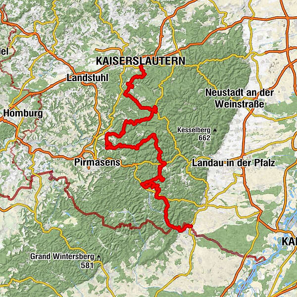
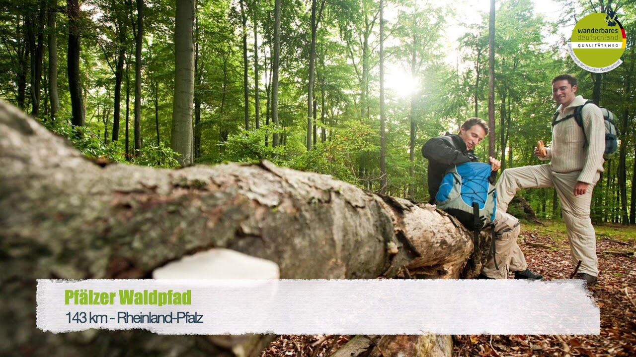
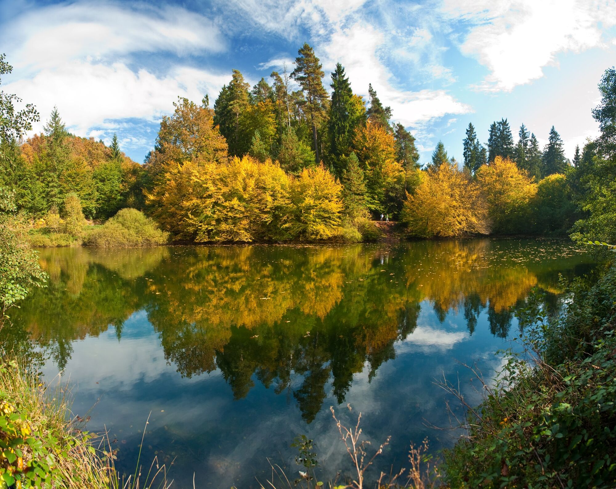
The 140km long Pfälzer Waldpfad trail offers spectacular rocks, deep valleys and above all – forest as far as the eye can see!
- Difficulty
-
medium
- Rating
-
- Starting point
-
Kaiserslautern central station
- Route
-
Kaiserslautern0.3 kmGroßer Humberg (424 m)4.0 kmDreieckstein5.1 kmPfaffenbrunnen6.2 kmUnnerbrünnchen7.5 kmRambachbrunnen9.8 kmAlte Schmelz12.2 kmHungerbrunnen13.6 kmNaturfreundehaus Finsterbrunnertal17.0 kmUnterhammer18.9 kmKlug'sche Mühle20.0 kmWilensteiner Mühle20.1 kmBartelsberg21.3 kmOberhammer21.7 kmGutenbrunnerhof24.4 kmLauberhof24.5 kmMoosalbsprung26.8 kmCafe-Restaurant Nicklis28.3 kmJohanniskreuz28.8 kmSchächerdell30.8 kmMolkenborn36.8 kmKieselweiherbrunnen38.2 kmNaturfreundehaus Lettenkaut Heltersberg43.2 kmGroßer Westrich (441 m)44.3 kmWilhelmsquelle50.3 kmDonsieders56.4 kmMartin-Luther-Kirche56.7 kmAm Hölzernen Kreuz58.4 kmGeißendelle59.0 kmAbbrunnen60.3 kmHilschberghaus62.1 kmRodalben62.2 kmSaufelsen63.3 kmHirschbrunnen65.7 kmCafé & Bistro Birkwieserhof67.6 kmBirkwieserhof67.6 kmalte Pfarrkirche St. Peter72.1 kmMerzalben72.1 kmGräfenstein Hütte PWV Merzalben73.6 kmHolländerklotz84.6 kmWeißenberg (609 m)85.0 kmLuitpoldturm85.2 kmWeißenberg (610 m)85.2 kmLuitpoldstein85.8 kmHermersbergerhof87.0 kmBacköfel94.7 kmBacköfel94.9 kmMittelpferch97.5 kmPaddelweiher-Hütte98.2 kmQueichquelle100.3 kmWanderheim Dicke Eiche101.3 kmBlick ins Queichtal102.2 kmWinterkirchel102.9 kmGrünbrunnen-Wiesen104.6 kmHöbelwiesen105.0 kmSchwalbenhalde106.1 kmLachberg (322 m)107.6 kmLachberg (321 m)107.7 kmVogelsberg (296 m)108.9 kmProtestantische Pfarrkirche Dahn110.1 kmDahn110.4 kmKapelle St. Michael111.2 kmJägerhof113.7 kmErfweiler113.9 kmAlsenbornwiesen114.1 kmKahlenberg116.6 kmRauhberg117.7 kmErfweiler Sattelfelsen117.8 kmBärenbrunnermühle119.8 kmHexenplätzel121.0 kmBusenberg121.9 kmDrachenfels (368 m)123.6 kmDrachenfelshütte123.8 kmSt. Gertraud125.9 kmErlenbach bei Dahn126.9 kmHedwigsbrunnen131.6 kmSankt Germanshof137.1 kmCarrefour de Langenberg (227 m)139.5 kmBannholz (250 m)140.8 kmProtestantische Kirchengemeinde143.6 kmSchweigen-Rechtenbach144.0 km
- Best season
-
JanFebMarAprMayJunJulAugSepOctNovDec
- Description
-
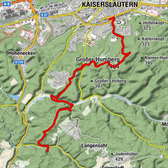
Stage 1: Kaiserslautern to Finsterbrunnertal
From Kaiserslautern, the first stage of the Pfälzer Waldpfad trail brings us on a route about 16km long through pretty forests to the Humberg Tower, with its great views, and on into the Moosalbe Valley, where we reach our destination of the ‘Naturfreundehaus Finsterbrunnertal’ guest house and campsite.
Stage 2: Finsterbrunnertal to Johanniskreuz
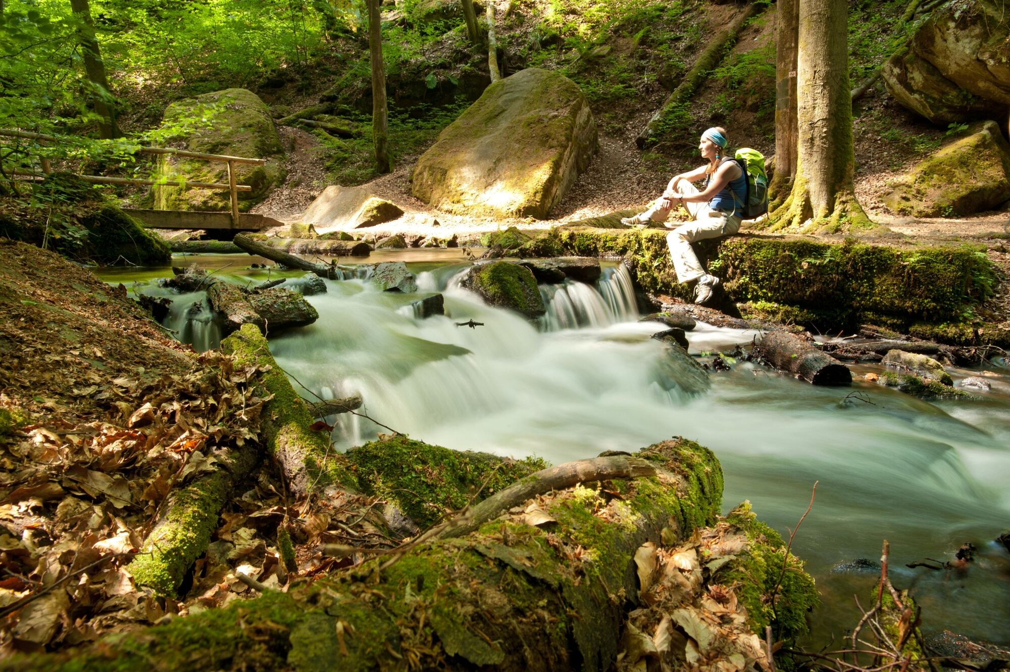
At only 12km, the second stage is the shortest part of the Pfälzer Waldpfad trail. It brings us along the Moosalbe River through the Karlstal ravine and 470m up to the hamlet of Johanniskreuz.
Stage 3: Johanniskreuz to Heltersberg
The third stage of the Pfälzer Waldpfad trail takes us from Johanniskreuz to Heltersberg, through thick forest and river valleys with idyllic little lakes.
Stage 4: Heltersberg to Rodalben
The fourth stage of the trail leads us past the imposing Seelen rocks to the remains of a Roman castle named ‘Heidelsburg’, before bringing us to the place of pilgrimage at Maria Rosenberg and finally to the end point at Rodalben.
Stage 5: Rodalben to Merzalben
The fifth stage of the Pfälzer Waldpfad trail leads us from the Hilschberghaus rest stop past Rodalben and the Birkwieserhof farm for 10km before arriving at the end of the stage in Merzalben.
Stage 6: Merzalben to Hauenstein
The 23km long sixth stage of the trail is not only the longest section of the route, it also boasts the highest point of the trail with the 607m high Weißenberg and the breath-taking views from the top to reward you for your exertions.
Stage 7: Hauenstein to Dahn
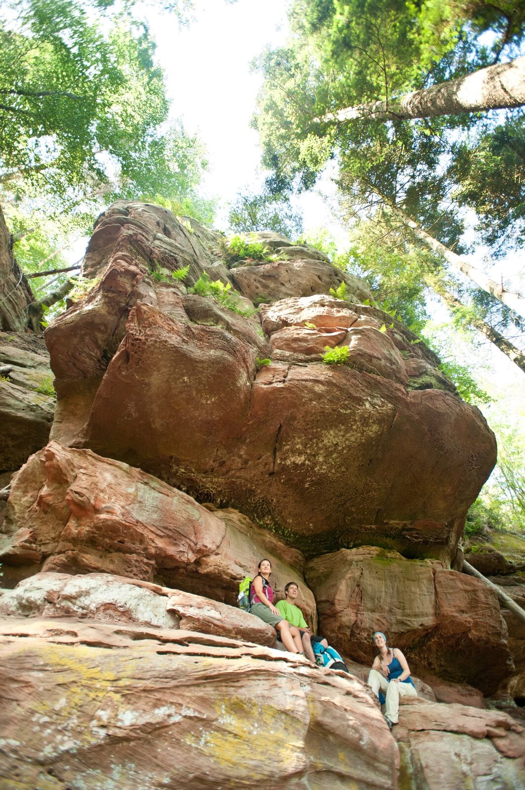
The seventh stage of the trail brings us from the town of Hauenstein, famous for its shoe industry, to Dahn, the 'capital' of the Dahner Felsenland, known for its red sandstone rock formations. Just before the end of the route, we find the Jungfernsprung, one of the most famous rocks in the Palatinate.
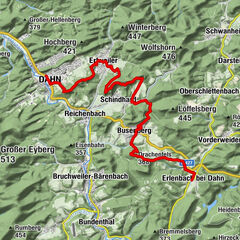
Stage 8: Dahn to Erlenbach
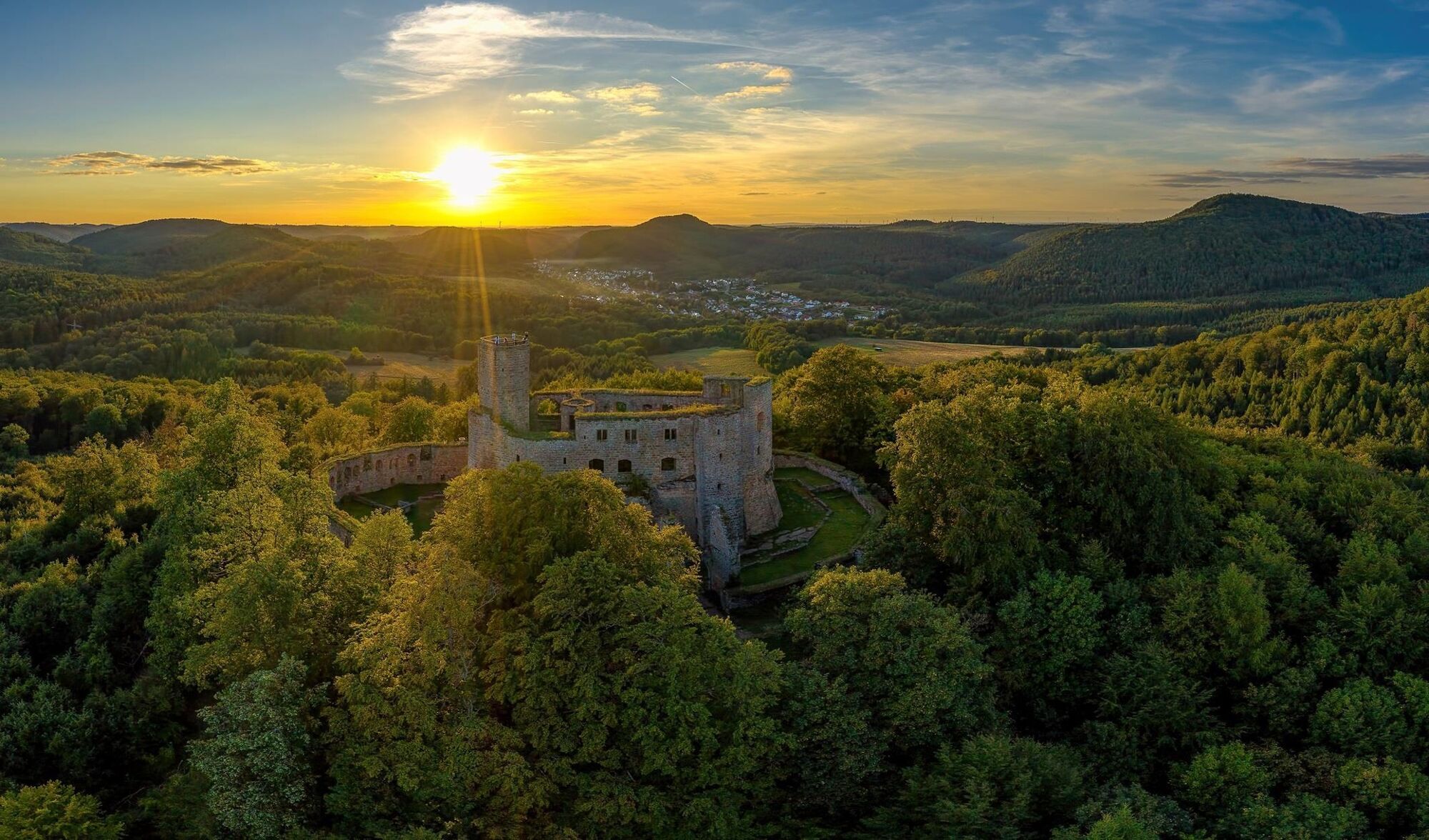
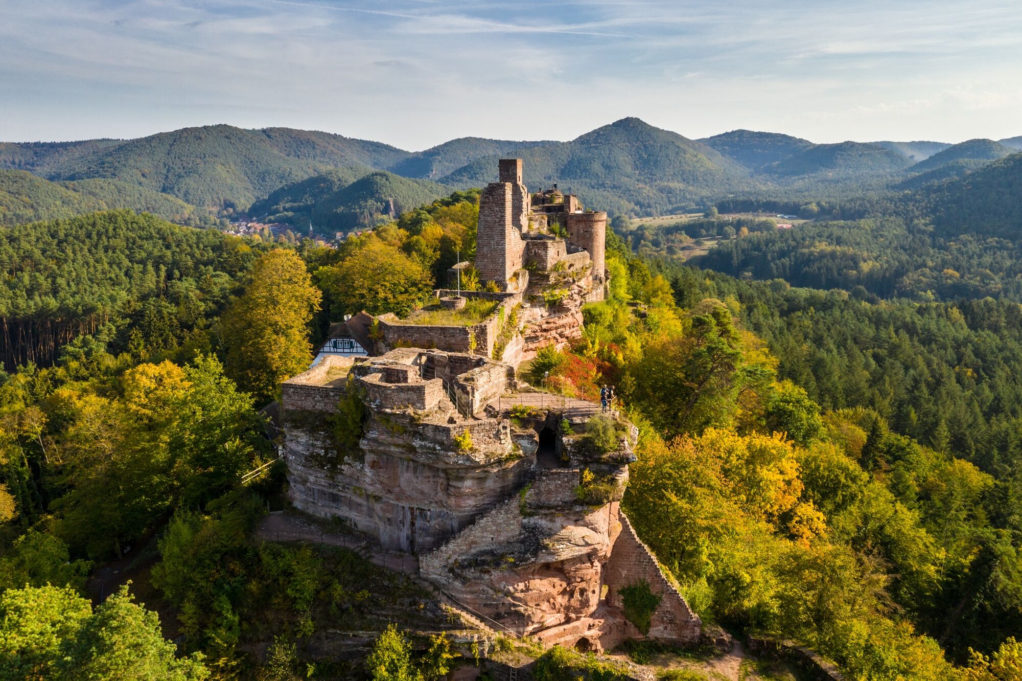
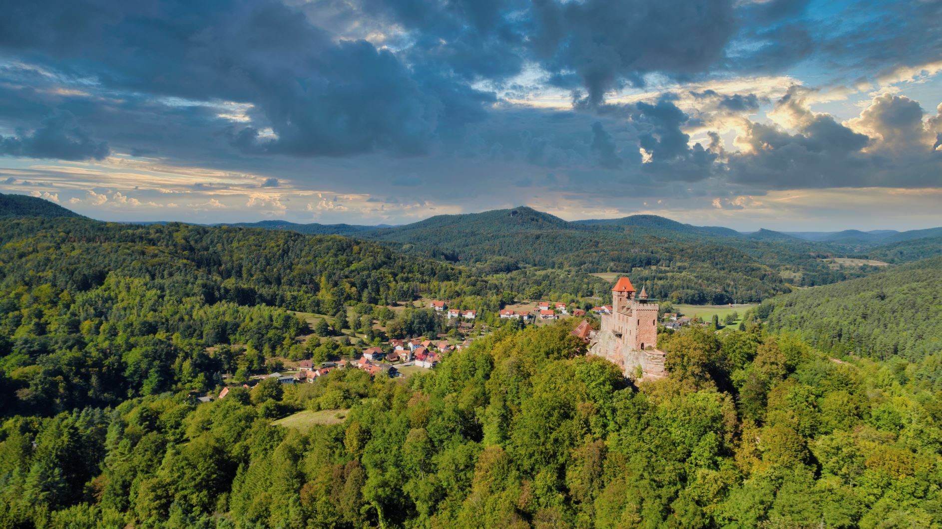
On the eighth stage of the trail from Dahn to Erlenbach we pass some impressive rock formations and the ruined castles of Altdahn, Grafendahn, Tanstein and Drachenfels perching dramatically on the red sandstone massif.
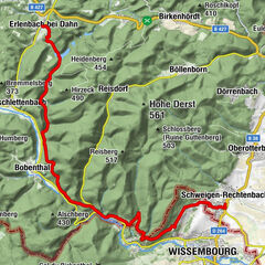
Stage 9: Erlenbach to Schweigen-Rechtenbach
From Erlenbach, the last stage of the trail brings us past the impressive Berwartstein Castle to Schweigen, the most southerly town on the German Wine Route. We walk through Alsace (France) for a few kilometres and have a great view from the Rhine plain to the Black Forest.UFFBASSE! - Campaign for being considerate of others in nature
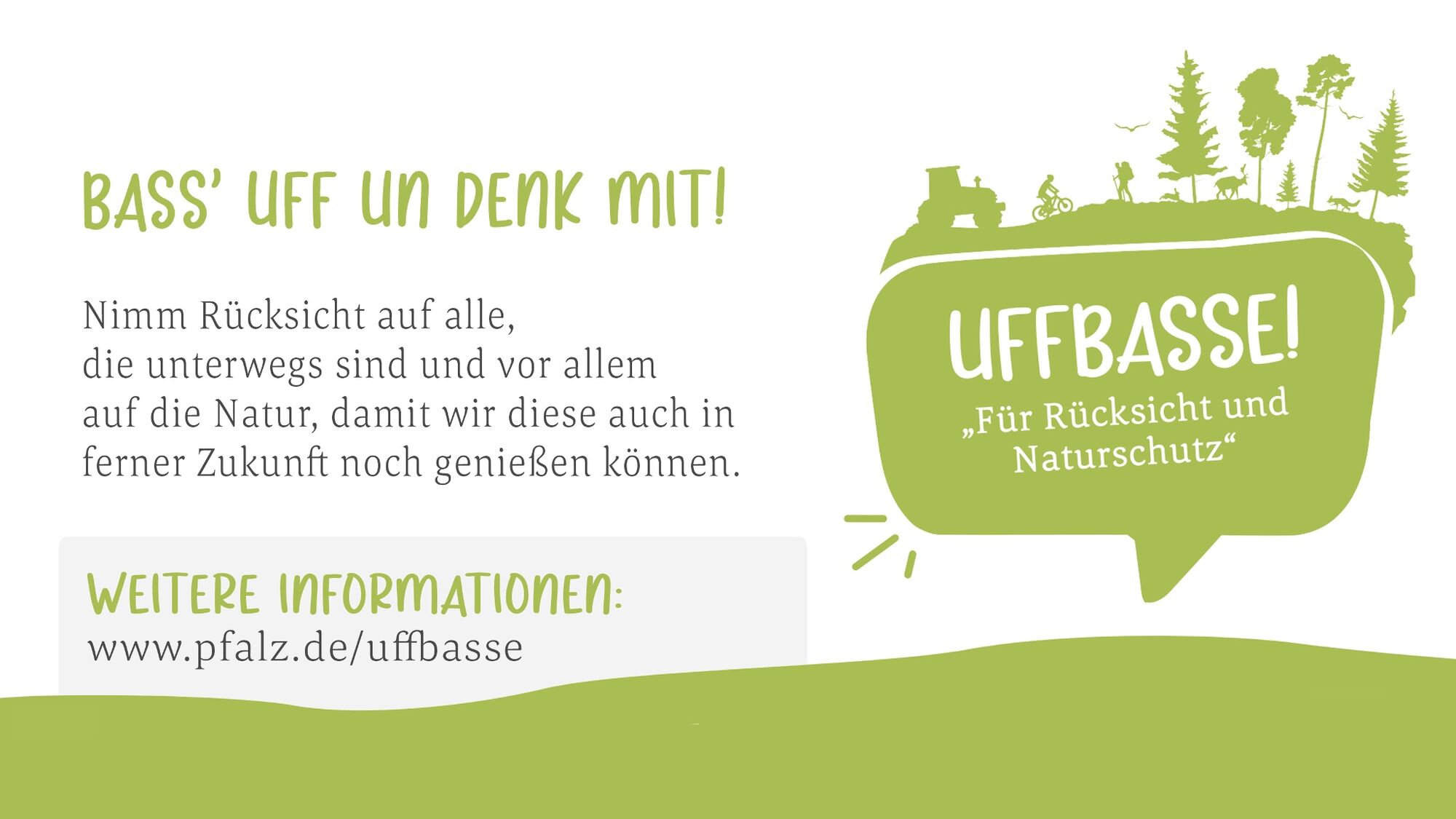
Always act in a proactive, friendly and considerate way towards everyone you encounter along the way. Respect nature, do not destroy plants and always stay on the paths. Try to avoid excessive noise and leave the forest before dusk. Remember to take a rubbish bag with you when you go out and take your rubbish back home. Please keep your dog on a leash at all times. Other visitors and animals thank you. For your own safety, observe all road closures, including at weekends. Park only in designated parking areas. Leave space for emergency vehicles and agricultural machinery. Please give priority to agricultural and forestry traffic. - Directions
-
Stage 1: Kaiserslautern to Finsterbrunnertal
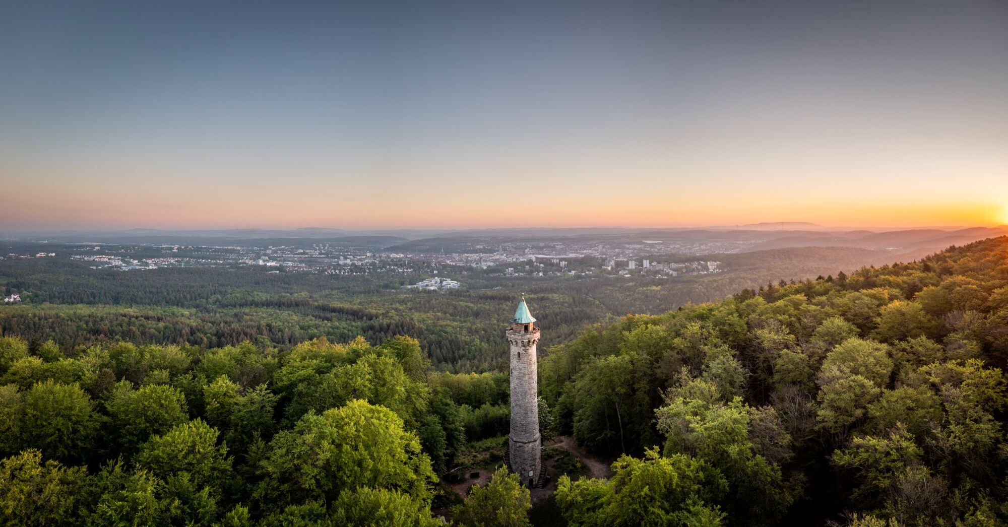
The first stage of the Pfälzer Waldpfad trail begins at Kaiserslautern central train station and it's not far from here to the southern outskirts of the city. We hike from here through thick forest uphill to the Humberg Tower. The tower is almost 36m high and was built in 1900. It offers a fantastic view of the northern Palatine Forest, the city of Kaiserslautern with the impressive Fritz-Walter stadium and the Donnersberg, the highest mountain in the Palatinate. The trail continues through the forest to 'Rote Hohl', with an old crossroads at the top of the pass between Kaiserslautern and the Aschbach Valley. After reaching the outskirts of Dansenberg, we descend into the Aschbach Valley and pass the Jagdhausweiher lake. The route leads us past the Alte Schmelz riding centre and guest house to the Blaukopf plateau and finally down into the Moosalbe Valley. The end point of this stage, the ‘Naturfreundehaus Finsterbrunnertal’ guest house lies at the entrance to a small side valley.
Stage 2: Finsterbrunnertal to Johanniskreuz
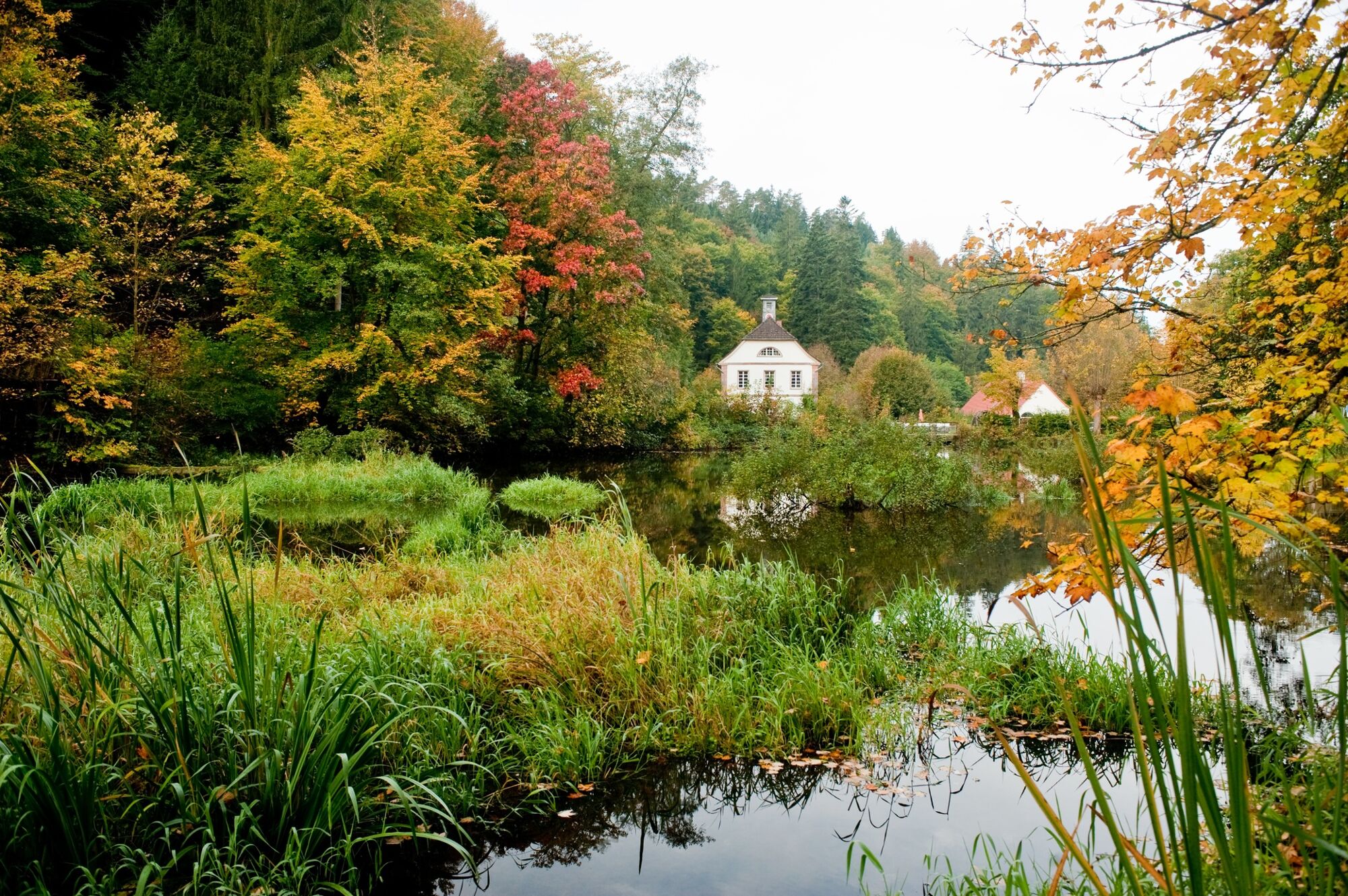
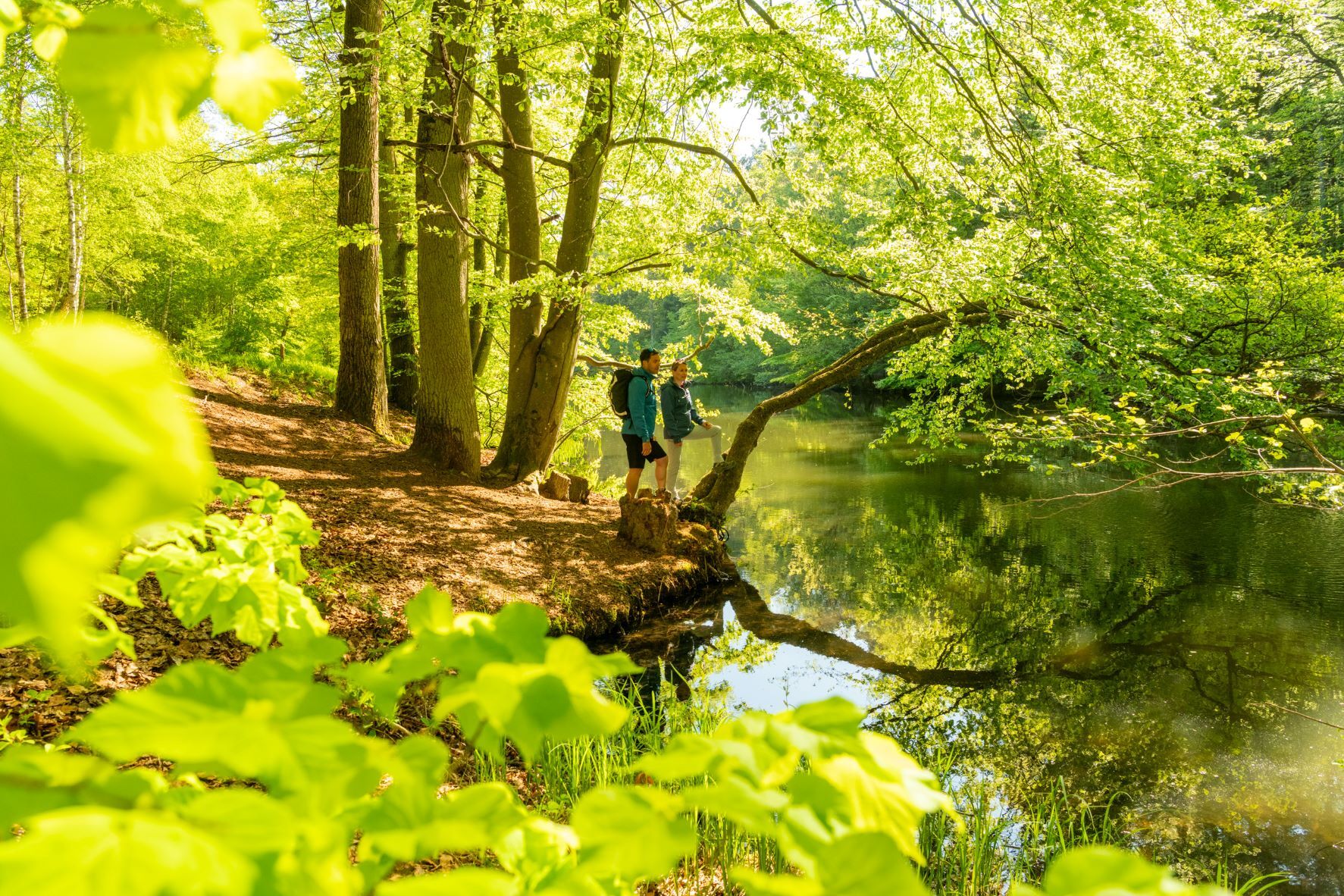
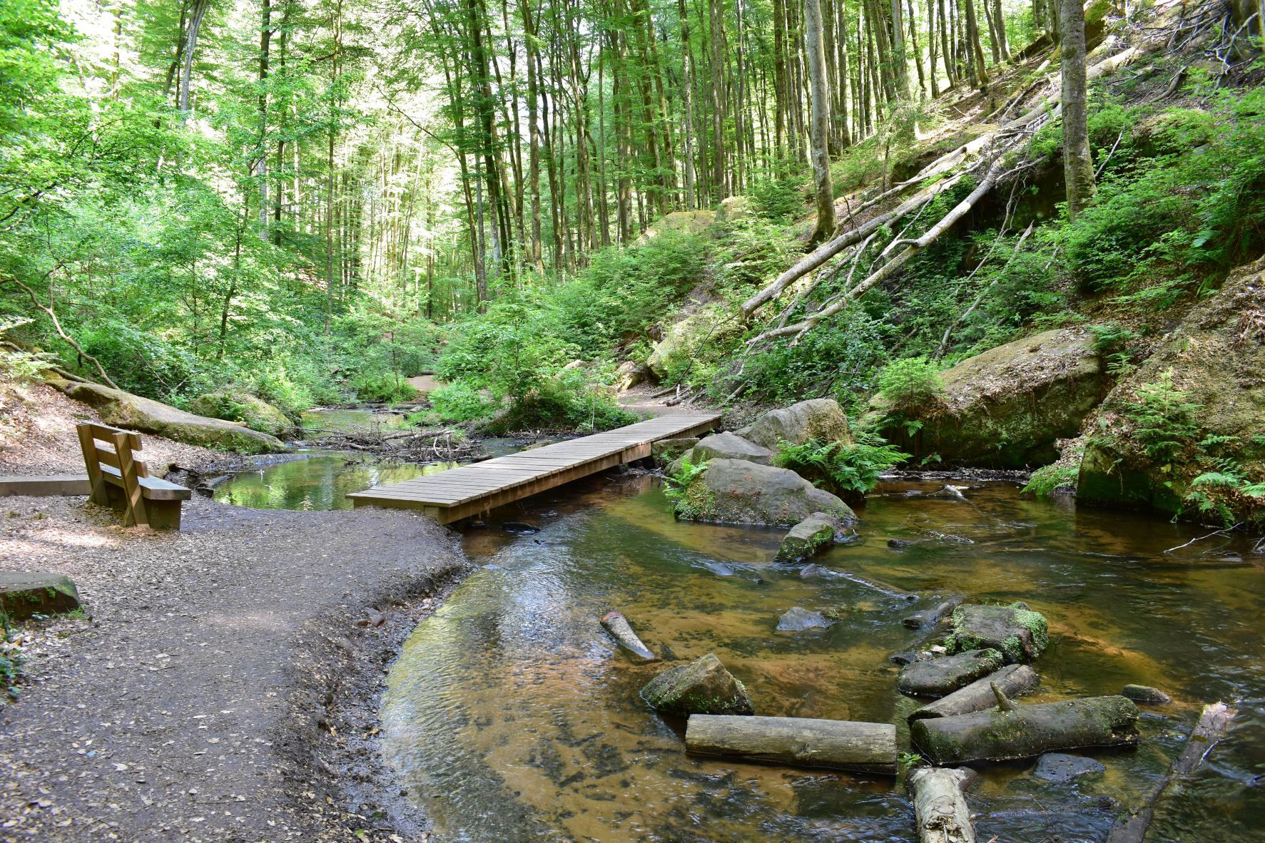
From the Naturfreundehaus Finsterbrunnertal we follow the Moosalbe upstream, passing various monuments of the former ironwork industry in the Palatinate, including the three former production facilities at Oberhammer, Mittelhammer and Unterhammer. Today there is a café at Unterhammer, in whose idyllic surroundings we can pause for a moment. You can also stop at the Klug’sche Mühle Restaurant/Café, which we pass shortly after leaving Unterhammer. At Mittelhammer we follow the Moosalbe into the imposing Karlstal ravine where a small river, with rapids and waterfalls, flows past huge rocks and steep red sandstone cliffs. At the top of the ravine is Oberhammer and we walk on through the now wider and more gentle valley. We take a small forest path to reach the 'Moosalbsprung' springs, where we can stop for a moment to enjoy the water. At the end of the valley we climb the forest paths to Johanniskreuz, where our hike ends at the Haus der Nachhaltigkeit – Centre for Sustainable Living. You can also stay overnight in Johanniskreuz and enjoy the local cuisine.
Stage 3: Johanniskreuz to Heltersberg
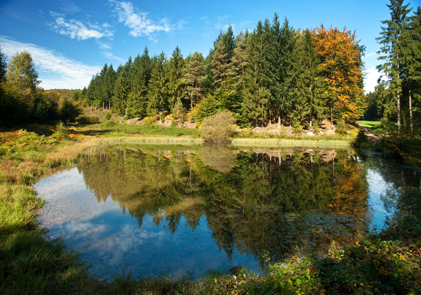
The Pfälzer Waldpfad trail leads us back into the forest from the large car park of the Centre for Sustainable Living, past the 'Hindenburgkiefer' natural monument. We hike down to the Schwarzbach Valley and take the easy paths to the Burgalbweiher pond. The trail then follows the right side of the valley, over the Schwarzbach River. We climb over a hill to reach the catchment area of the Hahnenseybach River, and, rather than descending, we follow the slope to the Molkenbrunnen springs. It's worth resting here for a moment before continuing on past mossy green rocks to the Kieselweiher lake. After another ascent, we follow a service road over the hill, before crossing the Hundsbächel Valley and making the final ascent to Heltersberg. The Heltersberg Naturfreundehaus guest house, restaurant and visitor centre at the edge of the forest offers a chance to have something to eat and to rest. From here, the end point of this stage of the trail, the bus stop in Heltersberg town centre, is only a few hundred metres away.
Stage 4: Heltersberg to Rodalben
The fourth stage of our hike takes us out of Heltersberg and across the fields past Weststrichhof into the forest. From there, we have a fairly long hike over the hill before reaching the impressive Seelen rocks high over the Schwarzbach Valley. We follow the trail past these rocks into a small side valley and then up to the remains of a Roman castle named ‘Heidelsburg’, which once served as a defence against Germanic invasions. The trail then leads us through the Schwarzbach Valley to a former smithy. We leave the valley here and hike over the hill through meadows and fields to the place of pilgrimage at Maria Rosenberg, with its pilgrim church and Virgin Mary grotto. A short ascent from here brings us to Donsieders. Leaving the church of this small hamlet behind us, we follow the Höhgasse out of the hamlet and continue uphill to the Orleberg plateau. Here you can admire an imposing red sandstone monolith, surrounded by fields and accompanied by a plaque with a poem about the legend of Donsieders. The trail continues through the forest past some distinctive rock features to the outskirts of Rodalben, where we arrive at the Hilschberghaus rest stop. This hut, managed by the PWV (Pfälzerwaldverein – local association), is open from 12pm Monday - Saturday and from 10am on Sundays and holidays.
Stage 5: Rodalben to Merzalben
Stealing a final view of Rodalben from the terrace of the Hilschberghaus (PWV, opening hours: Mon-Sat from 12pm/Sundays and holidays from 10.00am), we then continue on curving paths on the slopes above the town, until the descent into the Rodalbe Valley. We reach the farmstead of the old Birkwieserhof farm by following the river through a small side valley. The last section of this stage brings us along more curving forest paths to Merzalben. We pass the church, which stands on the left of the main road, and arrive at our final destination at the Zimmerbergstraße junction.
Stage 6: Merzalben to Hauenstein
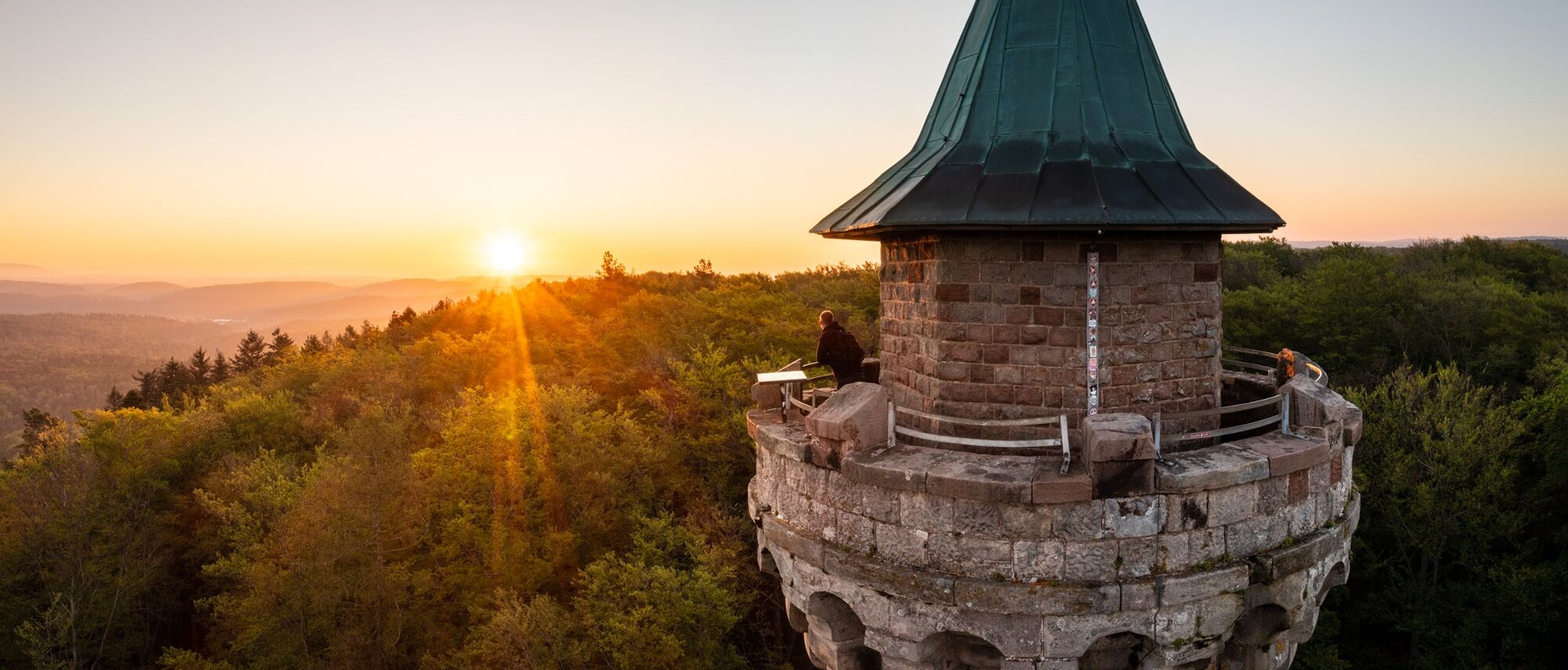
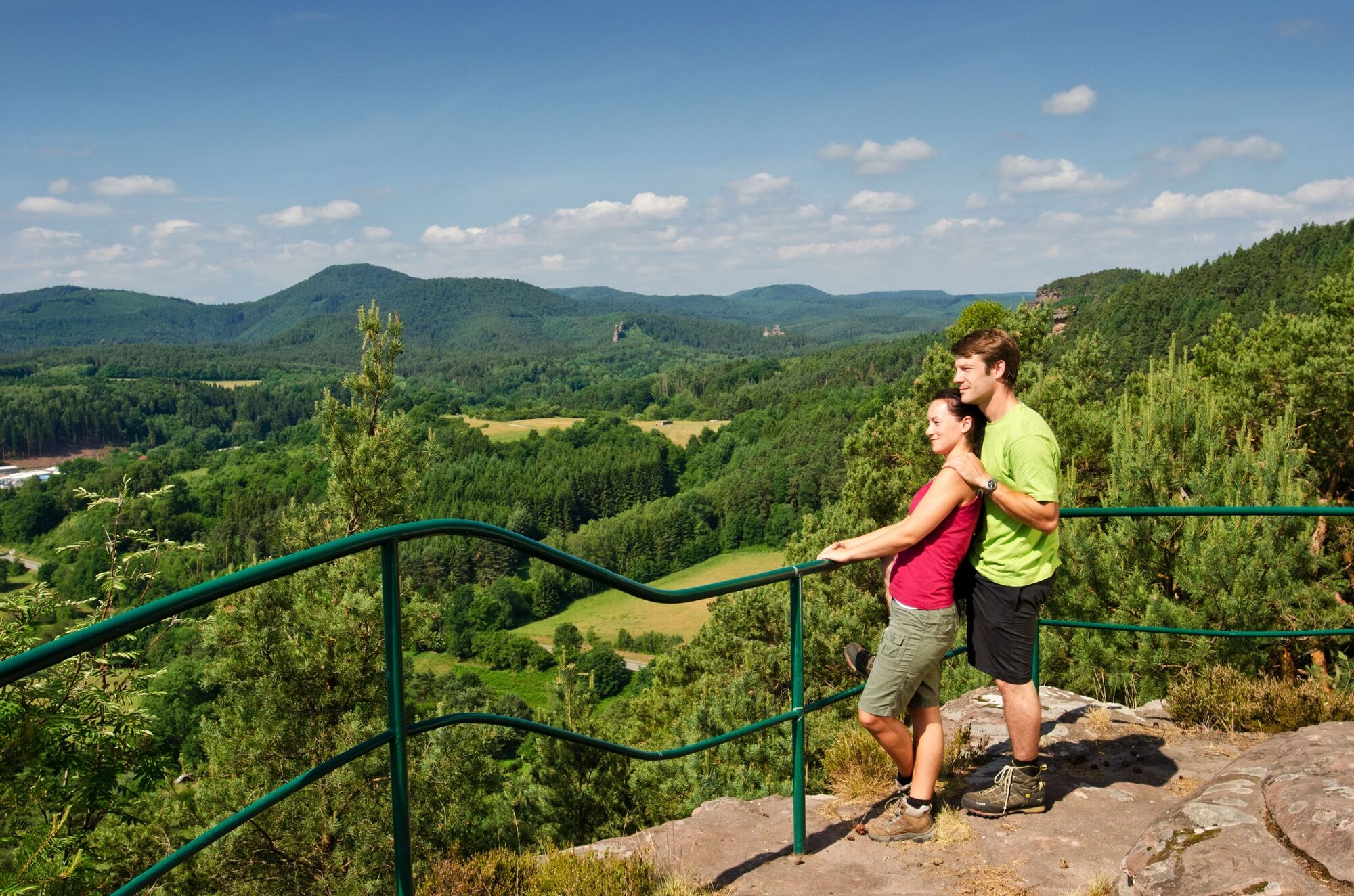
The so-called 'King's stage' of the Pfälzer Waldpfad trail begins in the centre of Merzalben, on the corner of the Hauptstraße/Zimmerbergstraße streets. It then leads us into the forest and after a short ascent to the ruins of Gräfenstein Castle, which dates from the era of the Swabian dynasty in the Middle Ages. Equipped with the torches we have brought with us, we can explore the castle's seven-cornered keep and enjoy the view over Merzalben and, in the distance, the rolling green hills of the Palatinate Forest. We leave the castle and return to the car park, where we can begin our ascent to Winschertkopf. This mighty red sandstone rock stands on a hill and towers high over the Merzalbe Valley. After enjoying the magnificent views once again, we continue through the forest on gently undulating paths and gradually ascend to the top of the Weißenberg. At 607m above sea level, this is the highest point on the Pfälzer Waldpfad trail. We can enjoy another magnificent view from the Luitpold Tower, this time of the largest continuously forested area in Germany. We then descend to the hamlet of Hermersbergerhof and from there past the ruins of Falkenburg castle and into the Queich Valley. We can make a quick detour to visit Wilgartswiesen, with its twin-towered sandstone church, before reaching our final destination of Hauenstein.
Stage 7: Hauenstein to Dahn
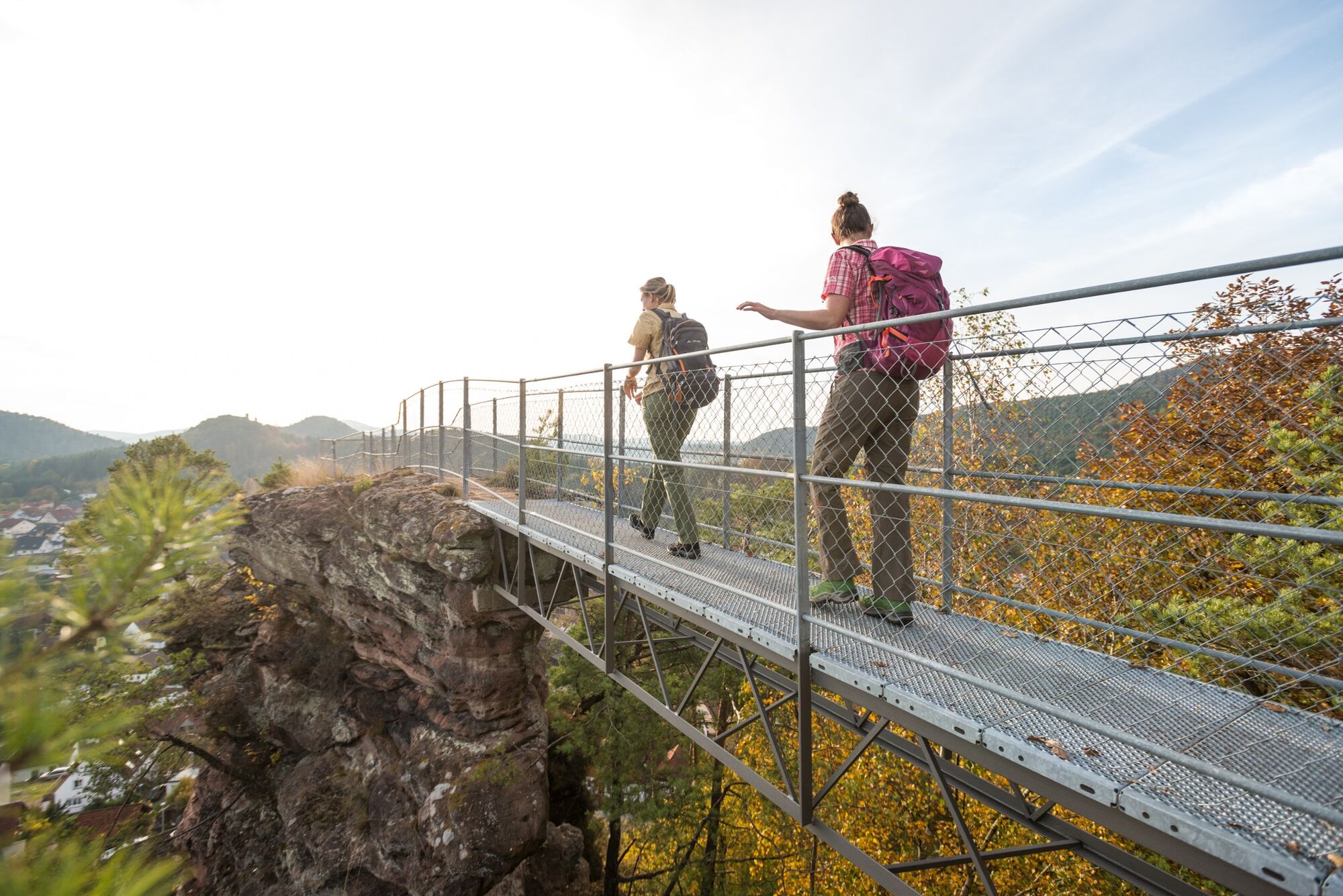
At the start of the stage we hike past some rocks to the Felsentor, the northernmost entrance to Hauenstein, where the road (Bahnhofstraße) runs through two steeply rising rock walls. The trail then brings us along the slopes above Hauenstein to Paddelweiher lake, and then follows the Queich upstream to its source. We can refresh our tired feet with a quick walk through the newly-added wading pool or sit down on the conveniently placed benches nearby. The next ascent should be a bit easier after this refreshing rest stop. At the end of the ascent we are rewarded with the Dicke Eiche (PWV) rest stop and restaurant (opening hours: weekends and holidays 9am - 6pm, from May - October also on Wednesdays 10am - 6pm, closed 25.12, 26.12 and 01.01). Enjoy some typical Palatine cuisine accompanied by a glass of wine or a beer straight from the tap. Duly refreshed and ready to go again, we pass the namesake of the Dicke Eiche – a large oak tree which was vandalised many years ago and now stands as a stump on the edge of the clearing where it once stood in all its glory. Our next stop is the Winterkirchel – a little chapel in the forest. The trail brings us down the valley to the outskirts of Erfweiler and then along the slopes of the Wölmersberg mountain to the outskirts of Dahn. We then tackle the considerable ascent up to the Lachberg. Following the rock ridge, we eventually reach the Jungfernsprung, a high rocky outcrop which is a landmark of the nearby town of Dahn. From here we descend to Dahn town centre, where the seventh stage comes to an end.
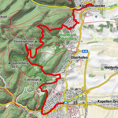
Stage 8: Dahn to Erlenbach
From Dahn we follow the Pfälzer Waldpfad trail to the Ehren cemetery, with its St Michael Chapel and its picturesque location directly underneath the rock massif of the Hochstein mountain. The trail then leads us through the woods over the hill to the castles of Altdahn, Grafendahn and Tanstein. The ruins of these three castles are perched high above Dahn on a red sandstone rocky crag. We then descend to Erfweiler, walking through the village and through the woods to the viewing point on the opposite slope of the Kahlenberg mountain, on the edges of a pine forest flooded with light. After passing another viewing point on the summit of the Kahlenberg, the trail brings us down to the outskirts of Schindhard and further through the woods to Busenberg. From there we can walk to the ruins of Drachenfels Castle, which stands, like the castles at Dahn, on a massive red sandstone rock. Not far from the ruins is the Drachenfels Hut (run by PWV, a local association) where we can enjoy something to eat before our last descent, which brings us to Erlenbach. The Drachenfels Hut is open all year round (except for Christmas and New Year), Wednesdays from 11am, Saturdays from 12pm and Sundays and holidays from 9am.
Stage 9: Erlenbach to Schweigen-Rechtenbach
The final stage of the Pfälzer Waldpfad trail brings us from Erlenbach to Berwartstein Castle, the only castle of the Wasgau area still inhabited today. Next we pass the Seehof-Weiher, great for swimming during hot weather, and follow the Portzbach downstream to just before it flows into the Wieslauter. The trail now leads us through the forest on curving paths on the slopes north of the Wieslauter to the St Germanshof inn, which lies directly on the German-French border. A little later we reach French territory. Shortly after reaching the edge of the forest, there is an amazing view to our right of the North Alsace town of Wissembourg. In clear conditions, this view can extend as far as the Hornisgrinde mountain in the Black Forest. We hike through the vineyards and back into German territory over an actual green border (an international border in the countryside) and down the slope to Schweigen, at the foot of the hills. Here we reach the German Wine Gate which marks both the end of the German Wine Route and our hike. A walk around the historical old town of Wissembourg is highly recommended. And of course you shouldn't miss the opportunity to finish your trip with a visit to a winemaker. If you still haven't had enough of hiking, the wine tasting session can serve as a prelude to the Pfälzer Weinsteig trail. - Highest point
- 597 m
- Endpoint
-
Deutsches Weintor Schweigen-Rechtenbach
- Height profile
-
 © outdooractive.com
 - Equipment
-
We recommend the following equipment as standard for our hiking tours: Sturdy shoes Clothing suitable for the weather Sun and rain protection Sufficient quantity of food and drink, as refreshment stops or shopping facilities are not always available or open. Although the paths are very well marked throughout, for safety reasons it is always advisable to carry a suitable hiking map so that you can quickly find your way to a safe area in the event of a thunderstorm or emergency.
- Safety instructions
-
Hiking on nature trails and paths - Particularly in the fall, you should also be aware that leaves lying on the ground can hide uneven surfaces, roots, stones or holes in the path. After thunderstorms or rainstorms, trees can still fall over or branches can fall down. Especially in adverse weather conditions, muddy and slippery passages can occur on near-natural paths. Not all rocks or precipices are secured with ropes or handrails. Surefootedness is required in places. You must be prepared for this type of path impairment if you go on a hike. If you are of the opinion that certain sections of the trail are not suitable for you, you should avoid them. Despite the "impassable" markings on the premium hiking trails, we recommend that you always have a corresponding hiking map with you for safety reasons, so that you can quickly find a safe area in the event of a thunderstorm or an emergency, for example. Trail closures and detour must be observed at all times.
Dangerous situations - If an emergency situation arises, help is needed quickly. And even if cell phones can send GPS signals, the classic rescue points are often the fastest. These are located in places that are easily accessible for rescue vehicles. Remember the points with the green signs and a white cross. Return there in an emergency and quote the number on the sign when you make an emergency call. This way, the emergency services will know where to find you.
- Tips
-
The Palatinate is one of the three most beautiful hiking regions in the German-speaking world: that is the opinion of the readers of the specialist magazine trekking. All regions (almost 70) that were presented in the magazine in 2020 were up for election in the so-called trekking Award 2021, including the Palatinate. 6500 readers voted and voted the Palatinate into third place in the category "The most beautiful hiking regions in Germany/Austria/Switzerland". This put the Palatinate ahead of well-known competitors such as the Berchtesgaden Alps (4th place) and Tannheimer Tal (5th place).
- Directions
-
A63 or A6 to Mainz-Kaiserslautern junction or Kaiserslautern-West exit
- Public transportation
-
Train to Kaiserslautern (ICE stop).
Other stations along the route: Schopp (access route), Waldfischbach-Burgalben (access route), Pirmasens (access route), Rodalben (access route), Münchweiler an der Rodalb (access route), Hauenstein (access route), Dahn, Wissembourg (access route)
Timetable information: via the DB travel information service
- Parking
-
At Kaiserslautern central station


-

-
AuthorThe tour Pfälzer Waldpfad Complete Trail is used by outdooractive.com provided.


General info
-
Pfalz
1512
-
Pfälzerwald
1046