

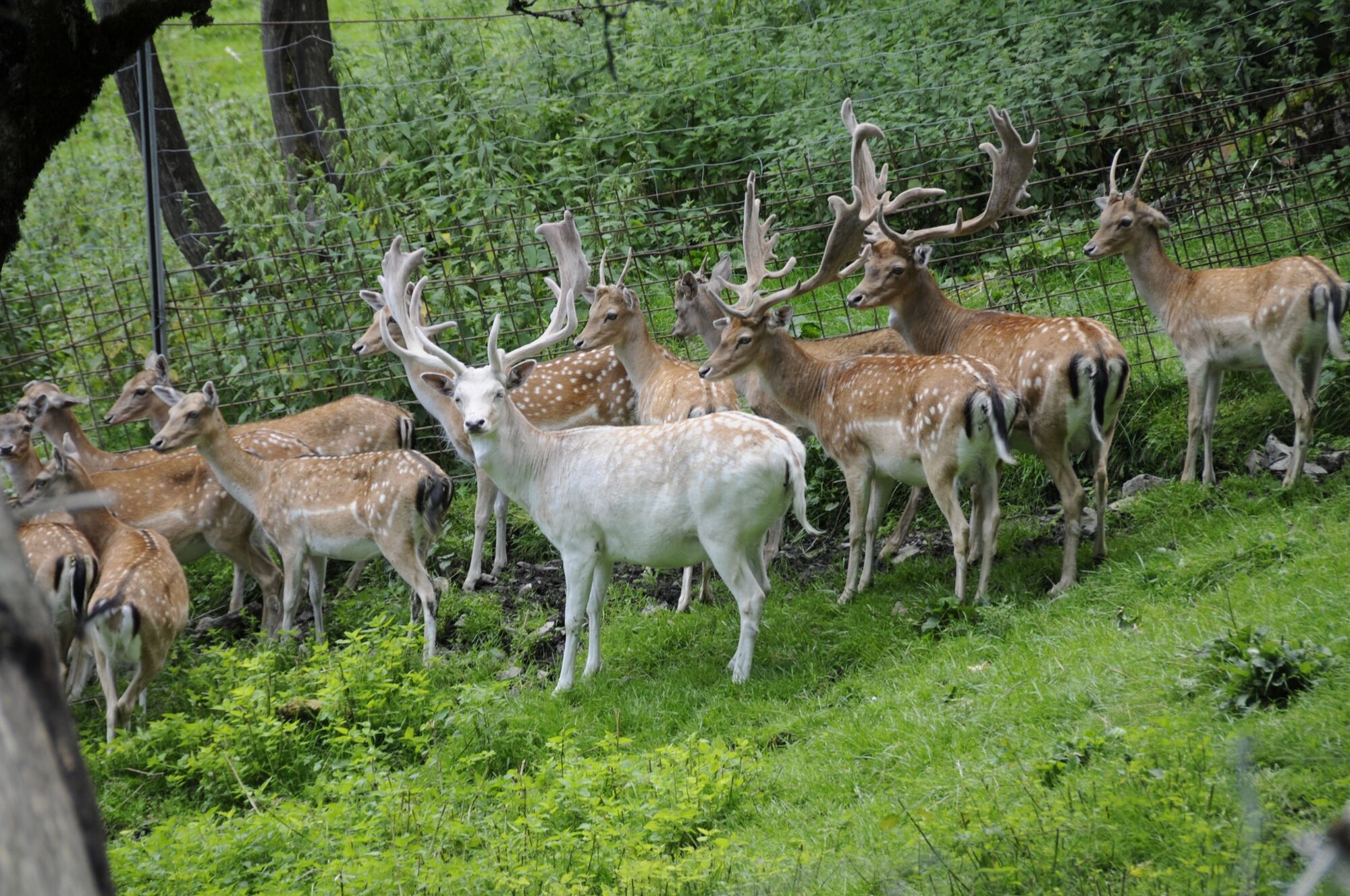
© Wildpark Untertauern

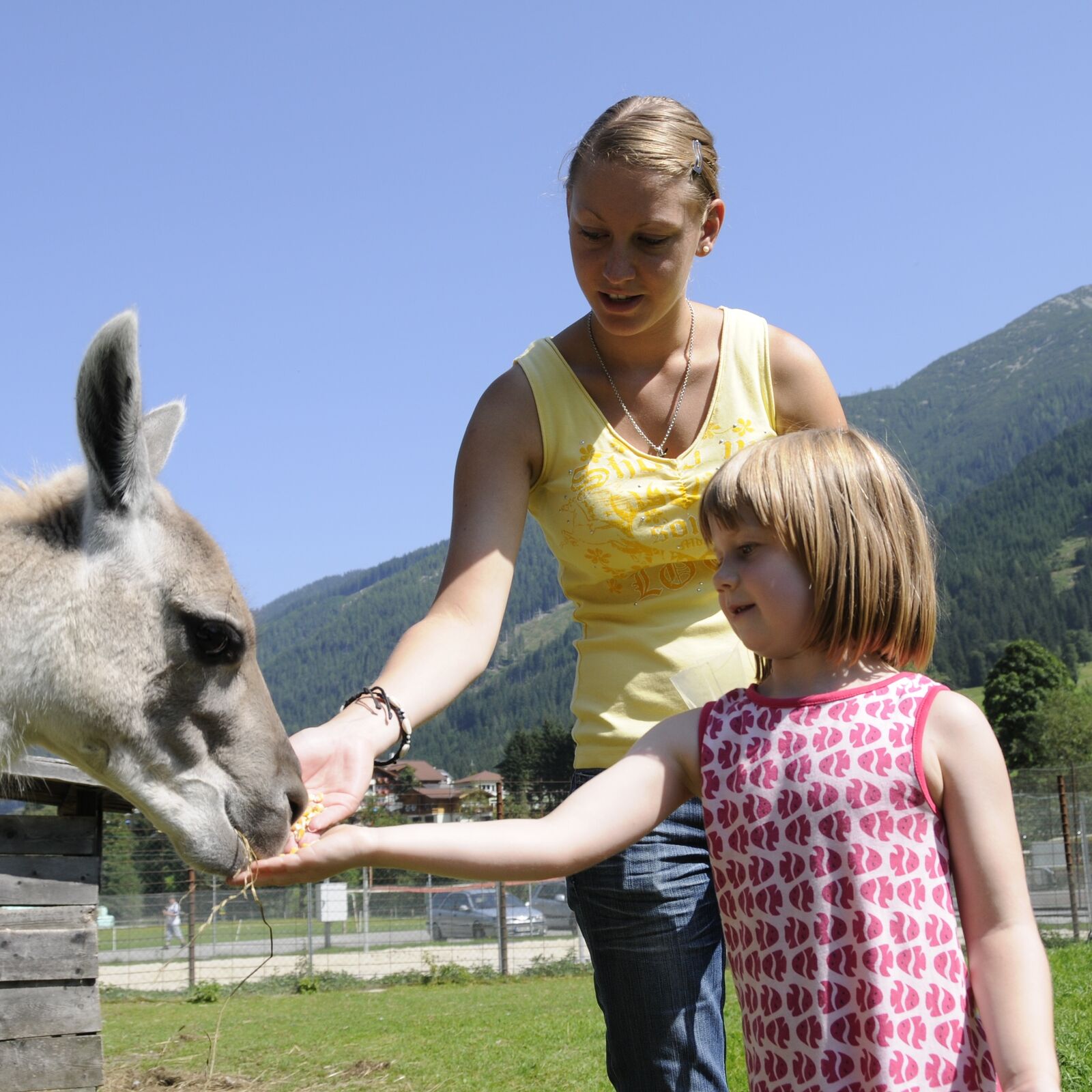
© Wildpark Untertauern

© Tourismusverband Radstadt/Hans Huber - Hans Huber

- Brief description
-
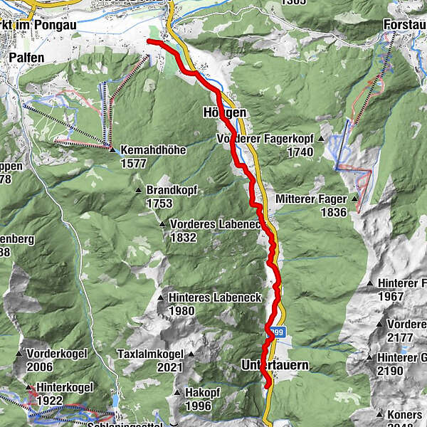
Comfortable hiking trail along the former Roman path to the wildlife park in Untertauern.
- Difficulty
-
easy
- Rating
-
- Starting point
-
Hiking starting point at the hotel "Zum Junge Römer"
- Route
-
JOSEF's Das RestaurantRadstadt (858 m)Höggen2.8 kmUntertauern10.4 kmFischerhütte10.4 km
- Best season
-
JanFebMarAprMayJunJulAugSepOctNovDec
- Directions
-
You start from the Hotel Zum Jungen Römer and walk along the Taxerweg to Katschbergbundesstraße (B99). There you turn right and continue along the bike and footpath on the B 99 and soon reach the Walchhofweg, which branches off to the right to the Stieglerhof. From there you walk along the Taurach and after a long but very relaxing walk you reach the wildlife park in Untertauern.
Tip: This route is also highly recommended by bike (“Taurach Valley Cycle Path”).
- Highest point
- 998 m
- Endpoint
-
Untertauern Wildlife Park
- Height profile
-

- Equipment
-
In our hiking test center in Radstadt you can rent and test hiking shoes, hiking sticks, backpacks and child carriers. With the guest card, the first day is free.
- Tips
-
The hiking route along the Taurach Valley Cycle Path is also highly recommended by bike.
-

-
AuthorThe tour Roman path to the wildlife park in Untertauern (54) is used by outdooractive.com provided.
GPS Downloads


Other tours in the regions
-
Schladming - Dachstein
3001
-
Obertauern
1648
-
Fageralm / Forstau
631


