© EVAdinarica Project - EVA dinarica
© EVAdinarica Project - EVA dinarica
© EVAdinarica Project - EVA dinarica
© EVAdinarica Project - EVA dinarica
© EVAdinarica Project - EVA dinarica

- Highest point
- 23 m
- Height profile
-
 © outdooractive.com

-

-
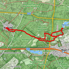
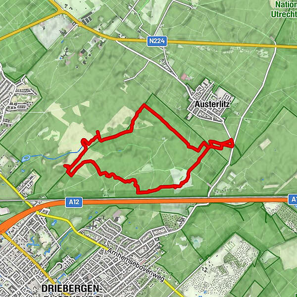
AuthorThe tour Rondje Bornia op de Utrechtse Heuvelrug is used by outdooractive.com provided.
GPS Downloads


Other tours in the regions