


- Brief description
- Difficulty
-
difficult
- Rating
-
- Starting point
-
Spodnje Radvanje, Maribor
- Route
-
MariborBellevue (1,040 m)5.9 kmKoča6.0 kmMariborsko Pohorje (1,042 m)6.1 kmMariborska koča8.7 kmReški vrh (1,142 m)9.9 kmRuška koča13.5 kmŠport hotel Areh13.7 kmPeršetov vrh (1,245 m)16.7 kmKlopni vrh (1,340 m)25.4 kmKoča na Pesku (1,382 m)32.0 kmJezerski vrh (1,537 m)41.8 kmRibniška koča42.6 kmMali Črni vrh (1,536 m)43.0 kmVišavje (1,509 m)43.4 kmSchwarzkogel (1,543 m)45.0 kmOtiše (1,416 m)46.9 kmPungart (1,374 m)47.8 kmHolcer47.8 kmGrmovškov dom pod Veliko Kopo47.9 kmKope47.9 kmVelika Kopa (1,541 m)49.2 kmMala kopa (1,524 m)50.2 kmPočitniški dom Partizanka50.7 kmKaštivsko sedlo (1,191 m)51.9 kmErtarjev vrh (1,229 m)52.3 kmSedlarjev vrh (1,205 m)52.6 kmKremžarjev vrh (1,164 m)55.6 kmSlovenj Gradec61.5 kmSaloon steak house65.5 kmSveti Miklavž65.6 kmSveti Rok66.8 kmCerkev svete Uršule74.8 kmDom na Uršlji gori74.8 kmSv. Vid81.7 kmOsekani vrh (1,220 m)86.2 kmKramarica (1,124 m)88.8 kmDom na Smrekovcu92.2 kmKapelica sv. Cirila in Metoda97.1 kmKomen (1,684 m)97.3 kmHlipovec98.9 kmKoča na Travniku101.5 kmŽarh107.7 kmSnežnica na Raduhi107.8 kmKoča na Loki pod Raduho108.4 kmRaduha (2,062 m)110.8 kmMala Raduha (2,029 m)111.5 kmPlanina Grohat113.8 kmKoča v Grohatu pod Raduho113.8 kmPlanina Javorje117.5 kmRobanov kot120.7 kmRobanova planina125.1 kmSedelce (1,902 m)129.0 kmOjstrica (2,350 m)131.2 kmŠkarje (2,179 m)132.1 kmLučka Baba (2,331 m)133.0 kmVilice (2,343 m)133.3 kmPlanjava - Vzhodni vrh (2,392 m)133.7 kmKamniška koča na Kamniškem sedlu135.8 kmKamniško sedlo (1,870 m)135.8 kmSanntaler Sattel (1,999 m)140.9 kmSeeländer Sattel (2,034 m)141.2 kmKranjska koča na Ledinah142.6 kmKoroška Rinka (2,433 m)144.5 kmMala Rinka (2,296 m)145.0 kmSkuta (2,532 m)146.9 kmKokrsko sedlo (1,793 m)150.9 kmZois-Hütte am Kankersattel150.9 kmSpodnje Jame151.7 kmGrintovec (2,558 m)153.6 kmDolška škrbina (2,279 m)154.8 kmJezerska Kočna (2,540 m)155.3 kmTschechische Hütte158.0 kmMakekov preval (1,342 m)159.7 kmPr' studenc (1,230 m)160.5 kmSeeland162.6 kmGostišče Kanonir165.8 kmDom na Kališču174.0 kmBašeljsko sedlo (1,631 m)175.1 kmStoržič (2,132 m)176.3 kmŠkarjev rob (1,804 m)177.3 kmPlanina Jesenje179.6 kmDom pod Storžičem179.9 kmLovska koča na Mali Poljani182.0 kmPlanina Mala Poljana182.1 kmTolsti vrh (1,715 m)183.1 kmJircek (1,662 m)183.7 kmPrekova klopca184.9 kmVrh Vrata (1,591 m)184.9 kmKoča na Kriški gori185.7 kmKriška gora (1,472 m)185.8 kmVelika Mizica (976 m)187.8 kmMala Mizica (766 m)188.2 kmSveti Jožef188.9 kmRestavracija Raj189.2 kmNeumarktl189.3 kmFeistritz bei Neumarkt (543 m)190.5 kmCerkev Svete Neže192.4 kmBressiach192.4 kmVaško (1,046 m)193.9 kmBreška gora (1,216 m)194.9 kmKoča na Dobrči196.4 kmSivora (1,317 m)198.0 kmVrh Luž (1,212 m)198.8 kmUkanov štruc (1,358 m)199.5 kmPlanina Preval (Prevala)201.7 kmPreval-Alm201.7 kmVeliki vrh (Begunjščica) (2,060 m)203.9 kmSrednji vrh (1,978 m)204.5 kmRoblekov dom205.6 kmPlaninski dom na Zelenici208.7 kmŠija (1,693 m)211.1 kmKrkotnik (2,116 m)213.9 kmHochstuhl (2,237 m)214.7 kmKleiner Hochstuhl (2,187 m)215.1 kmPrešernova koča na Stolu215.2 kmPotoški Stol (2,017 m)217.3 kmWeinaschsattel (1,971 m)217.6 kmPlanina Seča (1,698 m)221.4 kmBelska planina (Svečica)223.8 kmPlaninski stan na Belski planini223.8 kmSedlo Kočna / Kotschnasattel (1,469 m)226.0 kmMaria-Elend-Sattel (1,439 m)227.4 kmKahlkogelhütte229.2 kmKahlkogel (1,834 m)230.3 kmEckelesattel / Jekljevo sedlo (1,487 m)233.8 kmRožca236.0 kmRosenkogel (1,776 m)237.2 kmPlanina Dovška Rožca239.1 kmStarka239.6 kmLahov preval (1,370 m)239.9 kmLangenfeld in der Oberkrain (711 m)243.7 kmMeistern in der Oberkrain244.8 kmPizzeria Kot244.8 kmKoča pri Peričniku249.2 kmPeričnik249.5 kmKreda (857 m)250.1 kmAljažev dom v Vratih254.9 kmAljaževa kapela sv. Cirila in Metoda254.9 kmIzvir Bistrice257.3 kmBegunjski studenec259.5 kmDom Valentina Staniča pod Triglavom260.4 kmKredarica (2,540 m)261.6 kmTriglavski dom na Kredarici262.0 kmTricorno (2,864 m)263.2 kmKleiner Dreikopf (2,739 m)263.8 kmTriglavska vrata264.0 kmDom Planika pod Triglavom264.7 kmSedlo Dolič (2,164 m)267.7 kmKoča na Doliču268.0 kmPod Steno (1,888 m)269.3 kmJolanda (1,760 m)270.5 kmPri Bajti271.1 kmBovški Gamsovec (2,392 m)274.8 kmDovška vratca (2,176 m)275.2 kmGriva (2,050 m)276.5 kmPogačnikov dom na Kriških Podih276.5 kmSedlo Planja (2,352 m)278.0 kmRazor (2,601 m)278.4 kmKriški podi 30 (2,435 m)278.8 kmMlinarica281.1 kmPrisojnik (2,547 m)285.3 kmNa Robu287.2 kmSedlo za Sovno glavo (1,715 m)288.2 kmSovna glava (1,750 m)288.4 kmTičarjev dom na Vršiču289.5 kmVeliki Ozebnik (2,480 m)297.6 kmJalovško sedelce (2,392 m)297.9 kmMonte Gialuz (2,645 m)298.5 kmJezerca S (2,390 m)299.1 kmZavetišče pod Špičkom300.5 kmStaro Utro (1,578 m)302.3 kmPlanina Trenta (1,381 m)302.8 kmKoča pri izviru Soče306.1 kmNa Turi307.9 kmPri Cerkvi308.8 kmVršič nad Logom (717 m)310.3 kmTrentathal311.2 kmPizzerija in špageterija Trenta311.2 kmVodni vir317.2 kmZasavska koča na Prehodavcih321.2 kmLake Ledvice High Viewpoint322.9 kmJezero v Ledvicah Viewpoint323.3 kmKoča pri Triglavskih jezerih326.5 kmDom na Komni334.0 kmMajerca (1,500 m)335.0 kmBogatin-Hütte335.0 kmPlanina Duplje342.3 kmPlaninski dom pri Krnskih jezerih342.6 kmUtro343.6 kmKrnska škrbina (2,058 m)347.7 kmGomiščkovo zavetišče na Krnu348.3 kmKrennberg (2,244 m)348.6 kmMali Peski (2,063 m)352.6 kmPeski352.8 kmMalen (1,775 m)355.1 kmPrehodci (1,635 m)356.2 kmČaramonka360.2 kmKoča na planini Razor369.7 kmVogel (1,922 m)372.7 kmČez Suho Saddle376.3 kmČez Suho (1,771 m)376.3 kmRodica (1,963 m)378.4 kmSuha Rodica (1,940 m)379.1 kmNovi vrh (1,942 m)379.3 kmVeliki Raskovec (1,967 m)380.1 kmMali Matajurski vrh (1,845 m)380.8 kmPoljanski vrh (1,896 m)381.9 kmKonjski vrh (1,878 m)382.3 kmVrata (1,704 m)383.2 kmDom Zorka Jelinčiča384.3 kmČrna prst (1,844 m)384.3 kmČez Suho (1,760 m)384.7 kmNa Kalu (1,362 m)387.1 kmPlanina Kal (1,362 m)387.5 kmKobla (1,498 m)388.3 kmŠance (1,350 m)389.5 kmPetrovo Brdo394.4 kmPohoški kup (Glava) (1,542 m)399.0 kmPlaninski dom na Poreznu400.0 kmPorezen (1,632 m)400.3 kmMedrce (1,411 m)401.5 kmVelbnik (1,331 m)401.8 kmPoljane405.5 kmDolenji Novaki408.7 kmVrata (831 m)413.8 kmVrhovčev grič (1,048 m)416.0 kmPlaninska koča na Ermanovcu (964 m)417.1 kmVrhovčev grič (1,048 m)418.3 kmKladje420.8 kmCerkljanski Vrh423.2 kmBevšek426.3 kmLedine434.7 kmLedinske Krnice435.2 kmLedinsko Razpotje436.3 kmVrh Golice (845 m)437.6 kmIdria (334 m)441.5 kmJohn of Nepomuk Chapel442.1 kmKoča na Hleviški planini445.6 kmHleviška planina (908 m)446.0 kmBlaškova planina (915 m)447.4 kmMohoričev vrh (975 m)449.3 kmVojsko455.4 kmSrednji Golak (1,480 m)466.2 kmMali Golak (1,495 m)467.1 kmIztokova koča pod Golaki468.1 kmGrande Mandràsovici (1,355 m)474.6 kmKoča Antona Bavčerja na Čavnu475.5 kmV Grapi479.0 kmBeilenstein479.4 kmNa Hribu479.7 kmDolski maj (913 m)481.2 kmHottelz482.9 kmNavrše (857 m)484.6 kmKolberji485.4 kmKoča na Sinjem Vrhu487.3 kmKolk487.5 kmSinji vrh (1,002 m)487.6 kmČrne stene (836 m)490.9 kmPravi vrh (Vrh Podrta gora) (830 m)491.8 kmPodrta gora (827 m)492.7 kmKraguljc (897 m)493.0 kmKolk (961 m)495.0 kmZagoli497.4 kmSv. Lenart498.1 kmZoll498.2 kmPirnatova koča na Javorniku505.9 kmPodicrai (808 m)513.3 kmNanos523.1 kmPleša (1,262 m)530.4 kmVojkova koča na Nanosu530.5 kmGostilna NANOS535.7 kmPrevallo535.7 kmSan Bartolomeo541.9 kmSenosetsch542.1 kmVirbašnnji dol545.5 kmAuremiano (1,027 m)547.1 kmČemparjev vrh (892 m)548.9 kmGradischie di San Canziano556.9 kmBelvedere557.9 kmMattauno558.4 kmNacla San Maurizio559.4 kmPotok564.2 kmNigrignano564.6 kmArtuise (817 m)566.9 kmTrmun (788 m)567.3 kmGolačji vrh (768 m)569.7 kmMersane570.7 kmMarcossina574.4 kmScandaussina577.2 kmTaiano (1,028 m)581.1 kmTumova koča na Slavniku581.2 kmCigan (988 m)581.8 kmPištenik583.4 kmSv. Jedrt587.2 kmBresenza587.3 kmPetrigna590.6 kmS 5 (420 m)595.0 kmGrotta Sacra595.4 kmCraneglie595.7 kmRestavracija595.7 kmSan Servolo595.8 kmSv. Socerb595.9 kmKal Prebenek (208 m)597.0 kmSan Pietro e Paolo598.6 kmOspo598.8 kmPri Vovku598.9 kmGolo brdo (120 m)599.8 kmCerkev sv. Mihaela601.5 kmAntignano (374 m)601.6 kmSlatine603.0 kmAlbaro Vescovà di Sopra604.6 kmScoffie606.1 kmReber606.6 kmElleri606.8 kmRizzotti606.8 kmRestavracija Jasna 2609.1 kmBosici609.1 kmCrevatini609.9 kmNorbedi610.2 kmMonte Moro (119 m)610.7 kmBandima611.6 kmAncarano611.8 kmVilla Andor612.9 kmGasello (71 m)613.3 kmPunta Grossa (28 m)615.1 km
- Best season
-
JanFebMarAprMayJunJulAugSepOctNovDec
- Description
-
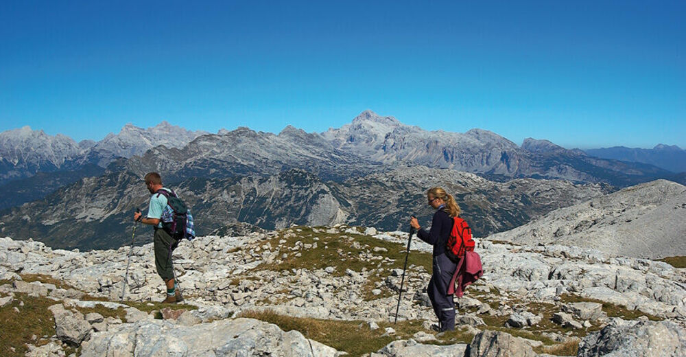
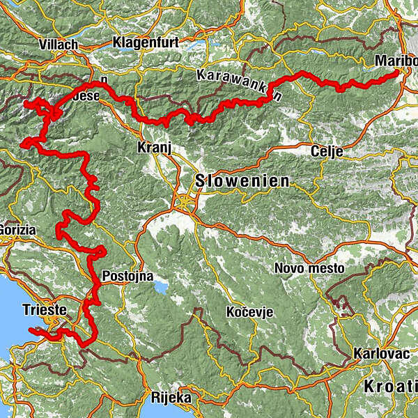
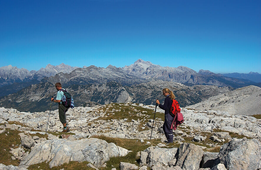
It begins in Maribor and crosses the plateaus of the Pohorje Hills, from where you already have a glimpse of the tallest Alpine summits in the distance. The trail first enters the Alps in the Kamnik and Savinja Alpine range, as it runs across its highest peaks, and then the trail continues along the long Karavanke range, which separates Slovenia from Austria. From there, it again descends into the valley and soon rises into the heart of the Julian Alps, to Mount Triglav and the steepest peaks, with breathtaking views following one after another as the trail approaches the Adriatic sea.
The Slovenian Mountain Trail ends at Debeli Rtič on the Adriatic coast and connects 49 mountain huts, 23 peaks, and 5 towns. It is well marked with Knafelc blazes and the number 1. THow much time will you need to walk this trail? It can be walked in 28 days, and some of the best mountain runners even run along it. The record is seven days, eight hours, and ten minutes.
- Directions
-
On the Slovenian Mountain Trail – in brief (adapted by Borut Peršolja as recorded by Janez Černilec)
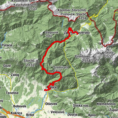
The Slovenian Mountain Trail begins in Radvanje near Maribor (270 m) where it ascends to Pohorje, a 60-kilometre mountain chain with the highest point at Črni vrh (1,543 m), and numerous mountain huts and ski tows. In the west, the trail descends to Slovenj Gradec (420 m) and then ascends to Carinthian monadnock, Uršlja gora (1,699 m). From here, the trail continues over Smrekovec (1,577 m) and Komen (1,684 m) to Raduha (2,062 m) and past Bukovnik (1,327 m), the highest farm in Slovenia, then descends to Solčava (642 m) in the Upper Savinja Valley. Through the picturesque Robanov Kot Landscape Park, the trail approaches the foothills of high mountains for the first time. From Molička planina (1,780 m), with the second oldest Slovenian mountain hut, now renovated, named after Fran Kocbek, the trail ascends via Korošica (1,808 m) to Ojstrica (2,350 m), our second most beautiful mountain. The trail continues to Planjava (2,394 m) and from Kamniško sedlo (1,864 m) to Brana (2,252 m), Turska gora (2,251 m), Skuta (2,532 m) and past Kokrško sedlo (1,793 m) to Grintovec (2,558 m), the highest peak in the Kamnik-Savinja Alps. Via Kočna (2,540 m) and Češka koča mountain hut at Spodnje Ravne (1,542 m), the trail descends to Zgornje Jezersko (880 m), which used to be known as a health resort.
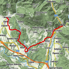
The trail continues to Storžič (2,132 m) with magnificent views and descends via Tolsti vrh (1,715 m) and Kriška gora (1,471 m) to Tržič (515 m), which was once an important industrial town. It then ascends to Dobrča (1,634 m) and past Roblekov dom mountain hut (1,657 m) to Begunjščica (2,060 m) and Stol (2,236 m), the highest peak in the Karavanke, which bears an inscription in Slovenian and German: ‘The mountains of friendship’. The trail continues below the ridge along high mountains to Golica (1,835 m) below which lie extensive meadows famed for their daffodils.
After descending into the valley, the trail leads to Dovje (704 m), where the priest Jakob Aljaž, author of the mountaineering anthem ‘Oj, Triglav, moj dom’ (Oh, Triglav, My Home), worked for many years. From Mojstrana (641 m), home of the Slovenian Alpine Museum, the trail continues through the valley of Vrata past Peričnik waterfall to Aljažev dom mountain hut (1,015 m). A steep trail goes via the remarkable Triglav north wall to Kredarica (2,515 m) with the highest mountain hut in Slovenia and on to Triglav (2,864 m), the highest peak and a symbol of Slovenia, where Aljaž Tower is situated. Via Kriški podi (2,050 m) with high mountain lakes, Razor (2,601 m) and Prisank (2,547 m), the trail continues to Vršič (1,611 m), a mountain pass between the Gorenjska region and Trenta with five mountain huts. The trail to Jalovec (2,645 m), according to many the most beautiful Slovenian mountain, whose image is also in the coat-of-arms of the Alpine Association of Slovenia, is easy at first, but extremely challenging in the final section.
The trail then descends into the valley of Trenta with the spring of the Soča River, Slovenia’s most beautiful river. Through Zadnjica, the trail again ascends to Prehodavce (2,071 m) and into the Triglav Lakes Valley or the Valley of the Seven Lakes (1,685 m). The present Triglav National Park has its origins here. From Komna (1,520 m) and along the Krn Lakes (1,385 m), the trail ascends to Krn (2,244 m) which offers beautiful views. The trail continues along the northern slope of the Lower Bohinj Mountains from Vogel (1,922 m) to Črna prst (1,844 m), below which a new mountain hut was built recently at the site of the former oldest Slovenian mountain hut, the Orožen hut. The trail continues to the Cerkljansko and Idrijsko Hills to Idrija (325 m), which once boasted the second largest mercury mine in the world.
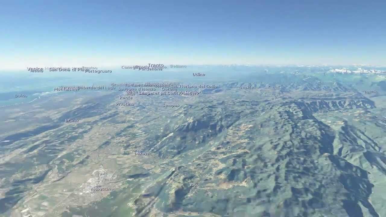
From Trnovski gozd and Javornik (1,240 m) further to Nanos (1,313 m) and via Vremščica (1,027 m) to Slavnik (1,028 m), the last 1,000-metre mountain on the trail. It is not far now to the Adriatic Sea, where the Slovenian Mountain Trail ends in Ankaran (8 m).
- Highest point
- 2,764 m
- Endpoint
-
Debeli Rtič
- Height profile
-
 © outdooractive.com
 - Equipment
-
Pair of quality hiking boost, rain jacket, map of the trail and of course, a trail dairy in which you will collect the stamps of completed stages. When finnishing you will recieve an honorary badge.
Sleeping bag is advised, for overnights in huts. Gps and a map of the area.
- Safety instructions
-
You will encounter different weather patterns, which means you will have to keep a close eye to the weather forecasts, especially in high mountains. The trail is on some parts technically and orientation wise demanding.
- Tips
-
Its founder, Ivan Šumljak, advised hikers: “Walk slowly, my friend. In that way, you will experience much, much more.” You can make it week by week.
- Additional information
-
Check when huts are open, most of them are closed during the winter. In the months June , July and August, reservation in advance is highly recomended. Most of the huts do NOT allow pets in the living quarters.
You can get maps and hiking guides at Slovenian Alpine Association.
- Directions
-
By car, by bus, by train or by plane (Ljubljana, Maribor, Celovec/Klagenfurt). From Ljubljana there is 1h15 to both Maribor and Ankaran. Both starting points are also close to the airports (Venice, Zagreb, Ljubljana, Trieste)
- Public transportation
-
Maribor city bus, line 6 will take you to Pohorje, to the official starting point. There is also a bus connection to the finishing point at Debeli Rtič. There is also railway connection of this two points with Ljubljana. Visitor has also a chance to stop or start the trail on several points during the trail, where it comes to the villages or cities, that have public transport connections.
- Parking
-
Parking at Pohorje cable car or at Tuš supermarket. Payable parking at Debeli Rtič. Numerous parking possibilities along the trail.
- Author
-
The tour Slovenia mountain trail is used by outdooractive.com provided.


General info
-
Gorenjska
141
-
Škofja Loka
6