


- Brief description
-
Discover the eastern Valais Alps in 9 stages over 122 kilometers.
- Difficulty
-
medium
- Rating
-
- Starting point
-
Bivacco Cingino
- Route
-
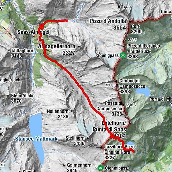
Alpe del Lago0.1 kmAlpe Corone (2,463 m)1.4 kmBitzinen6.5 kmAlpina11.3 kmFurggstalden11.3 kmSaas-Almagell12.1 kmAlmagelleralp14.9 km
- Best season
-
JanFebMarAprMayJunJulAugSepOctNovDec
- Description
-
2nd stage:
You climb the old mule track of the "Strada Antronesca" to the Saaspass. In the past, this route was the connection between Villadossola and Saas Almagell. On the pass, where you can still find the remains of an old retreat, there is a panoramic view over the 4000 m of the Saas Valley. The route then leads down into the valley to Furggstalden, a little above Saas Almagell. Furggstalden can also be reached from the pass via a new panoramic route that leads to a chair lift (Heidbodme) that goes down to the village. From Furggstalden you can reach the stage destination Almagelleralp via a secured path.
- Directions
-
Bivacco Cingino - Alpe Corone - Laghetto - Saaspass - Fine Morena - Furggalp - Furgstalden - Bivio - Almagelleralp
- Highest point
- 2,844 m
- Endpoint
-
Almagelleralp
- Height profile
-
 © outdooractive.com
 - Equipment
-
Equipment adapted to the weather is essential. Good, sturdy mountain boots are strongly recommended for all hikes.
- Safety instructions
-
The hike is at your own risk. Insurance is the hiker's responsibility.
- Tips
-
Take a short break at the "Heidbodme" pond. Enjoy nature and the silence.

- Author
-
The tour SFT - Cingino - Almagelleralp is used by outdooractive.com provided.


-
Aletsch Arena
1489
-
Saastal
486
-
Saas-Almagell
96
")


